|
Hauran
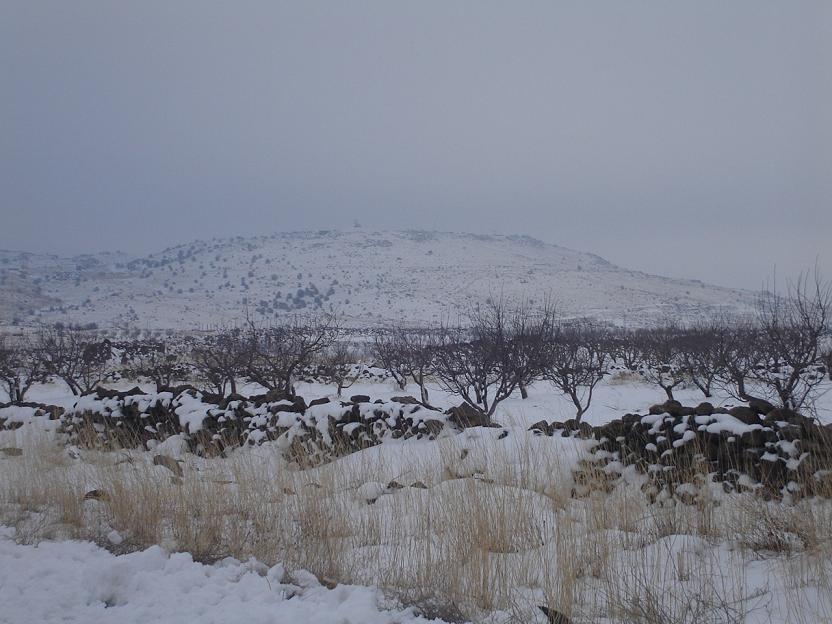
The Hauran (; also spelled ''Hawran'' or ''Houran'') is a region that spans parts of southern Syria and northern Jordan. It is bound in the north by the Ghouta oasis, to the northeast by the al-Safa field, to the east and south by the Harrat al-Sham and to the west by the Golan Heights. Traditionally, the Hauran consists of three subregions: the Nuqrah and Jaydur plains, the Jabal al-Druze massif, and the Lajat volcanic field. The population of the Hauran is largely Arab, but religiously heterogeneous; most inhabitants of the plains are Sunni Muslims belonging to large agrarian clans, while Druze form the majority in the eponymous Jabal al-Druze and a significant Greek Orthodox and Greek Catholic minority inhabit the western foothills of Jabal al-Druze. The region's largest towns are Daraa, al-Ramtha, and al-Suwayda. From the mid-1st century BC, the region was governed by the Roman Empire's Herodian and Nabatean client kings until it was formally annexed by the empire in ... [...More Info...] [...Related Items...] OR: [Wikipedia] [Google] [Baidu] |
Druze
The Druze ( ; , ' or ', , '), who Endonym and exonym, call themselves al-Muwaḥḥidūn (), are an Arabs, Arab Eastern esotericism, esoteric Religious denomination, religious group from West Asia who adhere to the Druze faith, an Abrahamic religions, Abrahamic, Monotheism, monotheistic, and Religious syncretism, syncretic religion whose main tenets assert the unity of God, reincarnation, and the eternity of the soul. Although the Druze faith developed from Isma'ilism, Druze do not identify as Muslims. They maintain Arabic language and Arabic culture, culture as integral parts of their identity, with Arabic being their primary language. Most Druze religious practices are kept secret, and conversion to their religion is not permitted for outsiders. Interfaith marriages are rare and strongly discouraged. They differentiate between spiritual individuals, known as "uqqāl", who hold the faith's secrets, and secular ones, known as "juhhāl", who focus on worldly matters. Druze be ... [...More Info...] [...Related Items...] OR: [Wikipedia] [Google] [Baidu] |
Lajat
The Lajat (/ALA-LC: ''al-Lajāʾ''), also spelled ''Lejat'', ''Lajah'', ''el-Leja'' or ''Laja'', is the largest lava field in southern Syria, spanning some 900 square kilometers. Located about southeast of Damascus, the Lajat borders the Hauran plain to the west and the foothills of Jabal al-Druze to the south. The average elevation is between 600 and 700 meters above sea level, with the highest volcanic cone being 1,159 meters above sea level. Receiving little annual rainfall, the Lajat is largely barren, though there are scattered patches of arable land in some of its depressions. The region has been known by a number of names throughout its history, including "Argob" ( ''’Argōḇ'',) in the Hebrew Bible and "Trachonitis" () by the Hellenistic period, Greeks, a name under which it is mentioned in the Gospel of Luke (Luke 3, ). Long inhabited by Arab groups, it saw development under the Roman Empire, Romans, who built a road through the center of the region connecting it wi ... [...More Info...] [...Related Items...] OR: [Wikipedia] [Google] [Baidu] |
Nabatean Kingdom
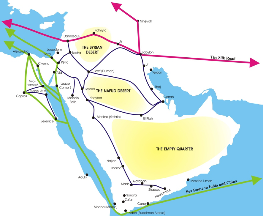
The Nabataean Kingdom ( Nabataean Aramaic: 𐢕𐢃𐢋𐢈 ''Nabāṭū''), also named Nabatea () was a political state of the Nabataeans during classical antiquity. The Nabataean Kingdom controlled many of the trade routes of the region, amassing large wealth and drawing the envy of its neighbors. It stretched south along the Tihamah into the Hejaz, up as far north as Damascus, which it controlled for a short period (85–71 BC). Nabataea remained an independent political entity from the mid-3rd century BC until it was annexed in AD 106 by the Roman Empire, which renamed it to Arabia Petraea. History Nabataeans The Nabataeans were one among several formerly nomadic Arab tribes that roamed (later settled) the Arabian Desert and moved with their herds to wherever they could find pasture and water. They became familiar with their area as seasons passed, and they struggled to survive during bad years when seasonal rainfall diminished. The origin of the specific tribe of Arab nom ... [...More Info...] [...Related Items...] OR: [Wikipedia] [Google] [Baidu] |
Daraa
Daraa (, Levantine Arabic: ) is a city in southwestern Syria, north of the border with Jordan. It is the capital of Daraa Governorate in the Hauran region. Located south of Damascus on the Damascus–Amman highway, it serves as a way station for travelers. Nearby localities include Umm al-Mayazen and Nasib to the southeast, al-Naimah to the east, Ataman to the north, al-Yaduda to the northwest and Ramtha, Jordan, to the southwest. According to the Syrian Central Bureau of Statistics, Daraa had a population of 97,969 in the 2004 census. It is the administrative center of a ''nahiya'' (subdistrict) which contained eight localities with a collective population of 146,481 in 2004. By the 3rd century, it had gained the status of polis or self-governed city. The Roman historian Eusebius referred to it. The area east of Adraa was a centre of the Ebionites. Adraa itself was a Christian bishopric. Arabio, the first bishop of Adraa whose name is known, participated in the ... [...More Info...] [...Related Items...] OR: [Wikipedia] [Google] [Baidu] |
Ar Ramtha
Ar-Ramtha (), colloquially transliterated as Ar-Romtha (), is a city situated in the far northwest of Jordan near the border with Syria. It covers 40 km2 on a plain 30 km northeast of the Jordan River and Irbid. In 2017, Ar-Ramtha had a population of approximately 164,211, making it the eleventh largest city in Jordan, and the second in Irbid Governorate, and the city has grown since then. It is part of the Ar-Ramtha district of the Irbid Governorate. Etymology The origin of the name Ar-Ramtha is debated. Some claim it is named after a local desert plant, al-ramath (). Many biblical archaeologists identify Ar-Ramtha with the ancient Israelite city of Ramoth-Gilead, Hebrew for "Heights of Gilead"; in that case, the present-day Arabic name might preserve the Biblical Hebrew one. During the Roman and Byzantine periods, Ar-Ramtha was known as Ramatha. History Prehistory The stable climate in ar-Ramtha and its surrounding areas attracted many animals to live in neighb ... [...More Info...] [...Related Items...] OR: [Wikipedia] [Google] [Baidu] |
Golan Heights
The Golan Heights, or simply the Golan, is a basaltic plateau at the southwest corner of Syria. It is bordered by the Yarmouk River in the south, the Sea of Galilee and Hula Valley in the west, the Anti-Lebanon mountains with Mount Hermon in the north and Ruqqad, Wadi Raqqad in the east. It hosts vital water sources that feed the Hasbani River and the Jordan River. Two thirds of the area was Israeli occupation of the Golan Heights, occupied by Israel following the 1967 Six-Day War and then Golan Heights Law, effectively annexed in 1981 – an action unrecognized by the international community, which continues to consider it Israeli occupation, Israeli-occupied Syrian territory. In 2024 Israeli invasion of Syria, 2024, Israel occupied the remaining one third of the area. The earliest evidence of human habitation on the Golan dates to the Upper Paleolithic period. It was home to the biblical Geshur, and was later incorporated into Aram-Damascus,Michael Avi-Yonah (1979). ''The Hol ... [...More Info...] [...Related Items...] OR: [Wikipedia] [Google] [Baidu] |
Batanea
Batanaea or Batanea was an area often mentioned between the first century BCE and the fourth century CE. It is often mixed with the biblical Bashan, the part of the Biblical Holy Land, northeast of the Jordan River, as its Latinized form. Bashan was, in biblical context, the whole region east of the Jordan, above Gadara and Abila until the Jabal al-Druze, the old Hauran (Bashan) mountains. History Bataneaea was one of the four post-exile divisions of the area of Bashan. Today, as it was during Greco-Roman times, Batanaea is more commonly considered to be the area east of the Leja. The region south of the Leja and west of the Hauran (Auranitis) called Nuqrah to the southwestern edge of the Leja is sometimes falsely called Batanaea. This is because of the permanent mix with the name of the Basan/Bashan region. The biblical Bashan/Basan was the whole area from Adra (Deraa) at its ancient capital to the Hauran mountains. Its highest peak may be the Hill of Basan referenced i ... [...More Info...] [...Related Items...] OR: [Wikipedia] [Google] [Baidu] |
Al-Suwayda
Suwayda (), also spelled Sweida, is a mainly Druze city located in southern Syria, close to the border with Jordan. It is the capital of Suwayda Governorate, one of Syria's 14 governorates, bordering Jordan in the South, Daraa Governorate in the West and Rif Dimashq Governorate in the north and east. The city is referred to by some as "Little Venezuela" due to the city's influx of affluent Venezuelan Syrian immigrants. Many of them originally emigrated from Suweida in the nineteenth century, so when their descendants returned, they brought back the Spanish language and South American culture. History Ancient and Medieval eras The city was founded by the Nabataeans as Suada. It became known as Dionysias Soada () in the Hellenistic period and the Roman Empire, for the god Dionysus, patron of wine - the city is situated in a famous ancient wine-producing region. The name ''Dionysias'' replaced the former Nabataean name in 149 AD after Nabataean influence decreased and then ... [...More Info...] [...Related Items...] OR: [Wikipedia] [Google] [Baidu] |
Arab
Arabs (, , ; , , ) are an ethnic group mainly inhabiting the Arab world in West Asia and North Africa. A significant Arab diaspora is present in various parts of the world. Arabs have been in the Fertile Crescent for thousands of years. In the 9th century BCE, the Assyrians made written references to Arabs as inhabitants of the Levant, Mesopotamia, and Arabia. Throughout the Ancient Near East, Arabs established influential civilizations starting from 3000 BCE onwards, such as Dilmun, Gerrha, and Magan (civilization), Magan, playing a vital role in trade between Mesopotamia, and the History of the Mediterranean region, Mediterranean. Other prominent tribes include Midian, ʿĀd, and Thamud mentioned in the Hebrew Bible, Bible and Quran. Later, in 900 BCE, the Qedarites enjoyed close relations with the nearby Canaan#Canaanites, Canaanite and Aramaeans, Aramaean states, and their territory extended from Lower Egypt to the Southern Levant. From 1200 BCE to 110 BCE, powerful ... [...More Info...] [...Related Items...] OR: [Wikipedia] [Google] [Baidu] |
Ghouta
Ghouta ( / ALA-LC: ''Ḡūṭat Dimašq'') is a countryside area in southwestern Syria that surrounds the city of Damascus along its eastern and southern rim. Name Ghouta is an Arabic term (''ghuta'') for 'garden'. Geography The Ghouta is an oasis formed by the Barada River, as its waters flow east of Mount Qasioun, and its seven tributaries. It surrounds the city of Damascus. To the east and south of the Ghouta lies the Marj plain, which forms a narrow belt of fields, and south of that lies the Hauran plain. The Barada River Valley borders the Ghouta to the northeast. The area north of the Ghouta is less fertile and eventually desolate hill country. To the west of the region is the Anti-Lebanon Mountains. The Ghouta is historically the most celebrated 'green zone' (a verdant, fertile area around an urban center) in the Levant, according to the historian Beshara Doumani. He also notes that its fame in this regard persists, despite the significant loss of its planted areas ... [...More Info...] [...Related Items...] OR: [Wikipedia] [Google] [Baidu] |
Harrat Al-Sham
The ''Ḥarrat al-Shām'' (), also known as the ''Harrat al-Harra'' or ''Harrat al-Shaba'', and sometimes the Black Desert in English, is a region of rocky, basaltic desert straddling southern Syrian region and the northern Arabian Peninsula. It covers an area of some in the modern-day Syrian Arab Republic, Israel, Jordan, and Saudi Arabia. Vegetation is characteristically open acacia shrubland with patches of juniper at higher altitudes. The ''Harrat'' has been occupied by humans since at least the Late Epipalaeolithic (). One of the earliest known sites is Shubayqa 1 (occupied ), a Natufian site where archaeologists have discovered the remains of the oldest known bread. Geology The ''Harrat'' is part of a system of volcanic fields formed by tectonic activity from the Oligocene through to the Quaternary. This system, which geologists refer to as the 'Harrat Ash Shamah Volcanic Field', is the largest of several volcanic fields on the Arabian Plate, containing more than 8 ... [...More Info...] [...Related Items...] OR: [Wikipedia] [Google] [Baidu] |
Salīhids
The Salīḥids (), also known simply as Salīḥ or by their royal house, the Zokomids (Arabic: ''Ḍajaʿima'') were the dominant Arab ''foederati'' of the Byzantine Empire in the 5th century. They succeeded the Tanukhids, who were dominant in the 4th century, and were in turn defeated and replaced by the Ghassanids in the early 6th century. The Salihids were originally concentrated in the Wadi Sirhan and Balqa Governorate, Balqa regions of modern Jordan, but spread as far as northern Syria (region), Syria after entering the service of the Byzantine Empire. The Salihids were charged with collecting tax from Bedouins dwelling within the ''Limes Arabicus'' (Byzantine frontier with the Syrian Desert, Syrian and Arabian Desert, Arabian deserts) and protecting the frontier from Bedouin raiders. They were ardent Christians and at least one of their phylarchs and kings, Dawud, built a Monastery#Christianity, Christian monastery, Deir Dawud. Sources The Salihid period is far more obs ... [...More Info...] [...Related Items...] OR: [Wikipedia] [Google] [Baidu] |


