|
Hart Burn
Hart Burn is a river that flows through Northumberland, England. It is a tributary of the River Wansbeck, is 24 km long and has a catchment area of 45 km squared. Course Hart Burn forms at the confluence of Ottercops Burn and Birky Burn just North West of Raechester and South West of Harwood. The river then proceeds South East through/near - * Hartington Hall * Rothley * Scots' Gap * Hartburn, Northumberland, Hartburn - from which the river takes its name * Meldon Park lastly feeding into the River Wansbeck near Meldon Park. Major Tributaries From Source to Mouth: * Fairnley Burn * Chesters Burn * Holy Burn * Delf Burn * Angerton Lake * Dean Burn References Rivers of Northumberland {{England-river-stub ... [...More Info...] [...Related Items...] OR: [Wikipedia] [Google] [Baidu] |
Northumberland
Northumberland () is a ceremonial counties of England, county in Northern England, one of two counties in England which border with Scotland. Notable landmarks in the county include Alnwick Castle, Bamburgh Castle, Hadrian's Wall and Hexham Abbey. It is bordered by land on three sides; by the Scottish Borders, Scottish Borders region to the north, County Durham and Tyne and Wear to the south, and Cumbria to the west. The fourth side is the North Sea, with a stretch of coastline to the east. A predominantly rural area, rural county with a landscape of moorland and farmland, a large area is part of Northumberland National Park. The area has been the site of a number of historic Anglo-Scottish wars, battles with Scotland. Name The name of Northumberland is recorded as ''norð hẏmbra land'' in the Anglo-Saxon Chronicle, meaning "the land north of the Humber". The name of the kingdom of ''Northumbria'' derives from the Old English meaning "the people or province north of th ... [...More Info...] [...Related Items...] OR: [Wikipedia] [Google] [Baidu] |
River Wansbeck
The River Wansbeck runs through the county of Northumberland, England. It rises above Sweethope Lough on the edge of Fourlaws Forest in the area known locally as The Wanneys (Great Wanney Crag, Little Wanney Crag; thus the "Wanneys Beck"); runs through the town of Ashington before discharging into the North Sea at Sandy Bay near Newbiggin-by-the-Sea. The River flows through the village of Kirkwhelpington, the town of Morpeth, Hartburn, where the tributary Hart Burn joins, and the village of Mitford, where the River Font joins. The River Wansbeck is nicknamed the River Wanney. The term 'The Wilds of Wanney' is used by people of Tyneside to refer to the rural areas of Northumberland where the Wansbeck rises. The River lent its name to the former Wansbeck district which was based in Ashington, and included Newbiggin-by-the-Sea, Bedlington and Stakeford. Barrage and navigation Between 1974-75, a £250,000 barrage with a navigation lock was built near the rivermouth and adjace ... [...More Info...] [...Related Items...] OR: [Wikipedia] [Google] [Baidu] |
Confluence
In geography, a confluence (also: ''conflux'') occurs where two or more flowing bodies of water join to form a single channel. A confluence can occur in several configurations: at the point where a tributary joins a larger river ( main stem); or where two streams meet to become the source of a river of a new name (such as the confluence of the Monongahela and Allegheny rivers at Pittsburgh, forming the Ohio); or where two separated channels of a river (forming a river island) rejoin at the downstream end. Scientific study of confluences Confluences are studied in a variety of sciences. Hydrology studies the characteristic flow patterns of confluences and how they give rise to patterns of erosion, bars, and scour pools. The water flows and their consequences are often studied with mathematical models. Confluences are relevant to the distribution of living organisms (i.e., ecology) as well; "the general pattern ownstream of confluencesof increasing stream flow and decreasing ... [...More Info...] [...Related Items...] OR: [Wikipedia] [Google] [Baidu] |
Hartburn, Northumberland
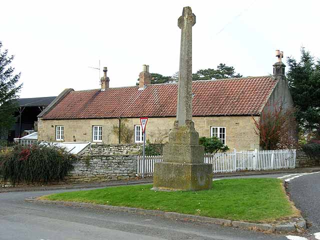
Hartburn is a village in Northumberland, in England. It is situated about to the west of Morpeth. The population at the 2011 census was 194. The place-name 'Hartburn' is first attested in Charter Rolls of 1198, where it appears as ''Herteburne''. The name means 'stag stream'. The village is on the Hart Burn river, which a couple of miles downstream joins the River Wansbeck, which flows through Morpeth and Ashington to the sea. Landmarks The Devil's Causeway passes the western edge of the village, just before its crosses the Hart river (burn). The causeway was a Roman road which started at Portgate on Hadrian's Wall, north of Corbridge, and extended northwards across Northumberland to the mouth of the River Tweed at Berwick-upon-Tweed. To the north of the village lies Hartburn Glebe, an area of woodland alongside the river Hart Burn currently in the care of the Woodland Trust. This small woodland has been described as one of the best British woods for views. A cave, ... [...More Info...] [...Related Items...] OR: [Wikipedia] [Google] [Baidu] |
