|
Harsimus
Harsimus (also known as Harsimus Cove) is a neighborhood within Downtown Jersey City, Hudson County, in the U.S. state of New Jersey. The neighborhood stretches from the Harsimus Stem Embankment (the Sixth Street Embankment) on the north to Christopher Columbus Drive on the south between Coles Street and Grove Street or more broadly, to Marin Boulevard. It borders the neighborhoods of Hamilton Park to the north, Van Vorst Park to the south, the Village to the west, and the Powerhouse Arts District to the east. Newark Avenue has traditionally been its ''main street''. The name is from the Lenape, used by the Hackensack Indians who inhabited the region and could be translated as ''Crow's Marsh''. From many years, the neighborhood was part of the "Horseshoe", a political delineation created by its position between the converging rail lines and political gerrymandering. Early settlement Harsimus is a derivative of a Lenape phrase possibly meaning ''Crow's Marsh''. Variant ... [...More Info...] [...Related Items...] OR: [Wikipedia] [Google] [Baidu] |
Jersey City, New Jersey
Jersey City is the List of municipalities in New Jersey, second-most populousTable1. New Jersey Counties and Most Populous Cities and Townships: 2020 and 2010 Censuses New Jersey Department of Labor and Workforce Development. Accessed December 1, 2022. city (New Jersey), city in the U.S. state of New Jersey, after Newark, New Jersey, Newark.The Counties and Most Populous Cities and Townships in 2010 in New Jersey: 2000 and 2010 , United States ... [...More Info...] [...Related Items...] OR: [Wikipedia] [Google] [Baidu] |
Harsimus Stem Embankment
The Harsimus Stem Embankment, also called Sixth Street Embankment, is a half-mile-long historic railroad embankment, disused and largely overgrown with foliage, in the heart of the historic downtown of Jersey City, New Jersey in the United States. The embankment runs along the south side of Sixth Street west from Marin Boulevard to Brunswick Street. It is the border between the Harsimus and Hamilton Park neighborhoods. The overhead tracks of the beam bridge west of Brunswick Street were dismantled but the stone abutments remain. This elevated stone structure was once owned and operated by Conrail and carried seven tracks of the Pennsylvania Railroad's Passaic and Harsimus Line to its freight yards and carfloat operations on the Hudson River at Harsimus Cove, and to its warehouse and distribution facility (now Harborside Financial Center). The line was part of the railroad's holdings on the waterfront, which included the Exchange Place passenger terminal and the Greenvill ... [...More Info...] [...Related Items...] OR: [Wikipedia] [Google] [Baidu] |
Pavonia, New Netherland
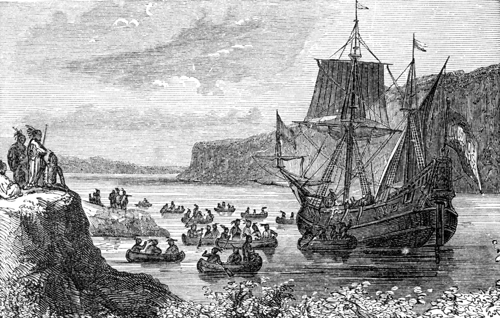
Pavonia was the first European settlement on the west bank of the North River (Hudson River) that was part of the seventeenth-century province of New Netherland in what would become the present Hudson County, New Jersey. Hudson and the Hackensack The first European to record exploration of the area was Robert Juet, first mate of Henry Hudson, an English sea captain commissioned by the Dutch East India Company. Their ship, the ''Halve Maen'' (''Half Moon''), ventured in the Kill van Kull and Newark Bay and anchored at Weehawken Cove during 1609, while exploring the Upper New York Bay and the Hudson Valley. By 1617 a '' factorij'', or trading post, was established at Communipaw. Initially, these posts were set up for fur trade with the indigenous population. At that time the area was inhabited by bands of Algonquian language speaking peoples, known collectively as Lenni Lenape and later called the Delawares. Early maps show it to be the territory of the Sangicans. Later, the ... [...More Info...] [...Related Items...] OR: [Wikipedia] [Google] [Baidu] |
Hudson County, New Jersey
Hudson County is a county in the U.S. state of New Jersey, its smallest and most densely populated. Lying in the northeast of the state and on the west bank of the Hudson River, the North Jersey county is part of the state's Gateway Region and the New York metropolitan area. Its county seat is Jersey City,New Jersey County Map . Accessed February 27, 2023. the county's largest city in terms of both population and area. Established in 1840, it is named for , the sea captain who explored the area in 16 ... [...More Info...] [...Related Items...] OR: [Wikipedia] [Google] [Baidu] |
Hudson County
Hudson County is a List of counties in New Jersey, county in the U.S. state of New Jersey, its smallest and most densely populated. Lying in the northeast of the state and on the west bank of the North River (Hudson River), Hudson River, the North Jersey county is part of the state's Gateway Region and the New York metropolitan area. Its county seat is Jersey City, New Jersey, Jersey City,New Jersey County Map New Jersey Department of State. Accessed February 27, 2023. the county's largest city in terms of both population and area. Established in 1840, it is named for Henry Hudson, the sea captain who explored the area in 1609. As of the 2020 United States census, the county was the state's List of counties in New Jersey, fourth-most-populous and fastest-growing county in the previous decade, [...More Info...] [...Related Items...] OR: [Wikipedia] [Google] [Baidu] |
Bergen, New Netherland
Bergen was a part of the 17th century province of New Netherland, in the area in Gateway Region, northeastern New Jersey along the Hudson River, Hudson and Hackensack River, Hackensack Rivers that would become contemporary Hudson County, New Jersey, Hudson and Bergen County, New Jersey, Bergen Counties. Though it only officially existed as an independent municipality from 1661, with the founding of a village at Bergen Square, Bergen began as a Factory (trading post), factory at Communipaw circa 1615 and was first settled in 1630 as Pavonia, New Netherland, Pavonia. These early settlements were along the banks of the North River (Hudson River) across from New Amsterdam, under whose jurisdiction they fell. ''Halve Maen'' Explored to The Narrows by Giovanni da Verrazzano, sailing on a French expedition in 1524, the area was visited by Spanish and English seafarers during the next century. It was again visited in 1609 by the Englishman Henry Hudson, who had been commissioned by t ... [...More Info...] [...Related Items...] OR: [Wikipedia] [Google] [Baidu] |
Van Vorst Park
Van Vorst Park is a neighborhood in the Historic Downtown of Jersey City, Hudson County, New Jersey, centered on a park sharing the same name. The neighborhood is located west of Paulus Hook and Marin Boulevard, north of Grand Street, east of the Turnpike Extension, and south of The Village and Christopher Columbus Drive. Much of it is included in the Van Vorst Park Historical District. The park was a centerpiece of Van Vorst Township, a township that existed in Hudson County from 1841 to 1851. Van Vorst was incorporated as a township by an Act of the New Jersey Legislature on April 12, 1841, from portions of Bergen Township. On March 18, 1851, Van Vorst Township was annexed by Jersey City.Snyder, John P''The Story of New Jersey's Civil Boundaries: 1606-1968'' Bureau of Geology and Topography; Trenton, New Jersey; 1969. p. 148. Accessed June 26, 2013. The name Van Vorst comes from a prominent family in the area, the first of which arrived in the 1630s as superintendent of ... [...More Info...] [...Related Items...] OR: [Wikipedia] [Google] [Baidu] |
The Village, Jersey City
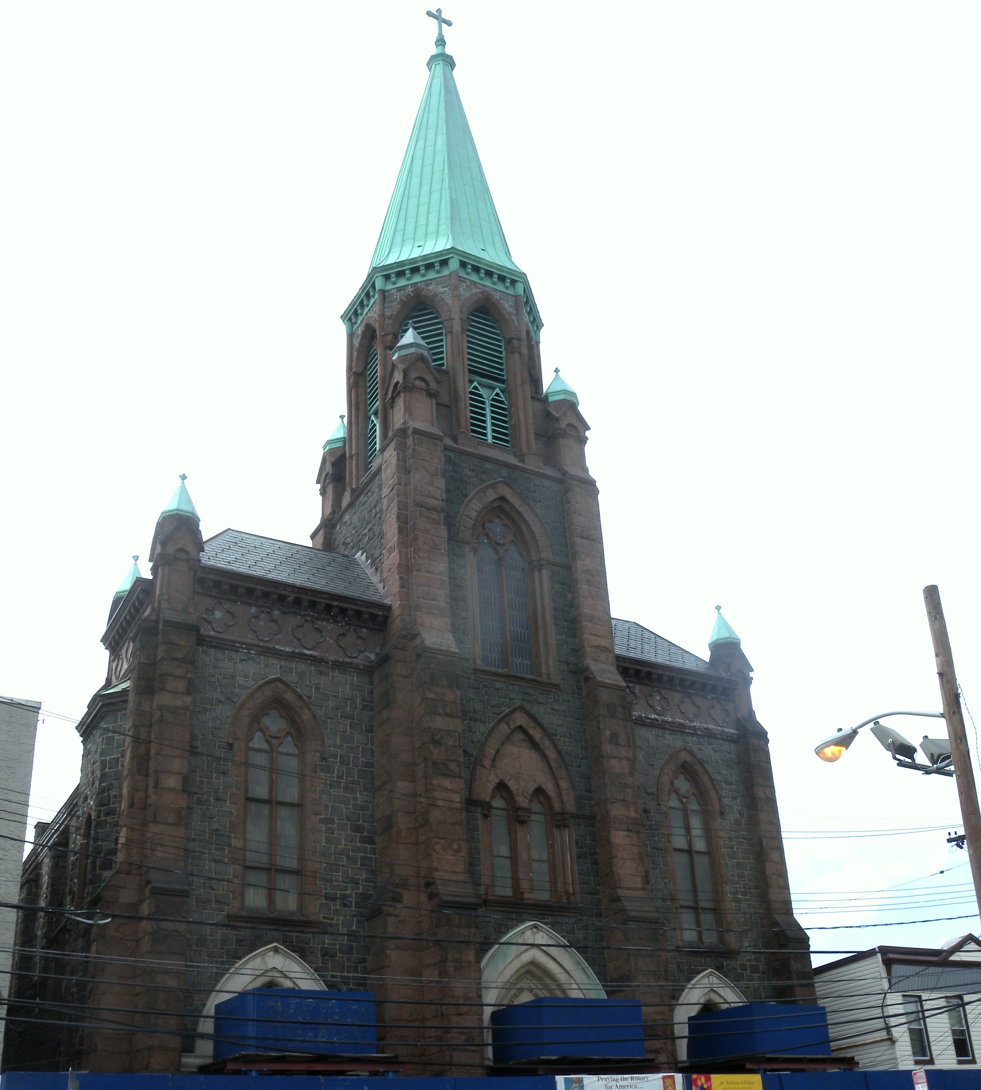
The Village is a neighborhood in the western section of Downtown Jersey City, Historic Downtown in Jersey City, New Jersey, Jersey City. It is bordered by Hamilton Park, Jersey City, New Jersey, Hamilton Park and Harsimus, Harsimus Cove to the east and the Interstate 78 in New Jersey, Turnpike Extension to the west, on the other side of which Jones Park and Mary Benson Park are located. Newark Plank Road, Newark Avenue is the major street across the Village from Grove Street (Hudson County), Grove Street at the east to Bergen Hill at the west. The neighborhood for many years was considered the city's "Little Italy" neighborhood. Brunswick Street, between 1st and 10th Streets was once full of merchants and nicknamed "Bushel Avenue". St. Anthony of Padua Roman Catholic Church at 457 Monmouth St. received its historic designation on March 22, 2004. An annual feast organised by Holy Rosary Church on 6th and Brunswick Streets has taken place since the turn of 20th century.Mosca, Dav ... [...More Info...] [...Related Items...] OR: [Wikipedia] [Google] [Baidu] |
Hamilton Park, Jersey City
Hamilton Park is a neighborhood in Downtown Jersey City, Historic Downtown Jersey City, New Jersey, Jersey City, Hudson County, New Jersey, Hudson County, in the U.S. state of New Jersey, centered on a park with the same name. Hamilton Park is located west of Newport, Jersey City, Newport, north of Harsimus, Harsimus Cove, north and east of The Village, Jersey City, The Village and south of Holland Tunnel, Boyle Plaza. The Victorian age park is located between Eighth Street and Ninth Street and Hamilton Place on the west and McWilliams Place on the East. Like the Van Vorst Park neighborhood to the south, this quiet park is surrounded by nineteenth century brownstones. The park underwent renovations completed in 2010. Programs The park produces several events throughout the year, some of which include * A Shakespeare in the Park series by the Hudson Shakespeare Company. The professional company produces one Shakespeare or classical show for each summer month. This is paid ... [...More Info...] [...Related Items...] OR: [Wikipedia] [Google] [Baidu] |
Hackensack Indians
Hackensack was the exonym given by the Dutch colonists to a band of the Lenape, or ''Lenni-Lenape'' ("original men"), a Native American tribe. The name is a Dutch derivation of the Lenape word for what is now the region of northeastern New Jersey along the Hudson and Hackensack rivers. While the Lenape people occupied much of the mid-Atlantic area, Europeans referred to small groups of native people by the names associated with the places where they lived. Territory and society The territory of the Hackensack was variously called Ack-kinkas-hacky, Achkinhenhcky, Achinigeu-hach, Ackingsah-sack, among other spellings (translated as "place of stony ground" or "mouth of a river") and included the areas around the Upper New York Bay, Newark Bay, Bergen Neck, the Meadowlands, and the Palisades. A phratry of the Lenape, the Hackensack spoke the Unami dialect, one of the two major dialects of the Lenape, or Delaware, languages, which were part of the Algonquian language family. ... [...More Info...] [...Related Items...] OR: [Wikipedia] [Google] [Baidu] |
Horseshoe, Jersey City
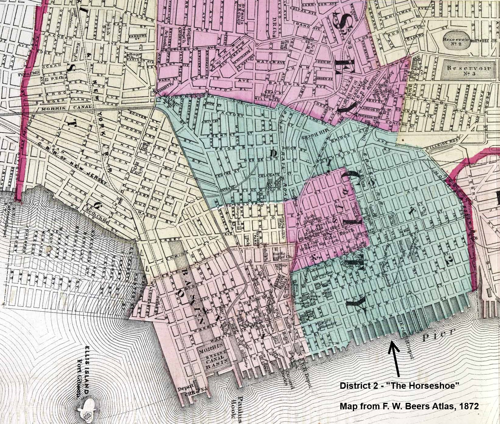
The Horseshoe section of Jersey City, New Jersey, was the second ward, and was the home of the immigrants, tenements, and taverns. The History of the United States Republican Party, Republican-controlled New Jersey Legislature, Legislature gerrymandering, gerrymandered the district in 1871 to concentrate and isolate History of the United States Democratic Party, Democratic, and mostly Catholic Church in the United States, Catholic, votes, thus preserving Republican dominance in the rest of the city. The curved shape of the district was said to resemble a horseshoe. As competing railroads built Cut (earthmoving), cuts through Bergen Hill, they also built viaducts from the foot of the cliff which passed through residential districts to the waterfront. The district is often associated with the name Pavonia, New Netherland, Pavonia encompassing Harsimus Cove, Hamilton Park, Jersey City, Hamilton Park, Powerhouse Arts District, Jersey City, Powerhouse and the former site of the Erie ... [...More Info...] [...Related Items...] OR: [Wikipedia] [Google] [Baidu] |
Michael Reyniersz Pauw
Michiel Reiniersz Pauw (29 March 1590 – 24 March 1640) was a director of the Dutch West India Company (WIC) between 1621 and 1636. He is buried at Nieuwe Kerk, Amsterdam. He grew up in Warmoesstraat in an influential Calvinist merchant family and studied law in Leiden. In 1615, Michiel married Hillegonda Spiegel; in 1631 they lived at Singel 200. His brother Adriaan Pauw (1585 - February 21, 165 was Grand Pensionary of Holland from 1631 to 1636 and from 1651 to 1653, and signatory of the Peace of Münster (1648) for which he was instrumental as ambassador for Holland. They had four brothers: Cornelis, Reynier, Pieter, and Jacob. Their father, Reynier Pauw (1564–1636) was a merchant in grain and timber, one of the founders of the Dutch East India Company and the Dutch West India Company, several times mayor of Amsterdam. West India Company The WIC was founded in 1621 to exploit trade in the Western Hemisphere, and by 1625 had established a colony at Fort Amsterdam (Low ... [...More Info...] [...Related Items...] OR: [Wikipedia] [Google] [Baidu] |


