|
Harrowfield
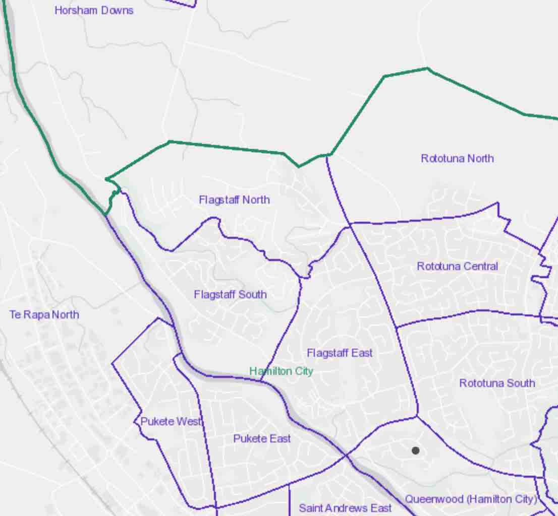
Harrowfield is a suburb in eastern Hamilton in New Zealand. It was built in about 1991. Part of Tauhara Park borders the suburb. The park has a mini golf area, a playground, sports fields and walkway/cycleway paths, which connect Harrowfield to the Kirikiriroa Stream valley, Queenwood and Flagstaff. Some of the park, on the far side of Wairere Drive, covers the old Rototuna landfill. Since the late 1990s much of the leachate from the landfill has been collected for disposal at Pukete sewage works. However residents were expressing concerns about it in 2012. Christmas lights in the suburb attract many visitors. In 2017 development of a further 22 dwellings, including 8 duplexes, was approved. Previous developments were on plots of around , rather than the higher density of the new one, which backs on to Wairere Drive. Demographics Harrowfield is marked on the 1:50,000 map and is referred to as a suburb in its own right, but as a census area it is part of Queenwood. Har ... [...More Info...] [...Related Items...] OR: [Wikipedia] [Google] [Baidu] |
List Of Streets In Hamilton, Waikato
Hamilton streets have been formed since the 1864 Invasion of the Waikato, after which the first crown grants were given to members of the occupying force, the 4th Waikato Militia, and plans made of the initial street layout. The tables below show the 1,782 streets listed by Hamilton City Council as at 3 August 2020. They also include information from Hamilton City Libraries Heritage street name index cards. As the dates of naming and the old maps (see External links below) show, the city has grown a lot since it was village in 1864. The shortest roads are small cul-de-sacs, the longest road reaching the centre of the city is River Road, which stretches to Ngāruawāhia. The list is not comprehensive, omitting streets such as Percival Road. The suburbs are as shown on the 2020 list, though there is some inconsistency, such as May and the adjoining June streets being shown in different suburbs. Bader Beerescourt Chartwell Chedworth Claudelands Deanwell ... [...More Info...] [...Related Items...] OR: [Wikipedia] [Google] [Baidu] |
Hamilton, New Zealand
Hamilton ( mi, Kirikiriroa) is an inland city in the North Island of New Zealand. Located on the banks of the Waikato River, it is the seat and most populous city of the Waikato, Waikato region. With a territorial population of , it is the country's List of cities in New Zealand, fourth most-populous city. Encompassing a land area of about , Hamilton is part of the wider Hamilton Urban Area, which also encompasses the nearby towns of Ngāruawāhia, Te Awamutu and Cambridge, New Zealand, Cambridge. In 2020, Hamilton was awarded the title of most beautiful large city in New Zealand. The area now covered by the city was originally the site of several Māori people, Māori villages, including Kirikiriroa, from which the city takes its Māori name. By the time English settlers arrived, most of these villages, which sat beside the Waikato River, were abandoned as a result of the Invasion of Waikato and New Zealand land confiscations, land confiscation (''Raupatu'') by the Crown. Initi ... [...More Info...] [...Related Items...] OR: [Wikipedia] [Google] [Baidu] |
St Andrews, Hamilton
St Andrews is a suburb in north-western Hamilton in New Zealand. One of its main features is an 18-hole golf course built on an old flood plain on the west bank of the Waikato River. This area was regularly flooded before the construction of the Karapiro HEP dam further up river. Demographics Saint Andrews covers and had an estimated population of as of with a population density of people per km2. Saint Andrews had a population of 5,361 at the 2018 New Zealand census, an increase of 366 people (7.3%) since the 2013 census, and an increase of 210 people (4.1%) since the 2006 census. There were 1,929 households, comprising 2,562 males and 2,796 females, giving a sex ratio of 0.92 males per female, with 1,119 people (20.9%) aged under 15 years, 1,071 (20.0%) aged 15 to 29, 2,304 (43.0%) aged 30 to 64, and 870 (16.2%) aged 65 or older. Ethnicities were 73.5% European/Pākehā, 23.3% Māori, 5.0% Pacific peoples, 11.1% Asian, and 2.4% other ethnicities. People may identif ... [...More Info...] [...Related Items...] OR: [Wikipedia] [Google] [Baidu] |
Pukete
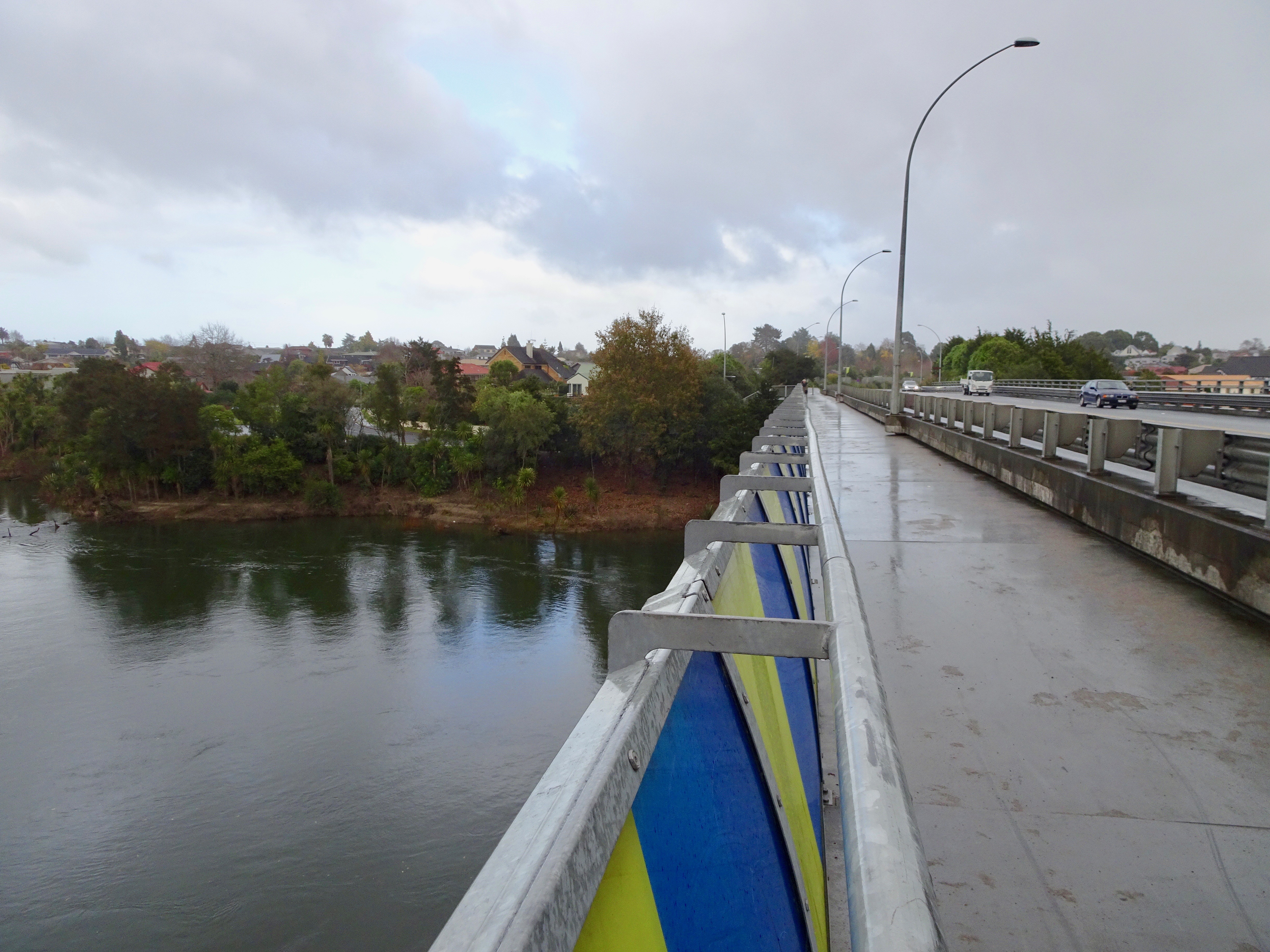
Pukete is a 1970s riverside suburb in northwestern Hamilton in New Zealand. The cobblestoned walk in the park has a grass dog exercise area. The riverside walkway, which includes many pedestrian bridges, can be used by walkers or cyclists, but the lower sections are subject to flooding in winter. A pedestrian bridge links Braithwaite Park to Flagstaff on the eastern side of the Waikato River. A 2015 River Plan proposed it become 'a flower garden bridge'. There is a small beach on the west side of the river at Braithwaite park often used in summer by water skiers and picnickers. To the north of the residential area is the Pukete Mountain Bike track, an Equestrian centre, and a two-lane launching ramp into the Waikato River, all on the Pukete Farm Park. A concreted riverside track, for bikes and pedestrians, runs north from Mountain View Lane starting by the southeast side of the Fonterra Te Rapa Milk powder factory. The eastern part of Pukete and neighbouring St Andrews is bu ... [...More Info...] [...Related Items...] OR: [Wikipedia] [Google] [Baidu] |
Suburbs Of Hamilton, New Zealand
List of Hamilton suburbs. *Aberdeen * Ashmore * Bader *Beerescourt *Callum Brae * Chartwell *Chedworth Park * Claudelands * Crawshaw *Deanwell * Dinsdale * Enderley * Fairfield * Fairview Downs * Fitzroy * Flagstaff * Forest Lake * Frankton * Glenview * Grandview Heights * Hamilton Central * Hamilton East * Hamilton Lake * Hamilton North * Hamilton West *Harrowfield * Hillcrest * Huntington *Livingstone * Magellan Rise * Maeroa * Melville * Nawton * Peacocke * Pukete * Queenwood * River Road * Riverlea *Rotokauri *Rototuna * Ruakura * Silverdale * Stonebridge *St Andrews * St James Park * St Petersburg * Somerset Heights * Stonebridge *Te Rapa * Te Kowhai *Temple View Temple View is a suburb of the city of Hamilton, New Zealand. Temple View was established in the 1950s out of the construction of the Hamilton New Zealand Temple and the Church College of New Zealand by the Church of Jesus Christ of Latter-day ... * Thornton * Western Heights * Whitiora {{div col end ... [...More Info...] [...Related Items...] OR: [Wikipedia] [Google] [Baidu] |
Queenwood
Queenwood is a suburb in northern Hamilton in New Zealand. This place is separated by Chartwell Park from Chartwell. It is mostly a residential area, with the typical range of local shops. It is located between River Road and Hukanui Road. Demographics Queenwood statistical area, which also includes Harrowfield, covers and had an estimated population of as of with a population density of people per km2. Queenwood had a population of 2,382 at the 2018 New Zealand census, an increase of 117 people (5.2%) since the 2013 census, and an increase of 144 people (6.4%) since the 2006 census. There were 864 households, comprising 1,149 males and 1,233 females, giving a sex ratio of 0.93 males per female. The median age was 41.1 years (compared with 37.4 years nationally), with 456 people (19.1%) aged under 15 years, 450 (18.9%) aged 15 to 29, 1,062 (44.6%) aged 30 to 64, and 414 (17.4%) aged 65 or older. Ethnicities were 82.2% European/Pākehā, 12.8% Māori, 3.0% Pacific peop ... [...More Info...] [...Related Items...] OR: [Wikipedia] [Google] [Baidu] |
Flagstaff, Hamilton
Flagstaff is a suburb in north-east Hamilton, New Zealand. It was originally called Dulverton on council plans, but it was officially named ''Flagstaff'' in 1986 when it was declared as a suburb. The area was heavily developed in the 1990s. Sometimes the name Rototuna is used to collectively refer to all of the city north of Wairere Drive and east of the Waikato River, including Flagstaff and its developments of St Petersburg and Magellan Rise. The name "Flagstaff" comes from the flagstaff that was located on the hillock at the western end of Sylvester Road in the 1870s. A flag was raised by the local farmer when a steamer passed to alert the port authorities in the settlement 7 km further south. Flagstaff is connected to Pukete by a 5 m wide pedestrian bridge that connects with a series of walkways on both banks of the Waikato River. The suburb is served by a shopping centre with parks for 50 cars. It has 18 shops and a gym. Two playgrounds serve the new sub ... [...More Info...] [...Related Items...] OR: [Wikipedia] [Google] [Baidu] |
Rototuna
Rototuna is a suburb in northern Hamilton, New Zealand, east of Flagstaff. It is one of the newest and fastest-growing suburbs in Hamilton, along with neighbouring Huntington and Flagstaff. Sometimes the name Rototuna is used to collectively refer to all of the city north of Wairere Drive and east of the Waikato River, including Flagstaff, St Petersburg, Magellan Rise, Ashmore, Somerset Heights, St James, Callum Brae and Huntington. Although many Hamilton City publications say it was built on what was previously the bed of an ancient lake of which Rototuna was a tiny remnant, Lake Tunawhakapeka was to the north in Horsham Downs. However, its alternative name of Lake Rototuna, was the inspiration for the name given to a new post office in 1907 and later adopted for the area. The New Zealand Ministry for Culture and Heritage gives a translation of "eel lake" for . History Carbon dating of 1550 to 1625 was put on charcoal from a cultivation ground, which was uncovered on ... [...More Info...] [...Related Items...] OR: [Wikipedia] [Google] [Baidu] |
2006 New Zealand Census
The New Zealand Census of Population and Dwellings ( mi, Te Tatauranga o ngā Tāngata Huri Noa i Aotearoa me ō rātou Whare Noho) is a national population and housing census conducted by government department Statistics New Zealand every five years. There have been 34 censuses since 1851. In addition to providing detailed information about national demographics, the results of the census play an important part in the calculation of resource allocation to local service providers. The 2018 census took place on Tuesday 6 March 2018. The next census is expected in March 2023. Census date Since 1926, the census has always been held on a Tuesday and since 1966, the census always occurs in March. These are statistically the month and weekday on which New Zealanders are least likely to be travelling. The census forms have to be returned by midnight on census day for them to be valid. Conducting the census Until 2018, census forms were hand-delivered by census workers during the lead ... [...More Info...] [...Related Items...] OR: [Wikipedia] [Google] [Baidu] |
Buddhism In New Zealand
Buddhism is New Zealand's third-largest religion after Christianity and Hinduism standing at 1.5% of the population of New Zealand. Buddhism originates in Asia and was introduced to New Zealand by immigrants from East Asia. History The first Buddhists in New Zealand were Chinese diggers in the Otago goldfields in the 1860s. Their numbers were small, and the 1926 census, the first to include Buddhism, recorded only 169. In the 1970s travel to Asian countries and visits by Buddhist teachers sparked an interest in the religious traditions of Asia, and significant numbers of New Zealanders adopted Buddhist practices and teachings. Since the 1980s Asian migrants and refugees have established their varied forms of Buddhism in New Zealand. In the 2010s more than 50 groups, mostly in the Auckland region, offered different Buddhist traditions at temples, centres, monasteries and retreat centres. Many migrant communities brought priests or religious specialists from their own countries an ... [...More Info...] [...Related Items...] OR: [Wikipedia] [Google] [Baidu] |
Hinduism In New Zealand
Hinduism is the second largest religion in New Zealand. It is also one of the fastest-growing religions in New Zealand. According to the 2018 census, Hindus form 2.65% of the population of New Zealand. There are about 123,534 Hindus in New Zealand. Hindus from all over India continue to immigrate today, with the largest Indian ethnic subgroup being Gujaratis. A later wave of immigrants also includes Hindu immigrants who were of Indian descent from nations that were historically under European colonial rule, such as Fiji. Today there are Hindu temples in all major New Zealand cities. History Early settlement In 1836 the missionary William Colenso saw Māori women near Whangarei using a broken bronze bell to boil potatoes. The inscription is in very old Tamil script. This discovery has led to speculation that Tamil-speaking Hindus may have visited New Zealand hundreds of years ago. However, the first noted settlement of Hindus in New Zealand dates back to the arrival of ... [...More Info...] [...Related Items...] OR: [Wikipedia] [Google] [Baidu] |
Christianity In New Zealand
Christianity in New Zealand dates to the arrival of missionaries from the Church Missionary Society who were welcomed onto the beach at Rangihoua Bay in December 1814. It soon became the predominant belief amongst the indigenous people with an estimated 60% of Māori pledging allegiance to the Christian message within the first 35 years. It remains New Zealand's largest religious group despite there being no official state church A state religion (also called religious state or official religion) is a religion or creed officially endorsed by a sovereign state. A state with an official religion (also known as confessional state), while not secular, is not necessarily a t .... Today, slightly less than half the population identify as Christians, Christian. The largest Christian groups are Catholic Church in New Zealand, Catholic, Anglican Church in Aotearoa, New Zealand and Polynesia, Anglican and Presbyterian Church in New Zealand, Presbyterian. Christian organisations are t ... [...More Info...] [...Related Items...] OR: [Wikipedia] [Google] [Baidu] |


