|
Harrison Bungwon
Engr. Dr. Harrison Yusuf Bungwon (Tyap: Harrison Isuu Bunggwon) FNSE (25 November 1949 – 6 April 2016) was a paramount ruler of Atyap Chiefdom a Nigerian traditional state in southern Kaduna State, Nigeria. He was also known by the title ''Agwatyap II''. Early life and education Bungwon was born to A̠tyoli Bungwon Yawa and A̠yanga̠li Atoh Bungwon on 25 November 1949 in Bafoi, Ka̠nai District, Atyapland, Northern Region, British Nigeria (now in southern Kaduna State, Nigeria). His father died in 1953, when he was only four years old. His educational career began in January, 1957 at the age of seven in Native Authority Junior Primary School, Bafwoi-Ka̠nai (Gora Bafai). After passing his entrance examination in 1961, he got admitted into Native Authority Senior Primary School, Kachia. In 1963, Bungwon got admitted into Government Technical School, Soba, Zaria, where he had a two and a half year stint before he got admitted in 1965 into the prestigious Government Technical ... [...More Info...] [...Related Items...] OR: [Wikipedia] [Google] [Baidu] |
Atyap Chiefdom
Atyap Chiefdom is a Nigerian traditional state of the Atyap people, located on the upper Kaduna River basin of the central Nigeria plateau in the Middle Belt. Its headquarters is at A̠tak Njei, Zangon Kataf, southern Kaduna state, Nigeria. People History The Atyap Chiefdom was created in 1995. In 2007, it was upɡraded to a First Class status. Government The Atyap Chiefdom is run by the Atyap Traditional Council, with the A̠gwatyap as its head. Administrative divisions Districts The Kaduna state Ministry of Local Government Affairs gave its number of ''Existing Districts'' as 16, ''Approved Districts'' as five and ''Approved Village Units'' as 61. Districts of Atyap Chiefdom These are the districts between 1995 and 2017: However, these are the current five Government-Approved Districts from 2017 onwards, trimmed down by the incumbent Kaduna State governor Nasir Elrufai who accordingly said, as reported b''Premium Times, Nigeria''that the committee set up to address the ... [...More Info...] [...Related Items...] OR: [Wikipedia] [Google] [Baidu] |
Kano (city)
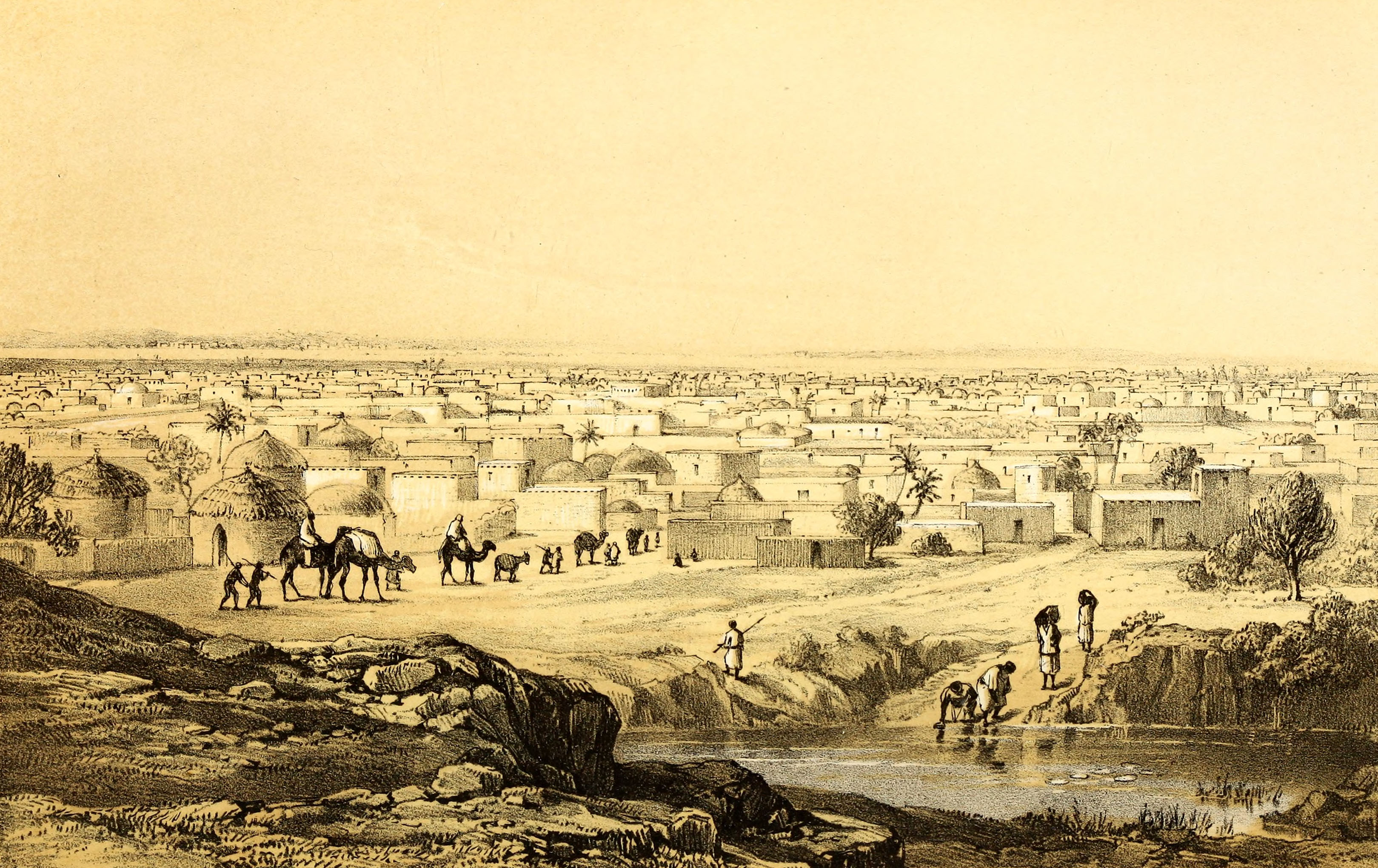
Kano ( Ajami: كانو) is a city in northern Nigeria and the capital of Kano State. It is the second largest city in Nigeria after Lagos, with over four million citizens living within ; located in the Savanna, south of the Sahel, Kano is a major route of the trans-Saharan trade. The city has been a trade and human settlement for millennia. It is the traditional state of the Dabo dynasty who since the 19th century have ruled as emirs over the city-state. Kano Emirate Council is the current traditional institution inside the city boundaries of Kano, and under the authority of the Government of Kano State. The city is one of the medieval Hausa seven kingdoms and the principal inhabitants of the city are the Hausa people. Centuries before British colonization, Kano was strongly cosmopolitan with settled populations of Arab, Berber, Tuareg, Kanuri and Fula and remains so with the Hausa language spoken as a lingua-franca by over 70 million speakers in the region. Isla ... [...More Info...] [...Related Items...] OR: [Wikipedia] [Google] [Baidu] |
Plateau State Polytechnic
Plateau State Polytechnic is a state owned polytechnic in Plateau State, North Central Nigeria. The institution has two campuses, one at Barkin Ladi and the other at Bukuru Bukuru is a city located on the Jos Plateau in Nigeria. It was previously considered a separate city from the city of Jos close by, but like every other form of urbanization, the city of Jos has merged with the town of Bukuru to form the Jos-Buk ... near Jos, the capital of the state. It provides education to degree and national diploma level. The rector is BLDR. John Dawam. History The institution was founded in 1978 as a College of Technology on the site of Government Technical College, Bukuru. It became a polytechnic in 1980. Courses offered * Agricultural Engineering / Technology * Banking and Finance * Building Technology * Business Administration and Management * Civil Engineering Technology * Computer Engineering * Computer Science * Electrical Electronics Engineering * Foundry Technology * Ho ... [...More Info...] [...Related Items...] OR: [Wikipedia] [Google] [Baidu] |
Osun State
Osun State (; yo, Ìpínlẹ̀ Ọ̀ṣun), occasionally known as the State of Osun by the state government, is a state in southwestern Nigeria; bounded to the east by Ekiti and Ondo states, to the north by Kwara State, to the south by Ogun State and to the west by Oyo State. Named for the River Osun—a vital river which flows through the state—the state was formed from the southeast of Oyo State on 27 August 1991 and has its capital as the city of Osogbo. Of the 36 states of Nigeria, Osun is the ninth smallest in area and nineteenth most populous with an estimated population of about 4.7 million as of 2016. Geographically, the state is divided between the Nigerian lowland forests in most of the state and the drier Guinean forest–savanna mosaic in the north. The major geographical features are rivers including the state's namesake, the River Osun which bisects the state's interior before forming much of the state's southwestern border with Oyo State and flowing ... [...More Info...] [...Related Items...] OR: [Wikipedia] [Google] [Baidu] |
Osogbo
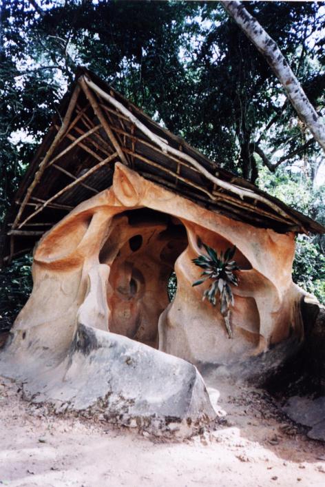
Osogbo (also ''Oṣogbo'', rarely ''Oshogbo'') is a city in Nigeria. It became the capital city of Osun State in 1991. Osogbo city seats the Headquarters of both Osogbo Local Government Area (situated at Oke Baale Area of the city) and Olorunda Local Government Area (situated at Igbonna Area of the city). It is some 88 kilometers by road northeast of Ibadan. It is also by road south of Ilorin(kwara state) and northwest of Akure. Osogbo shares boundaries with Ikirun, Ilesa, Ede, Egbedore, Ogbomosho and Iragbiji and is easily accessible from any part of the state because of its central nature. It is about 48 km from Ife, 32 km from Ilesa, 46 km from Iwo, 48 km from Ikire and 46 km from Ila-Orangun; The city had a population of about 500,000 people and an approximate land area of 2875 km2 the postal code of the area is 230. Infrastructure and demographics Osogbo lies on the railway line from Lagos to Kano. It is known for the Osogbo School of ... [...More Info...] [...Related Items...] OR: [Wikipedia] [Google] [Baidu] |
Abuja
Abuja () is the capital and eighth most populous city of Nigeria. Situated at the centre of the country within the Federal Capital Territory (FCT), it is a planned city built mainly in the 1980s based on a master plan by International Planning Associates (IPA), a consortium of three American planning and architecture firms made up of Wallace, Roberts, McHarg & Todd (WRMT – a group of architects) as the lead, Archisystems International (a subsidiary of the Howard Hughes Corporation), and Planning Research Corporation. The Central Business District of Abuja was designed by Japanese architect Kenzo Tange. It replaced Lagos, the country's most populous city, as the capital on 12 December 1991. Abuja's geography is defined by Aso Rock, a monolith left by water erosion. The Presidential Complex, National Assembly, Supreme Court and much of the city extend to the south of the rock. Zuma Rock, a monolith, lies just north of the city on the expressway to Kaduna. At the ... [...More Info...] [...Related Items...] OR: [Wikipedia] [Google] [Baidu] |
Defence Industries Corporation Of Nigeria
Defence Industries Corporation of Nigeria (DICON) is the state-run defense corporation of Nigeria and operated by the Nigerian Armed Forces. It is responsible for the production of defense equipment and civilian products. History DICON was established in 1964 through an act of parliament in the Nigerian National Assembly. From 2018 to March 2021, Major General Victor Okwudili Ezugwu was appointed as DICON's director-general. Major General MO Uzoh was appointed DG in March 2021. Products It makes licensed copies of the Mills M36M (M36) handgrenade, Browning P-35 (NP-1) pistol, Beretta M12 (PMG-12) submachine gun, Beretta BM59 and FN FAL (NR1 Model 7.62) battle rifles, FN MAG (GPMG) machinegun, and RPG-7 (RPG) rocket launcher. The OBJ-006, a copy of the 7.62mm AK-47 The AK-47, officially known as the ''Avtomat Kalashnikova'' (; also known as the Kalashnikov or just AK), is a gas-operated assault rifle that is chambered for the 7.62×39mm cartridge. Developed in the Sovie ... [...More Info...] [...Related Items...] OR: [Wikipedia] [Google] [Baidu] |
Kaduna Polytechnic
Kaduna Polytechnic is one of the earliest polytechnics in Nigeria, located at Tudun Wada area of Kaduna South local government of Kaduna state, North-Western Nigeria. It was established in 1956 as Kaduna Technical Institute after the British Government accepted the upgrading of Yaba Higher College (now Yaba College of Technology) to a technical institute and also proposed the establishment of technical institutes in Kaduna and Enugu through the recommendation of the Higher Education Commission. The polytechnic offers National Diploma and Higher National Diploma courses at the undergraduate level. In 2019/2020 academic session the institute will start awarding National Diploma in Railway Engineering Technology as approved by NBTE on 30 January 2020. The board of Governors of Kaduna Polytechnic was set up in 1991, with representative of eleven state governments, universities, rectors. the board is responsible for the supervision and control of the school. they are called the ... [...More Info...] [...Related Items...] OR: [Wikipedia] [Google] [Baidu] |
United Kingdom
The United Kingdom of Great Britain and Northern Ireland, commonly known as the United Kingdom (UK) or Britain, is a country in Europe, off the north-western coast of the European mainland, continental mainland. It comprises England, Scotland, Wales and Northern Ireland. The United Kingdom includes the island of Great Britain, the north-eastern part of the island of Ireland, and many List of islands of the United Kingdom, smaller islands within the British Isles. Northern Ireland shares Republic of Ireland–United Kingdom border, a land border with the Republic of Ireland; otherwise, the United Kingdom is surrounded by the Atlantic Ocean, the North Sea, the English Channel, the Celtic Sea and the Irish Sea. The total area of the United Kingdom is , with an estimated 2020 population of more than 67 million people. The United Kingdom has evolved from a series of annexations, unions and separations of constituent countries over several hundred years. The Treaty of Union between ... [...More Info...] [...Related Items...] OR: [Wikipedia] [Google] [Baidu] |
University Of Manchester Institute Of Science And Technology
The University of Manchester Institute of Science and Technology (UMIST) was a university based in the centre of the city of Manchester in England. It specialised in technical and scientific subjects and was a major centre for research. On 1 October 2004, it amalgamated with the Victoria University of Manchester (commonly called the University of Manchester) to produce a new entity called the University of Manchester. UMIST gained its royal charter in 1956 and became a fully autonomous university in 1994. Previously its degrees were awarded by the Victoria University of Manchester. The UMIST motto was ''Scientia et Labore'' (By Knowledge and Work). Manchester Mechanics' Institute (1824–1882) The foundation of UMIST can be traced to 1824 during the Industrial Revolution when a group of Manchester businessmen and industrialists met in a public house, the Bridgewater Arms, to establish the ''Mechanics' Institute in Manchester'', where artisans could learn basic science, particu ... [...More Info...] [...Related Items...] OR: [Wikipedia] [Google] [Baidu] |
Minsk
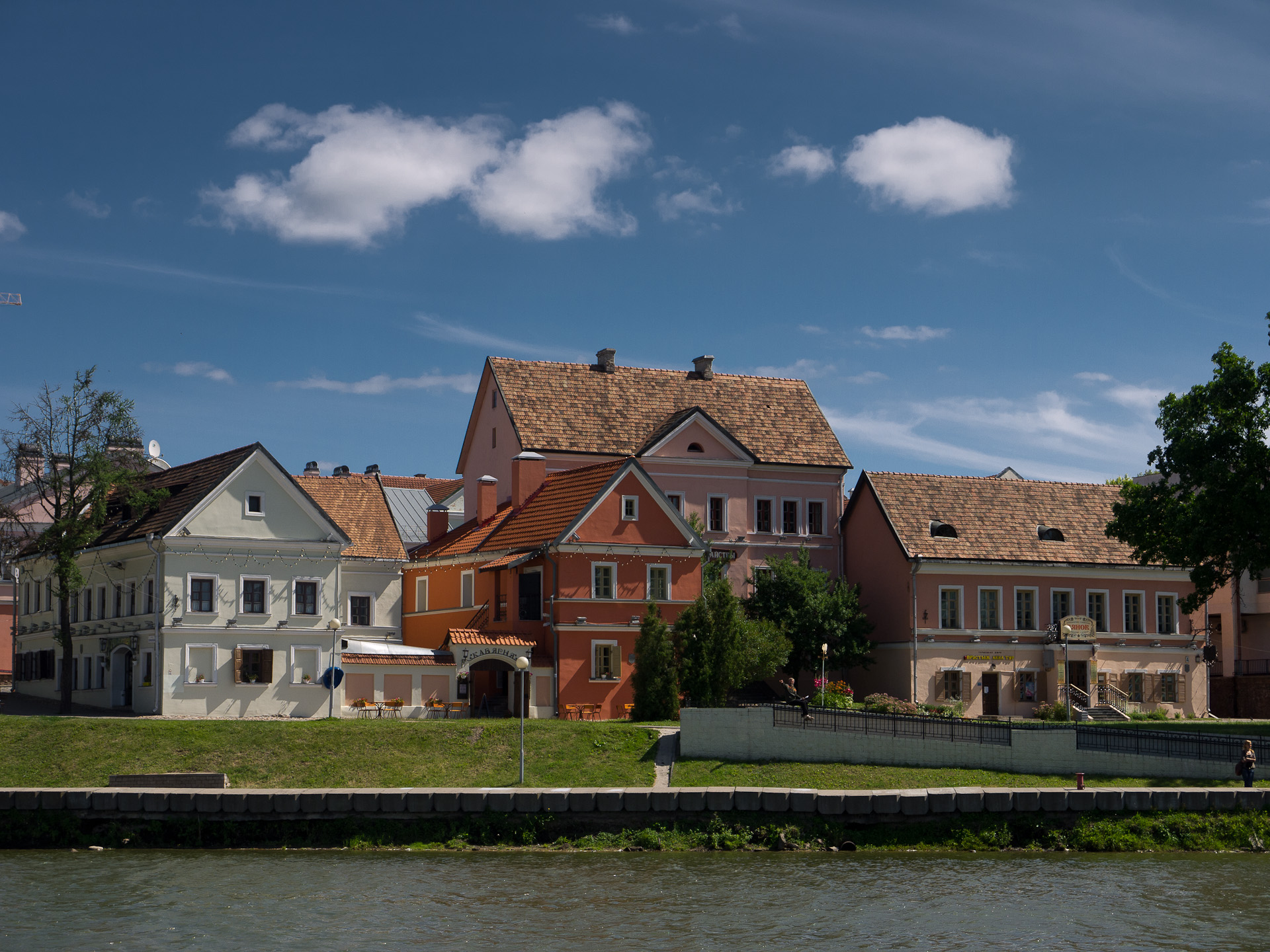
Minsk ( be, Мінск ; russian: Минск) is the capital and the largest city of Belarus, located on the Svislach (Berezina), Svislach and the now subterranean Nyamiha, Niamiha rivers. As the capital, Minsk has a special administrative status in Belarus and is the administrative centre of Minsk Region (oblast, voblast) and Minsk District (Raion, raion). As of January 2021, its population was 2 million, making Minsk the Largest cities in Europe, 11th most populous city in Europe. Minsk is one of the administrative capitals of the Commonwealth of Independent States (CIS) and the Eurasian Economic Union (EAEU). First documented in 1067, Minsk became the capital of the Principality of Minsk before being annexed by the Grand Duchy of Lithuania in 1242. It received town privileges in 1499. From 1569, it was the capital of the Minsk Voivodeship, an administrative division of the Polish–Lithuanian Commonwealth. It was part of a region annexed by the Russian Empire in 1793, as a c ... [...More Info...] [...Related Items...] OR: [Wikipedia] [Google] [Baidu] |
Belarusian State Technological University
Belarusian State Technological University (russian: Белорусский государственный технологический университет; be, Беларускі Дзяржаўны Тэхналагічны Універсітэт) is a university in Minsk, Belarus specialized in engineering and technology. It was established in Gomel in 1930 as the Forestry Institute. In 1941, it was evacuated to Sverdlovsk, now Yekaterinburg. Returned to Gomel in 1944, but in 1946 relocated to Minsk as the Belarusian Institute of Technology. Structure *47 departments *11 faculties *Dean's office for foreign students *Pre-University courses *Negoreloe forestry experimental station *Botanical garden *Meteorological station *Educational-production forest-processing complex *Borisov educational-scientific experimental station *Technological gymnasium Prominent alumni *Yuri Puntus - former BATE Borisov and Belarus national football team The Belarus national football team ... [...More Info...] [...Related Items...] OR: [Wikipedia] [Google] [Baidu] |


