|
Hardanger Line
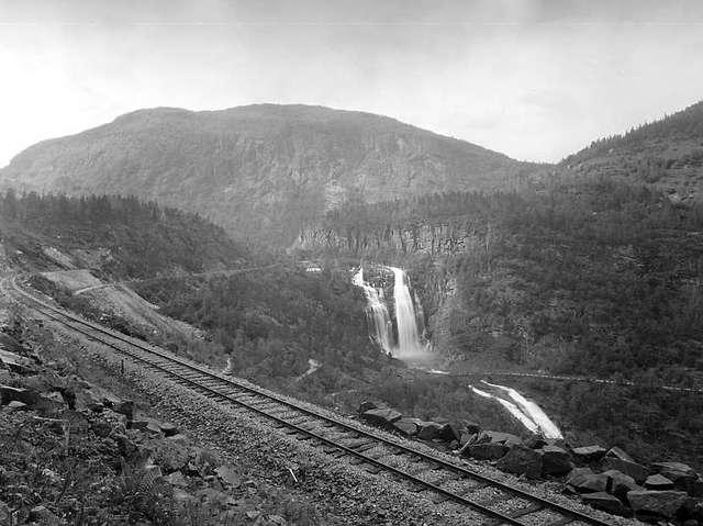
The Hardanger Line () was a railway between Voss and Granvin in Hordaland, Norway. The line connected to the Bergen Line in Voss and ran to the Hardangerfjord and the district of Hardanger. Construction started in 1921, but the line did not open until 1 April 1935. Owned and operated by Norwegian State Railways (NSB), passenger transport was provided by three NSB Class 64 electric multiple units. They remained in use until 1985 when passenger transport was terminated. All transport ceased in 1988, and of the line was demolished in 1991. The from Voss to Palmafoss is still intact and is owned by the Norwegian National Rail Administration. The line featured six stations, fourteen halts and four tunnels and was one of Norway's steepest railways. It was NSB's first line to be electrified. The line was known as the Granvin Line () until February 1936. In 2016, Palmafoss established an emergency freight terminal and the tracks were re-established. Route The Hardanger Line ran fro ... [...More Info...] [...Related Items...] OR: [Wikipedia] [Google] [Baidu] |
NSB Class 64
NSB Class 64 () is a class of three electric multiple units built by Strømmens Værksted for the Norwegian State Railways. Delivered in 1935, they were built for the opening of the Hardanger Line and served there until 1985, when the line closed and the trains were retired. They also periodically served on the Flåm Line. The delivery consisted of three motor cars and four carriages, with each train consisting of up to three units. The motor cars were long, had a power output of and were capable of . The motor units were given road numbers 505 through 507. Two of the units have been preserved by the Norwegian Railway Club and are at Garnes Station. __TOC__ History The Hardanger Line opened in 1935 as a steep and curvy branch of the Bergen Line to connect Bergen to the Hardangerfjord. The line was long, had a maximum gradient of 4.5 percent, a minimum curve radius of , a maximum speed of , a maximum permitted axle load of , standard gauge and a electrification system. ... [...More Info...] [...Related Items...] OR: [Wikipedia] [Google] [Baidu] |
Norwegian National Road 7
Norwegian National Road 7 (, ) is a national road in Norway which runs from the town of Hønefoss in Buskerud county to the village of Granvin in Vestland county. The route is long and runs east–west through Viken and Vestland counties over the vast Hardangervidda plateau. The road begins at the European route E16 highway just south of Heradsbygda in Ringerike municipality and runs through the Sogna river valley to the village of Sokna (this part is called the ''Soknedalsveien''). It then continues further on to Hamremoen and up along the east side of the lake Krøderen to Gulsvik, where it crosses the river and then follows the Hallingdalen valley through Flå, Nesbyen, Gol, Torpo, Ål, Hol, and Geilo (this part is called the ''Hallingdalsveien''). From there, the road begins its path across the Hardangervidda plateau via Ustaoset and Haugastøl, passing the Vøringsfossen waterfall while descending through 4 tunnels (including the 1,893-meter Måbø Tun ... [...More Info...] [...Related Items...] OR: [Wikipedia] [Google] [Baidu] |
Standard Gauge
A standard-gauge railway is a railway with a track gauge of . The standard gauge is also called Stephenson gauge (after George Stephenson), international gauge, UIC gauge, uniform gauge, normal gauge in Europe, and SGR in East Africa. It is the most widely used track gauge around the world, with about 55% of the lines in the world using it. All high-speed rail lines use standard gauge except High-speed rail in Russia, those in Russia, High-speed rail in Finland, Finland, High-speed rail in Uzbekistan, Uzbekistan, and some line sections in High-speed rail in Spain, Spain. The distance between the inside edges of the heads of the rails is defined to be 1,435 mm except in the United States, Canada, and on some heritage British lines, where it is defined in Imperial and US customary measurement systems, U.S. customary/Imperial units, British Imperial units as exactly "four feet eight and one half inches", which is equivalent to 1,435.1mm. History As railways developed and expa ... [...More Info...] [...Related Items...] OR: [Wikipedia] [Google] [Baidu] |
Norwegian National Road 13
National Road 13 (, ) is a national road which runs from the town of Stavanger in Rogaland county to the village of Sogndalsfjøra in Vestland county. The route is long and runs south–north through Rogaland and Vestland counties, following a more inland path than the European route E39 highway. Prior to 2019, the northern terminus of the road was at the village of Balestrand, but in 2019, the section of Norwegian County Road 55 from Balestrand to Sogndalsfjøra was added to National Road 13, extending it all the way to Sogndalsfjøra. In 2020, a new tunnel was opened between Stavanger and Tau, Ryfylke Tunnel, the world's deepest public road tunnel. National Road 13 was then rerouted through this tunnel, making it end in Stavanger instead of Sandnes. The road between Tau and Sandnes which has a ferry crossing (Oanes to Lauvika across the Høgsfjorden) became county roads. Route description Historically, Rv13 also included the road between the village of Balestrand to t ... [...More Info...] [...Related Items...] OR: [Wikipedia] [Google] [Baidu] |
Norwegian National Rail Administration
Jernbaneverket () was a government agency responsible for owning, maintaining, operating and developing the Norwegian railway network, including the track, stations, classification yards, traffic management and timetables. Safety oversight was the duty of the Norwegian Railway Inspectorate, while numerous operating companies run trains on the lines; the largest being the state owned passenger company Vy (formerly NSB) and the freight company CargoNet. The administration operated all railways in Norway, except public station areas and freight terminals built before 1997 and private sidings. All track is standard gauge, with a total of , of which is electrified, and is double track.Jernbanestatistikk 2012, p. 4. The Norwegian Railway Museum was a subsidiary of the rail administration. On 1 December 1996, NSB was split up; formally NSB and the inspectorate were demerged from the National Rail Administration, and NSB made a limited company. All three became subordinate to ... [...More Info...] [...Related Items...] OR: [Wikipedia] [Google] [Baidu] |
Electric Multiple Unit
An electric multiple unit or EMU is a multiple-unit train consisting of self-propelled carriages using electricity as the motive power. An EMU requires no separate locomotive, as electric traction motors are incorporated within one or a number of the carriages. An EMU is usually formed of two or more semi-permanently coupled carriages. However, electrically powered single-unit railcars are also generally classed as EMUs. The vast majority of EMUs are passenger trains but versions also exist for carrying mail. EMUs are popular on intercity, commuter, and suburban rail networks around the world due to their fast acceleration and pollution-free operation, and are used on most rapid-transit systems. Being quieter than diesel multiple units (DMUs) and locomotive-hauled trains, EMUs can operate later at night and more frequently without disturbing nearby residents. In addition, tunnel design for EMU trains is simpler as no provision is needed for exhausting fumes, although retrofitting ... [...More Info...] [...Related Items...] OR: [Wikipedia] [Google] [Baidu] |
Hardanger
Hardanger is a traditional district in the western part of Norway, dominated by the Hardangerfjord and its inner branches of the Sørfjorden and the Eid Fjord. It consists of the municipalities of Ullensvang, Eidfjord, Ulvik and Kvam, and is located inside the county of Vestland. The area is dominated by the vast Hardangervidda plateau in the east and the large Folgefonna glacier on the central Folgefonna peninsula. The district was selected as the millennium site for the old Hordaland county. In the early Viking Age, before Harald Fairhair, Hardanger was a petty kingdom with its capital at Kinsarvik. Etymology The Old Norse form of the name was ''Harðangr''. The first element is derived from the ethnonym '' hǫrðar'', or from ''harðr'' meaning "hard" (referring to wind and weather). The last element is ''angr'' "tight fjord" (the name originally belonged to the fjord, now called Hardangerfjord). Agriculture The region is one of Norway's most important sources of fr ... [...More Info...] [...Related Items...] OR: [Wikipedia] [Google] [Baidu] |
Hardangerfjord
The Hardangerfjord () is the fifth longest fjord in the world, and the second longest fjord in Norway. It is located in Vestland county in the Hardanger region. The fjord stretches from the Atlantic Ocean into the mountainous interior of Norway along the Hardangervidda plateau. The innermost point of the fjord reaches the town of Odda. Location The Hardangerfjord starts at the Atlantic Ocean about south of the city of Bergen. Here the fjord heads in a northeasterly direction between the island of Bømlo and the mainland. It passes by the larger islands of Stord, Tysnesøya, and Varaldsøy on the north/west side and the Folgefonna peninsula on the south/east side. Once it is surrounded by the mainland, it begins to branch off into smaller fjords that reach inwards towards the grand Hardangervidda mountain plateau. The longest branch of the Hardangerfjord is Sørfjorden which cuts south about from the main fjord. Its maximum depth is more than just outside the v ... [...More Info...] [...Related Items...] OR: [Wikipedia] [Google] [Baidu] |
Norway
Norway, officially the Kingdom of Norway, is a Nordic countries, Nordic country located on the Scandinavian Peninsula in Northern Europe. The remote Arctic island of Jan Mayen and the archipelago of Svalbard also form part of the Kingdom of Norway. Bouvet Island, located in the Subantarctic, is a Dependencies of Norway, dependency, and not a part of the Kingdom; Norway also Territorial claims in Antarctica, claims the Antarctic territories of Peter I Island and Queen Maud Land. Norway has a population of 5.6 million. Its capital and largest city is Oslo. The country has a total area of . The country shares a long eastern border with Sweden, and is bordered by Finland and Russia to the northeast. Norway has an extensive coastline facing the Skagerrak strait, the North Atlantic Ocean, and the Barents Sea. The unified kingdom of Norway was established in 872 as a merger of Petty kingdoms of Norway, petty kingdoms and has existed continuously for years. From 1537 to 1814, Norway ... [...More Info...] [...Related Items...] OR: [Wikipedia] [Google] [Baidu] |
Hordaland
Hordaland () was a county in Norway, bordering Sogn og Fjordane, Buskerud, Telemark, and Rogaland counties. Hordaland was the third largest county, after Akershus and Oslo, by population. The county government was the Hordaland County Municipality, which is located in Bergen. Before 1972, the city of Bergen was its own separate county, apart from Hordaland. On 1 January 2020, the county was merged with neighbouring Sogn og Fjordane county, to form the new Vestland county. Name and symbols Name Hordaland () is the old name of the region which was revived in 1919. The first element is the plural genitive case of , the name of an old Germanic tribe (see Charudes). The last element is which means 'land' or 'region' in the Norwegian language. Until 1919 the name of the county was which meant '(the) southern (part of) Bergenhus amt'. (The old was created in 1662 and was divided into Northern and Southern parts in 1763.) Flag Hordaland's flag shows two golden axes ... [...More Info...] [...Related Items...] OR: [Wikipedia] [Google] [Baidu] |


