|
Hampankatta
Hampankatta (also known as Happananakatte/Hampankatte/Hampananakatte/Hampanakatte and pronounced as 'Hampanakatte' in Tulu and Kannada) is the centre of Mangalore City, Karnataka. Most of the public utilities are located here. Hampanakkatte was named by the British in 1920. Its original name was 'Appanakatte'. The town was named after a person called ''Appanna Poojary'' who constructed a 'well' in the region around 1900. Mangalore Central Rail connectivity in Mangalore was established in 1907. Mangalore was also the starting point of India's longest rail route. The city has two railway stations, Mangalore Central (at Hampankatta) and Mangalore Junction (at Kankanadi). A metre gauge railway track, built through the Western Ghats, connects Mangalore with Hassan. The broad gauge track connecting Mangalore to Bangalore via Hassan was opened to freight traffic in May 2006 and passenger traffic in December 2007. Mangalore is also connected to Chennai through the Southern Railw ... [...More Info...] [...Related Items...] OR: [Wikipedia] [Google] [Baidu] |
Mangalore
Mangaluru (), formerly called Mangalore ( ), is a major industrial port city in the Indian state of Karnataka and on the west coast of India. It is located between the Laccadive Sea and the Western Ghats about west of Bengaluru, the state capital, north of Karnataka–Kerala border and south of Goa. Mangaluru is the state's only city to have all four modes of transport—air, road, rail and sea. The population of the urban agglomeration was 619,664 national census of India. It is known for being one of the locations of the Indian strategic petroleum reserves. The city developed as a port in the Laccadive Sea during ancient times, and after Independence a new port was constructed in 1968 and has since become a major port of India that handles 75 percent of India's coffee and cashew exports. It is also the country's seventh largest container port. Mangaluru has been ruled by several major powers, including the Mauryan empire, Kadambas, Alupas, Vij ... [...More Info...] [...Related Items...] OR: [Wikipedia] [Google] [Baidu] |
Town Hall, Mangalore
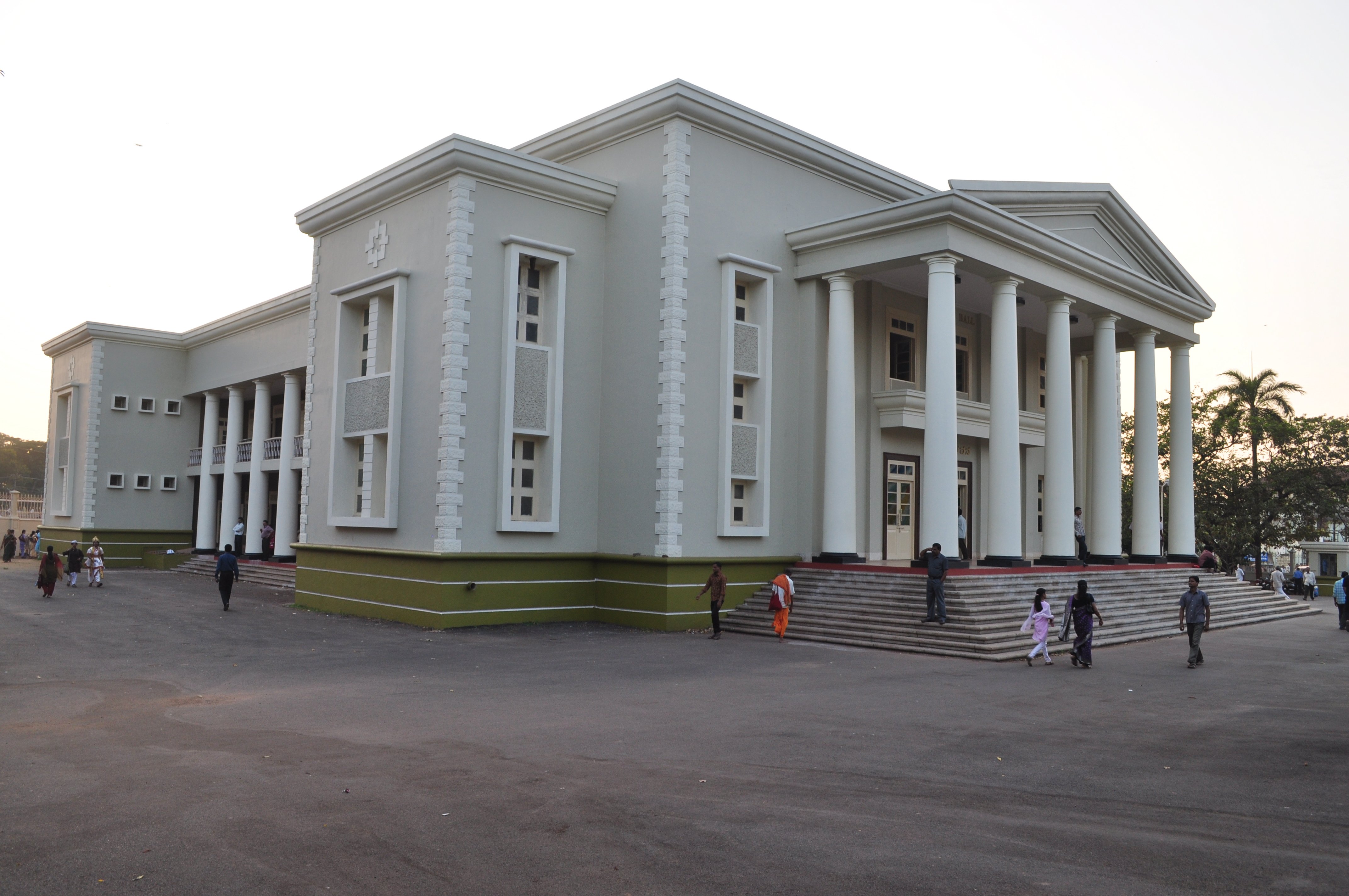
Town Hall of Mangaluru, inaugurated on 29 December 1964 is a Town Hall situated in Hampankatta locality of Mangaluru, Karnataka which is a prominent platform for all major social, political and cultural events in the city. Overview Yakshagana, Tulu, Kannada, Konkani Dramas are staged in Town Hall. Especially most of the Tulu Drama's maiden show is played here before the teams start their tours. It was renovated in November 2016 at a cost of Rs 4.58 crore and was inaugurated on Children's Day Children's Day is a commemorative date celebrated annually in honour of children, whose date of observance varies by country. In 1925, International Children's Day was first proclaimed in Geneva during the World Conference on Child Welfare. Sin .... References Buildings and structures in Mangalore {{India-struct-stub ... [...More Info...] [...Related Items...] OR: [Wikipedia] [Google] [Baidu] |
Mangalore Central Railway Station
Mangalore Central railway station (officially Mangaluru Central railway station)(station code: MAQ) is an NSG–2 category Indian railway station in Palakkad railway division of Southern Railway zone. It is the main railway terminus in the city of Mangalore, Karnataka and provides connectivity for Konkan Railway and South Western Railway. It is one of the five central railway stations of India. History Mangalore Railway Station presently known as Mangalore Central, had celebrated a quiet centenary in 2007. Though there are no exact records to prove that the railway station was opened in 1907 and the first train services commenced the same year, if one goes by the foundation stone on a quaint little guard house at the northern-end of the railway bridge across the Netravathi which says "The last rivet was put in position and the bridge formally declared completed by H.E. Sir Arthur Lawley. KCMG, GCIE, Governor of Madras on the 4th November 1907," one can conclude that the trai ... [...More Info...] [...Related Items...] OR: [Wikipedia] [Google] [Baidu] |
Mangalore Junction Railway Station
Mangalore Junction railway station (formerly Kankanadi railway station(station code: MAJN) is an NSG–3 category Indian railway station in Palakkad railway division of Southern Railway zone. It is an important railway station connecting Konkan, Western Ghat (Mangalore Hassan Mysore line) and Malabar railways and is also the gateway to the port city of Mangalore located at Darbar Hill, Padil, Mangalore, 575007. The station is a junction interconnecting Mangalore Central railway station with Kerala in the south, Maharashtra/Goa and Mangalore Sea Port in the north and Bangalore–Chennai in the east. It is the busiest railway junction in the area, as all north- and southbound trains touch Mangalore through this station. It was formerly called Kankanadi railway station when the city railway station was simply called Mangalore railway station. Later both were renamed as Mangalore Junction and respectively to avoid confusion. This is the first station in the Southern Railway zon ... [...More Info...] [...Related Items...] OR: [Wikipedia] [Google] [Baidu] |
Dakshina Kannada
Dakshina Kannada district is located in the states and territories of India, state of Karnataka in India, with its headquarters in the coastal city of Mangaluru. The district covers an area nestled in between the Western Ghats to its east and the Arabian Sea to its west. Dakshina Kannada receives abundant rainfall during the Indian monsoon. It is bordered by Udupi district (formerly a part of this district) to the north, Chikmagalur district to the northeast, Hassan district to the east, Kodagu to the southeast and Kasaragod district of Kerala to the south. According to the 2011 census of India, Dakshina Kannada district had a population of 2,089,649. It is the only district in Karnataka state to have all modes of transport like road, rail, water and air due to the presence of a major hub, Mangaluru. This financial district is also known as the Cradle of Indian banking. Geography File:Sullia. Karnataka (3).jpg, Hilly region – Sullia Town File:Tannirubhavi beach 02.JPG, Coasta ... [...More Info...] [...Related Items...] OR: [Wikipedia] [Google] [Baidu] |
Kollur, Udupi District
Kollur () is a village located in the southern state of Karnataka, India. Village code= 1292400 Navunda, Udupi, Karnataka It is located in the Byndoor taluk of Udupi district in Karnataka. Demographics As of 2001 India census,Kollour had a population of 3863 with 1900 males and 1962 females. See also * Udupi * Byndoor * Districts of Karnataka The southern Indian state of Karnataka consists of 31 districts grouped into 4 administrative divisions, ''viz''., Belagavi, Bengaluru , Gulbarga, and Mysore. Geographically, the state has three principal variants: the western coastal stretc ... * Murdeshwara References External links * http://Udupi.nic.in/ Villages in Udupi district {{Udupi-geo-stub ... [...More Info...] [...Related Items...] OR: [Wikipedia] [Google] [Baidu] |
Kasaragod
Kasaragod () is a municipal town and the administrative headquarters of the Kasaragod district in the state of Kerala, India. Established in 1966, Kasaragod was the first municipal town in the district. It is the northernmost district of Kerala and is also known as ''Sapta Bhasha Sangama Bhumi'' ('The Land of Seven Languages'). Situated in the rich biodiversity of Western Ghats, it is known for the Chandragiri Fort, Kerala, Chandragiri and Bekal Fort, Chandragiri River, historic Kolathiri, Kolathiri Rajas, natural environment of Ranipuram and Kottancheri Hills, historical and religious sites like the Madiyan Kulom temple, Madhur Temple, Ananthapura Lake Temple, Ananthapuram Lake Temple and Malik Deenar Mosque. The historic hill of Ezhimala is located on the southern portion of Kavvayi Backwaters of Nileshwaram. Kasaragod is located 90 km north of Kannur city corporation and 50 km south of Mangalore. Kasaragod district has the maximum number of rivers in Kerala - 12. ... [...More Info...] [...Related Items...] OR: [Wikipedia] [Google] [Baidu] |
Puttur, Karnataka
Puttur (Pronunciation:) is a city in the Dakshina Kannada district of Karnataka state in India. The Puttur Shree Mahalingeshwara Temple is located here. Geography Puttur is located at . It has an average elevation of . Puttur is situated south-east of Mangalore city. Climate Demographics As of 2011 India census, Puttur had a population of 48,063. Males constitute 50% of the population and females 50%. Hinduism is the major religion constituting to 65%, Muslims are about 22%, Christianity constitute 6% and other religions constitute 7%. Languages Tulu language, Tulu is the native mother tongue of most people in Puttur Taluk. A steady large scale migration of Malayalis from neighbouring Kerala into the Taluk has made Malayalam the 2nd most spoken language, followed by the state official language, Kannada and Beary. The Havigannada dialect is spoken by the Havyaka Brahmin community in Puttur. Notable places Puttur Shree Mahalingeshwara Temple is a 12th-century temple, loca ... [...More Info...] [...Related Items...] OR: [Wikipedia] [Google] [Baidu] |
Karkala
Karkala ( ) ( ) is a town and the headquarters of eponymous Karkala taluk in the Udupi district of Karnataka state in India. It lies near the foothills of the Western Ghats, Karkala has a number of natural and historical landmarks, and is a major tourist and transit destination due to its strategic location along the way to Hebri, Sringeri, Kalasa, Horanadu, Udupi, Kollur, Subrahmanya and Dharmasthala. Etymology Black granite is abundant in the area, and used widely in the local architecture. Hence, the name of the town is derived from ''kari-kal'', meaning black stone. There is still a place called as ''Kariya Kall'' in the city which means 'Black Rock' in Tulu and Kannada languages. The name 'Kariya Kall/ ಕರಿಯಕಲ್ಲ್ changed to 'Karikal/ಕರಿಕಲ್' and eventually to 'Karkal/ಕರ್ಕಲ್/ಕಾರ್ಕಳ್'. However, some studies assert that the original name was 'Kari Kola' meaning 'elephant lake' in Tulu and Kannada languages, which ... [...More Info...] [...Related Items...] OR: [Wikipedia] [Google] [Baidu] |
Shimoga
Shimoga, officially Shivamogga, is a city and the district headquarters of Shimoga district in the Karnataka state of India. The city lies on the banks of the Tunga River. Being the gateway for the hilly region of the Western Ghats, the city is popularly nicknamed the "Gateway of Malnad". The population of Shimoga city is 322,650 as per 2011 census. The city has been selected for the Smart Cities Mission ' standing in the fourth position in the state and 25th in the country as of November 2020. The city is 569 m above sea level and is surrounded by lush green paddy fields, arecanut and coconut groves. It is located 267 km from the state capital Bangalore and 195 km from the port city Mangalore. History The name of the city is derived from the term ' ''shivmoga A version of the etymology is the story that Shiva drank the Tunga River hence the name "Shiva-Mukha" which means the "face of Shiva". Another version of the etymology is that the name is derived from the ... [...More Info...] [...Related Items...] OR: [Wikipedia] [Google] [Baidu] |
Moodabidri
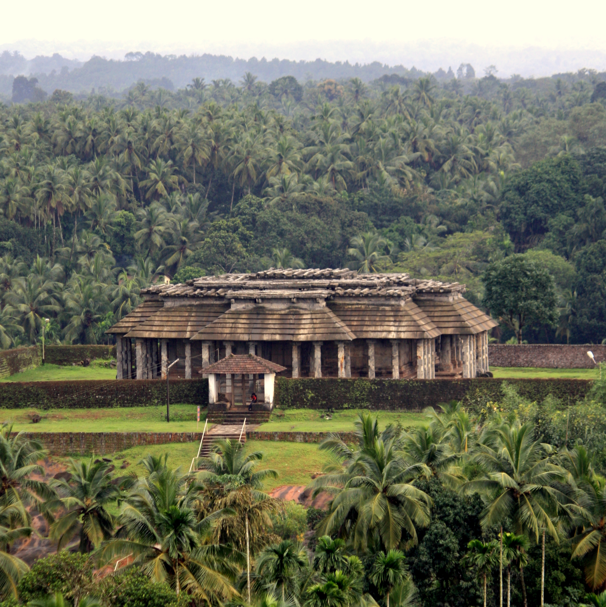
Moodubidire (''Mūḍubidire''; also called Mudbidri, Moodbidri and Bedra) is a town and taluk in Dakshina Kannada district. It lies 34 km northeast of the district headquarters, Mangalore, in Karnataka, India. Because of widely grown bamboo in ancient days, this place was named as ''Moodubidire''. ''Moodubidire'' comes from two Kannada words, ''Moodu'' "east" and ''Bidiru'' "bamboo". Its average elevation is . Demographics India census, Moodabidri had a population of 25,710. Males constitute 48% of the population and females 52%. Moodabidri has an average literacy rate of 88.57%, Male literacy is 93.13%, and female literacy is 84.13%. Moodabidri basically contains two villages: Pranthya and Marnad. Moodabidri is also called as " Jaina Kashi of the South". Location Moodabidri is on National Highway 169 (old NH 13). It is accessible from Mangalore city (34 km away) by road. Mangalore International Airport is 23 km away from Moodabidri. It is 54 k ... [...More Info...] [...Related Items...] OR: [Wikipedia] [Google] [Baidu] |


