|
Hammer Bottom
Hammer Bottom or Hammer Vale is a hamlet in the civil parish of Bramshott and Liphook, in the East Hampshire district in the county of Hampshire, England. Hammer Bottom lies at the meeting point of the counties of Hampshire, West Sussex and Surrey. Nearby settlements include the town of Haslemere, the villages of Liphook, Bramshott, Linchmere (sometimes also spelt Lynchmere), Shottermill, Camelsdale, Critchmere, Hammer and Woolmer Hill. For transport there is the B2131 road which the hamlet is nearly on and the A3 road, the A287 road, the A286 road nearby. The nearest railway station is Haslemere railway station. It once had a beer house called the Sussex Bell. ''The Prince of Wales'' pub dates from the 1920s, and was listed in the 50th edition of the Good Beer Guide The ''Good Beer Guide'' is a book published annually by the Campaign for Real Ale (CAMRA) listing what it considers to be the best 4,500 real ale outlets (pubs A pub (short for public house) is a kind ... [...More Info...] [...Related Items...] OR: [Wikipedia] [Google] [Baidu] |
Bramshott And Liphook
Liphook is a large village in the East Hampshire district of Hampshire, England. It is 4.1 miles (6.6 km) west of Haslemere, bypassed by the A3 road, and lies on the Hampshire/West Sussex/ Surrey borders. It is in the civil parish of Bramshott and Liphook, which also includes Bramshott and Hammer Bottom. Liphook has a railway station, on the Portsmouth Direct Line. The village grew as a coaching stop between London and Portsmouth during the 17th and 18th centuries. It served as a base during the First World War and the Second World War for Canadian troops stationed in Southern England. History Pre-coaching times The first record of Liphook is in the Bramshott Manor Court Rolls to one 'Robert of Lupe' in 1281. Then follows Matilda of 'Lhupe' in 1337, William at 'Lupe' in 1365, John at 'Lepe' in 1386, and John Maunser at 'Leope' in 1423. On his death in 1428, John Maunser's tenancy at 'Lepe' between modern London Road and Headley Road is the first identifiable landmark in ... [...More Info...] [...Related Items...] OR: [Wikipedia] [Google] [Baidu] |
Good Beer Guide
The ''Good Beer Guide'' is a book published annually by the Campaign for Real Ale (CAMRA) listing what it considers to be the best 4,500 real ale outlets (pubs A pub (short for public house) is a kind of drinking establishment which is licensed to serve alcoholic drinks for consumption on the premises. The term ''public house'' first appeared in the United Kingdom in late 17th century, and was ..., clubs, and off-licences) in the United Kingdom. Details The content of the guide is decided upon by volunteers in CAMRA's 200-plus local branches. Throughout the preceding year CAMRA members anonymously rate the quality of the cellarmanship of beer in venues using CAMRA's National Beer Scoring System (NBSS) through eitheWhatPubor the Good Beer Guide app. These scores are then reviewed by local volunteers in the spring who put forward those they consider to serve the best real ale. The number of entries each branch area has is decided at county level with an emphasis on en ... [...More Info...] [...Related Items...] OR: [Wikipedia] [Google] [Baidu] |
Haslemere Railway Station
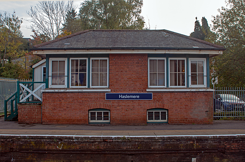
Haslemere railway station is on the Portsmouth Direct Line, serving the town of Haslemere, Surrey, England. It is down the line from , measured via Woking. History The large car park (to the south) and industrial estate (to the north) were originally large goods sidings. Platform 3 is an addition to the original structure, built in 1938 when the line was electrified. Until then, Haslemere was just a standard wayside station, but it became steadily busier as commuter traffic from the surrounding countryside grew. There are now four trains an hour to Waterloo and three to Portsmouth. The station still has its signal box, complete with the original 1895 forty-seven lever Stevens lever frame, situated on the down platform. It was in regular use until a programme of improvements, starting on 12 February 2022, when the line was shut between Guildford and Petersfield for 9 days, saw its functions taken over by the Basingstoke Railway Operating Centre. The box is an LSWR type 4 desi ... [...More Info...] [...Related Items...] OR: [Wikipedia] [Google] [Baidu] |
A286 Road
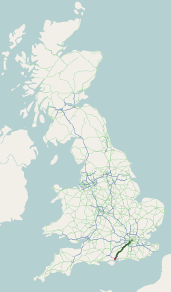
The A286 is an A class road in the south of England, from its northernmost point in Milford, Surrey, to Birdham, West Sussex. It passes through the market towns of Haslemere and Midhurst, and the cathedral city of Chichester. The road is mostly single carriageway, with a small dual carriageway section as part of the Chichester ring road. The road is long and follows a predominantly rural route through common land, farmland, woodland and the South Downs. Route Surrey The A286 begins at a junction with the A3100 (the old A3 London to Portsmouth road) in Milford. A few hundred metres south of its origin the A286 crosses the A283 road to Petworth, then crosses Witley Common, a Site of Special Scientific Interest. The route passes Witley Park and through the village centres of Brook and Grayswood before dropping down into Haslemere, passing Haslemere Educational Museum and Haslemere Town Hall, where it crosses the B2131 road leading west to Liphook and east to Petworth. ... [...More Info...] [...Related Items...] OR: [Wikipedia] [Google] [Baidu] |
A287 Road
List of A roads in zone 2 in Great Britain starting south of the River Thames The River Thames ( ), known alternatively in parts as the River Isis, is a river that flows through southern England including London. At , it is the longest river entirely in England and the second-longest in the United Kingdom, after the ... and east of the A3 (roads beginning with 2). __FORCETOC__ Single- and double-digit roads Triple-digit roads Four digit roads {{United Kingdom roads 2 2 ... [...More Info...] [...Related Items...] OR: [Wikipedia] [Google] [Baidu] |
A3 Road
The A3, known as the Portsmouth Road or London Road in sections, is a major road connecting the City of London and Portsmouth passing close to Kingston upon Thames, Guildford, Haslemere and Petersfield. For much of its length, it is classified as a trunk road and therefore managed by National Highways. Almost all of the road has been built to dual carriageway standards or wider. Apart from bypass sections in London, the road travels in a southwest direction and, after Liss, south-southwest. Close to its southerly end, motorway traffic is routed via the A3(M), then either the east–west A27 or the Portsmouth-only M275 which has multiple lanes leading off the westbound A27 — for non-motorway traffic, the A3 continues into Portsmouth alongside the A3(M), mostly as a single carriageway in each direction through Waterlooville and adjoining small towns. The other section of single carriageways is through the urban environs of Battersea, Clapham and Stockwell towards ... [...More Info...] [...Related Items...] OR: [Wikipedia] [Google] [Baidu] |
Woolmer Hill
Woolmer Hill is an area of high ground in the south-west corner of Surrey, England in the Borough of Waverley abutting Hampshire to the west and West Sussex to the south. It is in the circa 1900-founded parish of Shottermill The town of Haslemere () and the villages of Shottermill and Grayswood are in south west Surrey, England, around south west of London. Together with the settlements of Hindhead and Beacon Hill, they comprise the civil parish of Haslemere in .... Accessed 23 Dec 2018. In the north it is covered by woodland, and a higher land to the south has its residential neighbourhood on streets Hatchett's Drive and Lower Hanger. The hill reaches 185.5 metres above sea level, its foot being about 60 metres below. [...More Info...] [...Related Items...] OR: [Wikipedia] [Google] [Baidu] |
Camelsdale
Linchmere, also often spelled Lynchmere, is a village and a civil parish, the northernmost parish in the Chichester district of West Sussex, England. As well as Linchmere village, the parish contains the settlements of Hammer and Camelsdale. Linchmere parish is bordered to the north by Haslemere in Surrey with a tributary of the River Wey as boundary, to the east by Fernhurst parish, to the south by Linch civil parish with the Shulbrede stream as boundary, and to the west by the civil parish of Bramshott in Hampshire. In the 2001 census there were in the civil parish 836 households, with a total population of 2,225 of whom 1,127 were economically active. The population at the 2011 Census was 2,392. Richard Dimbleby is buried in St Peter's churchyard. According to the link, he was cremated. History The name Linchmere was, in ancient times, spelled ''Wlenchemere''. The area includes the remains of an Augustinian priory founded in 1200 and at first known as Woolynchmere Pr ... [...More Info...] [...Related Items...] OR: [Wikipedia] [Google] [Baidu] |
East Hampshire
East Hampshire is a local government district in Hampshire, England. Its council is based in Petersfield. Other towns are Alton and Bordon. The district was originally to be known as the District Council of Petersfield. It comprised 42 seats and first met on 18 June 1973. For ten months it operated alongside the councils that it was formed to replace: the Alton and Petersfield urban districts along with Alton Rural District and Petersfield Rural District. On 8 October 1973, the new council changed its name to the current East Hampshire District Council (or EHDC as it is usually known). On 1 April 1974, the old councils were dissolved, leaving only EHDC. Sandy Hopkins was the first joint Chief Executive in Hampshire when she was appointed to head both EHDC and Havant Borough Council in October 2009. Councillors approved the business case put forward by the Chief Executive for a shared management team between the two authorities in June 2010. The new team took up its ... [...More Info...] [...Related Items...] OR: [Wikipedia] [Google] [Baidu] |
Shottermill
The town of Haslemere () and the villages of Shottermill and Grayswood are in south west Surrey, England, around south west of London. Together with the settlements of Hindhead and Beacon Hill, they comprise the civil parish of Haslemere in the Borough of Waverley. The tripoint between the counties of Surrey, Hampshire and West Sussex is at the west end of Shottermill. Much of the civil parish is in the catchment area of the south branch of the River Wey, which rises on Blackdown in West Sussex. The urban areas of Haslemere and Shottermill are concentrated along the valleys of the young river and its tributaries, and many of the local roads are narrow and steep. The National Trust is a major landowner in the civil parish and its properties include Swan Barn Farm. The Surrey Hills Area of Outstanding Natural Beauty is to the north of the town and the South Downs National Park is to the south. Haslemere is thought to have originated as a planned town in the 12th century and ... [...More Info...] [...Related Items...] OR: [Wikipedia] [Google] [Baidu] |


