|
Haivoron
Haivoron (, ) is a city in Holovanivsk Raion, Kirovohrad Oblast, Ukraine. It hosts the administration of the Haivoron urban hromada, Haivoron Urban Hromada, one of the hromadas of Ukraine. Haivoron is situated along the Southern Bug.Гайворон // Большая Советская Энциклопедия. / редколл., гл. ред. Б. А. Введенский. 2-е изд. том 10. М., Государственное научное издательство «Большая Советская энциклопедия», 1952. стр.103Гайворон // Большая Советская Энциклопедия. / под ред. А. М. Прохорова. 3-е изд. том 6. М., «Советская энциклопедия», 1971. стр.46 History Haivoron is a former village from Gaysin uezd, Gaysin uyezd in Podolian Governorate of the Russian Empire. From 1897 to 1898 a locomotive repair plant was built in Haivoron. During World War II, the settlement ... [...More Info...] [...Related Items...] OR: [Wikipedia] [Google] [Baidu] |
Haivoron Raion
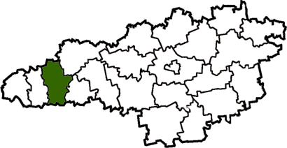
Haivoron Raion was a raion (district) of Kirovohrad Oblast in central Ukraine. The administrative center of the raion was the town of Haivoron. The raion was abolished on 18 July 2020 as part of the administrative reform of Ukraine, which reduced the number of raions of Kirovohrad Oblast to four. The area of Haivoron Raion was merged into Holovanivsk Raion. The last estimate of the raion population was At the time of disestablishment, the raion consisted of two hromadas: * Haivoron urban hromada with the administration in Haivoron; * Zavallia settlement hromada with the administration in the urban-type settlement Urban-type settlement, abbreviated: ; , abbreviated: ; ; ; ; . is an official designation for lesser urbanized settlements, used in several Central and Eastern Europe, Central and Eastern European countries. The term was primarily used in the So ... of Zavallia. References {{Authority control Former raions of Kirovohrad Oblast 1935 establishments in Ukraine ... [...More Info...] [...Related Items...] OR: [Wikipedia] [Google] [Baidu] |
Holovanivsk Raion
Holovanivsk Raion is a raion (district) of Kirovohrad Oblast in central Ukraine. The administrative center of the raion is the rural settlement of Holovanivsk. Its population is On 18 July 2020, as part of the administrative reform of Ukraine, the number of raions of Kirovohrad Oblast was reduced to four, and the area of Holovanivsk Raion was significantly expanded. Four abolished raions, Blahovishchenske, Haivoron, Novoarkhanhelsk, and Vilshanka Raions, were merged into Holovanivsk Raion. The January 2020 estimate of the raion population was Subdivisions Current After the reform in July 2020, the raion consisted of 10 hromadas: * Blahovishchenske urban hromada with the administration in the city of Blahovishchenske, transferred from Blahovishchenske Raion; * Haivoron urban hromada with the administration in the city of Haivoron Haivoron (, ) is a city in Holovanivsk Raion, Kirovohrad Oblast, Ukraine. It hosts the administration of the Haivoron urban hromada, Haivoron Ur ... [...More Info...] [...Related Items...] OR: [Wikipedia] [Google] [Baidu] |
Southern Bug
The Southern Bug, also called Southern Buh (; ; ; or just ), and sometimes Boh River (; ), at the Encyclopedia of Ukraine is a navigable river located in Ukraine. It is the List of longest rivers of Ukraine, second-longest river flowing exclusively in Ukraine. While located in relatively close proximity, the river should not be confused with Western Bug or Bug which flows in opposite direction towards Baltics. The source of the Southern Bug is in the west of Ukraine, in the Volhynian-Podolian Upland, about from the Polish border, from where it flows southeasterly into the Bug Estuary (Black Sea basin) through the southern steppes (see Granite-steppe lands of Buh park). It is long and drains . [...More Info...] [...Related Items...] OR: [Wikipedia] [Google] [Baidu] |
List Of Cities In Ukraine
There are 463 populated places in Ukraine, populated places in Ukraine that have been officially granted city status () by the Verkhovna Rada, the country's parliament, as of 23 April 2025. Settlements with more than 10,000 people are eligible for city status although the status is typically also granted to settlements of historical or regional importance. Smaller settlements are Populated places in Ukraine#Rural settlements, rural settlements () and villages (). Historically, there were systems of city rights, granted by the territorial lords, which defined the status of a place as a ''misto'' or ''selo''. In the past, cities were self-governing and had several privileges. The list of cities is roughly ordered by population and the 2022 estimates are compared to the 2001 Ukrainian census, except for Chernobyl for which the population is an unofficial estimate. The City with special status, cities with special status are shown in ''italic''. The average population size is 62,000. ... [...More Info...] [...Related Items...] OR: [Wikipedia] [Google] [Baidu] |
Kirovohrad Oblast
Kirovohrad Oblast (), also known as Kirovohradshchyna (), is an administrative divisions of Ukraine, oblast (''province'') in central Ukraine. The administrative center of the oblast is the city of Kropyvnytskyi. The oblast's population is It is Ukraine's second least populated oblast, ahead of Chernivtsi Oblast, Chernivtsi. In 2019, the Constitutional Court of Ukraine approved the change of the oblast's name to Kropyvnytskyi Oblast (, unofficially ''Kropyvnychchyna'' ()). The change is not yet implemented. The largest cities of the region are Kropyvnytskyi, Oleksandriia, Znamianka, Kirovohrad Oblast, Znamianka and Svitlovodsk. Geography The area of the province is . The city of Dobrovelychkivka is the geographical center of Ukraine. Most of the region is located within historic Right-bank Ukraine and Zaporizhzhia (region), Zaporizhzhia, and the western outskirts are part of historic Podolia. History The lands of the modern Kirovohrad Oblast were first inhabited by Scythians ... [...More Info...] [...Related Items...] OR: [Wikipedia] [Google] [Baidu] |
Russian Empire
The Russian Empire was an empire that spanned most of northern Eurasia from its establishment in November 1721 until the proclamation of the Russian Republic in September 1917. At its height in the late 19th century, it covered about , roughly one-sixth of the world's landmass, making it the list of largest empires, third-largest empire in history, behind only the British Empire, British and Mongol Empire, Mongol empires. It also Russian colonization of North America, colonized Alaska between 1799 and 1867. The empire's 1897 census, the only one it conducted, found a population of 125.6 million with considerable ethnic, linguistic, religious, and socioeconomic diversity. From the 10th to 17th centuries, the Russians had been ruled by a noble class known as the boyars, above whom was the tsar, an absolute monarch. The groundwork of the Russian Empire was laid by Ivan III (), who greatly expanded his domain, established a centralized Russian national state, and secured inde ... [...More Info...] [...Related Items...] OR: [Wikipedia] [Google] [Baidu] |
Cities In Kirovohrad Oblast
A city is a human settlement of a substantial size. The term "city" has different meanings around the world and in some places the settlement can be very small. Even where the term is limited to larger settlements, there is no universally agreed definition of the lower boundary for their size. In a narrower sense, a city can be defined as a permanent and Urban density, densely populated place with administratively defined boundaries whose members work primarily on non-agricultural tasks. Cities generally have extensive systems for housing, transportation, sanitation, Public utilities, utilities, land use, Manufacturing, production of goods, and communication. Their density facilitates interaction between people, government organisations, government organizations, and businesses, sometimes benefiting different parties in the process, such as improving the efficiency of goods and service distribution. Historically, city dwellers have been a small proportion of humanity overall, bu ... [...More Info...] [...Related Items...] OR: [Wikipedia] [Google] [Baidu] |
National Oceanic And Atmospheric Administration
The National Oceanic and Atmospheric Administration (NOAA ) is an American scientific and regulatory agency charged with Weather forecasting, forecasting weather, monitoring oceanic and atmospheric conditions, Hydrography, charting the seas, conducting deep-sea exploration, and managing fishing and protection of marine mammals and endangered species in the US exclusive economic zone. The agency is part of the United States Department of Commerce and is headquartered in Silver Spring, Maryland. History NOAA traces its history back to multiple agencies, some of which are among the earliest in the federal government: * United States Coast and Geodetic Survey, formed in 1807 * National Weather Service, Weather Bureau of the United States, formed in 1870 * United States Fish Commission, Bureau of Commercial Fisheries, formed in 1871 (research fleet only) * NOAA Commissioned Corps, Coast and Geodetic Survey Corps, formed in 1917 The most direct predecessor of NOAA was the Enviro ... [...More Info...] [...Related Items...] OR: [Wikipedia] [Google] [Baidu] |
1989 Soviet Census
The 1989 Soviet census (), conducted between 12 and 19 January of that year, was the final census carried out in the Soviet Union. The census found the total population to be 286,730,819 inhabitants. In 1989, the Soviet Union ranked as the third most populous in the world, above the United States (with 248,709,873 inhabitants according to the 1990 census), although it was well below China and India. Statistics In 1989, about half of the Soviet Union's total population lived in the Russian SFSR, and approximately one-sixth (18%) of them in the Ukrainian SSR. Almost two-thirds (65.7%) of the population was urban, leaving the rural population with 34.3%.Encyclopædia Britannica Book of the Year 1991, Soviet Union, page 720. In this way, its gradual increase continued, as shown by the series represented by 47.9%, 56.3% and 62.3% of 1959, 1970 and 1979, respectively. [...More Info...] [...Related Items...] OR: [Wikipedia] [Google] [Baidu] |
Administrative Reform Of Ukraine (2020)
The administrative divisions of Ukraine ( ) are under the jurisdiction of the Ukrainian Constitution. Ukraine is a unitary state with three levels of administrative divisions: 27 regions (24 oblasts, two cities with special status and one autonomous republic), 136 raions (districts) and 1469 hromadas. The administrative reform of July 2020 merged most of the 490 legacy raions and 118 pre-2020 cities of regional significance into 136 reorganized raions, or districts of Ukraine. The next level below raions are hromadas. Following the annexations of Crimea and southeastern Ukraine by the Russian Federation, Autonomous Republic of Crimea and Sevastopol as well as portions of Donetsk, Kherson, Luhansk and Zaporizhzhia oblasts came under the '' de facto'' administration of the Russian Federation. Internationally, most states have not recognized the Russian claims. Overview According to Article 133 of the Constitution of Ukraine as amended, the system of administrative and terri ... [...More Info...] [...Related Items...] OR: [Wikipedia] [Google] [Baidu] |


