|
HMS Speedy (1893)
HMS ''Speedy'' was a of the British Royal Navy. She was built by Thornycroft from 1892–1894. She was converted to a minesweeper in 1908–1909 and continued these duties during the First World War. ''Speedy'' was sunk by a German mine on 3 September 1914. Design and construction ''Speedy'' was one of 11 ''Alarm''-class torpedo gunboats ordered for the Royal Navy under the 1889 Naval Defence Act, which authorised the shipbuilding programme for the next five years, and also included the last two torpedo-gunboats of the and the five torpedo-gunboats of the . The ''Alarm''s were slightly modified versions of the previous ''Sharpshooter''-class, with modified engines to improve reliability. ''Speedy'' was long between perpendiculars, with a beam of and a draught of . Displacement was . ''Speedy'' differed from other ships of her class in having eight Thornycroft water-tube boilers rather than the locomotive boilers used for the rest of the class, with three funnels being fit ... [...More Info...] [...Related Items...] OR: [Wikipedia] [Google] [Baidu] |
United Kingdom Of Great Britain And Ireland
The United Kingdom of Great Britain and Ireland was the union of the Kingdom of Great Britain and the Kingdom of Ireland into one sovereign state, established by the Acts of Union 1800, Acts of Union in 1801. It continued in this form until 1927, when it evolved into the United Kingdom, United Kingdom of Great Britain and Northern Ireland, after the Irish Free State gained a degree of independence in 1922. It was commonly known as Great Britain, Britain or England. Economic history of the United Kingdom, Rapid industrialisation that began in the decades prior to the state's formation continued up until the mid-19th century. The Great Famine (Ireland), Great Irish Famine, exacerbated by government inaction in the mid-19th century, led to Societal collapse, demographic collapse in much of Ireland and increased calls for Land Acts (Ireland), Irish land reform. The 19th century was an era of Industrial Revolution, and growth of trade and finance, in which Britain largely dominate ... [...More Info...] [...Related Items...] OR: [Wikipedia] [Google] [Baidu] |
Ceremonial Ship Launching
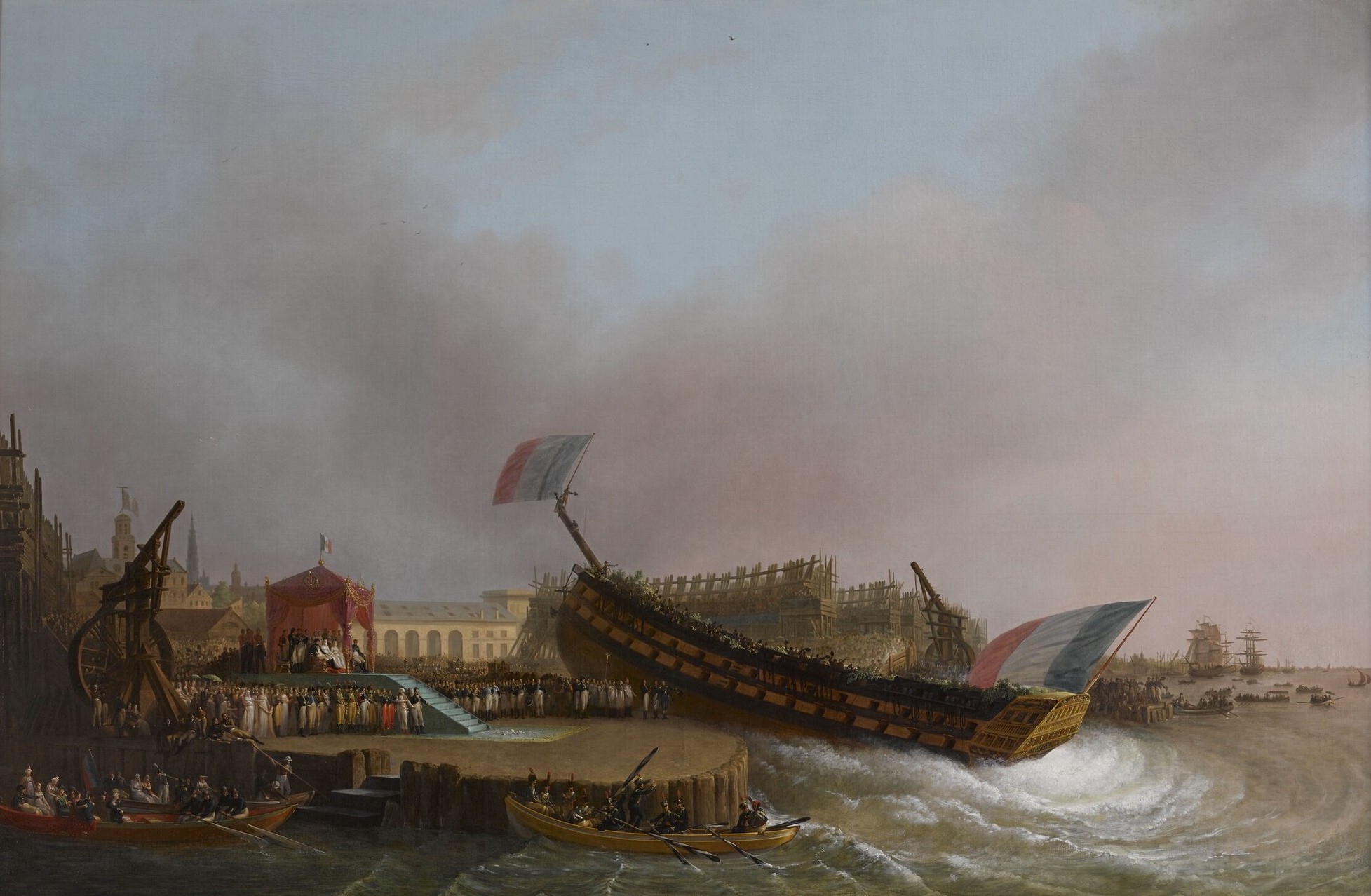
Ceremonial ship launching involves the performing of ceremonies associated with the process of transferring a vessel to the water. It is a nautical tradition in many cultures, dating back millennia, to accompany the physical process with ceremonies which have been observed as public celebration and a solemn blessing, usually but not always, in association with the launch itself. Ship launching imposes stresses on the ship not met during normal operation and in addition to the size and weight of the vessel represents a considerable engineering challenge as well as a public spectacle. The process also involves Sailors' superstitions, many traditions intended to invite good luck, such as baptism#Boats and ships, christening by breaking a sacrificial bottle of champagne over the bow (ship), bow as the ship is named aloud and launched. Methods There are three principal methods of conveying a new ship from building site to water, only two of which are called "launching". The ol ... [...More Info...] [...Related Items...] OR: [Wikipedia] [Google] [Baidu] |
The Engineer (UK Magazine)
''The Engineer'' is a London-based monthly magazine and website covering the latest developments and business news in engineering and technology in the UK and internationally. History and description ''The Engineer'' was founded in January 1856. It was established by Edward Charles Healey, an entrepreneur and engineering enthusiast with financial interests in the railways whose friends included Robert Stephenson and Isambard Kingdom Brunel. The journal was created as a technical magazine for engineers. ''The Engineer'' began covering engineering including inventions and patents during a high point of British economic manufacturing power. In the 19th century it also published stock prices of raw materials. Together with the contemporary ''Engineering Engineering is the practice of using natural science, mathematics, and the engineering design process to Problem solving#Engineering, solve problems within technology, increase efficiency and productivity, and improve S ... [...More Info...] [...Related Items...] OR: [Wikipedia] [Google] [Baidu] |
River Tyne
The River Tyne is a river in North East England. Its length (excluding tributaries) is . It is formed by the North Tyne and the South Tyne, which converge at Warden, Northumberland, Warden near Hexham in Northumberland at a place dubbed 'The Meeting of the Waters'. The Tyne Rivers Trust measure the whole Tyne Drainage basin, catchment as , containing of waterways. Course North Tyne The Ordnance Survey records 'the source of the North Tyne river' at grid reference NY 605974 at Deadwater, a few tens of metres short of the Scottish border. It flows southeast through the village of Kielder before entering first Bakethin Reservoir and then Kielder Water, both set within Kielder Forest. It then passes by the village of Bellingham, Northumberland, Bellingham before the River Rede enters as a left-bank tributary at Redesmouth. It passes Hadrian's Wall near Chollerford before joining the South Tyne near Warden to the northwest of Hexham. South Tyne The South Tyne rises at Tyne ... [...More Info...] [...Related Items...] OR: [Wikipedia] [Google] [Baidu] |
River Humber
The Humber is a large tidal estuary on the east coast of Northern England. It is formed at Trent Falls, Faxfleet, by the confluence of the tidal rivers Ouse and Trent. From there to the North Sea, it forms part of the boundary between the East Riding of Yorkshire on the north bank and North Lincolnshire on the south bank. Also known as the River Humber, it is tidal its entire length. Below Trent Falls, the Humber passes the junction with the Market Weighton Canal on the north shore, the confluence of the River Ancholme on the south shore; between North Ferriby and South Ferriby and under the Humber Bridge; between Barton-upon-Humber on the south bank and Kingston upon Hull on the north bank (where the River Hull joins), then meets the North Sea between Cleethorpes on the Lincolnshire side and the long and thin headland of Spurn Head to the north. Ports on the Humber include the Port of Hull, the Port of Grimsby and the Port of Immingham; there are lesser p ... [...More Info...] [...Related Items...] OR: [Wikipedia] [Google] [Baidu] |
Home Fleet
The Home Fleet was a fleet of the Royal Navy that operated from the United Kingdom's territorial waters from 1902 with intervals until 1967. In 1967, it was merged with the Mediterranean Fleet creating the new Western Fleet. Before the First World War between 1902 and 1904 the Admiralty reorganised its ships in home waters into a permanent force called the Home Squadron. At the beginning of 1905, it was renamed the Channel Fleet. In 1907 a new Home Fleet was formed from ships in reserve and new ships, and in 1909 the Channel Fleet was merged into it, forming the principal fleet in British waters. In 1912 it was renamed the Home Fleets, formed of the First, Second and Third. On the outbreak of the First World War the First Fleet became the Grand Fleet. When the Grand Fleet was redistributed after the war, the reserve fleet was briefly named Home Fleet in 1919 before being renamed, and after the Invergordon Mutiny in 1931 the Atlantic Fleet was renamed Home Fleet in 1932. Du ... [...More Info...] [...Related Items...] OR: [Wikipedia] [Google] [Baidu] |
Harwich
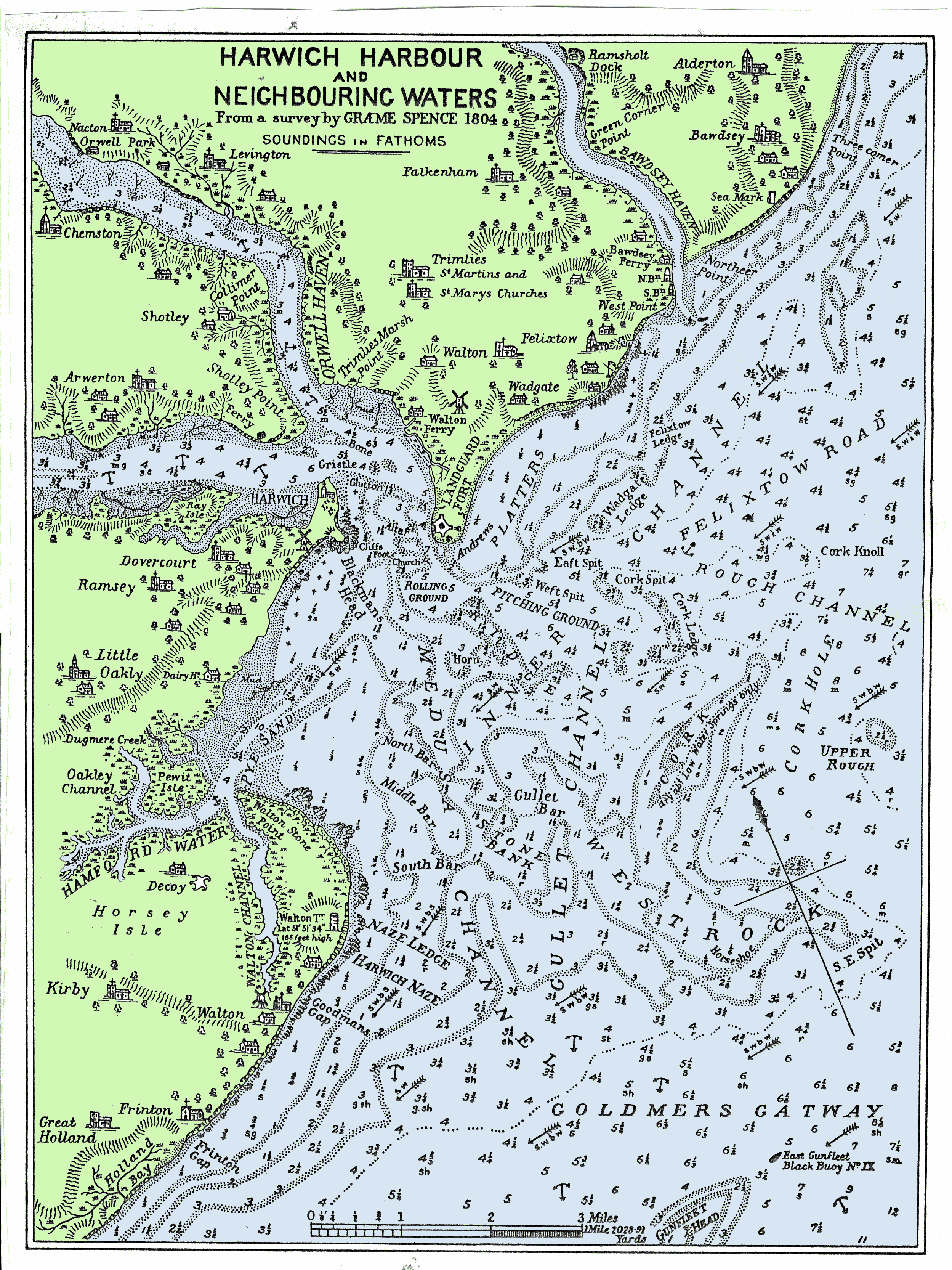
Harwich is a town in Essex, England, and one of the Haven ports on the North Sea coast. It is in the Tendring district. Nearby places include Felixstowe to the north-east, Ipswich to the north-west, Colchester to the south-west and Clacton-on-Sea to the south. It is the northernmost coastal town in Essex. Its position on the estuaries of the Stour and Orwell rivers, with its usefulness to mariners as the only safe anchorage between the Thames and the Humber, led to a long period of civil and military maritime significance. The town became a naval base in 1657 and was heavily fortified, with Harwich Redoubt, Beacon Hill Battery, and Bath Side Battery. Harwich is the likely launch point of the ''Mayflower'', which carried English Puritans to North America, and is the presumed birthplace of ''Mayflower'' captain Christopher Jones. Harwich today is contiguous with Dovercourt and the two, along with Parkeston, are often referred to collectively as ''Harwich''. History ... [...More Info...] [...Related Items...] OR: [Wikipedia] [Google] [Baidu] |
Aden
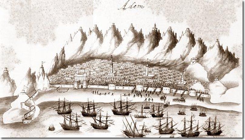
Aden () is a port city located in Yemen in the southern part of the Arabian peninsula, on the north coast of the Gulf of Aden, positioned near the eastern approach to the Red Sea. It is situated approximately 170 km (110 mi) east of the Bab-el-Mandeb strait. With its strategic location on the coastline, Aden serves as a gateway between the Red Sea and the Arabian Sea, making it a crucial maritime hub connecting Africa, Asia, and the Middle East. As of 2023, Aden city has a population of approximately 1,080,000 residents, making it one of the largest cities in Yemen. Aden is the capital and principal part of Aden Governorate, encompassing eight districts. During the colonial period, the name ''Aden'' referred to the area along the north coast of the gulf, encompassing Tawahi (Aden), Tawahi, Mualla, Crater (Aden), Crater, and much of Khor Maksar district. The western harbour peninsula, known as ''Little Aden'', now falls within the Al Buraiqeh district, Al Buraiqeh distr ... [...More Info...] [...Related Items...] OR: [Wikipedia] [Google] [Baidu] |
Hodeida
Hodeidah (), also transliterated as Hodeda, Hodeida, Hudaida or al-Hudaydah, is the fourth-largest city in Yemen and its principal port on the Red Sea and it is the centre of Al Hudaydah Governorate. As of 2023, it had an estimated population of 735,000. History In Islamic chronicles, the name Hodeidah was first mentioned in the year 1454/55. The city's importance grew in the 1520s, when the Ottomans took over the Yemeni Tihāmah region. In the 1830s, Hodeidah was controlled by Ibrahim Pasha's troops, which turned over its administration to Sherif Husayn ibn Ali Haydar. In 1849, it became part of the Yemen Eyalet. The Malay writer Abdullah bin Abdul Kadir visited Hodeidah on his pilgrimage to Mecca in 1854, and describes the city in his account of the journey, mentioning that the custom of chewing khat was prevalent in the city at this time. During the 19th century, Hodeidah had a large slave market. The slaves came from the Oromia region of modern Ethiopia. In 1914, dur ... [...More Info...] [...Related Items...] OR: [Wikipedia] [Google] [Baidu] |
Perim
Perim (), also called Mayyun () in Arabic, is a Yemeni volcanic island in the Strait of Mandeb at the south entrance into the Red Sea, off the south-west coast of Yemen. It administratively belongs to Dhubab District or Bab al-Mandab District, Taiz Governorate. The island of Perim divides the strait of Mandeb into two channels. The island, as a dependency of Aden colony, was a part of the British Empire between 1857 and 1967. Etymology In ancient time, it was called "the island of Diodorus" (, ). It is mentioned by Pliny the Elder, by the author of the ''Periplus of the Erythraean Sea'' and in Ptolemy's Geography. ''Perim'' possibly derives from the Arab general term ''Barim'' (chain) associated with the history of the Straits and one of its Arab names, the other Arab name being Mayyun. The Portuguese called it Majun or Meho (derived from Mayun), although Albuquerque had solemnly named the island ''Vera Cruz'' in 1513. On many British and French maps of the 17th and 18th cent ... [...More Info...] [...Related Items...] OR: [Wikipedia] [Google] [Baidu] |
Suakin
Suakin or Sawakin (, Beja: ''Oosook'') is a port city in northeastern Sudan, on the west coast of the Red Sea. It was formerly the region's chief port, but is now secondary to Port Sudan, about north. Suakin used to be considered the height of medieval luxury on the Red Sea, but the old city built of coral is now in ruins. In 1983, the adjacent historic mainland town, known as the Geyf, had a population of 18,030 and the 2009 population was estimated at 43,337. Ferries run daily from Suakin to Jeddah in Saudi Arabia. Etymology The Beja name for Suakin is ''Oosook''. This is possibly from the Arabic word ''suq'', meaning market. In Beja, the locative case for this is ''isukib'', whence Suakin might have derived.Berg, RobertSuakin: Time and Tide. ''Saudi Aramco World.'' The spelling on Admiralty charts in the late 19th century was "Sauakin", but in the popular press "Suakim" was predominant. History Ancient Suakin was likely Ptolemy's Port of Good Hope, Limen Evangelis, whic ... [...More Info...] [...Related Items...] OR: [Wikipedia] [Google] [Baidu] |
Suez
Suez (, , , ) is a Port#Seaport, seaport city with a population of about 800,000 in north-eastern Egypt, located on the north coast of the Gulf of Suez on the Red Sea, near the southern terminus of the Suez Canal. It is the capital and largest city of the Suez Governorate. It has three ports: the Suez Port (Port Tewfik), al-Adabiya, and al-Zaytiya, and extensive port facilities. Together, the three cities form the Suez metropolitan area, located mostly in Africa with a small portion in Asia. Railway lines and highways connect the city with Cairo, Port Said, and Ismailia. Suez has a petrochemical plant, and its oil refineries have pipelines carrying the finished product to Cairo. These are represented in the flag of the governorate: the blue background refers to the sea, the gear refers to Suez's status as an industrial governorate, and the flame refers to the petroleum firms of Suez. The modern city of Suez is a successor of the ancient city of Clysma, a major Red Sea port and ... [...More Info...] [...Related Items...] OR: [Wikipedia] [Google] [Baidu] |


