|
Gzhat River
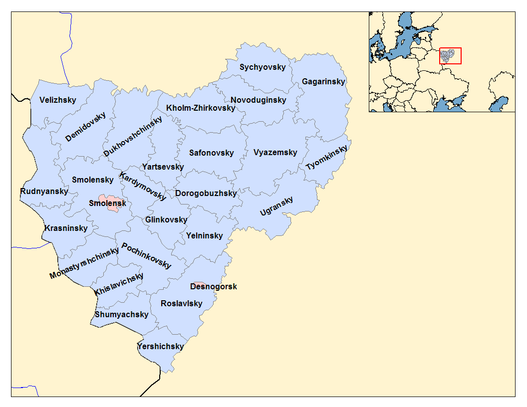
The Gzhat () is a river in Smolensk Oblast, Russia. It is 113 km long, with a drainage basin of 2370 km².«Река ГЖАТЬ» Russian State Water Registry It is a right tributary of the Vazuza
The Vazuza (), a river in the Novoduginsky and Sychyovsky districts of Smolensk Oblast and in the Zubtsovsky District of Tver Oblast, Russia, becomes a right tributary of the Volga. It is long, and its drainage basin covers . Soviet engin ... . The town of Gagarin lies by the Gzhat.
References [...More Info...] [...Related Items...] OR: [Wikipedia] [Google] [Baidu] |
Russia
Russia, or the Russian Federation, is a country spanning Eastern Europe and North Asia. It is the list of countries and dependencies by area, largest country in the world, and extends across Time in Russia, eleven time zones, sharing Borders of Russia, land borders with fourteen countries. Russia is the List of European countries by population, most populous country in Europe and the List of countries and dependencies by population, ninth-most populous country in the world. It is a Urbanization by sovereign state, highly urbanised country, with sixteen of its urban areas having more than 1 million inhabitants. Moscow, the List of metropolitan areas in Europe, most populous metropolitan area in Europe, is the capital and List of cities and towns in Russia by population, largest city of Russia, while Saint Petersburg is its second-largest city and Society and culture in Saint Petersburg, cultural centre. Human settlement on the territory of modern Russia dates back to the ... [...More Info...] [...Related Items...] OR: [Wikipedia] [Google] [Baidu] |
Vazuza
The Vazuza (), a river in the Novoduginsky and Sychyovsky districts of Smolensk Oblast and in the Zubtsovsky District of Tver Oblast, Russia, becomes a right tributary of the Volga. It is long, and its drainage basin covers . Soviet engineers flooded the lower part of the river to form the Vazuza Reservoir. The towns of Sychyovka and Zubtsov are located on the banks the Vazuza (the latter at its confluence with the Volga). The main tributaries of the Vazuza are the Kasnya, the Gzhat The Gzhat () is a river in Smolensk Oblast, Russia. It is 113 km long, with a drainage basin A drainage basin is an area of land in which all flowing surface water converges to a single point, such as a river mouth, or flows into anothe ... (both right), the Losmina and the Osuga (left). The source of the Vazuza is located east of the village of Lukino in Novoduginsky District. The river flows north, crosses into Sychyovsky District, and downstream of the town of Sychyovka ... [...More Info...] [...Related Items...] OR: [Wikipedia] [Google] [Baidu] |
Smolensk Oblast
Smolensk Oblast (), informally also called Smolenshchina (), is a federal subjects of Russia, federal subject of Russia (an oblast). Its administrative centre is the types of inhabited localities in Russia, city of Smolensk. As of the 2021 Russian census, 2021 Census, its population was 888,421. Geography The oblast was founded on 27 September 1937.Исполнительный комитет Смоленского областного совета народных депутатов. Государственный архив Смоленской области. "Административно-территориальное устройство Смоленской области. Справочник", изд. "Московский рабочий", Москва 1981. Стр. 8 It borders Pskov Oblast in the north, Tver Oblast in the northeast, Moscow Oblast in the east, Kaluga Oblast in south, Bryansk Oblast in the southwest, and Mogilev Region, Mogilev and Vitebsk R ... [...More Info...] [...Related Items...] OR: [Wikipedia] [Google] [Baidu] |
Drainage Basin
A drainage basin is an area of land in which all flowing surface water converges to a single point, such as a river mouth, or flows into another body of water, such as a lake or ocean. A basin is separated from adjacent basins by a perimeter, the drainage divide, made up of a succession of elevated features, such as ridges and hills. A basin may consist of smaller basins that merge at river confluences, forming a hierarchical pattern. Other terms for a drainage basin are catchment area, catchment basin, drainage area, river basin, water basin, and impluvium. In North America, they are commonly called a watershed, though in other English-speaking places, " watershed" is used only in its original sense, that of the drainage divide line. A drainage basin's boundaries are determined by watershed delineation, a common task in environmental engineering and science. In a closed drainage basin, or endorheic basin, rather than flowing to the ocean, water converges toward the ... [...More Info...] [...Related Items...] OR: [Wikipedia] [Google] [Baidu] |
Gagarin, Smolensk Oblast
Gagarin (), known until 1968 as Gzhatsk (), is a town and the administrative centre of Gagarinsky District of Smolensk Oblast, Russia, located on the Gzhat River, northeast of Smolensk, the administrative centre of the oblast. Population: The town's former name is from that of the Gzhat River, which is of Baltic origin (cf. Old Prussian ''gudde'', meaning "forest"). Geography Climate Gagarin has a warm-summer humid continental climate (''Dfb'' in the Köppen climate classification). History In 1718, a village on the territory of modern Gagarin was transformed by a decree of Peter the Great to a transshipment landing stage (called Gzhatsky landing stage). From the mid-18th century, Gzhatsk was a ''sloboda'', and in 1776, by a decree by Catherine the Great, it was granted uyezd town status and a coat of arms showing "a barge loaded with bread ready for departure, on a field argent", meaning that the town was a good landing stage for grain. The town was built at ... [...More Info...] [...Related Items...] OR: [Wikipedia] [Google] [Baidu] |

