|
Gyantse
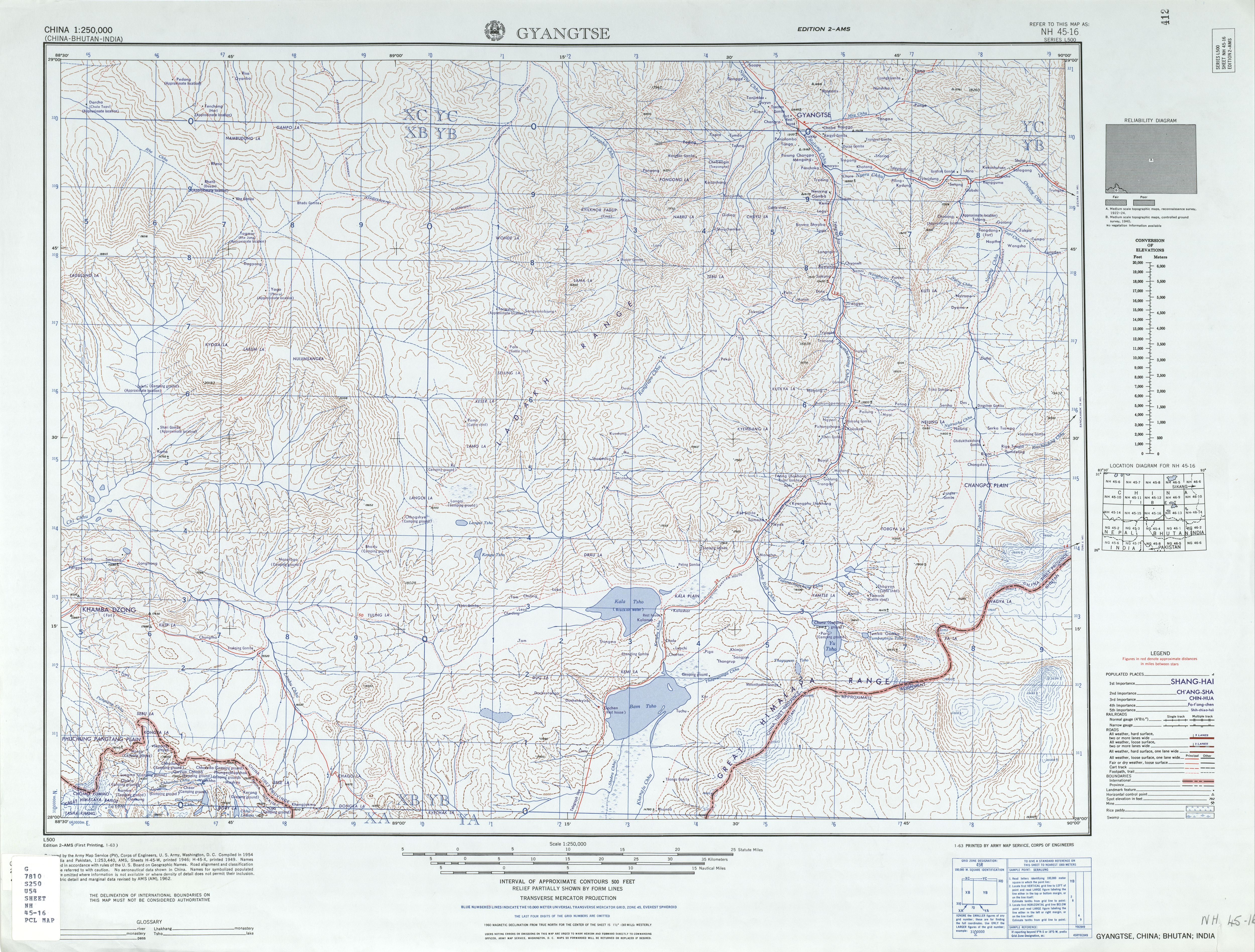
Gyantse, officially Gyangzê Town (also spelled Gyangtse; ; ), is a town located in Gyantse County, Shigatse Prefecture, Tibet Autonomous Region, China. It was historically considered the third largest and most prominent town in Tibet (after Lhasa and Shigatse), but there are now at least ten larger Tibetan cities. History In 1904, the British expedition to Tibet reached Gyantse on 11 April. The town's garrison had already fled, and the expedition's members entered the town bloodlessly through the front gates, which were opened for them, and occupied Gyantse. After the town was occupied, several British officers visited the Palcho Monastery and seized several statues and scrolls. During the occupation, the town's inhabitants continued to go about their business, and the expedition's medical officer, Herbert James Walton, attended to their medical needs, including performing several operations to correct the common problem of cleft palates. The expedition's officers spent tim ... [...More Info...] [...Related Items...] OR: [Wikipedia] [Google] [Baidu] |
Palcho Monastery
The Palcho Monastery or Pelkor Chode Monastery or Shekar Gyantse is the main monastery in the Nyangchu river valley in Gyantse, Gyantse County, Shigatse Prefecture, Tibet Autonomous Region. The monastery precinct is a complex of structures that, apart from the Tsuklakhang Monastery, also includes its Kumbum, believed to be the largest such structure in Tibet,Neville-Hadley p.771 quote:the nine story Kumbum the largest chorten in Tibet. that is most notable for its 108 chapels in its several floors and the old Dzong or fort. History The earliest history of the Penchor Chode Monastery is traced to the ninth century. Pelkhor-tsen, son of Langdarma (anti Buddhist King of West Tibet) after whom the monastery is named as Pelkor Chode, lived here and attempted to perpetuate the Yarlung dynasty of his father who had been assassinated.Dorje p.156 The town of Gyantse was established between the 14th and 15th centuries as a feudatory, with the Sakya sect playing a crucial overlord role. ... [...More Info...] [...Related Items...] OR: [Wikipedia] [Google] [Baidu] |
Gyantse Dzong
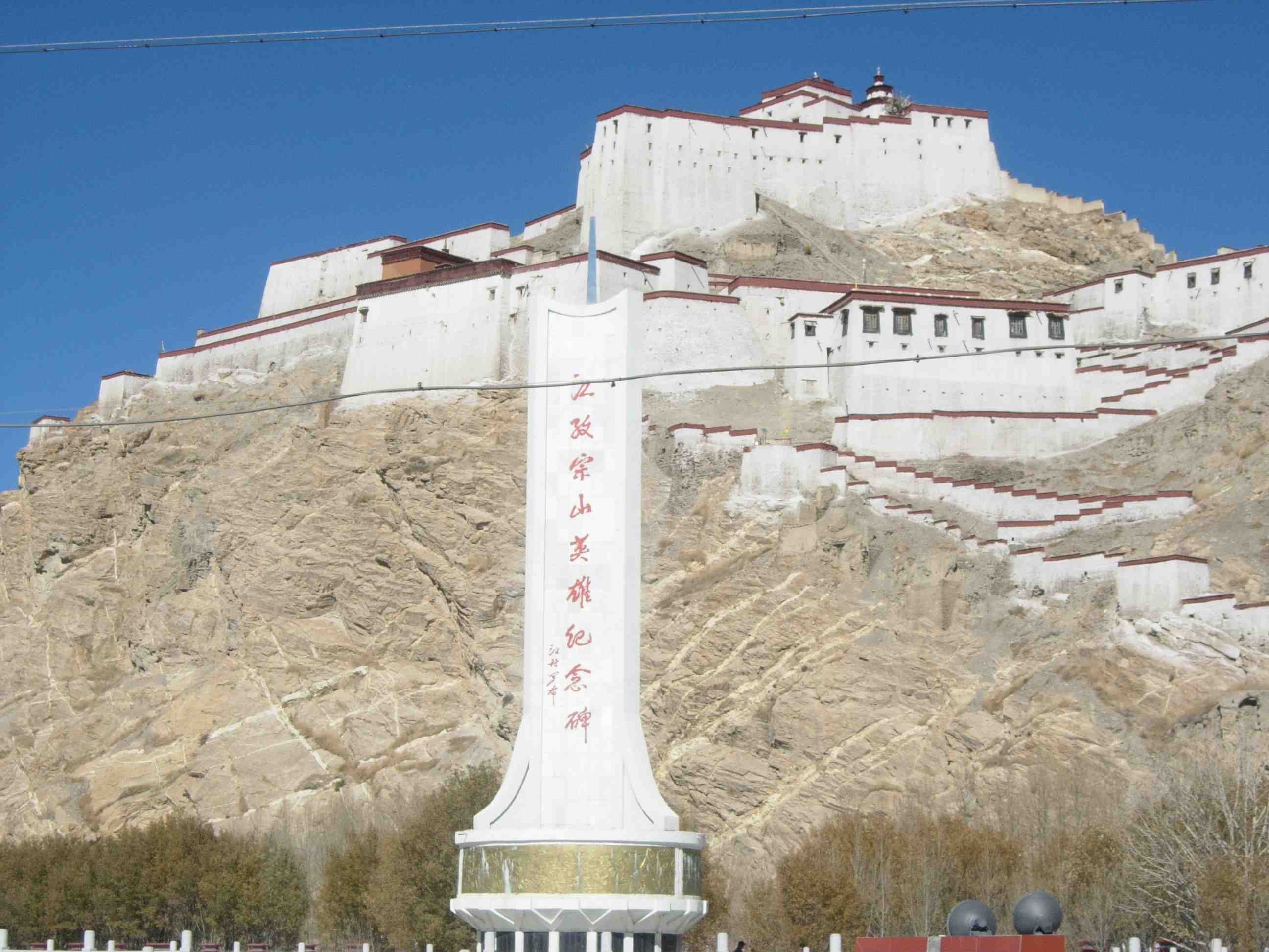
Gyantse Dzong or Gyantse Fortress is one of the best preserved dzongs in Tibet, perched high above the town of Gyantse on a huge spur of grey brown rock.French (1994), p. 227. According to Vitali, the fortress was constructed in 1390 and guarded the southern approaches to the Tsangpo Valley and Lhasa. The town was surrounded by a wall long.Buckley, Michael and Strauss, Robert (1986), p. 158. The entrance is on the eastern side. Early history The original fortress, known as Gyel-khar-tse was attributed to Pelkhor-tsen, son of the anti-Buddhist king Langdharma, who probably reigned from 838 to 841 CE. The present walls were supposedly built in 1268, after the rise in power of the Sakyapa sect. A large palace was built in 1365 by a local prince, Phakpa Pelzangpo (1318–1370), who had found favour campaigning for the Sakyapas in the south. He also brought a famous Buddhist teacher, Buton Rinchendrub of Zhalu, to live in a temple there. Later in the 14th century Phakpa Pelzang ... [...More Info...] [...Related Items...] OR: [Wikipedia] [Google] [Baidu] |
British Expedition To Tibet
The British expedition to Tibet, also known as the Younghusband expedition, began in December 1903 and lasted until September 1904. The expedition was effectively a temporary invasion by British Indian Army, British Indian Armed Forces under the auspices of the Tibet Frontier Commission, whose purported mission was to establish diplomatic relations and resolve the dispute over the border between Tibet and Kingdom of Sikkim, Sikkim.Landon, P. (1905). ''The Opening of Tibet'' Doubleday, Page & Co, New York. In the nineteenth century, the British had conquered Konbaung dynasty, Burma and Sikkim, with the whole southern flank of Tibet coming under the control of the British Raj, British Indian Empire. Tibet was ruled by the 13th 13th Dalai Lama, Dalai Lama under the Ganden Phodrang government as a Himalayas, Himalayan state under the Tibet under Qing rule, protectorate (or suzerainty) of the Chinese Qing dynasty until the 1911 Revolution, after which a Tibet (1912–1951), period of ... [...More Info...] [...Related Items...] OR: [Wikipedia] [Google] [Baidu] |
Gyantse County
Gyantse County officially Gyangzê County (; zh, s=江孜县) is a county of Xigazê in the Tibet Autonomous Region The Tibet Autonomous Region (TAR), often shortened to Tibet in English or Xizang in Pinyin, Hanyu Pinyin, is an Autonomous regions of China, autonomous region of the China, People's Republic of China. It was established in 1965 to replace the ..., China. Its main settlement is Gyantse Town known for its monasteries. Administration divisions Gyantse County is divided into 1 town and 18 townships. Climate References Counties of Shigatse National Famous Historical and Cultural City Long stubs with short prose {{Shigatse-geo-stub pl:Gyangzê ... [...More Info...] [...Related Items...] OR: [Wikipedia] [Google] [Baidu] |
Shigatse
Shigatse, officially known as Xigazê () or Rikaze ( zh, s=日喀则, p=Rìkāzé), is a prefecture-level city of the Tibet Autonomous Region of the People's Republic of China. Its area of jurisdiction, with an area of , corresponds to the historical Ü-Tsang region of Tibet. Overview The administrative center of the prefecture-level city is the Samzhubzê District. It is roughly equivalent to the historical Shigatse urban center, the second-largest city in Tibet, located about southwest of Lhasa and home to the Tashilhunpo Monastery, traditionally the seat of the Panchen Lama. Some of the towns in the prefecture are: Gyantse (Gyantse County), Tingri (town), Tingri (Tingri County), and Nyalam Town, Nyalam (Nyalam County). On 11 July 2014 Shigatse Prefecture was upgraded into a prefecture-level city (the same status as Lhasa). History In the eighth century, the Tibetan Empire of Chisong Dezan, Tibetan King Chisong Dezan invited Indian monk Padmasambhava into Tibet to build ... [...More Info...] [...Related Items...] OR: [Wikipedia] [Google] [Baidu] |
Yatung
Yatung or Yadong, also known as Shasima (, ), is the principal town in the Chumbi Valley or Yadong County in the Tibet Autonomous Region of China. It is also its administrative headquarters. Name The village is known locally as Shasima (''Sharsingma'') to the Tibetans, believed to be a Lepcha name. During the British Raj era, it was called Yatung, the name having been transferred from another location called "Yatung" in the valley between the Jelep La and Rinchengang. The original location later came to be called Old Yatung. The Chinese administration of Tibet uses the name Yatung (often transliterated "Yadong" in Chinese pinyin) for the county, and the name Shasima for the town. Geography Yatung is at the confluence of the Khambu Chu () and Tromo Chu (or Machu, ) rivers, which join here to form the Amo Chu river before it flows into Bhutan. Downstream along Amo Chu are further villages of Chumbi, Pipitang and Chema, within four miles distance. A further village ... [...More Info...] [...Related Items...] OR: [Wikipedia] [Google] [Baidu] |
Tibet
Tibet (; ''Böd''; ), or Greater Tibet, is a region in the western part of East Asia, covering much of the Tibetan Plateau and spanning about . It is the homeland of the Tibetan people. Also resident on the plateau are other ethnic groups such as Mongols, Monpa people, Monpa, Tamang people, Tamang, Qiang people, Qiang, Sherpa people, Sherpa, Lhoba people, Lhoba, and since the 20th century Han Chinese and Hui people, Hui. Tibet is the highest region on Earth, with an average elevation of . Located in the Himalayas, the highest elevation in Tibet is Mount Everest, Earth's highest mountain, rising above sea level. The Tibetan Empire emerged in the 7th century. At its height in the 9th century, the Tibetan Empire extended far beyond the Tibetan Plateau, from the Tarim Basin and Pamirs in the west, to Yunnan and Bengal in the southeast. It then divided into a variety of territories. The bulk of western and central Tibet (Ü-Tsang) was often at least nominally unified under a ser ... [...More Info...] [...Related Items...] OR: [Wikipedia] [Google] [Baidu] |
Herbert James Walton
Herbert Walton (19 January 1869 – 4 May 1938) was an English surgeon and naturalist. Born in London on 19 January 1869, he was the second child and elder son of James Sydney Walton and Eleanor Georgina Louissan, his wife. Walton was initially educated in Paris, before entering private schools in England, culminating in Charterhouse (1881–84); he went on to study medicine at St Bartholomew's Hospital.Plarr, V. (1938). ''Plarr's Lives of the Fellows of the Royal College of Surgeons of England.'' Vol. 3, p. 815. Royal College of Surgeons, London. Career Walton's first post was as assistant house surgeon at the Salop Infirmary, Shrewsbury. He graduated with honours at the M.B. examination at the University of London, and later won the gold medal at the M.D. He went on to join the Netley Hospital before passing first into the Indian Medical Service. He was gazetted lieutenant on 29 July 1896, winning both the Montefiore Prize for military surgery, and the Martin Memorial Medal ... [...More Info...] [...Related Items...] OR: [Wikipedia] [Google] [Baidu] |
Tibet Autonomous Region
The Tibet Autonomous Region (TAR), often shortened to Tibet in English or Xizang in Pinyin, Hanyu Pinyin, is an Autonomous regions of China, autonomous region of the China, People's Republic of China. It was established in 1965 to replace the Tibet Area (administrative division), Tibet Area, a former administrative division of the Republic of China (1912–1949), Republic of China. The current borders of the Tibet Autonomous Region were generally established in the 18th century and include about half of Tibet, cultural Tibet, which was at times independent and at times under Mongol or Chinese rule. The TAR spans more than and is the second-largest Administrative divisions of China, province-level division of China by area. Due to its harsh and rugged terrain, it has a total population of only 3.6 million people or approximately . Names and etymologies Tibet Autonomous Region is often shortened to Tibet in English or Xizang in Hanyu Pinyin. The earliest official record of the ... [...More Info...] [...Related Items...] OR: [Wikipedia] [Google] [Baidu] |
China Standard Time
The time in China follows a single standard UTC offset, time offset of UTC+08:00, where Beijing is located, even though the country spans five geographical time zones. It is the largest sovereign nation in the world that officially observes only one time zone. The nationwide standardized time is named Beijing Time (BJT; ) domestically and China Standard Time (CST) internationally. Daylight saving time has not been observed since 1991. China Standard Time (UTC+8) is consistent across Mainland China, Hong Kong Time, Hong Kong, and Macau Standard Time, Macau. It is also equivalent with Time in Taiwan, Taiwan, Philippine Standard Time, Philippines, Singapore Standard Time, Singapore, Time in Brunei, Brunei, most of Time in Mongolia, Mongolia, Time in Malaysia, Malaysia, Irkutsk Time of Russia, Time in Australia, Western Australia, and Time in Indonesia, Central Indonesia. History In the 1870s, the Shanghai Xujiahui Observatory was constructed by a French Catholic missionary. In 1 ... [...More Info...] [...Related Items...] OR: [Wikipedia] [Google] [Baidu] |


