|
Gulf Of Morbihan
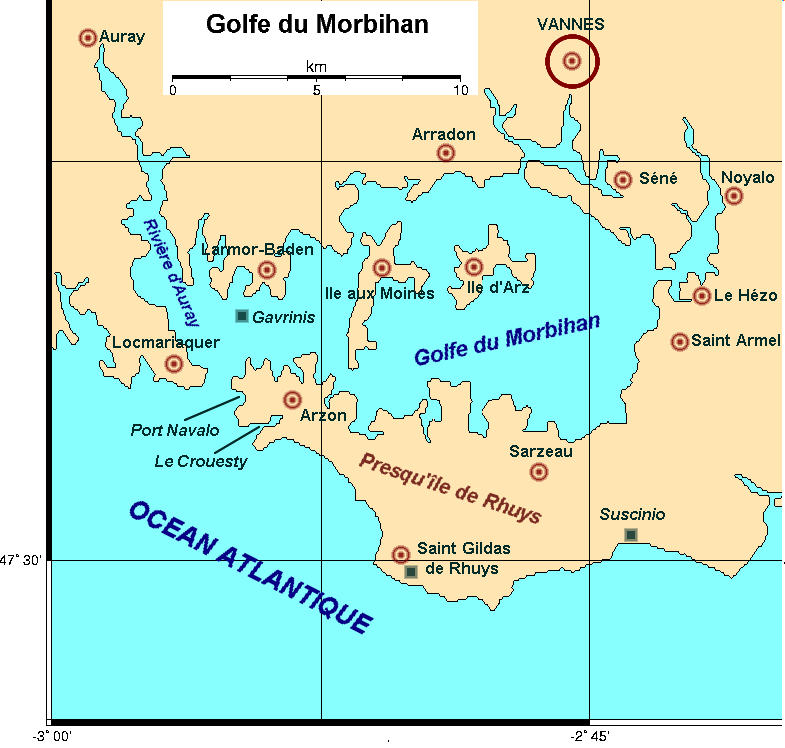
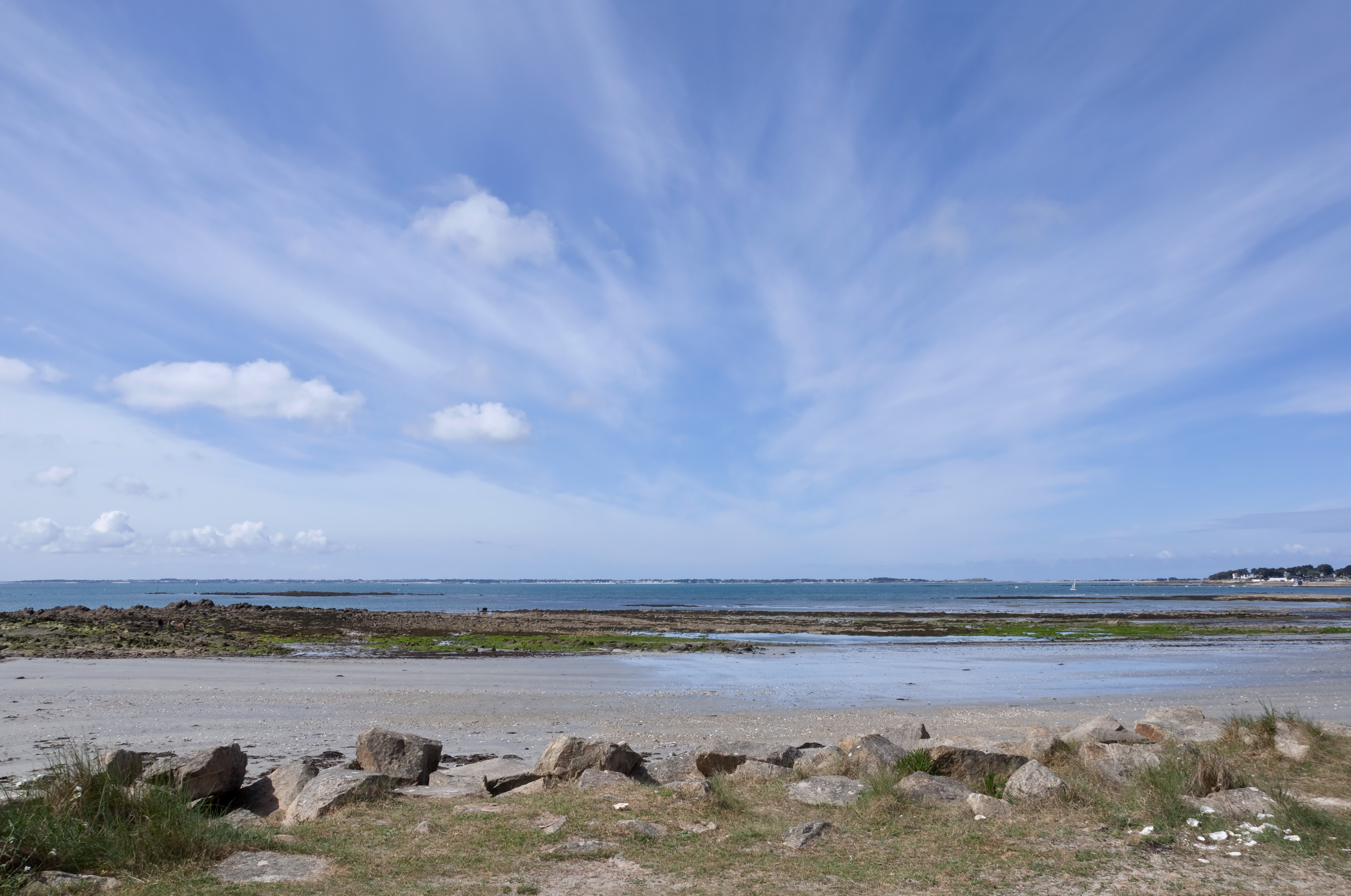
The Gulf of Morbihan (, ; ) is a natural harbour on the coast of the departments of France, department of Morbihan in southern Brittany, France. Its English name is taken from the French language, French version, ''le golfe du Morbihan'', though it would be more precisely called 'the Morbihan' as its Breton language, Breton name 'Ar Mor Bihan' means 'the little sea'. (Compare the Welsh language, Welsh ''y môr bychan''), as opposed to the Atlantic Ocean outside, (''Ar Mor Bras''). Legend says that there are as many islands in the Gulf as there are days of the year. In fact the gulf has about 40, depending on the tides. Many islands are private property, except the largest two, Île-aux-Moines and Île-d'Arz. Geography Tides and currents The gulf is sheltered from the Atlantic Ocean by the peninsula of Rhuys, a small gap between Port-Navalo (in the commune of Arzon) and Kerpenhir (commune of Locmariaquer) lets the water in and out. Because this gap is only approximately wid ... [...More Info...] [...Related Items...] OR: [Wikipedia] [Google] [Baidu] |
Bay Of Biscay
The Bay of Biscay ( ) is a gulf of the northeast Atlantic Ocean located south of the Celtic Sea. It lies along the western coast of France from Point Penmarc'h to the Spanish border, and along the northern coast of Spain, extending westward to Cape Ortegal. The average depth is and the greatest depth is . Etymology The Bay of Biscay is known in Spain as the Gulf of Biscay (; ). In France, it is called the Gulf of Gascony ( ; ; ; ). In Latin, the bay was known as ( Cantabrian Gulf); the name Cantabrian Sea is still used locally for the southern area of the Bay of Biscay that washes over the northern coast of Spain ( Cantabria). The English name comes from Biscay on the northern Spanish coast, probably standing for the western Basque districts (''Biscay'' up to the early 19th century). Geography Parts of the continental shelf extend far into the bay, resulting in fairly shallow waters in many areas and thus the rough seas for which the region is known. Heavy storms ... [...More Info...] [...Related Items...] OR: [Wikipedia] [Google] [Baidu] |
Rhuys
The Rhuys Peninsula (, ) is located in the ''département'' of Morbihan in the region of Brittany in northwestern France. Three communes are located on the peninsula: * Sarzeau, the largest, covering 50% of the area of the peninsula * Arzon * Saint-Gildas-de-Rhuys Saint-Gildas-de-Rhuys () is a commune in the Morbihan department of Brittany in north-western France. Inhabitants of Saint-Gildas-de-Rhuys are called in French ''Gildasiens''. Its French name refers to Saint Gildas, who founded the abbey of ... History * Cairn of Petit Mont {{Authority control Landforms of Morbihan Peninsulas of Metropolitan France Landforms of Brittany ... [...More Info...] [...Related Items...] OR: [Wikipedia] [Google] [Baidu] |
Auray
Auray (; , or simply ) is a Communes of France, commune in the Morbihan Departments of France, department, Regions of France, administrative region of Brittany (administrative region), Brittany, northwestern France. Inhabitants of Auray are called ''Alréens'' (French) and ''Alreiz'' (Breton). Geography The city is surrounded by the communes of Crac'h to the south and the west, Brech to the north and Pluneret to the east. It is crossed by the Loch, a small coastal river, which flows into the Gulf of Morbihan. The town is high on the west bank of the river Auray on the edge of the Armorican plateau which is cut deeply by the river. The port of Saint-Goustan is also in the valley, east of the river. History The Battle of Auray on 29 September 1364 was the last battle of the Breton War of Succession. Kerblois, the place in Brech at which the defeated Charles de Blois was killed is marked by a crucifix. In 1632, sailors departed from the port of Saint-Goustan to re-capture the to ... [...More Info...] [...Related Items...] OR: [Wikipedia] [Google] [Baidu] |
Stonehenge
Stonehenge is a prehistoric Megalith, megalithic structure on Salisbury Plain in Wiltshire, England, west of Amesbury. It consists of an outer ring of vertical sarsen standing stones, each around high, wide, and weighing around 25 tons, topped by connecting horizontal lintel stones, held in place with mortise and tenon joints, a feature unique among contemporary monuments. Inside is a ring of smaller bluestones. Inside these are free-standing trilithons, two bulkier vertical sarsens joined by one lintel. The whole monument, now ruinous, is aligned towards the sunrise on the summer solstice and sunset on the winter solstice. The stones are set within Earthwork (archaeology), earthworks in the middle of the densest complex of Neolithic British Isles, Neolithic and Bronze Age Britain, Bronze Age monuments in England, including several hundred ''tumuli'' (burial mounds). Stonehenge was constructed in several phases beginning about 3100 BC and continuing until about 1600 B ... [...More Info...] [...Related Items...] OR: [Wikipedia] [Google] [Baidu] |
England
England is a Countries of the United Kingdom, country that is part of the United Kingdom. It is located on the island of Great Britain, of which it covers about 62%, and List of islands of England, more than 100 smaller adjacent islands. It shares Anglo-Scottish border, a land border with Scotland to the north and England–Wales border, another land border with Wales to the west, and is otherwise surrounded by the North Sea to the east, the English Channel to the south, the Celtic Sea to the south-west, and the Irish Sea to the west. Continental Europe lies to the south-east, and Ireland to the west. At the 2021 United Kingdom census, 2021 census, the population was 56,490,048. London is both List of urban areas in the United Kingdom, the largest city and the Capital city, capital. The area now called England was first inhabited by modern humans during the Upper Paleolithic. It takes its name from the Angles (tribe), Angles, a Germanic peoples, Germanic tribe who settled du ... [...More Info...] [...Related Items...] OR: [Wikipedia] [Google] [Baidu] |
Gavrinis
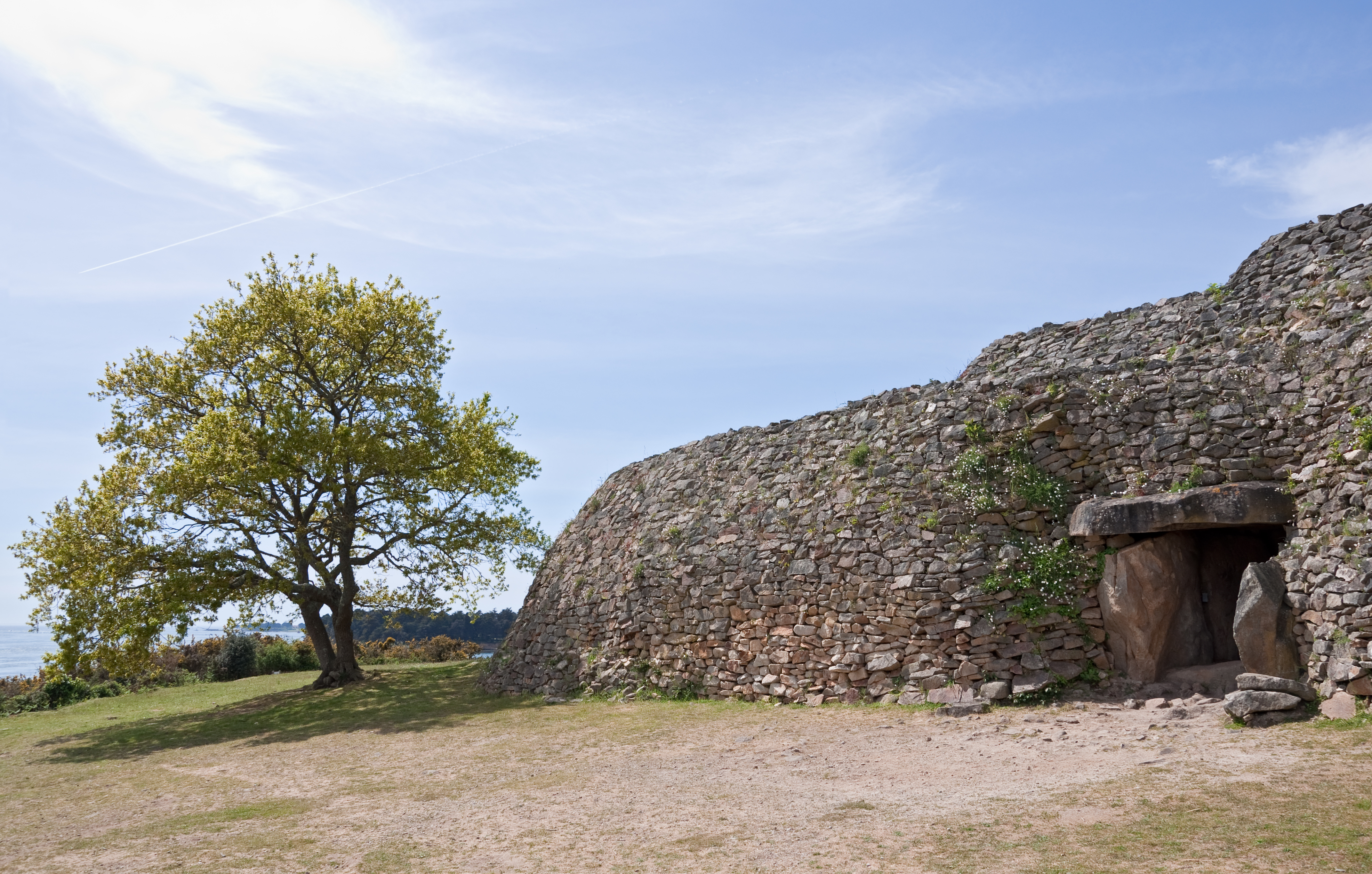
Gavrinis () is a small island in the Gulf of Morbihan in Brittany, France. It contains the Gavrinis tomb, a Neolithic passage tomb built around 4200–4000 BC, making it one of the world's oldest surviving buildings. Stones inside the passage and chamber are covered in megalithic art. It is likened to other Neolithic passage tombs such as Barnenez in Brittany and Newgrange in Ireland. Geography Reachable by boat from the town of Larmor-Baden near the opening of Morbihan Gulf to the Atlantic Ocean, Gavrinis is an uninhabited granite rock outcrop of 750 × 400m. Its highest point dominates much of the surrounding area. Name The name ''Gavrinis'' is popularly believed to be derived from the Breton words ''gavr'' (goat) and ''enez'' (island), suggesting a meaning of "goat island". This is probably a false etymology. In documents dating from 1184 and 1202, the island is named ''Guirv Enes'' and ''Guerg Enes'', respectively. The old Breton word ''Guerg'' is not related to ''gavr' ... [...More Info...] [...Related Items...] OR: [Wikipedia] [Google] [Baidu] |
Passage Grave
A passage grave or passage tomb consists of one or more burial chambers covered in earth or stone and having a narrow access passage made of large stones. These structures usually date from the Neolithic Age and are found largely in Western Europe. When covered in earth, a passage grave is a type of tumulus, burial mound which is found in various forms all over the world. When a passage grave is covered in stone, it is a type of cairn. Construction and design The building of passage graves was normally carried out with megaliths along with smaller stones. The earliest passage tombs seem to take the form of small dolmens, although not all dolmens are passage graves. The passage itself in a number of notable instances is aligned in such a way that the sun shines through the passage and into the chamber at a significant point in the year, often at sunrise on the solstice, winter solstice or at sunset on the equinox. Many later passage tombs were constructed at the tops of hills or mo ... [...More Info...] [...Related Items...] OR: [Wikipedia] [Google] [Baidu] |
Carnac
Carnac (; , ) is a commune beside the Gulf of Morbihan on the south coast of Brittany in the Morbihan department in north-western France. Its inhabitants are called ''Carnacois'' in French. Carnac is renowned for the Carnac stones – one of the most extensive Neolithic menhir collections in the world – as well as its beaches, which are popular with tourists. Located on a narrow peninsula halfway between the medieval town Vannes and the seaside resort Quiberon, Carnac is split into two centres: ''Carnac-Ville'' and ''Carnac-Plage'' (the beachfront). In total there are five beaches, including ''la Grande Plage'', and further to the east, ''Plage Men Dû'' and ''Beaumer''. Map Standing stones Carnac is famous as the site of more than 10,000 Neolithic standing stones, also known as menhirs. The stones were hewn from local rock and erected by the pre-Celtic people of Brittany. Local tradition claims that the reason they stand in such perfectly straight lines is th ... [...More Info...] [...Related Items...] OR: [Wikipedia] [Google] [Baidu] |
Menhir
A menhir (; from Brittonic languages: ''maen'' or ''men'', "stone" and ''hir'' or ''hîr'', "long"), standing stone, orthostat, or lith is a large upright stone, emplaced in the ground by humans, typically dating from the European middle Bronze Age. They can be found individually as monoliths, or as part of a group of similar stones. Menhirs' size can vary considerably, but they often taper toward the top. Menhirs are found across Europe, Africa, and Asia, with a concentration in Western Europe, notably in Ireland, Great Britain, and Brittany. Theories concerning their purpose remain speculative, with hypotheses ranging from druidic rituals to territorial markers or elements of an ideological system. Some menhirs feature engravings, including anthropomorphic figures and symbols, and are often associated with ancient religious ceremonies and burial chambers. Etymology The word ''menhir'' was adopted from French by 19th-century archaeologists. The introduction of the ... [...More Info...] [...Related Items...] OR: [Wikipedia] [Google] [Baidu] |
Stone Circle
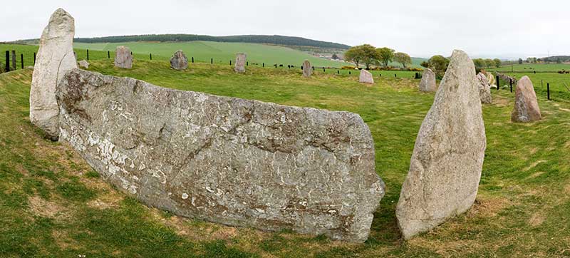
A stone circle is a ring of megalithic standing stones. Most are found in Northwestern Europe – especially Stone circles in the British Isles and Brittany – and typically date from the Late Neolithic and Early Bronze Age, with most being built between 3300 and 2500 BC. The best known examples include those at the henge monument at Avebury, the Rollright Stones, Castlerigg, and elements within the ring of standing stones at Stonehenge. Scattered examples exist from other parts of Europe. Later, during the Iron Age, stone circles were built in southern Scandinavia. The archetypical stone circle is an uncluttered enclosure, large enough to congregate inside, and composed of megalithic stones. Often similar structures are named 'stone circle', but these names are either historic, or incorrect. Examples of commonly misinterpreted stone circles are ring cairns, burial mounds, and kerb cairns. Although it is often assumed there are thousands of stone circles across the Br ... [...More Info...] [...Related Items...] OR: [Wikipedia] [Google] [Baidu] |
Pyramid
A pyramid () is a structure whose visible surfaces are triangular in broad outline and converge toward the top, making the appearance roughly a pyramid in the geometric sense. The base of a pyramid can be of any polygon shape, such as triangular or quadrilateral, and its surface-lines either filled or stepped. A pyramid has the majority of its mass closer to the ground with less mass towards the pyramidion at the apex. This is due to the gradual decrease in the cross-sectional area along the vertical axis with increasing elevation. This offers a weight distribution that allowed early civilizations to create monumental structures.Ancient civilizations in many parts of the world pioneered the building of pyramids. The largest pyramid by volume is the Mesoamerican Great Pyramid of Cholula, in the Mexican state of Puebla. For millennia, the largest structures on Earth were pyramids—first the Red Pyramid in the Dashur Necropolis and then the Great Pyramid of Khufu, bot ... [...More Info...] [...Related Items...] OR: [Wikipedia] [Google] [Baidu] |
Dolmen
A dolmen, () or portal tomb, is a type of single-chamber Megalith#Tombs, megalithic tomb, usually consisting of two or more upright megaliths supporting a large flat horizontal capstone or "table". Most date from the Late Neolithic period (40003000 BCE) and were sometimes covered with earth or smaller stones to form a tumulus (burial mound). Small pad-stones may be wedged between the cap and supporting stones to achieve a level appearance. In many instances, the covering has eroded away, leaving only the stone "skeleton". In Sumba (Indonesia), dolmens are still commonly built (about 100 dolmens each year) for collective graves according to lineage. The traditional village of Wainyapu, Sumba, Wainyapu has some 1,400 dolmens. Etymology Celtic or French The word ''dolmen'' entered archaeology when Théophile Corret de la Tour d'Auvergne used it to describe megalithic tombs in his (1796) using the spelling ''dolmin'' (the current spelling was introduced about a decade later and h ... [...More Info...] [...Related Items...] OR: [Wikipedia] [Google] [Baidu] |


