|
Grimsargh
Grimsargh is a village and civil parish in the City of Preston, Lancashire, England. located east of Preston. History The name Grimsargh is said to derive from an Old Norse name ''Grímr'' with Norse ''erg''. One reference lists it as coming from the Domesday Book's ''Grimesarge'', "at the temple of Grimr" (a name for Odin). Oliver Cromwell's Roundhead army came through Grimsargh en route to what is now Walton-le-Dale in Preston, on what became known as the Battle of Preston on 17 August 1648. In 1868 by E. G. Paley was contracted to rebuilt the nave and added a tower to an existing chapel in the village. Known today as St Michael's Church it is in sandstone with slate roofs, and consists of a nave, a north aisle, a chancel, a northeast vestry, and a west tower. The tower is in three stages, and has a southeast stair turret, angle buttresses, an embattled parapet, and a pyramidal roof. The parish was formed on 1 April 1934 from the merger of the parish of Elston with h ... [...More Info...] [...Related Items...] OR: [Wikipedia] [Google] [Baidu] |
Whittingham Hospital Railway
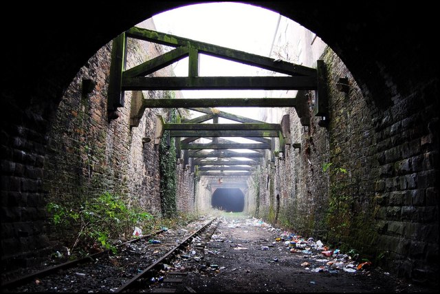
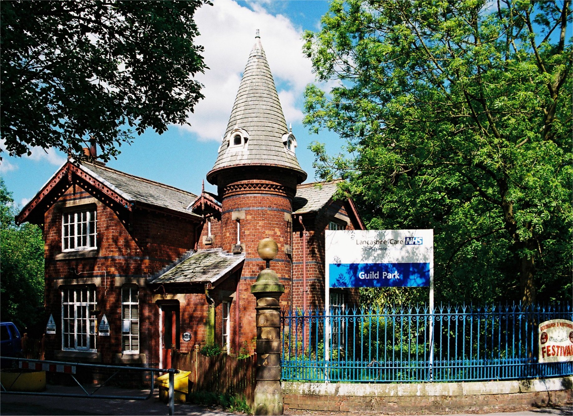
The Whittingham Hospital Railway (W.H.R.) was a private light railway operated by Lancashire County Council to serve Whittingham lunatic asylum. Opened in 1889, it carried goods and passengers between Grimsargh on the Preston and Longridge Railway and the hospital grounds. It closed to all traffic in 1957. Planning & construction The asylum was completed in 1873 and enlarged in 1879 to accommodate 2,895 patients. Before becoming a hospital, it was the long-time residence of the Waring family. The house was built in 1869 by Cooper and Tullis of Preston, to the designs of Henry Littler for £338,000. In the early days of the hospital, all supplies, including coal and provisions, had to be transported by horse and cart from Preston – a distance of – or from Longridge at the terminus of the Preston and Longridge Railway some distant. The cartage was expensive; permanently staffed with a stud of horses and vehicles. In 1884, the significant costs of this operation prompted ... [...More Info...] [...Related Items...] OR: [Wikipedia] [Google] [Baidu] |
Grimsargh Railway Station
Grimsargh railway station was on the single track Preston and Longridge Railway. It served the village of Grimsargh in Lancashire, England. When the line first opened in 1840, wagons carrying quarried stone ran downhill from Longridge to Preston and were hauled in the other direction by horses. There were rudimentary passenger facilities at Grimsargh — the nearby ''Plough Hotel'' was used as a booking office. It was not until 1870 that a proper station building was constructed, when the line was run jointly by the Lancashire and Yorkshire Railway and the London and North Western Railway. In 1889, the privately run Whittingham Hospital Railway The Whittingham Hospital Railway (W.H.R.) was a private light railway operated by Lancashire County Council to serve Whittingham lunatic asylum. Opened in 1889, it carried goods and passengers between Grimsargh on the Preston and Longridge Rai ... was opened to a second Grimsargh Station which was diagonally opposite the ... [...More Info...] [...Related Items...] OR: [Wikipedia] [Google] [Baidu] |
Longridge Branch Line
The Preston and Longridge Railway (P&LR) was a branch line in Lancashire, England. Originally designed to carry quarried stone in horse-drawn wagons, it became part of an ambitious plan to link the Lancashire coast to the heart of Yorkshire. The ambition was never achieved, but the line continued to carry passengers until 1930 and goods until 1967. Early history The Preston and Longridge Railway Company was set up in 1836 to build a tramway from the newly opened Tootle Heights Quarry in Longridge to Preston, Lancashire, Preston. The 6½-mile (10½ km) single-track line was opened on 1 May 1840, with crude passenger facilities at , and in Preston, Lancashire, Preston. Wagons were horse-drawn from Preston uphill to Longridge. Wagons gravity railway, ran by gravity in the opposite direction as far as Ribbleton, which was then a village just outside Preston. Horses were used for the final two miles (3 km) to Deepdale. Longridge ashlar sandstone was widely used in the re ... [...More Info...] [...Related Items...] OR: [Wikipedia] [Google] [Baidu] |
Preston Rural District
Preston was a rural district in Lancashire, England from 1894 to 1974. It surrounded Preston on the north, west and east sides. The district was created under the Local Government Act 1894. It was abolished in 1974 under the Local Government Act 1972, with its area being split between the new districts of South Ribble, Preston and Ribble Valley. It contained the following parishes: * Barton, Broughton, Elston (until 1934 when merged into Grimsargh), Goosnargh, Grimsargh-with-Brockholes (until 1934 when merged into Grimsargh), Grimsargh (from 1934), Haighton, Lea Ashton Ingol and Cottam (until 1934 when split into Lea, Fulwood Urban District and the County Borough of Preston), Lea (from 1934), Whittingham and Woodplumpton which were all transferred to the Borough of Preston in 1974 * Dutton, Hothersall and Ribchester which were all transferred to Ribble Valley in 1974 * Cuerdale, Farington, Howick (until 1934 when merged into Penwortham), Hutton, The Holme (until m ... [...More Info...] [...Related Items...] OR: [Wikipedia] [Google] [Baidu] |
Preston, Lancashire
Preston () is a city on the north bank of the River Ribble in Lancashire, England. The city is the administrative centre of the county of Lancashire and the wider City of Preston, Lancashire, City of Preston local government district. Preston and its surrounding district obtained City status in the United Kingdom, city status in 2002, becoming England's 50th city in the 50th year of Elizabeth II of the United Kingdom, Queen Elizabeth II's reign. Preston has a population of 114,300, the City of Preston district 132,000 and the Preston Built-up Area 313,322. The Preston Travel To Work Area, in 2011, had a population of 420,661, compared with 354,000 in the previous census. Preston and its surrounding area have provided evidence of ancient Roman Britain, Roman activity, largely in the form of a Roman road that led to a camp at Walton-le-Dale. The Angles established Preston; its name is derived from the Old English meaning "priest's settlement" and in the ''Domesday Book'' is reco ... [...More Info...] [...Related Items...] OR: [Wikipedia] [Google] [Baidu] |
Borough Of Preston
The City of Preston () is a city and non-metropolitan district in Lancashire, England. On the north bank of the River Ribble, it was granted city status in 2002, becoming England's 50th city in the 50th year of Queen Elizabeth II's reign. The City of Preston district has a population of (), and lies at the centre of the Central Lancashire sub-region, with a population of 335,000. The district, formerly known as the Borough of Preston, is named after the urban settlement of Preston which lies in the south of the district, and also contains nine civil parishes. History In 1974, the non-metropolitan district of Preston was formed from the County Borough of Preston, Fulwood Urban District, and a major part of Preston Rural District. The district was granted city status in 2002. Governance Preston City Council The City of Preston is divided into 16 district council wards represented by 48 councillors. In 2017 there are about 6,000 electors per ward, expected to rise to about 6,3 ... [...More Info...] [...Related Items...] OR: [Wikipedia] [Google] [Baidu] |
City Of Preston, Lancashire
The City of Preston () is a city and non-metropolitan district in Lancashire, England. On the north bank of the River Ribble, it was granted city status in 2002, becoming England's 50th city in the 50th year of Queen Elizabeth II's reign. The City of Preston district has a population of (), and lies at the centre of the Central Lancashire sub-region, with a population of 335,000. The district, formerly known as the Borough of Preston, is named after the urban settlement of Preston which lies in the south of the district, and also contains nine civil parishes. History In 1974, the non-metropolitan district of Preston was formed from the County Borough of Preston, Fulwood Urban District, and a major part of Preston Rural District. The district was granted city status in 2002. Governance Preston City Council The City of Preston is divided into 16 district council wards represented by 48 councillors. In 2017 there are about 6,000 electors per ward, expected to rise to abo ... [...More Info...] [...Related Items...] OR: [Wikipedia] [Google] [Baidu] |
Whittingham Hospital
Whittingham Hospital was a psychiatric hospital in the parish of Whittingham, near Preston, Lancashire, England. The hospital opened in 1873 as the Fourth Lancashire County Asylum and grew to be the largest mental hospital in Britain, and pioneered the use of electroencephalograms (EEGs). It closed in 1995. History Early years In 1866 the first three Lancashire lunatic asylums, at Prestwich, Rainhill and Lancaster, were deemed to be full. Extra accommodation was urgently needed and to this end the building of Whittingham Asylum "for pauper lunatics" began in 1869. The hospital was designed by Henry Littler of Manchester, Architect to the Lancashire Asylums BoardCracknell, Peter"County Asylums" accessed 6 May 2012 and built of red brick made from clay dug on site. The buildings followed a plan of multiple quadrangles with inter-connecting corridors radiating from a long axial corridor section. The hospital was officially opened as the Fourth Lancashire County Lunatic Asylum on ... [...More Info...] [...Related Items...] OR: [Wikipedia] [Google] [Baidu] |
Amounderness
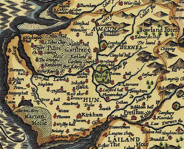
The Amounderness Hundred () is one of the six subdivisions of the historic county of Lancashire in North West England, but the name is older than the system of hundreds first recorded in the 13th century and might best be described as the name of a Norse wapentake. In the Domesday Book, it was used for some territories north of the River Ribble included together with parts of Yorkshire. The area eventually became part of Lancashire, sitting geographically between the Rivers Lune and Ribble, in the strip of coast between the Irish Sea and Bowland Forest. Etymology and history In the 19th century, the name was considered to have been first recorded in 705, as Hacmunderness. The Domesday Book in 1086 spells it Agemundrenessa. There are two suggested etymologies for Amounderness. The traditional 19th century reading was that the name derived from ''ac'' (oak) and ''mund'' (protection), "a ness or promontory sheltered by oaks". This was given currency by Porter.Porter, J, ''A His ... [...More Info...] [...Related Items...] OR: [Wikipedia] [Google] [Baidu] |
Wyre And Preston North
Wyre and Preston North is a county constituency represented in the House of Commons of the Parliament of the United Kingdom. Created in the most recent fifth periodic review of constituencies by the Boundary Commission for England, it elects one Member of Parliament (MP) by the first past the post voting system. It was formed of parts of the Ribble Valley, Fylde and Lancaster and Wyre constituencies. The current MP is Ben Wallace of the Conservative Party who is currently Secretary of State for Defence. Boundaries It was created as the sixteenth seat of the county of Lancashire by the Boundary Commission for England prior to the 2010 general election. It contains the Fulwood and rural areas of Preston and many small towns and villages of Wyre. The seat of Wyre and Preston North contains the Wyre towns of Poulton-le-Fylde, Garstang, St Michael's On Wyre, Catterall and parts of Thornton. From Preston are added the suburban Fulwood area and the rural parishes such as W ... [...More Info...] [...Related Items...] OR: [Wikipedia] [Google] [Baidu] |
Lancashire
Lancashire ( , ; abbreviated Lancs) is the name of a Historic counties of England, historic county, Ceremonial County, ceremonial county, and non-metropolitan county in North West England. The boundaries of these three areas differ significantly. The non-metropolitan county of Lancashire was created by the Local Government Act 1972. It is administered by Lancashire County Council, based in Preston, Lancashire, Preston, and twelve district councils. Although Lancaster, Lancashire, Lancaster is still considered the county town, Preston is the administrative centre of the non-metropolitan county. The ceremonial county has the same boundaries except that it also includes Blackpool and Blackburn with Darwen, which are unitary authorities. The historic county of Lancashire is larger and includes the cities of Manchester and Liverpool as well as the Furness and Cartmel peninsulas, but excludes Bowland area of the West Riding of Yorkshire transferred to the non-metropolitan county ... [...More Info...] [...Related Items...] OR: [Wikipedia] [Google] [Baidu] |
Vestry
A vestry was a committee for the local secular and ecclesiastical government for a parish in England, Wales and some English colonies which originally met in the vestry or sacristy of the parish church, and consequently became known colloquially as the "vestry". Overview For many centuries, in the absence of any other authority (which there would be in an incorporated city or town), the vestries were the sole ''de facto'' local government in most of the country, and presided over local, communal fundraising and expenditure until the mid or late 19th century using local established Church chairmanship. They were concerned for the spiritual but also the temporal as well as physical welfare of parishioners and its parish amenities, collecting local rates or taxes and taking responsibility for numerous functions such as the care of the poor, the maintaining of roads, and law enforcement, etc. More punitive matters were dealt with by the manorial court and hundred court, and latte ... [...More Info...] [...Related Items...] OR: [Wikipedia] [Google] [Baidu] |


