|
Great Sauk State Trail
Great Sauk State Trail is a bike trail in Sauk County, Wisconsin. The trail was built in 2017 on a former Milwaukee Road railroad line. The trail begins in Sauk City at the Wisconsin River and ends just south of Devil's Lake State Park. The trail will eventually connect with the existing 400 State Trail The 400 State Trail is a rail trail between Reedsburg and Elroy, Wisconsin. It is designed for foot, bicycle, equestrian, snowmobile traffic. It is designated as a multi-use trail, offering recreational access to the routes, and is open to the ... in Reedsburg. References Rail trails in Wisconsin {{Wisconsin-geo-stub ... [...More Info...] [...Related Items...] OR: [Wikipedia] [Google] [Baidu] |
Sauk County, Wisconsin
Sauk County is a county in Wisconsin. It is named after a large village of the Sauk people. As of the 2020 census, the population was 65,763. Its county seat and largest city is Baraboo. The county was created in 1840 from Wisconsin Territory and organized in 1844. Sauk County comprises the Baraboo, WI Micropolitan Statistical Area and is included in the Madison metropolitan area. History Sauk County was a New England settlement. The original founders of Sauk County consisted entirely of settlers from New England as well as some from upstate New York who had parents who moved to that region from New England shortly after the American Revolution. These people were "Yankee" settlers, that is to say they were descended from the English Puritans who settled New England in the 1600s. While most of them came to Wisconsin directly from New England, there were many who came from upstate New York. These were people whose parents had moved from New England to upstate New York in the i ... [...More Info...] [...Related Items...] OR: [Wikipedia] [Google] [Baidu] |
Milwaukee Road
The Chicago, Milwaukee, St. Paul and Pacific Railroad (CMStP&P), often referred to as the "Milwaukee Road" , was a Class I railroad that operated in the Midwest and Northwest of the United States from 1847 until 1986. The company experienced financial difficulty through the 1970s and 1980s, including bankruptcy in 1977 (though it filed for bankruptcy twice in 1925 and 1935, respectively). In 1980, it abandoned its Pacific Extension, which included track in the states of Montana, Idaho, and Washington. The remaining system was merged into the Soo Line Railroad , a subsidiary of Canadian Pacific Railway , on January 1, 1986. Much of its historical trackage remains in use by other railroads. The company brand is commemorated by buildings like the historic Milwaukee Road Depot in Minneapolis and preserved locomotives such as Milwaukee Road 261 which operates excursion trains. History Chicago, Milwaukee, St. Paul and Minneapolis Railroad The railroad that became the Milwauke ... [...More Info...] [...Related Items...] OR: [Wikipedia] [Google] [Baidu] |
Sauk City, Wisconsin
Sauk City is a village in Sauk County, Wisconsin, United States, North America. The population was 3,518 as of the 2020 census. The first incorporated village in the state, the community was founded by Agoston Haraszthy and his business partner, Robert Bryant. The village is adjacent to Prairie du Sac; together, these twin villages are referred to as Sauk Prairie. History Impressed by the beautiful scenery, Agoston Haraszthy, a charismatic Hungarian sometimes called "Count" Haraszthy, purchased a small plot of land along the Wisconsin River in 1840. Later, with his English-born business partner, Robert Bryant, Haraszthy bought additional land and founded the town of Haraszthy (originally called Széptáj, Hungarian for "beautiful place"). In 1849, the name of the town was changed to Westfield. Three years later, in 1852, it was changed again, this time to the current name of Sauk City. The community was incorporated as a village in 1854, making Sauk City the oldest incorporated ... [...More Info...] [...Related Items...] OR: [Wikipedia] [Google] [Baidu] |
Wisconsin River
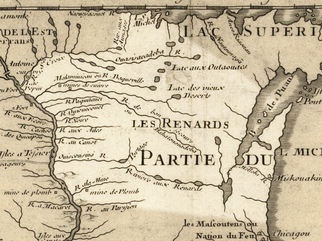
The Wisconsin River is a tributary of the Mississippi River in the U.S. state of Wisconsin. At approximately 430 miles (692 km) long, it is the state's longest river. The river's name, first recorded in 1673 by Jacques Marquette as "Meskousing", is rooted in the Algonquian languages used by the area's American Indian tribes, but its original meaning is obscure. French explorers who followed in the wake of Marquette later modified the name to "Ouisconsin", and so it appears on Guillaume de L'Isle's map (Paris, 1718). This was simplified to "Wisconsin" in the early 19th century before being applied to Wisconsin Territory and finally the state of Wisconsin. The Wisconsin River originates in the forests of the North Woods Lake District of northern Wisconsin, in Lac Vieux Desert near the border of the Upper Peninsula of Michigan. It flows south across the glacial plain of central Wisconsin, passing through Wausau, Stevens Point, and Wisconsin Rapids. In southern Wisconsi ... [...More Info...] [...Related Items...] OR: [Wikipedia] [Google] [Baidu] |
Devil's Lake State Park (Wisconsin)
Devil's Lake State Park is a state park located in the Baraboo Range in eastern Sauk County, just south of Baraboo, Wisconsin. It is around thirty-five miles northwest of Madison, and is on the western edge of the last ice-sheet deposited during the Wisconsin glaciation. The state park encompasses , making it the largest in Wisconsin. The state park is known for its quartzite bluffs along the Devil's Lake, which was created by a glacier depositing terminal moraines that plugged the north and south ends of the gap in the bluffs during the last ice age approximately 12,000 years ago. The sand at the bottom of Devil's Lake is thought to be deposited by glaciers. There are many quartzite rock formations, such as Balanced Rock and Devil's Doorway, throughout the park. Effigy mounds are also located throughout the park. The park contains approximately eleven miles of the Ice Age Trail. Its scenic beauty, along with its proximity to the Wisconsin Dells, has made it one of ... [...More Info...] [...Related Items...] OR: [Wikipedia] [Google] [Baidu] |
400 State Trail
The 400 State Trail is a rail trail between Reedsburg and Elroy, Wisconsin. It is designed for foot, bicycle, equestrian, snowmobile traffic. It is designated as a multi-use trail, offering recreational access to the routes, and is open to the public. History The original railway was constructed from Madison, Wisconsin to Winona, Minnesota, starting in 1870, by a predecessor of the Chicago and North Western Railway, the Baraboo Air Line Railroad Company. It was so named because of the straightness of the Air-line railroad route. The railway became the route of the ''Minnesota 400'', a named train of the C&NW that connected Chicago with Southern Wisconsin and Southern Minnesota. It eventually became the route of the South Dakota destined ''Dakota 400''. The "400" trains of the C&NW were related to the C&NW flagship high-speed Twin Cities 400, which met the ''Minnesota 400'' at Wyeville. The State of Wisconsin acquired the railway after it was abandoned by C&NW in 1988. After ... [...More Info...] [...Related Items...] OR: [Wikipedia] [Google] [Baidu] |
Reedsburg, Wisconsin
Reedsburg is a city in Sauk County, Wisconsin, United States. Located along the Baraboo River, it was founded in 1868, and was named for early settler David C. Reed. The city is surrounded by the Town of Reedsburg. It is part of the Baraboo Micropolitan Statistical Area. History Early settlement Early settlers came to this area due to the abundance of natural resources, especially lumber. In 1844, the first copper mine was established in this area, but it was soon abandoned. James W. Babb and his wife Rebecca Scarff Babb are the earliest recorded settlers, having brought their family to Wisconsin from Ohio in 1845. At a place 55 miles northeast of Mineral Point (the capital of Wisconsin Territory), long identified by the Winnebago who inhabited these lands as a convenient place to cross the Baraboo River, Babb left a flat-bottomed boat to help move supplies. At "Babb's Ford," in 1847 David C. Reed built a dam and a shanty to house the workers who constructed it. In June ... [...More Info...] [...Related Items...] OR: [Wikipedia] [Google] [Baidu] |
.jpg)


