|
Grayling Army Airfield
Grayling Army Airfield is a public/military use airport located one nautical mile (1.85 km) northwest of the central business district of Grayling, in Crawford County, Michigan, United States. It is owned by United States Army. The airfield is located northeast of the main cantonment area of Camp Grayling. It is included in the Federal Aviation Administration (FAA) National Plan of Integrated Airport Systems for 2017–2021, in which it is categorized as a general aviation facility. Grayling AAF covers an area of at an elevation of 1,158 feet (353 m) above mean sea level. For the 12-month period ending December 31, 2008, the airport had 4,691 aircraft operations, an average of 10 per day: 63% general aviation and 37% military. Although most U.S. airports use the same three-letter location identifier for the FAA and IATA, this airport is assigned GOV by the FAA but has no designation from the IATA (which assigned GOV to Gove Airport in Australia). History Camp Grayling i ... [...More Info...] [...Related Items...] OR: [Wikipedia] [Google] [Baidu] |
United States Army
The United States Army (USA) is the land warfare, land military branch, service branch of the United States Armed Forces. It is one of the eight Uniformed services of the United States, U.S. uniformed services, and is designated as the Army of the United States in the United States Constitution, U.S. Constitution.Article II, section 2, clause 1 of the United States Constitution (1789). See alsTitle 10, Subtitle B, Chapter 301, Section 3001 The oldest and most senior branch of the U.S. military in order of precedence, the modern U.S. Army has its roots in the Continental Army, which was formed 14 June 1775 to fight the American Revolutionary War (1775–1783)—before the United States was established as a country. After the Revolutionary War, the Congress of the Confederation created the United States Army on 3 June 1784 to replace the disbanded Continental Army.Library of CongressJournals of the Continental Congress, Volume 27/ref> The United States Army considers itself to be ... [...More Info...] [...Related Items...] OR: [Wikipedia] [Google] [Baidu] |
International Air Transport Association
The International Air Transport Association (IATA ) is a trade association of the world's airlines founded in 1945. IATA has been described as a cartel since, in addition to setting technical standards for airlines, IATA also organized tariff conferences that served as a forum for price fixing. Consisting in 2016 of 290 airlines, primarily major carriers, representing 117 countries, the IATA's member airlines account for carrying approximately 82% of total available seat miles air traffic. IATA supports airline activity and helps formulate industry policy and standards. It is headquartered in Canada in the city of Montréal, with executive offices in Geneva, Switzerland. History IATA was formed in April 1945 in Havana, Cuba. It is the successor to the International Air Traffic Association, which was formed in 1919 at The Hague, Netherlands. At its founding, IATA consisted of 57 airlines from 31 countries. Much of IATA's early work was technical and IATA provided inp ... [...More Info...] [...Related Items...] OR: [Wikipedia] [Google] [Baidu] |
Interstate 75 In Michigan
Interstate 75 (I-75) is a part of the Interstate Highway System that runs north–south from Miami, Florida, to Sault Ste. Marie in the Upper Peninsula of the US state of Michigan. I-75 enters the state from Ohio in the south, north of Toledo, and runs generally northward through Detroit, Pontiac and Bay City, crosses the Mackinac Bridge, and ends at the Canadian border in Sault Ste. Marie. The freeway runs for approximately on both of Michigan's major peninsulas. The landscapes traversed by I-75 include Southern Michigan farmland, northern forests, suburban bedroom communities, and the urban core of Detroit. The freeway also uses three of the state's monumental bridges to cross major bodies of water. There are four auxiliary Interstates in the state related to I-75, as well as nine current or former business routes, with either Business Loop I-75 (BL I-75) or Business Spur I-75 (BS I-75) designations. The freeway bears several names in addition to the I-75 designat ... [...More Info...] [...Related Items...] OR: [Wikipedia] [Google] [Baidu] |
M-72 (Michigan Highway)
M-72 is a state trunkline highway in the US state of Michigan, running from Lake Huron to Lake Michigan across the northern part of the Lower Peninsula. The highway connects M-22 in Empire with US Highway 23 (US 23) in Harrisville. It is one of only three Michigan state trunklines that cross the Lower Peninsula, shore to shore. In between, M-72 runs across Northern Michigan woodland, agricultural areas of the Leelanau Peninsula near Traverse City, and the Au Sable River watershed. The trunkline also provides access to Camp Grayling, a National Guard training facility near the city of the same name. Traffic levels along the highway vary from approximately 800 vehicles a day on the east end to over 32,000 vehicles near Traverse City. M-72 was first designated as a state highway by 1919 along a segment of its current route. It was extended southward in the mid-1920s and westward in the 1940s. One section of the modern highway added to M-72 in 1940 previ ... [...More Info...] [...Related Items...] OR: [Wikipedia] [Google] [Baidu] |
Business Routes Of Interstate 75 In Michigan
There have been nine business routes for Interstate 75 in the US state of Michigan. Numbered either Business Loop Interstate 75 (BL I-75) or Business Spur Interstate 75 (BS I-75) depending if they are a full business loop or a business spur, these highways are former routings of I-75's predecessor highways in the state. They were designated as I-75 was completed through the various areas of Michigan. The business loop in Pontiac runs through that city's downtown along a section of Woodward Avenue and a segment of roadway formerly used by M-24. The former Saginaw business loop was once a part of US Highway 23 (US 23), as was most of the original Bay City business loop (that one has been converted into a business spur). The roadways that make up the business loops in West Branch and Roscommon were previously part of M-76, I-75's predecessor through that part of the state. In Northern Michigan, the Grayling and Gaylord BL I-75s were part of US 27, ... [...More Info...] [...Related Items...] OR: [Wikipedia] [Google] [Baidu] |
M-93 (Michigan Highway)
M-93 is the designation of a state trunkline highway in the Lower Peninsula of the US state of Michigan. It links both Camp Grayling and Hartwick Pines State Park with Interstate 75 (I-75). Both termini of M-93 end at locations, rather than junctions with another road. The western end of M-93 ends in a traffic circle before it turns into Howe Road as it travels through Camp Grayling. The highway dates back to 1919 as a connection with the predecessor to Camp Grayling. Since that time, it has been extended through Grayling along first US Highway 27 (US 27) and now Business Loop I-75 (BL 75) to connect with the state park. Route description M-93 starts at the main gate of Camp Grayling. From there it runs north and east along Sharon Road parallel to the shore of Lake Margarethe through the edge of the base complex. The highway continues through forested terrain to a junction with M-72 west of the city of Grayling. M-93 turns east, running concurrently along M-72 ... [...More Info...] [...Related Items...] OR: [Wikipedia] [Google] [Baidu] |
REIL
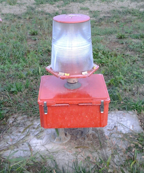
Runway end identifier lights (REIL) (ICAO identifies these as Runway Threshold Identification Lights) are installed at many airports to provide rapid and positive identification of the approach end of a particular runway. The system consists of a pair of synchronized flashing lights located laterally on each side of the runway threshold. REILs may be either omnidirectional or unidirectional facing the approach area.FAA Aeronautical Information Manual, Chapter 2 (Aeronautical Lighting and Other Airport Visual Aids), Section 1 (Airport Lighting Aids) They are effective for: * Identification of a runway surrounded by a preponderance of other ... [...More Info...] [...Related Items...] OR: [Wikipedia] [Google] [Baidu] |
VASI
a
{{disambiguation, surname ...
Vasi or VASI may refer to: *Visual Approach Slope Indicator, a system of lights on the side of an airport runway threshold *Vasi-vari or Wasi-wari language, a language spoken by the Wasi people in the Prasun Valley in Afghanistan Places *Vasi, Iran (other) People with the surname *Abbas Vasi, Gujarati poet *Denise Vasi, actress and model *Giuseppe Vasi, Italian engraver and architect See also *Vashi (other) Vashi may refer to: Places in India * Vashi, subunit of Navi Mumbai township, Mumbai (Bombay), Maharashtra * Vashi, Raigad, village in Pen Taluka, Raigad District, Maharashtra * Vashi, Sangli, village in Walwa Taluka, Sangli District, Maharashtra ... [...More Info...] [...Related Items...] OR: [Wikipedia] [Google] [Baidu] |
Non-directional Beacon
A non-directional beacon (NDB) or non-directional radio beacon is a radio beacon which does not include directional information. Radio beacons are radio transmitters at a known location, used as an aviation or marine navigational aid. NDB are in contrast to directional radio beacons and other navigational aids, such as low-frequency radio range, VHF omnidirectional range (VOR) and tactical air navigation system (TACAN). NDB signals follow the curvature of the Earth, so they can be received at much greater distances at lower altitudes, a major advantage over VOR. However, NDB signals are also affected more by atmospheric conditions, mountainous terrain, coastal refraction and electrical storms, particularly at long range. The system, developed by United States Air Force (USAF) Captain Albert Francis Hegenberger, was used to fly the world's first instrument approach on May 9, 1932. Types of NDBs NDBs used for aviation are standardised by International Civil Aviation Orga ... [...More Info...] [...Related Items...] OR: [Wikipedia] [Google] [Baidu] |
VHF Omnidirectional Range
Very high frequency omnirange station (VOR) is a type of short-range radio navigation system for aircraft, enabling aircraft with a receiving unit to determine its position and stay on course by receiving radio signals transmitted by a network of fixed ground radio beacons. It uses frequencies in the very high frequency (VHF) band from 108.00 to 117.95 MHz. Developed in the United States beginning in 1937 and deployed by 1946, VOR became the standard air navigational system in the world,VOR VHF omnidirectional Range , Aviation Tutorial – Radio Navaids, kispo.net used by both commercial and general aviation, until supplanted by satellite navigation systems such as ... [...More Info...] [...Related Items...] OR: [Wikipedia] [Google] [Baidu] |
Fixed-wing Aircraft
A fixed-wing aircraft is a heavier-than-air Aircraft, flying machine, such as an airplane, which is capable of flight using wings that generate Lift (force), lift caused by the aircraft's forward airspeed and the wing configuration, shape of the wings. Fixed-wing aircraft are distinct from rotorcraft, rotary-wing aircraft (in which the wings form a Helicopter rotor, rotor mounted on a spinning shaft or "mast"), and ornithopters (in which the wings bird flight#Flapping flight, flap in a manner similar to that of a bird). The wings of a fixed-wing aircraft are not necessarily rigid; kites, hang gliders, variable-sweep wing aircraft and airplanes that use wing morphing are all examples of fixed-wing aircraft. Gliding flight, Gliding fixed-wing aircraft, including free-flying Glider (aircraft), gliders of various kinds and tethered kites, can use moving air to gain altitude. Powered aircraft, Powered fixed-wing aircraft (airplanes) that gain forward thrust from an aircraft engine, ... [...More Info...] [...Related Items...] OR: [Wikipedia] [Google] [Baidu] |

.jpg)


