|
Grass Point State Park
Grass Point State Park is a state park located in the Town of Orleans in Jefferson County, New York. The park is located along the St. Lawrence River by NY 12 and NY 180, between Clayton and Alexandria Bay. Park description Grass Point State Park offers picnic tables with pavilions, a playground and playing fields, fishing and ice fishing, a boat launch and docks, a swimming beach, and seasonal hunting. A nearly snowmobile trail passes through the park, which may be used for hiking during the summer months. The park also includes a campground with 53 tent and 19 trailer sites, in addition to Grass Point Cottage, a two-story full-service accommodation located on the river's edge. The park is open from mid-May through mid-October. The park offers views of nearby Rock Island Light, also owned by New York State but accessible only by boat. See also * List of New York state parks * Fishers Landing, New York Fishers Landing is a hamlet and census-designated place (CDP) in the ... [...More Info...] [...Related Items...] OR: [Wikipedia] [Google] [Baidu] |
List Of New York State Parks
This is a list of state parks in the U.S. state of New York. Also listed are state golf courses, seasonal hunting areas, and ''former'' state parks. In New York, state parks are managed by the Office of Parks, Recreation and Historic Preservation (OPRHP), with the exception of the Adirondack and Catskill Parks which are managed by the Department of Environmental Conservation (DEC). Outside of the Adirondacks and the Catskills, the state parks department is organized into eleven regions: *Niagara *Allegany *Genesee *Finger Lakes *Central *Taconic *Palisades *Long Island *Thousand Islands *Saratoga/Capital District *New York City Forest preserve The largest parks in New York are the Adirondack Park, at ; and the Catskill Park, at . Together they comprise the New York Forest Preserve, properties that must be kept "Forever Wild" according to Article 14 of the New York Constitution. Both parks are managed by DEC; the Adirondack Park is managed by the Adirondack Park Agency, ... [...More Info...] [...Related Items...] OR: [Wikipedia] [Google] [Baidu] |
State Park
State parks are parks or other protected areas managed at the sub-national level within those nations which use "state" as a political subdivision. State parks are typically established by a state to preserve a location on account of its natural beauty, historic interest, or recreational potential. There are state parks under the administration of the government of each U.S. state, some of the Mexican states, and in Brazil. The term is also used in the Australian states of Victoria and New South Wales. The equivalent term used in Canada, Argentina, South Africa, and Belgium, is provincial park. Similar systems of local government maintained parks exist in other countries, but the terminology varies. State parks are thus similar to national parks, but under state rather than federal administration. Similarly, local government entities below state level may maintain parks, e.g., regional parks or county parks. In general, state parks are smaller than national parks, with a few ... [...More Info...] [...Related Items...] OR: [Wikipedia] [Google] [Baidu] |
Alexandria Bay, New York
Alexandria Bay is a village in Jefferson County, New York, United States, within the town of Alexandria. It is located in the Thousand Islands region of northern New York. The population of the village was 1,078 at the 2010 United States Census. It lies near the Thousand Islands Border Crossing of Canada and the United States. History Settlement began around 1817. By 1836, the community had about 25 dwellings. The George C. Boldt Yacht House, Church of Saint Lawrence, Cornwall Brothers' Store, Holland Library, Ingleside, and Longue Vue Island are listed on the National Register of Historic Places. In its heyday as a late 19th century and early 20th century resort, its main access was via steamer from Clayton, NY. Its nearest rail connection was Redwood on the Rome, Watertown and Ogdensburg Railroad's Rochester line bound for Ogdensburg. Geography According to the United States Census Bureau, the village has a total area of , of which are land and , or 49.77%, are wate ... [...More Info...] [...Related Items...] OR: [Wikipedia] [Google] [Baidu] |
New York State Office Of Parks, Recreation And Historic Preservation
The New York State Office of Parks, Recreation and Historic Preservation (NYS OPRHP) is a state agency within the New York State Executive DepartmentParks, Recreation and Historic Preservation Law § 3.03. "The office of parks, recreation and historic preservation is hereby continued in the executive department. .. charged with the operation of state parks and historic sites within the U.S. state of New York. As of 2014, the NYS OPRHP manages nearly of public lands and facilities, including 180 state parks and 35 historic sites, that are visited by over 78 million visitors each year. History The agency that would become the New York State Office of Parks, Recreation and Historic Preservation (NYS OPRHP) was created in 1970; however, the history of state parks and historic sites in New York stretches back to the latter part of the 19th century. Management of state-owned parks, and guidance for the entire state park system, was accomplished by various regional ... [...More Info...] [...Related Items...] OR: [Wikipedia] [Google] [Baidu] |
State Park
State parks are parks or other protected areas managed at the sub-national level within those nations which use "state" as a political subdivision. State parks are typically established by a state to preserve a location on account of its natural beauty, historic interest, or recreational potential. There are state parks under the administration of the government of each U.S. state, some of the Mexican states, and in Brazil. The term is also used in the Australian states of Victoria and New South Wales. The equivalent term used in Canada, Argentina, South Africa, and Belgium, is provincial park. Similar systems of local government maintained parks exist in other countries, but the terminology varies. State parks are thus similar to national parks, but under state rather than federal administration. Similarly, local government entities below state level may maintain parks, e.g., regional parks or county parks. In general, state parks are smaller than national parks, with a few ... [...More Info...] [...Related Items...] OR: [Wikipedia] [Google] [Baidu] |
Orleans, New York
Orleans is a town in Jefferson County, New York, United States. The population was 2,789 at the 2010 census, up from 2,463 in 2000. The town is located in the northern part of the county and is north of Watertown. Orleans is named after the commune of Orléans in France. History The Oneida tribe granted land, a tract, in the town to Peter Penet in 1788. The town was first settled around 1806. The community of La Fargeville was founded around 1816 by the construction of a mill on the Chaumont River. The town of Orleans was formed from part of the town of Brownville in 1821 at the same time as some other new towns. Fordham University was founded as St. Johns College in La Fargeville in 1838 by a purchase of the lands and home of John La Farge. The college moved to New York City after a few years. The Irwin Brothers Store and Stone Mills Union Church are listed on the National Register of Historic Places. Geography According to the United States Census Bureau, the ... [...More Info...] [...Related Items...] OR: [Wikipedia] [Google] [Baidu] |
Jefferson County, New York
Jefferson County is a county on the northern border of the U.S. state of New York. As of the 2020 census, the population was 116,721. Its county seat is Watertown. The county is named after Thomas Jefferson, third President of the United States of America. It is adjacent to Lake Ontario, southeast from the Canada–US border of Ontario. Jefferson County comprises the Watertown- Fort Drum, NY Metropolitan Statistical Area. In 2014, it elected Colleen M. O'Neill as the first woman county sheriff in the state. She had served with the New York State Police for 32 years. The popularity of the area as a summer tourist destination results in a dramatic increase of population during that season. The United States Army's 10th Mountain Division is based at Fort Drum. The base had a total population of nearly 13,000 according to the 2010 census. History When counties were established in the Province of New York in 1683, the present Jefferson County was part of Albany County. This ... [...More Info...] [...Related Items...] OR: [Wikipedia] [Google] [Baidu] |
New York (state)
New York, officially the State of New York, is a state in the Northeastern United States. It is often called New York State to distinguish it from its largest city, New York City. With a total area of , New York is the 27th-largest U.S. state by area. With 20.2 million people, it is the fourth-most-populous state in the United States as of 2021, with approximately 44% living in New York City, including 25% of the state's population within Brooklyn and Queens, and another 15% on the remainder of Long Island, the most populous island in the United States. The state is bordered by New Jersey and Pennsylvania to the south, and Connecticut, Massachusetts, and Vermont to the east; it has a maritime border with Rhode Island, east of Long Island, as well as an international border with the Canadian provinces of Quebec to the north and Ontario to the northwest. New York City (NYC) is the most populous city in the United States, and around two-thirds of the state's populat ... [...More Info...] [...Related Items...] OR: [Wikipedia] [Google] [Baidu] |
New York State Route 12
New York State Route 12 (NY 12) is a state highway extending for through central and northern New York in the United States. The southern terminus of the route is at U.S. Route 11 (US 11) in the town of Chenango (just north of Binghamton) in the Southern Tier. The northern terminus is at NY 37 near the village of Morristown in the North Country. In between, the route serves three cities of varying size: Norwich, Utica, and Watertown. NY 12 intersects several primary routes, including US 20 in Sangerfield, New York State Thruway via Interstate 790 (I-790) in Utica, overlaps NY 28 from Barneveld to the town of Remsen, NY 3 in Watertown, and I-81 in Pamelia and Orleans. It is a two lane, undivided, full access roadway for the majority of its length, except between the village of New Hartford and Alder Creek, where it is a four-lane highway. Within that span, it is a limited access highway in the city of Utica, referre ... [...More Info...] [...Related Items...] OR: [Wikipedia] [Google] [Baidu] |
New York State Route 180
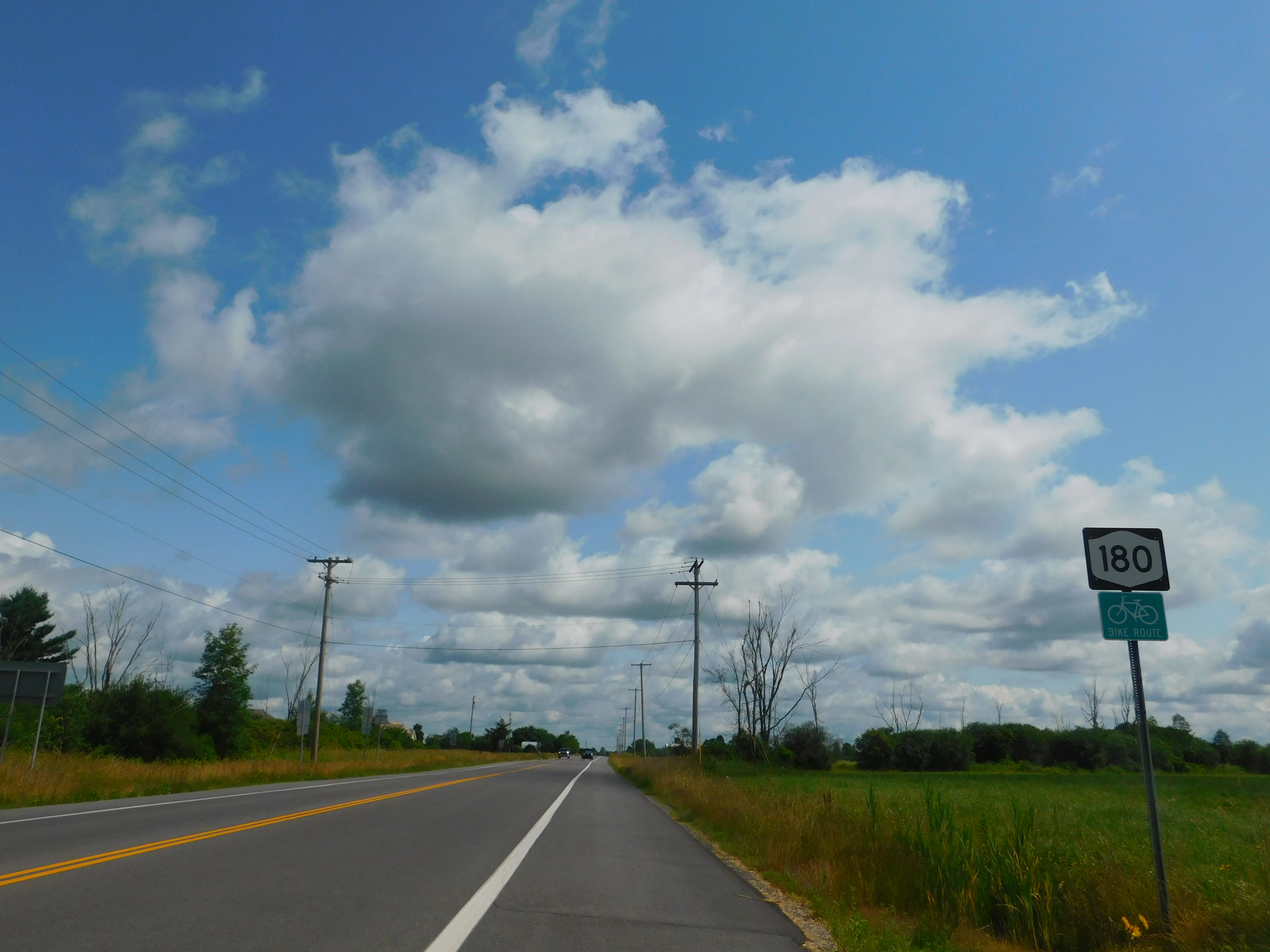
New York State Route 180 (NY 180) is a north–south state highway in the northwestern part of Jefferson County in the U.S. state of New York. The southern terminus of the route is at NY 3 in the Hounsfield hamlet of Baggs Corner, located west of downtown Watertown. The northern terminus is at NY 12 in the Orleans hamlet of Fishers Landing. NY 180 is part of the Seaway Trail from its southern terminus at Baggs Corner to its junction with NY 12E at the Brownville hamlet of Limerick. Route description NY 180 begins at an intersection with NY 3 in the Hounsfield hamlet of Baggs Corner. A state-maintained continuation of County Route 66 (CR 66), NY 180 runs northeast through the wide fields of Hounsfield, passing east of the Black River Bay, and after bending north, the route passes west of Watertown International Airport. NY 180 soon meets at a junction with NY 12F, which runs east past the entrance of ... [...More Info...] [...Related Items...] OR: [Wikipedia] [Google] [Baidu] |
Clayton (village), New York
Clayton is a village in the town of Clayton in Jefferson County, New York, United States. The village population was 1,978 at the 2010 census. Clayton is the home of the Antique Boat Museum and Clayton Opera House. The village is a summer resort, offering galleries, boutiques and quality services to summer visitors. History The area was originally inhabited by Algonquian tribes, but they were driven out by the Iroquois. Radiocarbon dating of a nearby dig site indicated Clayton was once home to a 2-3 long house, 180 person palisade ringed habitation, ''circa'' 1470. The community was formerly called "French Creek" and "Cornelia". By 1853, the population was 426. Clayton incorporated as a village, by vote of its citizens, in 1872. The arrival of the railroad in 1873 marked a major turning point in the local tourist industry. The Clayton Historic District and Capt. Simon Johnston House are listed on the National Register of Historic Places. Geography According to the United S ... [...More Info...] [...Related Items...] OR: [Wikipedia] [Google] [Baidu] |
Rock Island Light
Rock Island Light is a lighthouse on Rock Island in the Saint Lawrence River in Jefferson County, New York, United States. The island is owned by the New York State Office of Parks, Recreation and Historic Preservation and operated as Rock Island Lighthouse State Park. The lighthouse was listed on the National Register of Historic Places in November 1978. History Rock Island Light was first constructed in 1848 as one of three lights approved by the United States Congress for aiding navigation in the Thousand Islands region of the Saint Lawrence River. The other lights constructed at the same time were Crossover Island Light and Sunken Rock Light, both located east of Rock Island. The original structure was a combination brick house and light, with the lantern centered on the house's pitched roof. This structure was replaced in 1882 with a separate iron tower that held the light aloft near the center of the island; the current two-story Victorian house was built in 1884. Pro ... [...More Info...] [...Related Items...] OR: [Wikipedia] [Google] [Baidu] |


