|
Grange Over Sands
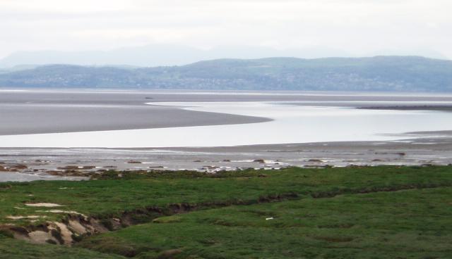
Grange-over-Sands is a town and civil parishes in England, civil parish on the north side of Morecambe Bay in Cumbria, England, a few miles south of the Lake District Lake District National Park, National Park. In the United Kingdom Census 2011, 2011 census the parish had a population of 4,114, increasing at the United Kingdom Census 2021, 2021 census to 4,279. Within the boundaries of the Historic counties of England, historic county of Lancashire, the town became administered as an Urban district (England and Wales), urban district in 1894. Though the town remains part of the Duchy of Lancaster, since 2023 it has been administered as part of the Westmorland and Furness Council area. Travelling by road, Grange-over-Sands is to the south of Kendal, to the east of Ulverston, to the east of Barrow-in-Furness and to the north of Lancaster, Lancashire, Lancaster. History The town developed in the Victorian era from a small fishing village and the arrival of the railway in 1857 ... [...More Info...] [...Related Items...] OR: [Wikipedia] [Google] [Baidu] |
Westmorland And Lonsdale (UK Parliament Constituency)
Westmorland and Lonsdale is a Constituencies of the Parliament of the United Kingdom, constituency in the south of Cumbria, represented in the House of Commons of the United Kingdom, House of Commons of the Parliament of the United Kingdom, UK Parliament since 2005 United Kingdom general election, 2005 by Tim Farron, the former leader of the Liberal Democrats (UK), Liberal Democrats (2015–2017). Westmorland and Lonsdale is the Liberal Democrats' longest continuously held seat in England, as the only English seat they have won in every election since 2005. Constituency profile Created in 1983, the seat is named after the Historic counties of England, historic county of Westmorland and the History of Lancashire, Lancashire Lonsdale Hundred, Hundred of Lonsdale, both of which extend beyond the bounds of the constituency. Important towns by size in the constituency include Kendal, Windermere, Cumbria (town), Windermere and Appleby-in-Westmorland. This is one of a minority of rur ... [...More Info...] [...Related Items...] OR: [Wikipedia] [Google] [Baidu] |
Barrow-in-Furness
Barrow-in-Furness is a port town and civil parish (as just "Barrow") in the Westmorland and Furness district of Cumbria, England. Historic counties of England, Historically in the county of Lancashire, it was incorporated as a municipal borough in 1867 and merged with Dalton-in-Furness Urban District in 1974 to form the Borough of Barrow-in-Furness. The borough subsequently merged with adjoining boroughs in 2023 to form the Westmorland and Furness unitary authority. At the tip of the Furness, Furness peninsula, close to the Lake District, it is bordered by Morecambe Bay, the Duddon Estuary and the Irish Sea. In 2021, Barrow's population was 55,489, making it the second largest urban area in Cumbria after Carlisle, Cumbria, Carlisle, and the largest in the Westmorland and Furness unitary authority. Natives of Barrow, as well as the local dialect, are known as Barrovian. In the Middle Ages, Barrow was a small hamlet (place), hamlet within the parish of Dalton-in-Furness with Fu ... [...More Info...] [...Related Items...] OR: [Wikipedia] [Google] [Baidu] |
Sheep
Sheep (: sheep) or domestic sheep (''Ovis aries'') are a domesticated, ruminant mammal typically kept as livestock. Although the term ''sheep'' can apply to other species in the genus '' Ovis'', in everyday usage it almost always refers to domesticated sheep. Like all ruminants, sheep are members of the order Artiodactyla, the even-toed ungulates. Numbering a little over one billion, domestic sheep are also the most numerous species of sheep. An adult female is referred to as a ''ewe'' ( ), an intact male as a ''ram'', occasionally a ''tup'', a castrated male as a ''wether'', and a young sheep as a ''lamb''. Sheep are most likely descended from the wild mouflon of Europe and Asia, with Iran being a geographic envelope of the domestication center. One of the earliest animals to be domesticated for agricultural purposes, sheep are raised for fleeces, meat ( lamb, hogget or mutton), and milk. A sheep's wool is the most widely used animal fiber, and is usually harvested by ... [...More Info...] [...Related Items...] OR: [Wikipedia] [Google] [Baidu] |
Quicksand
Quicksand (also known as sinking sand) is a colloid consisting of fine granular material (such as sand, silt or clay) and water. It forms in saturated loose sand when the sand is suddenly agitated. When water in the sand cannot escape, it creates a liquefied soil that loses strength and cannot support weight. Quicksand can form in standing water or in upward flowing water (as from an artesian spring). In the case of upward-flowing water, forces oppose the force of gravity and suspend the soil particle. The cushioning of water gives quicksand, and other liquefied sediments, a spongy, fluid-like texture. In accordance with Archimedes' principle, objects in liquefied sand sink to the level at which the weight of the object is equal to the weight of the displaced soil/water mix and the submerged object floats due to its buoyancy. Soil liquefaction may occur in partially saturated soil when it is shaken by an earthquake or similar forces. The movement combined with an increase ... [...More Info...] [...Related Items...] OR: [Wikipedia] [Google] [Baidu] |
Mudflats
Mudflats or mud flats, also known as tidal flats or, in Ireland, slob or slobs, are coastal wetlands that form in intertidal areas where sediments have been deposited by tides or rivers. A global analysis published in 2019 suggested that tidal flat ecosystems are as extensive globally as mangroves, covering at least of the Earth's surface. / They are found in sheltered areas such as bays, bayous, lagoons, and estuaries; they are also seen in freshwater lakes and salty lakes (or inland seas) alike, wherein many rivers and creeks end. Mudflats may be viewed geologically as exposed layers of bay mud, resulting from deposition of estuarine silts, clays and aquatic animal detritus. Most of the sediment within a mudflat is within the intertidal zone, and thus the flat is submerged and exposed approximately twice daily. A recent global remote sensing analysis estimated that approximately 50% of the global extent of tidal flats occurs within eight countries (Indonesia, China, Au ... [...More Info...] [...Related Items...] OR: [Wikipedia] [Google] [Baidu] |
Esplanade
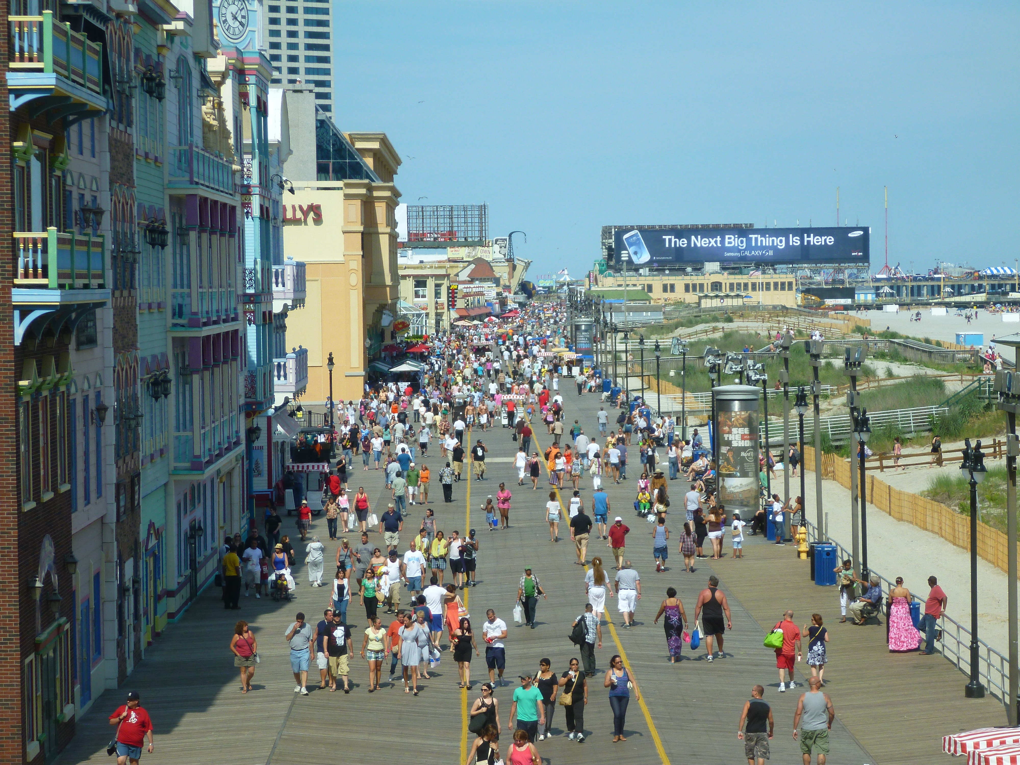
An esplanade or promenade is a long, open, level area, usually next to a river or large body of water, where people may walk. The historical definition of ''esplanade'' was a large, open, level area outside fortress or city walls to provide clear fields of fire for the fortress's guns. In modern usage, the space allows the area to be paved as a pedestrian walk; esplanades are often on sea fronts and allow walking whatever the state of the tide, without having to walk on the beach. History In the 19th century, the razing of city fortifications and the relocation of port facilities made it possible in many cities to create promenade paths on the former fortresses and ramparts. The parts of the former fortifications, such as hills, viewpoints, ditches, waterways and lakes have now been included in these promenades, making them popular excursion destinations as well as the location of cultural institutions. The rapid development of artificial street lighting in the 19th century als ... [...More Info...] [...Related Items...] OR: [Wikipedia] [Google] [Baidu] |
River Kent
The River Kent is a short river in the county of Cumbria in England. It originates in hills surrounding Kentmere, and flows for around 20 miles (32 km) into the north of Morecambe Bay. The upper reaches and the western bank of the estuary are located within the boundaries of the Lake District National Park. The river flows in a generally north to south direction, passing through Kentmere, Staveley, Cumbria, Staveley, Burneside, Kendal and Sedgwick, Cumbria, Sedgwick. Near Sedgwick, the river passes through a rock gorge which produces a number of low waterfalls. This section is popular with kayakers as it offers high quality whitewater for several days after rain. The village of Arnside is situated on the east bank of the Kent estuary, just above Morecambe Bay, and a tidal bore known as the Arnside Bore forms in the estuary at this point on high spring tides. The river has been used as a source of power since at least the 13th century. In 1848, the construction of Kentmere ... [...More Info...] [...Related Items...] OR: [Wikipedia] [Google] [Baidu] |
Listed Building
In the United Kingdom, a listed building is a structure of particular architectural or historic interest deserving of special protection. Such buildings are placed on one of the four statutory lists maintained by Historic England in England, Historic Environment Scotland in Scotland, in Wales, and the Historic Environment Division of the Department for Communities in Northern Ireland. The classification schemes differ between England and Wales, Scotland, and Northern Ireland (see sections below). The term has also been used in the Republic of Ireland, where buildings are protected under the Planning and Development Act 2000, although the statutory term in Ireland is "Record of Protected Structures, protected structure". A listed building may not be demolished, extended, or altered without permission from the local planning authority, which typically consults the relevant central government agency. In England and Wales, a national amenity society must be notified of any work to ... [...More Info...] [...Related Items...] OR: [Wikipedia] [Google] [Baidu] |
Grange Lido
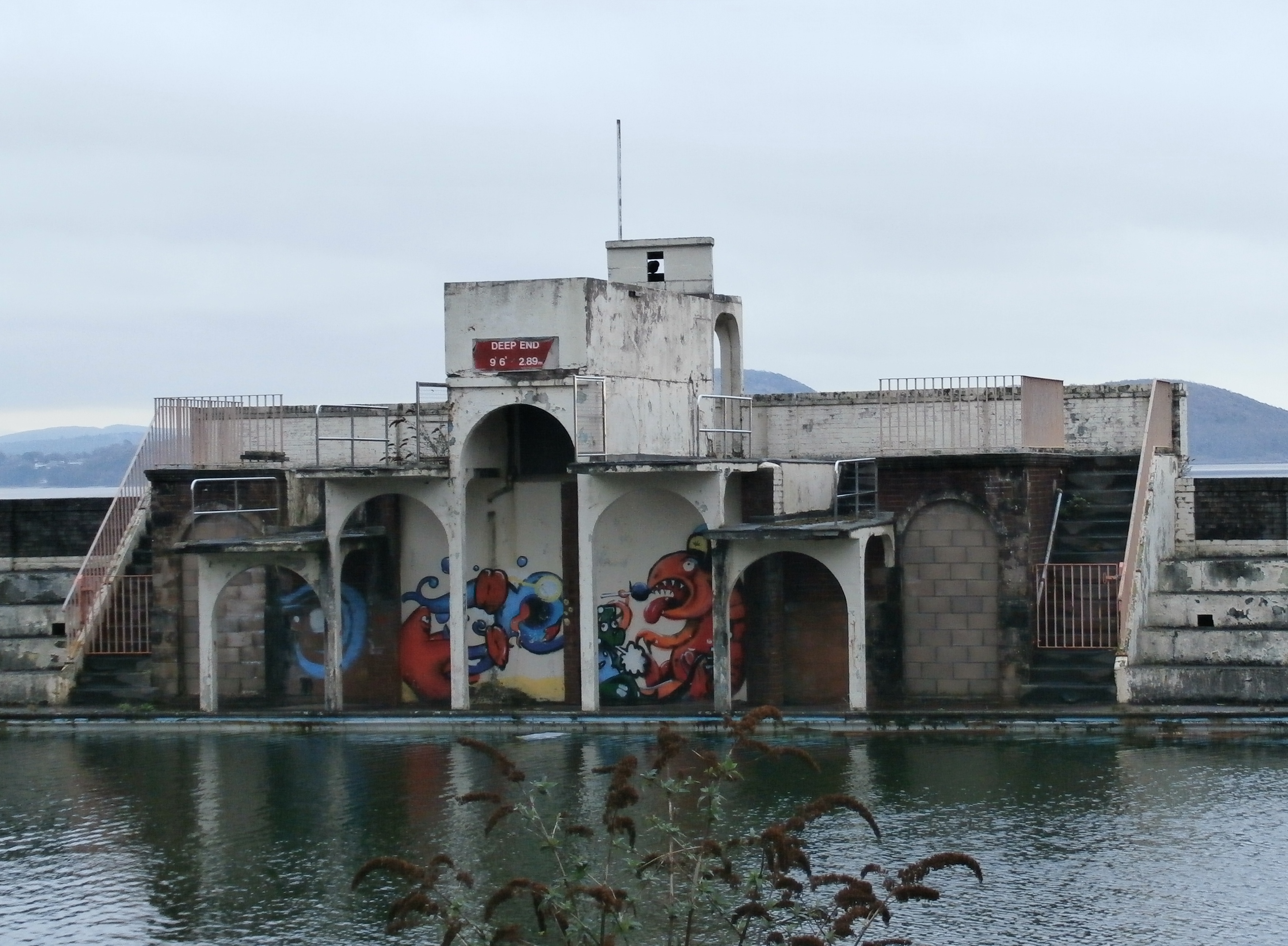
Grange Lido is an open-air 50 m sea-water swimming pool, or lido, in Grange-over-Sands, Cumbria, England. It opened in 1932 and closed in 1993, but campaigners are working to see it re-opened as a swimming pool. The lido is in Art Deco style, and is grade II listed. History and architecture The lido opened in 1932. The buildings were designed by Grange-over-Sands Urban District Council's surveyor, named Bernard Smith or Thomas Huddlestone. The lido sits on Grange promenade on the shore of Morecambe Bay, although the changing course of the River Kent means that the sea is at some distance from the promenade, separated by salt marsh. The pool was filled with filtered sea-water at high tide, and was unheated. The buildings are in Art Deco style. Historic Pools of Britain describes the lido as "A very fine intact Art Deco mushroom shaped lido in a stunning setting on the edge of Morecambe Bay". English Heritage state the reasons for the lido's grade II listing in 2011 as: ... [...More Info...] [...Related Items...] OR: [Wikipedia] [Google] [Baidu] |
Keswick, Cumbria
Keswick ( ) is a market town and civil parishes in England, civil parish in the Cumberland (unitary authority), Cumberland unitary authority area of Cumbria, England. It lies within the Lake District National Park, just north of Derwentwater and from Bassenthwaite Lake. The parish had a population of 4,658 at the 2021 United Kingdom census, 2021 census. There is evidence of Prehistoric Cumbria, prehistoric occupation of the area, but the first recorded mention of the town dates from the 13th century, when Edward I of England granted a market charter, charter for Keswick's market, which has maintained a continuous 700-year existence. The town was an important Coal mining in the United Kingdom, mining area, and from the 18th century has been known as a holiday centre; tourism has been its principal industry for more than 150 years. Its features include the Moot Hall, Keswick, Moot Hall; a modern theatre, the Theatre by the Lake; one of Britain's oldest surviving cinemas, the Alha ... [...More Info...] [...Related Items...] OR: [Wikipedia] [Google] [Baidu] |
Grange In Borrowdale
Grange, often called Grange in Borrowdale, is a village in Borrowdale in the English Lake District. It lies just off the B5289 road to the south of Derwent Water and south of Keswick, in the county of Cumbria, historically part of Cumberland, The village is overlooked by Grange Fell and Castle Crag, which flank either side of the narrow section of Borrowdale in which it sits. Its origins date back to medieval times, when the monks of Furness Abbey built a monastic grange on the site. The double-arched bridge that links the village to the B5289 across the River Derwent was built in 1675. Holy Trinity Church followed in 1861. The novelist Hugh Walpole owned Brackenburn, a large house about to the north of Grange, and lived there from 1924 until his death in 1941. Governance Grange in Borrowdale is within the Penrith and Solway UK Parliamentary constituency. For Local Government purposes it is in the Cumberland Cumberland ( ) is an area of North West England wh ... [...More Info...] [...Related Items...] OR: [Wikipedia] [Google] [Baidu] |
Morecambe
Morecambe ( ) is a seaside town and civil parish in the City of Lancaster district of Lancashire, England, on Morecambe Bay, part of the Irish Sea. In 2011 the parish had a population of 34,768. Name The first use of the name was by John Whitaker (historian), John Whitaker in his ''History of Manchester'' (1771), when he refers to the "æstury of Moricambe". It next appears four years later in ''Antiquities of Furness'', where the bay is described as "the Morecambe Bay, Bay of Morecambe". That name is derived from the Roman name ''Moriancabris Æsturis'' shown on maps prepared for them by ''Claudius Ptolemœus'' (Ptolemy) from his original Greek maps. At this distance in time it is impossible to say if the name was originally derived from an earlier language (e.g. Celtic language) or from Greek. The Latin version describes the fourth inlet north from Wales on the west coast of England as Moriancabris Æsturis. Translated, this gives a more accurate description than the present ... [...More Info...] [...Related Items...] OR: [Wikipedia] [Google] [Baidu] |


