|
Goulburn Valley Freeway
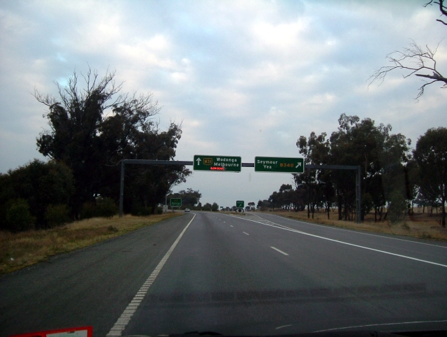
Goulburn Valley Highway is a highway located in Victoria, Australia, linking Tocumwal on the Murray River through North Central Victoria to Eildon. The section north of the Hume Freeway (part of which is Goulburn Valley Freeway) is part of the Melbourne to Brisbane National Highway (together with Hume Freeway) and is the main link between these two cities, as well as a major link between Victoria and inland New South Wales. It is also the most direct route between Melbourne and the major regional centre of Shepparton in Victoria (via Hume Freeway). Route Goulburn Valley Highway commences on the southern bank of the Murray River, forming the interstate border with New South Wales, and continues south from Newell Highway in Tocumwal into Victoria as a two-lane, single carriageway rural highway, until it reaches the intersection with Murray Valley Highway in Yarroweyah and heads west concurrently with it until Strathmerton, where it heads south again on its own alignment, th ... [...More Info...] [...Related Items...] OR: [Wikipedia] [Google] [Baidu] |
Newell Highway
Newell Highway is a National Highway (Australia), national highway in New South Wales (NSW), Australia. It provides the major road link between southeastern Queensland and Victoria (state), Victoria via central NSW and as such carries large amounts of freight. At in length, the Newell is the longest highway in NSW, and passes through fifteen Local government in Australia, local government areas. The highway is named in honour of H. H. Newell, the first Commissioner for Department of Main Roads (New South Wales), Main Roads in New South Wales (1932–1941). It is designated route A39 for its entire length. Route From its northern terminus at Goondiwindi in Queensland, where it meets the Cunningham Highway, Cunningham and Leichhardt Highways, and forms the southward extension of Cunningham Highway from Warwick and Brisbane, the Newell runs south across the Queensland-New South Wales border through Boggabilla, Moree, New South Wales, Moree, Narrabri, Coonabarabran, Gilgandra, Dub ... [...More Info...] [...Related Items...] OR: [Wikipedia] [Google] [Baidu] |
National Highway (Australia)
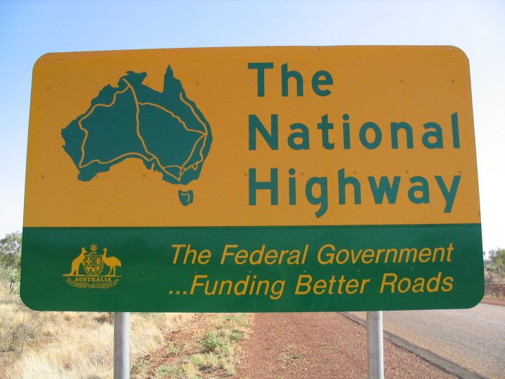
The National Highway (part of the National Land Transport Network) is a system of roads connecting all mainland states and territories of Australia, and is the major network of highways and motorways connecting Australia's capital cities and major regional centres. History Legislation National funding for roads began in the 1920s, with the federal government contributing to major roads managed by the state and territory governments. However, the Federal Government did not completely fund any roads until 1974, when the Whitlam government introduced the ''National Roads Act 1974''.. Under the act, the states were still responsible for road construction and maintenance, but were fully compensated for money spent on approved projects. In 1977, the 1974 Act was replaced by the ''State Grants (Roads) Act 1977'', which contained similar provisions for the definition of "National Highways". In 1988, the National Highway became redefined under the ''Australian Land Transport Deve ... [...More Info...] [...Related Items...] OR: [Wikipedia] [Google] [Baidu] |
Yea, Victoria
Yea ( ) is a town in Victoria (Australia), Victoria, Australia north-east of the state capital Melbourne at the junction of the Goulburn Valley Highway and the Melba Highway, in the Shire of Murrindindi local government area. In an area originally inhabited by the Taungurung people, it was first visited by Europeans of the Hume and Hovell expedition in 1824, and within 15 years most of the land in the area had been taken up by graziers. Surveyed in 1855, the township grew as a service centre for grazing, gold-mining and timber-getting in the area. The town has had a fairly stable population (around 1,100) since 1900, though it now has a relatively old population. The town economy is based around servicing the farming sector, and tourism, with good road links but little public transport. The town has education supplied by three schools (state primary and high schools, and a Catholic primary). It has three churches, and active sporting clubs. Heritage sites around the town includ ... [...More Info...] [...Related Items...] OR: [Wikipedia] [Google] [Baidu] |
Seymour, Victoria
Seymour () is a town located in the Southern end of the Goulburn Valley in the Shire of Mitchell, Victoria (Australia), Victoria, Australia and is located north of Melbourne. At the , Seymour had a population of 6,569. The township services the surrounding agricultural industries (primarily equine, cattle, sheep and wine) as well as the nearby military base of Puckapunyal (population 1,176), which is an important training centre for the Australian Army. Other important sectors of employment in Seymour include retail, light engineering, agricultural services support, medical services, and education. History The Taungurung people are the traditional owners and inhabitants of the area Seymour now occupies. Specifically, it is the land of the Buthera Balug clan who occupied the area when Europeans first settled the region in the early 1800s. In 1824, Hume and Hovell on their return from Port Phillip, camped by the Goulburn River (Victoria), Goulburn River not far upstream of Seymo ... [...More Info...] [...Related Items...] OR: [Wikipedia] [Google] [Baidu] |
Hume Highway
The Hume Highway, including the sections now known as the Hume Freeway and the Hume Motorway, is one of Australia's major inter-city national highways, running for between Melbourne in the southwest and Sydney in the northeast. Upgrading of the route from Sydney's outskirts to Melbourne's outskirts to dual carriageway was completed on 7 August 2013. From north to south, the road is called the Hume Highway in metropolitan Sydney, the Hume Motorway between the Cutler Interchange and Berrima, the Hume Highway elsewhere in New South Wales and the Hume Freeway in Victoria. It is part of the Auslink National Network and is a vital link for road freight to transport goods to and from the two cities as well as serving Albury–Wodonga and Canberra. It is therefore considered to be Australia's longest highway in terms of its dual-carriageway standard retaining the M, or motorway, alphanumeric. Route At its Sydney end, Hume Highway begins at Parramatta Road, in Ashfield. This ... [...More Info...] [...Related Items...] OR: [Wikipedia] [Google] [Baidu] |
Nagambie, Victoria
Nagambie is a town in the Goulburn Valley region of Victoria, Australia. The city is on the Goulburn Valley Freeway north of Seymour and in the Shire of Strathbogie. In the , Nagambie had a population of 2,254. History The Nagambie Region is in the traditional lands of the Taungurung people, who are the first inhabitants of the rivers, valleys and mountains in this region. The Taungurung lived according to the natural cycles and rhythms of the land, moving through their country seasonally, occupying the more cooler mountain areas in summer and autumn and the tributaries of the Goulburn River in winter and spring. Prior to the building of the Goulburn Weir, the Goulburn River at Nagambie was the site of several lagoons which, along with nearby Reedy Lake, provided an ideal camping place for the Taungurung people. The river, and its associated tributaries and wetlands, provided an abundance of food resources. Emus, kangaroos, possums and wombats were hunted by Taungurung f ... [...More Info...] [...Related Items...] OR: [Wikipedia] [Google] [Baidu] |
Goulburn River (Victoria)
The Goulburn River, a major inland perennial river of the Goulburn Broken catchment, part of the Murray-Darling basin, is located in the Alpine, Northern Country/North Central, and Southern Riverina regions of the Australian state of Victoria. The headwaters of the Goulburn River rise in the western end of the Victorian Alps, below the peak of Corn Hill before descending to flow into the Murray River near Echuca, making it the longest river in Victoria at . The river is impounded by the Eildon Dam to create Lake Eildon, the Eildon Pondage, the Goulburn Weir and Waranga Basin. Location and features The river rises below Corn Hill on the southwestern slopes of the Victorian Alps, south of near the town of in the Shire of Mansfield. The river flows generally north, then west, then north, then west passing through or adjacent to the regional cities and towns of , , , , Arcadia Downs, before reaching its confluence with the Murray River near Echuca. The Goulburn has 41 tri ... [...More Info...] [...Related Items...] OR: [Wikipedia] [Google] [Baidu] |
Arcadia, Victoria
Arcadia is a locality in Victoria, Australia, Victoria, Australia. It is on Kennedys Road, in the City of Greater Shepparton, south of Shepparton, Victoria, Shepparton. At the , Arcadia had a population of 212. The Arcadia railway station, Victoria, local railway station on the Goulburn Valley railway line, Victoria, Goulburn Valley line opened on 13 January 1880 and closed on 30 June 1977. The Post Office opened on 24 November 1873, being replaced by Arcadia Railway Station office, which was renamed Arcadia around 1902 and closed in 1993. References External links Towns in Victoria (state) City of Greater Shepparton {{Hume-geo-stub ... [...More Info...] [...Related Items...] OR: [Wikipedia] [Google] [Baidu] |
Shepparton, Victoria
Shepparton () ( Yortayorta: ''Kanny-goopna'') is a city located on the floodplain of the Goulburn River in northern Victoria, Australia, approximately north-northeast of Melbourne. As of the 2021 census, the estimated population of Shepparton, including the adjacent town of Mooroopna, was 53,841. It began as a sheep station and river crossing in the mid-19th century, before undergoing a major transformation as a railway town. Today it is an agricultural and manufacturing centre, and the centre of the Goulburn Valley irrigation system, one of the largest centres of irrigation in Australia. It is also a major regional service city and the seat of local government and civic administration for the City of Greater Shepparton, which includes the surrounding towns of Tatura, Merrigum, Mooroopna, Murchison, Dookie, Toolamba and Grahamvale. Toponymy The name of Shepparton is derived from the surname of one of the area's first European settlers, Sherbourne Sheppard, and not, as is ... [...More Info...] [...Related Items...] OR: [Wikipedia] [Google] [Baidu] |
Numurkah, Victoria
Numurkah ( ) is a town in Victoria (Australia), Victoria, Australia, located on the Goulburn Valley Highway, north of Shepparton, in the Shire of Moira. At the , Numurkah had a population of 4,768. History The area was occupied by the Yorta Yorta people prior to European settlement. Squatters moved into the area from NSW in the late 1830s. After the pastoral runs were made available for farm selection, the township of Numurkah was surveyed in 1875, the Post Office opening 2 November 1878. The Numurkah railway station, Victoria, local railway station was opened on the Goulburn Valley railway line, Victoria, Goulburn Valley railway in 1881, but has not seen any passenger services since 1993 when the train to Cobram was withdrawn. The station building remains in private ownership, and a footbridge crosses the line. Numurkah became the headquarters of the Murray Valley Soldier Settlement Area - one of the largest soldier settlements in Australia - after World War I. Under this s ... [...More Info...] [...Related Items...] OR: [Wikipedia] [Google] [Baidu] |
Strathmerton, Victoria
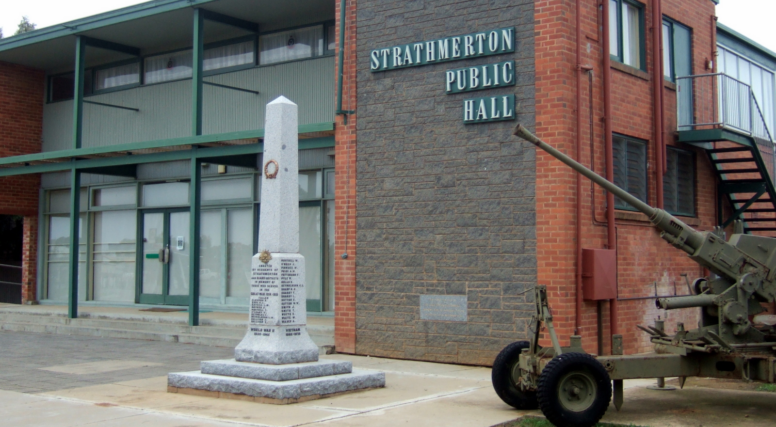
Strathmerton is a town in Victoria, Australia. It is located in the Shire of Moira local government area on the Murray Valley Highway and Goulburn Valley Highway, about west of Cobram. At the , Strathmerton had a population of 1072. Toponymy Benjamin Boyd, who was one of the earliest landowners in the district, initially named his property 'Ulupna'. He later changed it to Strathmerton from 'Merton', the name of his family home in Scotland, and 'strath', a Gaelic word meaning 'valley'. History Strathmerton Post Office opened on 1 September 1879. In 1888 on the arrival of the railway a Strathmerton Township Post Office opened near the station. In 1891 this was renamed Strathmerton. The local railway station was opened on the railway to Cobram in 1888, with the line to Tocumwal opened in 1905. The last regular passenger service was in 1993. Before road changes, Strathmerton was known as the intersection of the Goulburn Valley Highway and the Murray Valley Highway and was the no ... [...More Info...] [...Related Items...] OR: [Wikipedia] [Google] [Baidu] |
Yarroweyah, Victoria
Yarroweyah ( ) is a town in northern Victoria, Australia. The town is located in the Shire of Moira local government area, north of the state capital, Melbourne and west of Cobram. The town is situated near the intersection of Kenny Road, Kokoda Road and the Murray Valley Highway. At the , Yarroweyah and the surrounding area had a population of 551. History Yarroweyah Post Office opened on 1 January 1882. In 1888 it was renamed Yarroweyah South when a new Yarroweyah post office opened to the north. This latter office closed in 1976. After World War II, an extensive soldier settlement Soldier settlement was the settlement of land throughout parts of Australia by returning discharged soldiers under soldier settlement schemes administered by state governments after World War I and World War II. The post-World War II settlement ... area was established to the south of Yarroweyah. The north–south roads built in the area were named after theatres of war, and the east–west ro ... [...More Info...] [...Related Items...] OR: [Wikipedia] [Google] [Baidu] |
