|
Goodwin Islands
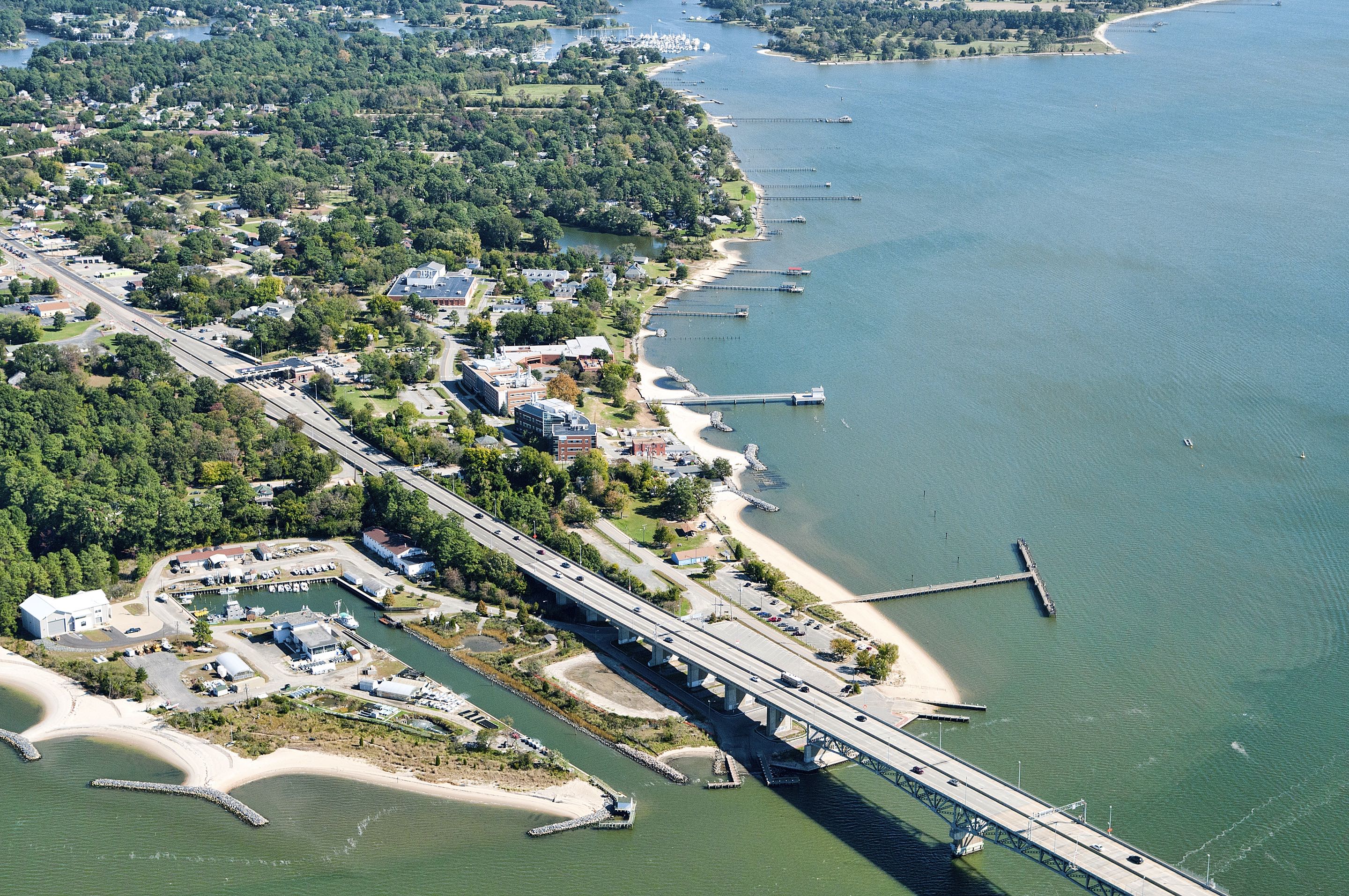
The Goodwin Islands are a archipelago of uninhabited salt marsh islands off the coast of York County, Virginia, at the mouth of the York River in Chesapeake Bay. They are owned by the College of William & Mary and are managed on the college's behalf by the Virginia Institute of Marine Science. The sole means of transportation to the Goodwin Islands is by boat, with permission being required to perform certain activities. The islands and their surrounding waters are home to many birds and fish, such as the mummichog.Ayers, Lisa Ann, "Finfish Communities of Two Intertidal Marshes of the Goodwin Islands, York River, Virginia" (1995). Dissertations, Theses, and Masters Projects. William & Mary. Paper 1539617679. Primary ecological community groups are situated on the islands, such as tidal meso-polyhaline marshes, maritime dune grasslands, salt scrub, and maritime upland forest. Salt marsh vegetation throughout the island primarily consists of salt marsh cordgrass and salt meadow ... [...More Info...] [...Related Items...] OR: [Wikipedia] [Google] [Baidu] |
York River (Virginia)
The York River is a navigable estuary, approximately long,U.S. Geological Survey. National Hydrography Dataset high-resolution flowline dataThe National Map, accessed April 1, 2011 in eastern Virginia in the United States. It ranges in width from at its head to near its mouth on the west side of Chesapeake Bay. Its watershed drains an area of the coastal plain of Virginia north and east of Richmond. Its banks were inhabited by indigenous peoples for thousands of years. In 2003 evidence was found of the likely site of Werowocomoco, one of two capitals used by the paramount chief Powhatan before 1609. The site was inhabited since 1200 as a major village. Enormously important in later U.S. history, the river was also the scene of early settlements of the Virginia Colony. It was the site of significant events and battles in both the American Revolutionary War and the American Civil War. Description The York River is formed at West Point, approximately east of Richmond ... [...More Info...] [...Related Items...] OR: [Wikipedia] [Google] [Baidu] |
Virginia Institute Of Marine Science
The Virginia Institute of Marine Science (VIMS) is one of the largest marine research and education centers in the United States. Founded in 1940, VIMS is unique among marine science institutions in its legal mandate to provide research, education, and advisory services to government, citizens, and industry. Funding for VIMS comes from the Commonwealth of Virginia, grants and contracts from federal and state agencies, and private giving. The School of Marine Science (SMS) at VIMS is the graduate school in marine science for the College of William & Mary. VIMS offers M.S., Ph.D., and professional M.A. degrees in marine science. The school has 52 faculty members, an enrollment of 80-100 students, and includes 4 academic departments. VIMS' main campus is located in Gloucester Point, Virginia. Mission Overall, the VIMS mission is "Science for the Bay, Impact for the World." VIMS provides research, education, and advisory services in marine science to Virginia, the nation, and the ... [...More Info...] [...Related Items...] OR: [Wikipedia] [Google] [Baidu] |
Climate Change
Present-day climate change includes both global warming—the ongoing increase in Global surface temperature, global average temperature—and its wider effects on Earth's climate system. Climate variability and change, Climate change in a broader sense also includes previous long-term changes to Earth's climate. The current rise in global temperatures is Scientific consensus on climate change, driven by human activities, especially fossil fuel burning since the Industrial Revolution. Fossil fuel use, Deforestation and climate change, deforestation, and some Greenhouse gas emissions from agriculture, agricultural and Environmental impact of concrete, industrial practices release greenhouse gases. These gases greenhouse effect, absorb some of the heat that the Earth Thermal radiation, radiates after it warms from sunlight, warming the lower atmosphere. Carbon dioxide, the primary gas driving global warming, Carbon dioxide in Earth's atmosphere, has increased in concentratio ... [...More Info...] [...Related Items...] OR: [Wikipedia] [Google] [Baidu] |
Semidiurnal Tide
Tides are the rise and fall of sea levels caused by the combined effects of the gravitational forces exerted by the Moon (and to a much lesser extent, the Sun) and are also caused by the Earth and Moon orbiting one another. Tide tables can be used for any given locale to find the predicted times and amplitude (or "tidal range"). The predictions are influenced by many factors including the alignment of the Sun and Moon, the phase and amplitude of the tide (pattern of tides in the deep ocean), the amphidromic systems of the oceans, and the shape of the coastline and near-shore bathymetry (see ''Timing''). They are however only predictions, the actual time and height of the tide is affected by wind and atmospheric pressure. Many shorelines experience semi-diurnal tides—two nearly equal high and low tides each day. Other locations have a diurnal tide—one high and low tide each day. A "mixed tide"—two uneven magnitude tides a day—is a third regular category. Tides va ... [...More Info...] [...Related Items...] OR: [Wikipedia] [Google] [Baidu] |


