|
Golegaon
Golegaon (Palam) is a small village in Purna taluka of Parbhani district in the Marathwada region of Maharashtra, India with total 163 families residing. The Golegaon Palam village has population of 835 of which 454 are males while 381 are females as per Population Census 2011. In Golegaon Palam village population of children with age 0-6 is 102 which makes up 12.24% of total population of village. Average Sex Ratio of Golegaon Palam village is 843 which is lower than Maharashtra state average of 929. Child Sex Ratio for the Golegaon Palam as per census is 855, lower than Maharashtra average of 894. Golegaon Palam village has lower literacy rate compared to Maharashtra. In 2011, literacy rate of Golegaon Palam village was 71.27% compared to 82.34% of Maharashtra. In Golegaon Palam Male literacy stands at 82.37% while female literacy rate was 58.08%. As per constitution of India and Panchyati Raaj Act, Golegaon Palam village is administrated by Sarpanch (Head of Village) who is ... [...More Info...] [...Related Items...] OR: [Wikipedia] [Google] [Baidu] |
Purna
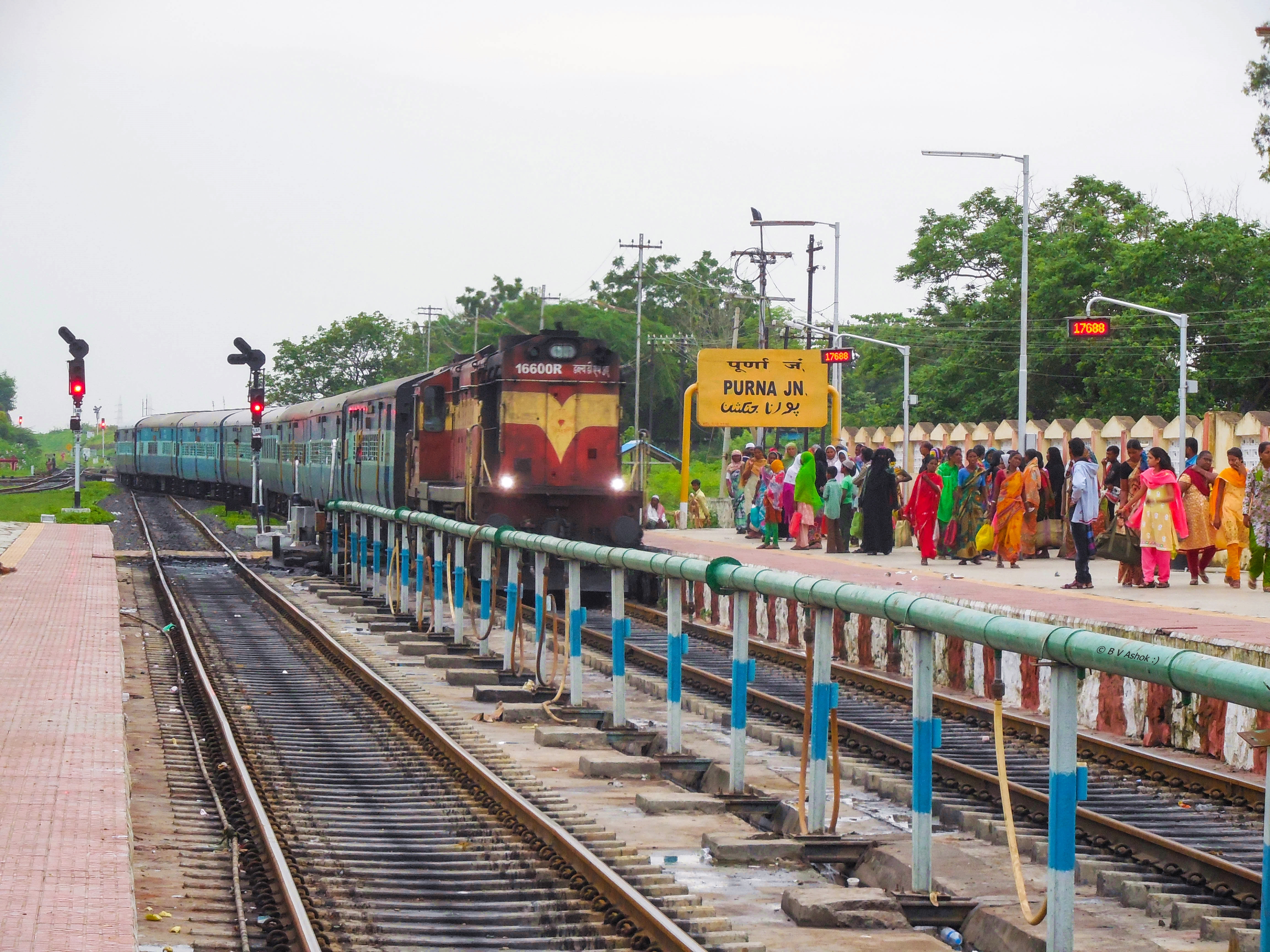
: Purna is a town with a municipal council in Parbhani district in the Indian state of Maharashtra. Geography Purna is located at . It has an average elevation of . Purna is situated in the Maharashtra state of India. Demographics India census, Purna had total 6,663 houses and population of 36,433. Males constitute 51% of the population and females 49%. Purna has an average literacy rate of 71.95, lower than the national average of 75%: male literacy is 79% and female literacy is 65.11%. In Purna, 14% of the population is under 6 years of age. Rail transport Purna Junction railway station (station code: PAU) is on the Kachiguda–Manmad section of Nanded (NED) Division of South Central Railway (SCR). In the meter gauge era Purna was the most important junction. Hundreds of railway employees were then stationed at Purna. At the time, nearly 50% of the population of the city was made up of railway employees and their families. Purna has massive land occupied by the Railway ... [...More Info...] [...Related Items...] OR: [Wikipedia] [Google] [Baidu] |
Parbhani
Parbhani (, IPA ) is a city in Maharashtra state of India. It is the administrative headquarters of Parbhani District. Parbhani is one of the largest cities in Marathwada region. Parbhani is around away from regional headquarters of Aurangabad while it is away from the state capital Mumbai. Along with the entire Marathwada region, Parbhani was a part of the erstwhile Nizam State; later a part of Hyderabad State; after reorganization of states in 1956 it became a part of the then- Bombay state; since 1960, it has been part of the present Maharashtra state. Parbhani is home to Vasantrao Naik Marathwada Agricultural University, which is one of only four agriculture universities in Maharashtra. Moreover, Parbhani also has an annual festival at Turabul Haq Dargah, which attracts lakhs of tourists each year. Parbhani is named after Goddess Prabhavati. Etymology, and history In ancient times, Parbhani was known as "''Prabhavati nagari''" ( mr, प्रभावतीनग ... [...More Info...] [...Related Items...] OR: [Wikipedia] [Google] [Baidu] |
Maharashtra
Maharashtra (; , abbr. MH or Maha) is a state in the western peninsular region of India occupying a substantial portion of the Deccan Plateau. Maharashtra is the second-most populous state in India and the second-most populous country subdivision globally. It was formed on 1 May 1960 by splitting the bilingual Bombay State, which had existed since 1956, into majority Marathi-speaking Maharashtra and Gujarati-speaking Gujarat. Maharashtra is home to the Marathi people, the predominant ethno-linguistic group, who speak the Marathi language, the official language of the state. The state is divided into 6 divisions and 36 districts, with the state capital being Mumbai, the most populous urban area in India, and Nagpur serving as the winter capital, which also hosts the winter session of the state legislature. Godavari and Krishna are the two major rivers in the state. Forests cover 16.47 per cent of the state's geographical area. Out of the total cultivable land in the s ... [...More Info...] [...Related Items...] OR: [Wikipedia] [Google] [Baidu] |
Godavari River
The Godavari ( IAST: ''Godāvarī'' �od̪aːʋəɾiː is India's second longest river after the Ganga river and drains into the third largest basin in India, covering about 10% of India's total geographical area. Its source is in Trimbakeshwar, Nashik, Maharashtra. It flows east for , draining the states of Maharashtra (48.6%), Telangana (18.8%), Andhra Pradesh (4.5%), Chhattisgarh (10.9%) and Odisha (5.7%). The river ultimately empties into the Bay of Bengal through an extensive network of tributaries. Measuring up to , it forms one of the largest river basins in the Indian subcontinent, with only the Ganga and Indus rivers having a larger drainage basin. In terms of length, catchment area and discharge, the Godavari is the largest in peninsular India, and had been dubbed as the Dakshina Ganga ( Ganges of the South). The river has been revered in Hindu scriptures for many millennia and continues to harbour and nourish a rich cultural heritage. In the past few decades ... [...More Info...] [...Related Items...] OR: [Wikipedia] [Google] [Baidu] |


