|
Goldfields (Victoria)
The Goldfields region of Victoria is a region commonly used but typically defined in both historical geography and tourism geography (in particular heritage tourism). The region is also known as the Victorian Golden Triangle. Description It takes in a specific area of North Central Victoria, the major cities of Ballarat and Bendigo as well as smaller centres including Daylesford, Castlemaine and Maryborough. It extends as far north as Inglewood and St Arnaud. It encroaches on the Western District near Ararat. Other significant towns include Maldon, Creswick, Clunes, Avoca and Buninyong. Although the region has a strong association with the Victorian gold rush there are, however, significant towns associated with the gold rush and gold mining located outside of this region - notable examples include Warburton, Walhalla, Warrandyte, Chiltern and Beechworth. The goldfields region is more strongly linked to the impact of the Victorian Gold Rush than the discover ... [...More Info...] [...Related Items...] OR: [Wikipedia] [Google] [Baidu] |
Creswick, Victoria
Creswick is a town in west-central Victoria, Australia, 18 kilometres north of Ballarat and 122 kilometres northwest of Melbourne, in the Shire of Hepburn. It is 430 metres above sea level. At the 2016 census, Creswick had a population of 3,170. Creswick was named after the Creswick family, the pioneer settlers of the region. History The area was inhabited by the Dja Dja Wurrung people before white settlement. The pioneer white settlers were Henry, Charles and John Creswick, three brothers who started a large sheep station in 1842. Creswick is a former gold-mining town, established during the Victorian gold rushes in the 1850s. The Post Office opened in September 1854. It was named Creswick's Creek until around 1857. The population reached a peak of 25,000 during the gold rush. Today, local industries include forestry, grazing and agriculture. Creswick was the site of the New Australasian Gold Mine disaster on 12 December 1882, Australia's worst mining disaster ... [...More Info...] [...Related Items...] OR: [Wikipedia] [Google] [Baidu] |
Sovereign Hill
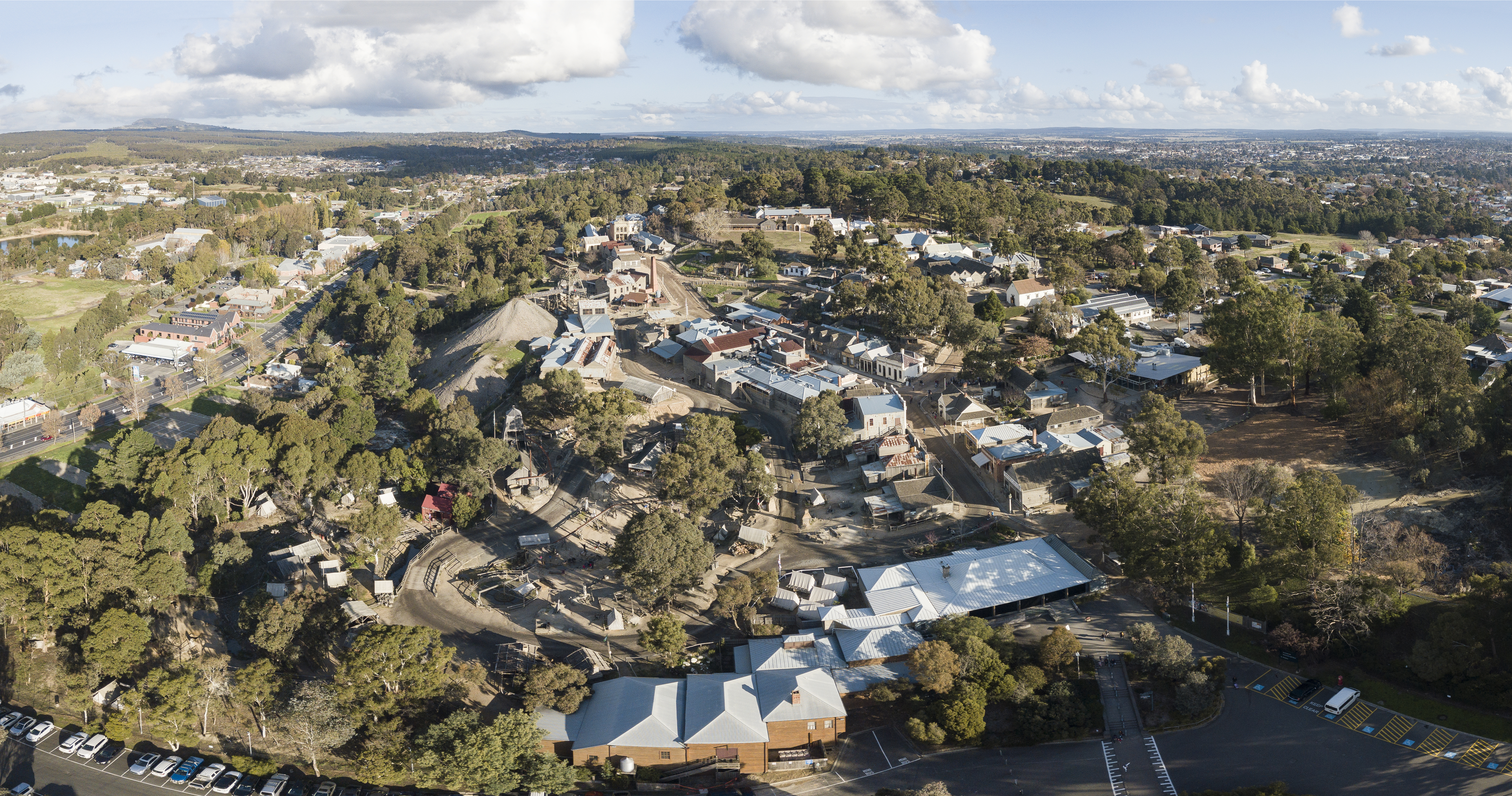
Sovereign Hill is an open-air museum in Golden Point, a suburb of Ballarat, Victoria, Australia. Sovereign Hill depicts Ballarat's first ten years after the discovery of gold there in 1851 and has become a nationally acclaimed tourist attraction. It is one of Victoria's most popular attractions and Ballarat's most famous. Set in the Australian 1850s, the complex is located on a 25-hectare site that is linked to the richest alluvial gold rush in the world. The site comprises over 60 historically recreated buildings, with costumed staff and volunteers, who are able to answer questions and will pose for photos. The recreation is completed with antiques, artwork, books and papers, machinery, livestock and animals, carriages, and devices all appropriate to the era. History The second-largest gold nugget in the world was found in Ballarat in the Red Hill Mine which is recreated in Sovereign Hill. The Welcome Nugget weighed 69 kg,(2,200 ounces) and comprised 99.2% pure gold, ... [...More Info...] [...Related Items...] OR: [Wikipedia] [Google] [Baidu] |
Ghost Town
A ghost town, deserted city, extinct town, or abandoned city is an abandoned settlement, usually one that contains substantial visible remaining buildings and infrastructure such as roads. A town often becomes a ghost town because the economic activity that supported it (usually industrial or agricultural) has failed or ended for any reason (e.g. a host ore deposit exhausted by mining). The town may have also declined because of natural or human-caused disasters such as floods, prolonged Drought, droughts, extreme heat or extreme cold, government actions, uncontrolled lawlessness, war, pollution, or nuclear and radiation accidents and incidents, nuclear and radiation-related accidents and incidents. The term can sometimes refer to cities, towns, and neighborhoods that, though still populated, are significantly less so than in past years; for example, those affected by high levels of unemployment and dereliction. Some ghost towns, especially those that preserve period-specific ... [...More Info...] [...Related Items...] OR: [Wikipedia] [Google] [Baidu] |
Victorian Architecture
Victorian architecture is a series of Revivalism (architecture), architectural revival styles in the mid-to-late 19th century. ''Victorian'' refers to the reign of Queen Victoria (1837–1901), called the Victorian era, during which period the styles known as Victorian were used in construction. However, many elements of what is typically termed "Victorian" architecture did not become popular until later in Victoria's reign, roughly from 1850 and later. The styles often included interpretations and Eclecticism in architecture, eclectic Revivalism (architecture), revivals of historic styles ''(see Historicism (art), historicism)''. The name represents the British and French custom of naming architectural styles for a reigning monarch. Within this naming and classification scheme, it followed Georgian architecture and later Regency architecture and was succeeded by Edwardian architecture. Although Victoria did not reign over the United States, the term is often used for American sty ... [...More Info...] [...Related Items...] OR: [Wikipedia] [Google] [Baidu] |
Victorian Gold Rush
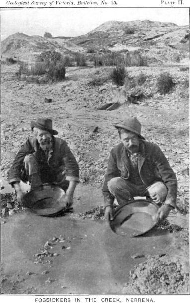
The Victorian gold rush was a period in the history of Victoria, Australia, approximately between 1851 and the late 1860s. It led to a period of extreme prosperity for the Australian colony and an influx of population growth and financial capital for Melbourne, which was dubbed " Marvellous Melbourne" as a result of the procurement of wealth. Overview The Victorian Gold Discovery Committee wrote in 1854: With the exception of the more extensive fields of California, for a number of years the gold output from Victoria was greater than in any other country in the world. Victoria's greatest yield for one year was in 1856, when 3,053,744 troy ounces (94,982 kg) of gold were extracted from the diggings. From 1851 to 1896 the Victorian Mines Department reported that a total of 61,034,682 oz (1,898,391 kg) of gold was mined in Victoria. Gold was first discovered in Australia on 15 February 1823, by assistant surveyor James McBrien, at Fish River, between Ry ... [...More Info...] [...Related Items...] OR: [Wikipedia] [Google] [Baidu] |
Beechworth, Victoria
Beechworth is a town located in the north-east of Victoria, Australia, famous for its major growth during the gold rush days of the mid-1850s. At the , Beechworth had a population of 3,290. Beechworth's many historical buildings are well preserved and the town has re-invented itself and evolved into a popular tourist destination and growing wine-producing centre. History Beechworth Parish and Township plans were prepared, named and certified by George D. Smythe after he had left the family estate near Liverpool in 1828, then again near Launceston, Tasmania, in 1838. Originally used for grazing by the settler David Reid, the area was also sometimes known as Mayday Hills until 1853. The Post Office opened on 1 May 1853 as Spring Creek and was renamed Beechworth on 1 January 1854. One Indigenous name for the area of unknown origin and language is Baarmutha. Gold Between 1852 and 1857, Beechworth was a gold-producing region and centre of government; however, its power, wealt ... [...More Info...] [...Related Items...] OR: [Wikipedia] [Google] [Baidu] |
Chiltern, Victoria
Chiltern is a town in Victoria, Australia, in the northeast of the state between Wangaratta and Wodonga, in the Shire of Indigo. At the 2021 census, Chiltern had a population of 1,580. It is the birthplace of Prime Minister John McEwen. The town is close to the Chiltern-Mount Pilot National Park. Chiltern was once on the main road between Melbourne and Sydney but is now bypassed by the Hume Freeway running one kilometre to the south. History The area around Chiltern is the traditional lands of the Dhudhuroa people. The nearby Yeddonba Aboriginal Cultural Site, in the Chiltern-Mt Pilot National Park, includes artworks created by the original inhabitants of the Chiltern area, including one ochre painting thought to represent a Thylacine, an animal now extinct and which has been extinct on mainland Australia for thousands of years. The area of Chiltern was on the Wahgunyah cattle run and was known as Black Dog Creek. The township, named after the Chiltern Hills in England, ... [...More Info...] [...Related Items...] OR: [Wikipedia] [Google] [Baidu] |
Warrandyte, Victoria
Warrandyte ( ) is a suburb of Melbourne, Victoria, Australia, 24 km north-east of Melbourne's Central Business District, located within the City of Manningham local government area. It is built on the lands of the Wurundjeri people of the Woiworung language group of the Kulin Nation. Warrandyte recorded a population of 5,541 at the . Warrandyte is bounded in the west by the Mullum Mullum Creek and Target Road, in the north by the Yarra River, in the east by Jumping Creek and Anzac Road, and in the south by an irregular line from Reynolds Road, north of Donvale, Park Orchards and Warrandyte South. Warrandyte was founded as a Victorian town, located in the once gold-rich rolling hills east of Melbourne, and is now on the north-eastern boundary of suburban Melbourne. Gold was first discovered in the town in 1851 and together, with towns like Bendigo and Ballarat, led the way in gold discoveries during the Victorian gold rush. Today Warrandyte retains much of its pas ... [...More Info...] [...Related Items...] OR: [Wikipedia] [Google] [Baidu] |
Walhalla, Victoria
Walhalla is a town in Victoria, Australia, founded as a gold-mining community in late 1862, and at its peak, home to around 4,000 residents. As of 2023, the town has a population of 20 permanent residents, though it has a large proportion of houses owned as holiday properties. It attracts large numbers of tourists and is a major focus of the regional tourism industry. The town's name is taken from an early gold mine in the area, named for the German hall of fame, the Walhalla temple (Valhalla from Norse sagas). Geography Walhalla is located in South-East Australia, in the eastern Victorian region of Gippsland, about 180 kilometres from the state capital Melbourne. It is located in the Great Dividing Range, in the steep Stringers Creek valley, approximately four kilometres upstream of the creek's junction with the Thomson River. The area around the town is designated as a historic area, adjoining the Baw Baw National Park.Ham, A., Holden, T., Morgan, K''Lonely Planet Melbour ... [...More Info...] [...Related Items...] OR: [Wikipedia] [Google] [Baidu] |
Warburton, Victoria
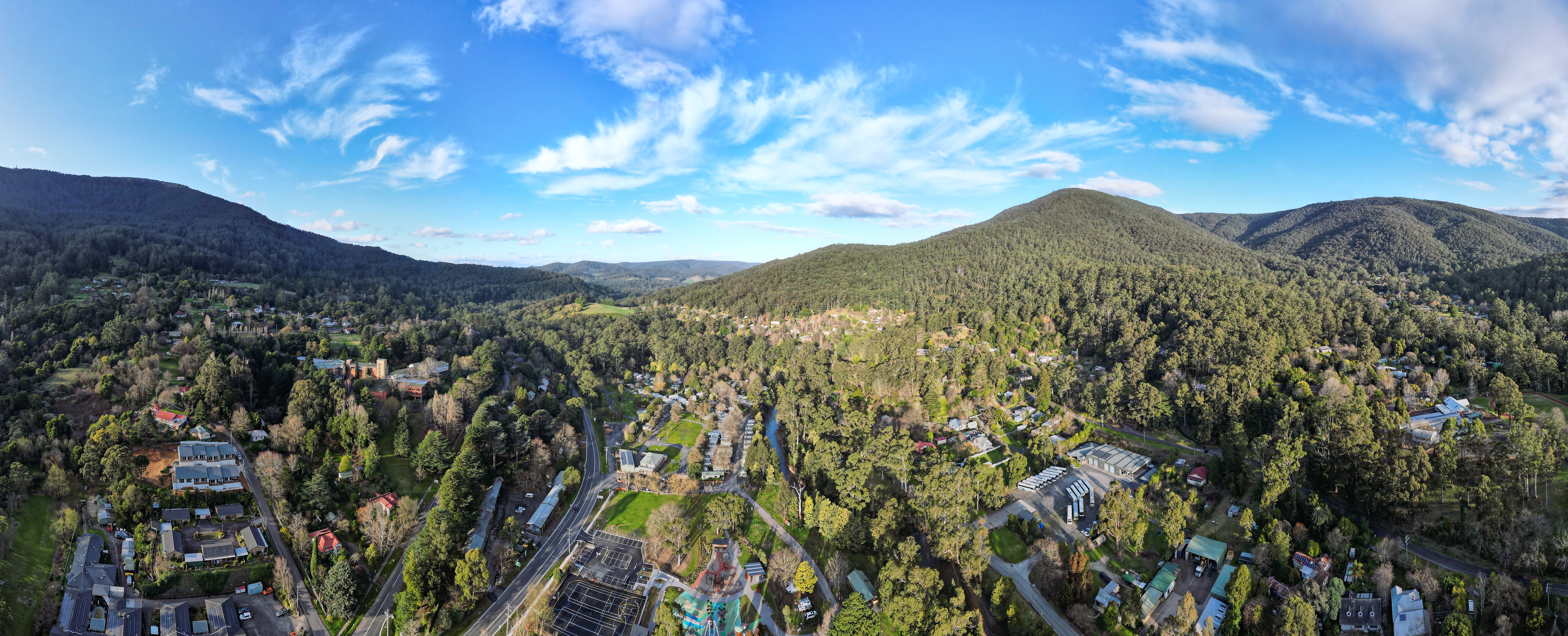
Warburton is a town in Victoria (Australia), Victoria, Australia, east of Melbourne, Melbourne's Melbourne city centre, central business district, located within the Shire of Yarra Ranges Local government areas of Victoria, local government area. Warburton recorded a population of 2,020 at the . History The name "Warburton" has been shared between two townships over the years. The mining town of "Yankee Jim's Creek" was located on the gold-bearing slopes of Mount Little Joe. Hostile terrain, fire, drought, flood, steep slopes, unsustainable roads, crime and easier pickings for miners further upstream put an end to "Old Warburton". Land was surveyed and sold in the valley below in 1884. The Post Office opened around 1884. Two earlier offices named Warburton were renamed as Launching Place, Victoria, Launching Place and Hoddles Creek, Victoria, Hoddle's Creek. Warburton railway station, Melbourne, Warburton was connected to Lilydale, Victoria, Lilydale by a Victorian Railways ... [...More Info...] [...Related Items...] OR: [Wikipedia] [Google] [Baidu] |
Victorian Gold Rush
The Victorian gold rush was a period in the history of Victoria, Australia, approximately between 1851 and the late 1860s. It led to a period of extreme prosperity for the Australian colony and an influx of population growth and financial capital for Melbourne, which was dubbed " Marvellous Melbourne" as a result of the procurement of wealth. Overview The Victorian Gold Discovery Committee wrote in 1854: With the exception of the more extensive fields of California, for a number of years the gold output from Victoria was greater than in any other country in the world. Victoria's greatest yield for one year was in 1856, when 3,053,744 troy ounces (94,982 kg) of gold were extracted from the diggings. From 1851 to 1896 the Victorian Mines Department reported that a total of 61,034,682 oz (1,898,391 kg) of gold was mined in Victoria. Gold was first discovered in Australia on 15 February 1823, by assistant surveyor James McBrien, at Fish River, between Ry ... [...More Info...] [...Related Items...] OR: [Wikipedia] [Google] [Baidu] |


