|
Glenluce
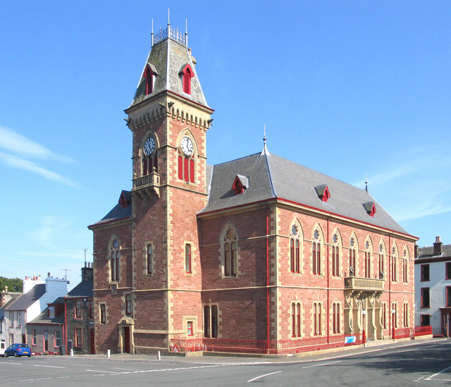
Glenluce () is a small village in the parish of Old Luce in Wigtownshire, Scotland. It contains a village shop, a caravan park and a town hall, as well as the parish church. Location Glenluce on the A75 road between Stranraer () and Newton Stewart (). It's south of Glasgow, west of Dumfries and south west of Edinburgh. The Church The Parish Church of Glenluce, with the two chapels, was vested by the king in 1587. In 1646 the parish of Glenluce was split in two to form Old Luce Parish Church and New Luce Parish Church. However, in 2016 the parishes churches were reunited to form Luce Valley Church, which covers Auchenmalg, Dunragit, Glenluce and New Luce, as well as the surrounding area. They meet at 11am every Sunday in the church in Glenluce and the current minister is Rev Stephen Ogston. Castle of Park The Castle of Park is an L-plan tower house near the village. It was built in 1596 by Thomas Hay, upon the lands given to him by his father, who was the last abbot ... [...More Info...] [...Related Items...] OR: [Wikipedia] [Google] [Baidu] |
Glenluce Abbey
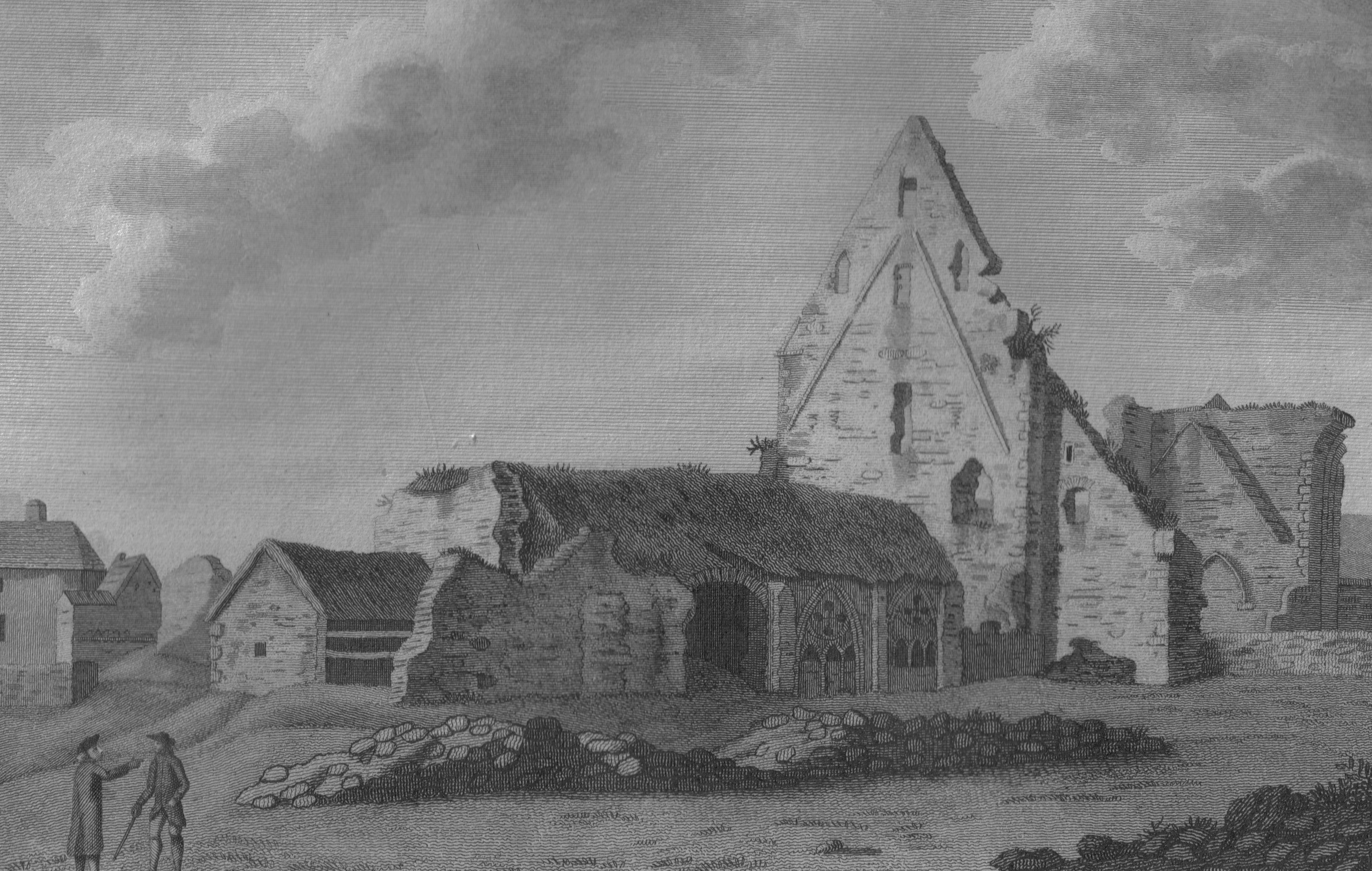
Glenluce Abbey, near to Glenluce, Scotland, was a Cistercian monastery called also ''Abbey of Luce'' or ''Vallis Lucis'' and founded around 1190 by Rolland or Lochlann, Lord of Galloway and Constable of Scotland. Following the Scottish Reformation in 1560, the abbey fell into disuse. Ballinclach On 23 January 1497, James IV erected "Ballinclach in Glenluce" into a burgh of barony in favour of the abbey, although there is no record of the burgh operating. Glenluce and the Kennedy family In 1560, after the Scottish Reformation, John Gordon of Lochinvar took possession of Glenluce Abbey. His servant Cuthbert Kirkpatrick refused entry to the abbot, Thomas Hay. Lochinvar removed himself and his servants in November 1561, and gave the key to Gilbert Kennedy, 4th Earl of Cassilis. Gilbert Kennedy, 4th Earl of Cassilis persuaded one of the monks of the abbey to counterfeit the necessary signatures to a deed conveying the lands of the abbey to him and his heirs. To ensure tha ... [...More Info...] [...Related Items...] OR: [Wikipedia] [Google] [Baidu] |
Old Luce
Old Luce is a civil parish in Dumfries and Galloway, Scotland. It lies in the Machars peninsula, in the traditional county of Wigtownshire. The parish is around long and broad, and contains . It was anciently named Glenluce which was divided in 1646 into two parts, the northern one named New Luce, and the southern one named Old Luce. In 1661 the two parishes of Old and New Luce were reunited for a time, and when the 1684 Wigtownshire Parish List was recorded, it listed both Old Luce and New Luce under “Glenluce Parish”. In 1688, after the Glorious Revolution, the separation of Old Luce and New Luce became permanent. Old Luce has a Community Council. Villages and places in Old Luce The town of Glenluce and Glenluce Church are in Old Luce Parish, as is Glenluce Abbey. In 1846 in the Topographical Dictionary of Scotland, Samuel Lewis wrote that the village of Glenluce was situated upon the road leading from Newton Stewart to Stranraer. "The church, erected in 1814, is a com ... [...More Info...] [...Related Items...] OR: [Wikipedia] [Google] [Baidu] |
Portpatrick And Wigtownshire Joint Railway
The Portpatrick and Wigtownshire Joint RailwaysThe final word is in the plural. was a network of railway lines serving sparsely populated areas of south-west Scotland. The title appeared in 1885 when the previously independent Portpatrick Railway (PPR) and Wigtownshire Railway (WR) companies were amalgamated by the Portpatrick and Wigtownshire Railways (Sale and Transfer) Act 1885 (48 & 49 Vict. c. clxxxiv) into a new company jointly owned by the Caledonian Railway, Glasgow & South Western Railway, Midland Railway and the London and North Western Railway and managed by a committee called the Portpatrick and Wigtownshire Joint Committee. The Portpatrick Railway connected and , opened in 1861 and 1862 and was intended to revive the transit to the north of Ireland through Portpatrick, although Stranraer actually became the dominant port. The line became known as ''The Port Road'', as nobody ever called Portpatrick anything other than 'The Port.' The Wigtownshire Railway, which ... [...More Info...] [...Related Items...] OR: [Wikipedia] [Google] [Baidu] |
Wigtownshire
Wigtownshire or the County of Wigtown (, ) is one of the Counties of Scotland, historic counties of Scotland, covering an area in the south-west of the country. Until 1975, Wigtownshire was an counties of Scotland, administrative county used for local government in Scotland, local government. Since 1975 the area has formed part of Dumfries and Galloway for local government purposes. Wigtownshire continues to be used as a territory for land registration, being a registration county. The historic county is all within the slightly larger Wigtown Area, which is one of the lieutenancy areas of Scotland and was used in local government as the Wigtown Districts of Scotland, District from 1975 to 1996. Wigtownshire forms the western part of the medieval lordship of Galloway, which retained a degree of autonomy until it was fully absorbed by Scotland in the 13th century. In 1369, the part of Galloway east of the River Cree was placed under the control of a steward and so became known as t ... [...More Info...] [...Related Items...] OR: [Wikipedia] [Google] [Baidu] |
A75 Road
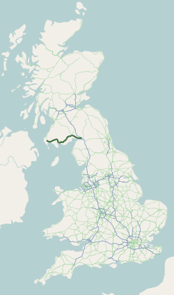
The A75 is a primary trunk road in Scotland, linking Stranraer and its ferry ports at Cairnryan with the A74(M) at Gretna, close to the border with England and the M6 motorway. Route Heading west along the south coast of Scotland from its junction with the A74(M) motorway at Gretna it continues past Eastriggs, Annan, Dumfries, Castle Douglas, Gatehouse of Fleet, Newton Stewart, Kirkcowan and Glenluce before ending at Stranraer. The majority of the road is of single-carriageway standard, although a few short dual carriageway sections exist, including a one-mile section past Gretna, a section past Collin (just east of Dumfries,) a two-mile section just west of Dumfries and a 1-mile section at Barlae (Between Glenluce and Newton Stewart). The road is widely felt to be unfit for the current large volumes of freight using it, but successive Westminster and laterly Scottish Governments have repeatedly shelved previously planned substantive upgrades, and delayed much needed ... [...More Info...] [...Related Items...] OR: [Wikipedia] [Google] [Baidu] |
Dunragit
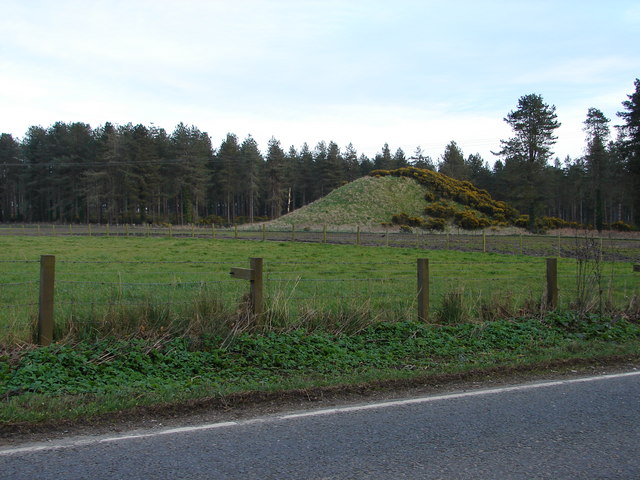
Dunragit () is a village on the A75 road, A75, between Stranraer and Glenluce in Dumfries and Galloway, south-west Scotland. Dunragit is within the parish of Old Luce, in the traditional county of Wigtownshire. The modern village grew up around the west gate of Dunragit House, an 18th-century country house, though there is evidence of Neolithic settlement in the area. Toponymy The place-name Dunragit is said to derive from ''Din Rheged'' meaning "Fort of Rheged", referring to the Britons (historical), Brythonic kingdom of Rheged which existed in northern Britain between the 5th and 8th centuries. RE Dunragit monument complex Between 1999 and 2002, archeological excavations have explored the Dunragit area, and a complex of Neolithic British Isles, Neolithic monuments has been uncovered. Nothing can now be seen above ground, but aerial photography and excavation has revealed an early Neolithic cursus monument, and the remains of three later Neolithic concentric timber circles, da ... [...More Info...] [...Related Items...] OR: [Wikipedia] [Google] [Baidu] |
Dumfries And Galloway
Dumfries and Galloway (; ) is one of the 32 unitary council areas of Scotland, located in the western part of the Southern Uplands. It is bordered by East Ayrshire, South Ayrshire, and South Lanarkshire to the north; Scottish Borders to the north-east; the English county of Cumbria, the Solway Firth, and the Irish Sea to the south, and the North Channel (Great Britain and Ireland), North Channel to the west. The administrative centre and largest settlement is the town of Dumfries. The second largest town is Stranraer, located to the west of Dumfries on the North Channel coast. Dumfries and Galloway corresponds to the counties of Scotland, historic shires of Dumfriesshire, Kirkcudbrightshire, and Wigtownshire, the last two of which are collectively known as Galloway. The three counties were combined in 1975 to form a single regions and districts of Scotland, region, with four districts within it. The districts were abolished in 1996, since when Dumfries and Galloway has been a ... [...More Info...] [...Related Items...] OR: [Wikipedia] [Google] [Baidu] |
New Luce
New Luce () is a civil parish in Dumfries and Galloway, south-west Scotland. It lies in the traditional county of Wigtownshire, and is about in length and in breath, being the upper part of the original Glenluce Parish. New Luce is shown as a civil parish on John Ainslie's county map of 1782. New Luce is also the principal village within the parish. The coast to coast walk, the Southern Upland Way, passes close to the village. The Covenanter Alexander Peden spent time preaching in the village. Places of interest A viaduct carried the Stranraer-Glasgow railway over the Main Water of Luce. Down the river from the viaduct is a pool called Bloody Wheel where the Hays of Castle of Park, near Glenluce (Old Luce), and the Linns of Larg in the adjoining parish of Inch, were said to have had a violent encounter centuries ago. Archaeology The Caves of Kilhern, between 2,000 and 3,000 years old, are in south New Luce. Cairn na Gath ("cairn of the wild cat"), near Balmurrie, is a ch ... [...More Info...] [...Related Items...] OR: [Wikipedia] [Google] [Baidu] |
Dumfries And Galloway Council
Dumfries and Galloway (; ) is one of the 32 unitary council areas of Scotland, located in the western part of the Southern Uplands. It is bordered by East Ayrshire, South Ayrshire, and South Lanarkshire to the north; Scottish Borders to the north-east; the English county of Cumbria, the Solway Firth, and the Irish Sea to the south, and the North Channel to the west. The administrative centre and largest settlement is the town of Dumfries. The second largest town is Stranraer, located to the west of Dumfries on the North Channel coast. Dumfries and Galloway corresponds to the historic shires of Dumfriesshire, Kirkcudbrightshire, and Wigtownshire, the last two of which are collectively known as Galloway. The three counties were combined in 1975 to form a single region, with four districts within it. The districts were abolished in 1996, since when Dumfries and Galloway has been a unitary local authority. For lieutenancy purposes, the area is divided into three lieutenanc ... [...More Info...] [...Related Items...] OR: [Wikipedia] [Google] [Baidu] |
Landmark Trust
The Landmark Trust is a British architectural conservation, building conservation charitable organization, charity, founded in 1965 by John Smith (Conservative politician), Sir John and Lady Smith, that rescues buildings of historic interest or architectural merit and then makes them available for holiday rental. The Trust's headquarters is at Shottesbrooke in Berkshire. Most Trust properties are in England, Scotland and Wales. Several are on Lundy Island off the coast of north Devon, operated under lease from the National Trust for Places of Historic Interest or Natural Beauty, National Trust. In continental Europe there are Landmark sites in Belgium, France and Italy. There are five properties in Vermont, US, one of which, Naulakha (Rudyard Kipling House), Naulakha, was the home of Rudyard Kipling in the 1890s. The Trust is a charity registered in England & Wales and in Scotland. The American sites are owned by an independent sister charity, Landmark Trust USA. There is also ... [...More Info...] [...Related Items...] OR: [Wikipedia] [Google] [Baidu] |
