|
Gilgil
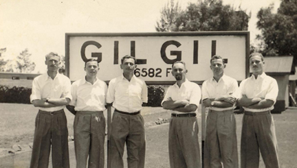
Gilgil, Kenya, is a town in Nakuru County, Kenya. The town is located between Naivasha and Nakuru and along the Nairobi - Nakuru highway. It is to the west of the Gilgil River, which flows south to feed Lake Naivasha. Gilgil has a population of 18,805 according to the 1999 census. Gilgil is the centre of the Gilgil Division in Nakuru County. History During the 1920s - 1940s, some members of the Happy Valley set lived in Gilgil. From 1944 to 1948, it also contained a British internment camp for Irgun and Lehi members. The first soldiers that arrived in the town were advance parties of the South African Army preparing for the arrival of the 1st South African Infantry Brigade, which was training in the area by mid-1940. Gilgil was made the brigade headquarters. In July 1958 Gilgil G1 Camp was occupied by the 1st Battalion, the King's Own Royal Regiment, first to take up accommodation at the camp since the end of the Second World War. In July 1959 2nd Battalion, Coldstre ... [...More Info...] [...Related Items...] OR: [Wikipedia] [Google] [Baidu] |
Irgun And Lehi Internment In Africa
From 1944 to 1948, Irgun and Lehi men being held without trial at the Latroun camp were deported by the British Mandate of Palestine authorities to internment camps in Africa, located in Sembel (near Asmara, Eritrea), Carthago, Sudan and Gilgil (north of Nairobi, Kenya). The deportees were returned in July 1948, only after the Israeli Declaration of Independence. The deportation The decision The decision to deport the underground members to Africa was made by the British following the radicalization of their activities and the recommendation of the chief secretary, substitute of the High Commissioner, John Shaw. After several successful escapes from the Latroun camp, the chance of them recurring in Africa seemed smaller. The British also believed the deportation to have a strong deterring element. The proponents of the decision did not believe it to be a substitute for the political solution of dividing the land, but hoped it would weaken the underground forces and allow the ... [...More Info...] [...Related Items...] OR: [Wikipedia] [Google] [Baidu] |
Gilgil River
The Gilgil River drains part of the floor of the Great Rift Valley, Kenya and the plateau to the east of the valley, flowing from the north into Lake Naivasha. The river runs to the east of the town of Gilgil, which is on the height of land between the Lake Naivasha and Lake Elmenteita basins. The river has its origins above , where rainfall is around annually. It has water year round. The Gilgil has three main headwaters. The Morindati rises at , the Kiriundu at and the Little Gilgil at . The maximimum horizontal channel length is and maximum drop is . Just north of the lake the river opens into a broad floodplain, through which channels have been dug to support irrigated farming. The river's inlet to Lake Naivasha is cloaked with Papyrus, other sedges and Typha. The Gilgil and the much larger Malewa are the main sources of water for Lake Naivasha. Both carry large amounts of sediment into the lake in the rainy seasons. One proposed solution had been to plant hedgerows of Veti ... [...More Info...] [...Related Items...] OR: [Wikipedia] [Google] [Baidu] |
Nakuru County
Nakuru County is a county in Kenya. It is County number 32 out of the 47 Kenyan Counties. Nakuru County is a host to Kenya's Forth City – Nakuru City. On 1 December 2021, President Uhuru Kenyatta awarded a City Charter status to Nakuru, ranking it with Nairobi, Mombasa, and Kisumu as the cities in Kenya. With a population of 2,162,202 (2019 census), it is the third most populous county in Kenya after Nairobi County and Kiambu County, in that order. With an area of 7,496.5 km2, it is Kenya's 19th largest county in size. Until 21 August 2010, it formed part of Rift Valley Province. Population Sites of interest Nakuru County is home to Lake Nakuru, Lake Elmenteita and Lake Naivasha, which are some of the Rift Valley soda lakes. Lake Nakuru is best known for its thousands, sometimes millions of flamingoes nesting along the shores. The surface of the shallow lake is often hardly recognizable due to the continually shifting mass of pink. The number of flamingos ... [...More Info...] [...Related Items...] OR: [Wikipedia] [Google] [Baidu] |
Happy Valley Set
The Happy Valley set was a group of hedonistic, largely British and Anglo-Irish aristocrats and adventurers who settled in the "Happy Valley" region of the Wanjohi Valley, near the Aberdare mountain range, in colonial Kenya and Uganda between the 1920s and the 1940s. In the 1930s, the group became infamous for its decadent lifestyles and exploits amid reports of drug use and sexual promiscuity. The area around Naivasha was one of the first to be settled in Kenya by white people and was one of the main hunting grounds of the 'set'."Naivasha, Kenya" (tourist information), go2africa.com, 2006, webpageGo2A/ref> The colonial town of Nyeri, Kenya, to the east of the Aberdare Range, was the centre of Happy Valley settlers."Cultural Safari" (concerning Aberdare & Happy Valley settlers), MagicalKenya.com, webpagMK In the mid-2000s, descendants of the Happy Valley set appeared again in the news, thanks to the legal troubles of Tom Cholmondeley, the great-grandson of Lord Delamere. ... [...More Info...] [...Related Items...] OR: [Wikipedia] [Google] [Baidu] |
1st South African Infantry Brigade
The South African 1st Infantry Brigade was an infantry brigade of the army of the Union of South Africa during World Wars I and II. During World War I, the Brigade served as a British formation in Egypt and on the Western Front, most famously the Battle of Delville Wood. It was reactivated at the start of the Second World War as a South African formation and served in East Africa and the Western Desert; the Brigade disbanded on 1 January 1943. World War I When the First World War broke out in 1914, the South African government chose to join the war on the side of the Allies. General Louis Botha, the then prime minister, faced widespread Afrikaner opposition to fighting alongside Great Britain so soon after the Second Boer War and had to put down a revolt by some of the more militant elements before he could mobilise and deploy troops as an expeditionary force (some 67,000 troops) to invade German South-West Africa (now Namibia). The South African Union Defence Act of 1 ... [...More Info...] [...Related Items...] OR: [Wikipedia] [Google] [Baidu] |
Lake Naivasha
Lake Naivasha is a freshwater lake in Kenya, outside the town of Naivasha in Nakuru County, which lies north west of Nairobi. It is part of the Great Rift Valley. The name derives from the local Maasai name ''Nai'posha'', meaning "rough water" because of the sudden storms which can arise. Location Lake Naivasha is at the highest elevation of the Kenyan Rift valley at in a complex geological combination of volcanic rocks and sedimentary deposits from a larger Pleistocene Era lake. Apart from transient streams, the lake is fed by the perennial Malewa and Gilgil rivers. There is no visible outlet, but since the lake water is relatively fresh it is assumed to have an underground outflow. The lake had a normal surface area of "THE OUTFLOW OF LAKE NAIVASHA BASED ON THE STABLE ISOTOPE COMPOSITION" (characteristics), M.K. Arusei, J. K Sanga, M.P Tole, Department of Chemistry, School of Environmental Studies, Moi University, P.O Box 3900 Eldoret, Kenya, webpagUNEP-Moi-Arusei-PDF/ ... [...More Info...] [...Related Items...] OR: [Wikipedia] [Google] [Baidu] |
National Museums Of Kenya
The National Museums of Kenya (NMK) is a state corporation that manages museums, sites and monuments in Kenya. It carries out heritage research, and has expertise in subjects ranging from palaeontology, archeology, ethnography and biodiversity research and conservation. Its headquarters and the National Museum (Nairobi National Museum) are located on Museum Hill, near Uhuru Highway between Central Business District and Westlands in Nairobi. The National Museum of Kenya was founded by the East Africa Natural History Society (E.A.N.H.S.) in 1910; the society's main goal has always been to conduct an ongoing critical scientific examination of the natural attributes of the East African habitat. The museum houses collections, and temporary and permanent exhibits. Today the National Museum of Kenya manages over 22 regional museums, many sites, and monuments across the country.NMK, "National Museums of Kenya," 2006-03-31, Museums.or.ke, webMuseumsOR/ref> Nairobi National Museum o ... [...More Info...] [...Related Items...] OR: [Wikipedia] [Google] [Baidu] |
Anti-Stock Theft Unit
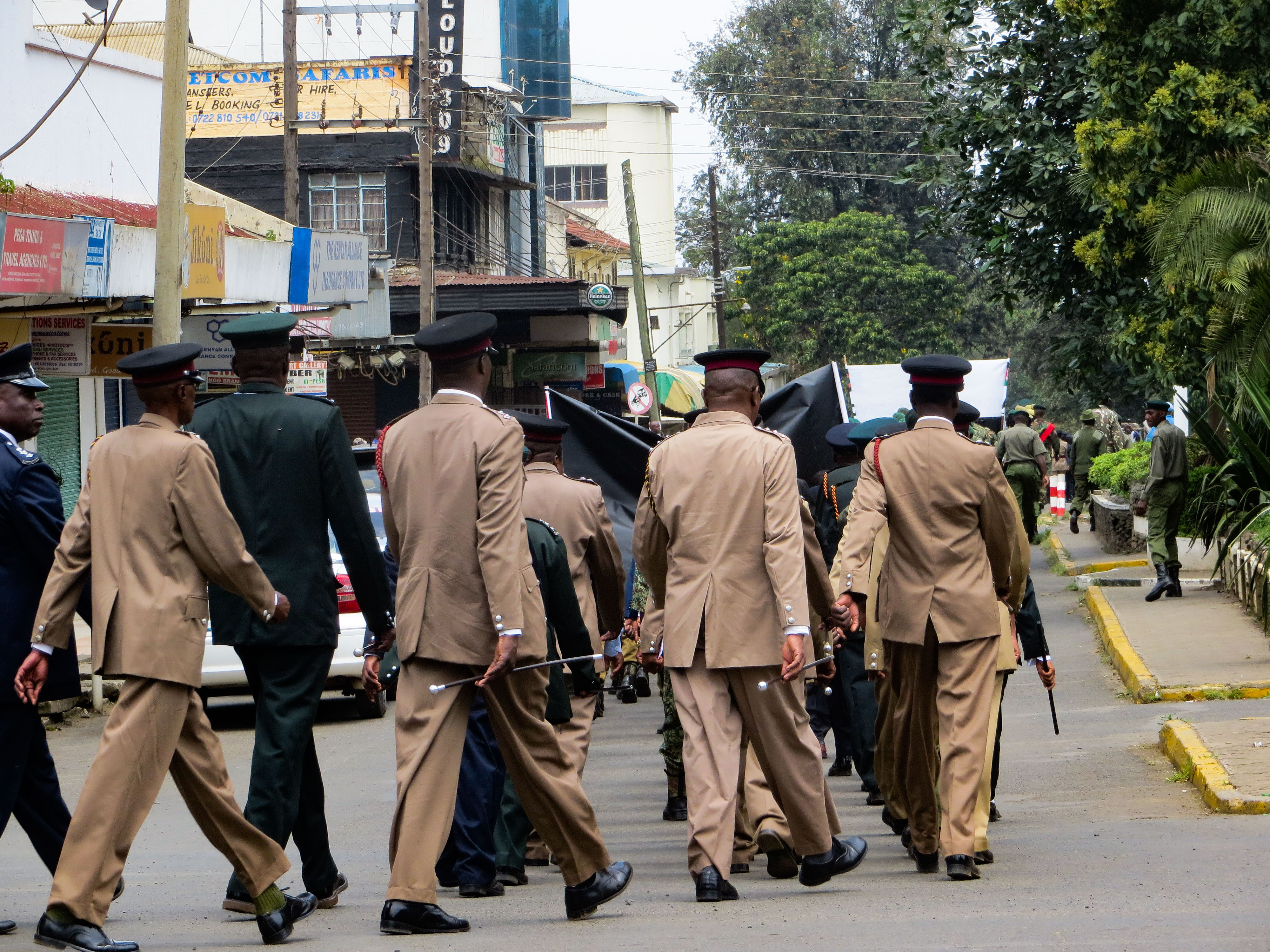
) , formedyear = 1958 , formedmonthday = , preceding1 = , dissolved = , superseding = , employees = 30,000 , volunteers = , budget = , country = Kenya , countryabbr = KEN , divtype = , divname = , subdivtype = , subdivname = , subdivdab = , map = Kenya districts.svg , mapcaption = , sizearea = , sizepopulation = 47,564,000 Kenya , governingbody = Kenya , governingbodyscnd = , constitution1 = , police = Yes , speciality = , overviewtype = , overviewbody = , headquarters = Jogoo House, Taifa Rd, Nairobi , hqlocmap = , hqlocleft = , hqloctop = , hqlocmappoptitle = , sworntype = Police Officer , sworn = , civilians = , total employees = , electeetype = , minister1name = , ... [...More Info...] [...Related Items...] OR: [Wikipedia] [Google] [Baidu] |
National Youth Service (Kenya)
The National Youth Service (NYS) is an organisation under the Government of Kenya. It was established in 1964 to train young people in important national matters. In 2019, the organization was transformed from a state department to a fully fledged semi-autonomous state corporation after enactment of NYS act, 20/nowiki>] by the Kenyan parliament. The core business of NYS is to train and mentor Kenya's youth through : # Paramilitary and regimentation . # National building programs. # Technical and vocational training in various skills and trades . Enrollment Enrollment to the service is voluntary for Kenyan youth aged between 18 –22 years old . Upon enlistment, the recruits are subjected to rigorous non-combat paramilitary training for 6 months . The recruits are required to offer at least 6 months of national service, which may include; *Construction *Vector control * Slums upgrade program * Traffic Control * Public security * Agriculture Before the late 1980s, studen ... [...More Info...] [...Related Items...] OR: [Wikipedia] [Google] [Baidu] |
Lake Elementaita
Lake Elmenteita is a soda lake, in the Great Rift Valley, about 120 km northwest of Nairobi, Kenya. Geography Elmenteita is derived from the Maasai word , meaning "dust place", a reference to the dryness and dustiness of the area, especially between January and March. The town of Gilgil is near the lake. In the south-to-north sequence of Rift Valley lakes, Elmenteita is between Lake Naivasha and Lake Nakuru. The major Nairobi- Nakuru highway ( A104 Road) runs along the nearby escarpment affording motorists a spectacular vista towards the lake. Today the lake is a protected area due to its bird life, and has been named as an UNESCO heritage site together with Lake Nakuru and Lake Bogoria. At the southern end of the lake are the "Kekopey" hot springs, in which an introduced fish, the Lake Magadi tilapia, breed. The reed beds nearby are fishing grounds for night herons and pelicans. History The Lake Elmenteita area saw its first white settlement when Lord ... [...More Info...] [...Related Items...] OR: [Wikipedia] [Google] [Baidu] |
Divisions Of Kenya
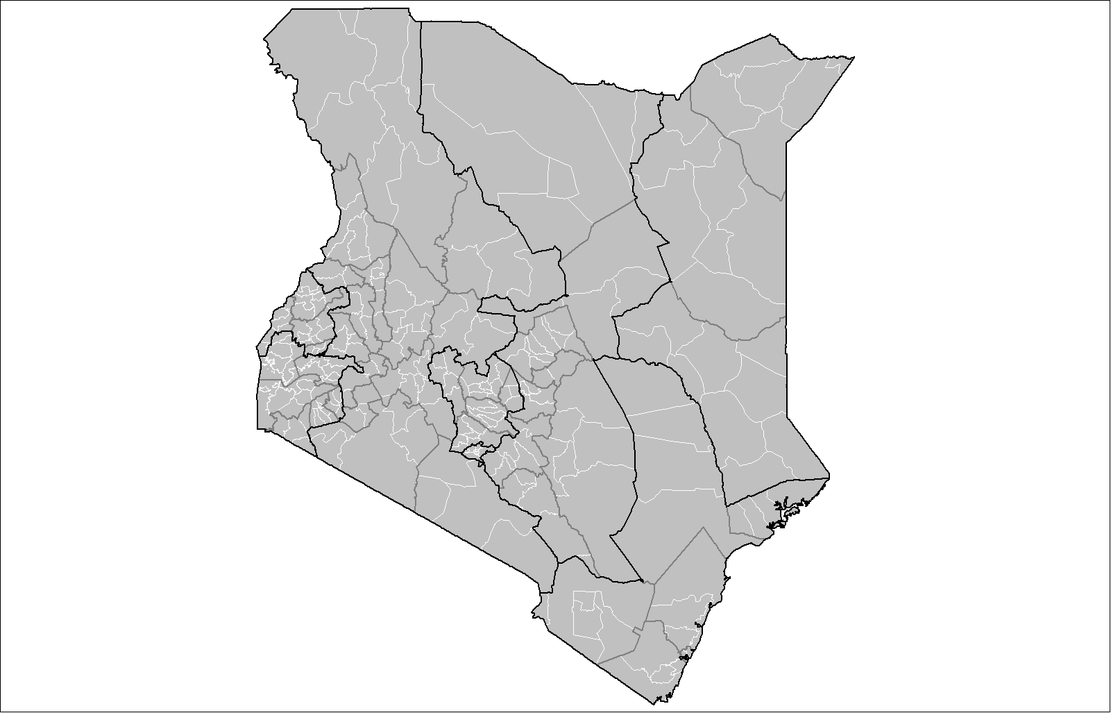
The districts of Kenya were divided into 262 divisions (''matarafa''). Divisions of Kenya were further subdivided into locations. Today's counties of Kenya are based on the merging of some of the districts on this list and since the divisions are one level under the districts they are now the sub-counties. This is because Kenya recently changed its constitution and 47 Counties emerged. Here are the divisions listed below, by district (before the change in administration): Baringo District * Kabarnet * Kabartonjo *Marigat *Mochongoi * Mogotio * Nginyang *Ravine * Tenges Bomet District * Bomet * Chepalungu * Konoin Bondo District Bungoma District * Cheptaisi * Kanduyi * Kapsokwony * Kimilili * Mt.elgon Forest * Sirisia * Tongareni * Webuye Buret District Busia * Teso North * Teso South * Amukura * Budalangi * Butula * Funyula * Nambale *Matayos Butere/Mumias District Embu District * Central *Nembure *Manyatta *Runyenjes *Kyeni *Gachoka *Mwea *Makima *Kiritiri ... [...More Info...] [...Related Items...] OR: [Wikipedia] [Google] [Baidu] |
Nakuru
Nakuru is a city in the Rift Valley region of Kenya. It is the capital of Nakuru County, and was formerly the capital of Rift Valley Province. As of 2019, Nakuru had an urban and rural population of 570,674 inhabitants, making it the largest urban center in the Rift Valley, with Eldoret in Uasin Gishu County following closely behind. The city lies along the Nairobi Nakuru Highway, a distance of 160 kilometers from Nairobi, the capital of Kenya. It is the fourth largest city in Kenya, behind Nairobi, Mombasa and Kisumu respectively. It lies about 1,850 m above sea level. History Archaeological discoveries located about 8 km from the Central Business District at the Hyrax Hill reserve have been dated to the prehistoric period. The city was created on January 28, 1904 when an area within a circle having a radius of one mile from the main entrance to the railway station was proclaimed to be a township. The name of the town was derived from the Maasai-speaking people of K ... [...More Info...] [...Related Items...] OR: [Wikipedia] [Google] [Baidu] |


