|
Gharife
Gharifeh () is a village in the Chouf District of Lebanon. History There are many legends about the origin of the name of Gharifeh. It may come from Syriac, and means "cliff" or "extended mountains." Location Gharifeh's elevation is 800 metres above sea level. It is 56 kilometers away from the capital of Lebanon, Beyrouth, and 8 kilometers from Beit ed-Dine, the administrative center of the Kaza. There are 8,260 residents in Gharifeh. In the last municipal Lebanese elections of 2005, Gharifeh counted 5,491 registered voters, 3,157 of which actually voted. Gharifeh has an elected municipal assembly. Gharifeh has two schools, one public school and one private school. The village of Gharifeh is located in the Kaza of Chouf, one of the six Kazas of the Mount-Lebanon mohafazah. The mohafazah of Mount-Lebanon is one of the eight Lebanon mohafazats. The village is surrounded by high mountains and virgin forests. The town is famous for its olive oil, which comes from olive tr ... [...More Info...] [...Related Items...] OR: [Wikipedia] [Google] [Baidu] |
List Of Sovereign States
The following is a list providing an overview of sovereign states around the world with information on their status and recognition of their sovereignty. The 205 listed states can be divided into three categories based on membership within the United Nations System: 193 member states of the United Nations, UN member states, two United Nations General Assembly observers#Current non-member observers, UN General Assembly non-member observer states, and ten other states. The ''sovereignty dispute'' column indicates states having undisputed sovereignty (188 states, of which there are 187 UN member states and one UN General Assembly non-member observer state), states having disputed sovereignty (15 states, of which there are six UN member states, one UN General Assembly non-member observer state, and eight de facto states), and states having a political status of the Cook Islands and Niue, special political status (two states, both in associated state, free association with New ... [...More Info...] [...Related Items...] OR: [Wikipedia] [Google] [Baidu] |
Governorates Of Lebanon
Lebanon is divided into nine governorates (Arabic: ). Each governorate is headed by a governor (Arabic: ). All of the governorates except for Beirut Governorate, Beirut and Akkar Governorate, Akkar are divided into districts of Lebanon, districts, which are further subdivided into list of municipalities of Lebanon, municipalities. The newest governorate is Keserwan-Jbeil, which was gazetted on 7 September 2017 but whose first governor, Pauline Deeb, was not appointed until 2020. Implementation of the next most recently created governorates, Akkar and Baalbek-Hermel, also remains ongoing since the appointment of their first governors in 2014. See also * Politics of Lebanon References External links Governorates of Lebanon, Administrative divisions in Asia, Lebanon 1 First-level administrative divisions by country, Governorates, Lebanon Lists of subdivisions of Lebanon, Governorates Subdivisions of Lebanon {{Lebanon-geo-stub ... [...More Info...] [...Related Items...] OR: [Wikipedia] [Google] [Baidu] |
Mount Lebanon Governorate
Mount Lebanon Governorate () is one of the nine governorates of Lebanon, of which it is the most populous. Its capital is Baabda. Other notable towns and cities include Aley, Bikfaya, and Beit Mery. This governorate is named after the mountainous region of Mount Lebanon and, except for the small Beirut Governorate which it surrounds, spans the stretch of the Mediterranean coast between Keserwan-Jbeil Governorate and South Governorate. Geography The Governorate of Mount Lebanon (except the area around Beirut) extends along the coast of the Mediterranean Sea. To the north, it borders the Northern Governorate, and it borders the Southern Governorate to the south. On the eastern side, it borders the governorates of Bekaa and Baalbek-Hermel. The governorate's altitude ranges from zero to 3,000 meters above sea level. It has diverse geographical features, including urban areas, mixed rural areas and natural areas. It is crossed by 5 rivers (Nahr El Kalb, Nahr Beirut, Damour, ... [...More Info...] [...Related Items...] OR: [Wikipedia] [Google] [Baidu] |
Districts Of Lebanon
The nine governorates of Lebanon are subdivided into 26 districts (''Aqdya'', singular''qadaa''). Beirut Governorate is not subdivided into districts, and Akkar Governorate comprises a single district. The districts are further divided into municipalities. List of districts Capitals (مراكز) of the governorates and districts are indicated in parentheses. #Akkar Governorate ( Halba) #* Akkar ( Halba) # Baalbek-Hermel Governorate (Baalbek) #*Baalbek (Baalbek) #* Hermel ( Hermel) #Beirut Governorate (Beirut Beirut ( ; ) is the Capital city, capital and largest city of Lebanon. , Greater Beirut has a population of 2.5 million, just under half of Lebanon's population, which makes it the List of largest cities in the Levant region by populatio ...) #Beqaa Governorate (Zahlé) #*Rashaya District, Rashaya (Rashaya) #*Western Beqaa District, Western Beqaa (Joub Jannine - winter Saghbine - summer) #*Zahlé District, Zahlé (Zahlé) #Keserwan-Jbeil Governorate (Jounieh) #* ... [...More Info...] [...Related Items...] OR: [Wikipedia] [Google] [Baidu] |
Chouf District
Chouf (also spelled Shouf, Shuf or Chuf; ) is a historic region of Lebanon, as well as an administrative district in the governorate ( muhafazat) of Mount Lebanon. Geography Located south-east of Beirut, the region comprises a narrow coastal strip notable for the Christian town of Damour, and the valleys and mountains of the western slopes of Jabal Barouk, the name of the local Mount Lebanon massif, on which the largest forest of Cedars of Lebanon is found. The mountains are high enough to receive snow. History The Emirs of Mount Lebanon resided in Chouf, most notably Druze Emir Fakhr al-Din II, who attained considerable power and autonomy from the Ottoman Empire in the 17th century. He is often referred to as the founder of modern Lebanon although his area of influence and control included parts of Palestine and Syria. Another emir is Bachir Chehab II, who built the palace of Beiteddine during the first half of the 19th century. Deir al Qamar (the monastery of the ... [...More Info...] [...Related Items...] OR: [Wikipedia] [Google] [Baidu] |
Eastern European Time
Eastern European Time (EET) is one of the names of UTC+02:00 time zone, 2 hours ahead of Coordinated Universal Time. The zone uses daylight saving time, so that it uses UTC+03:00 during the summer. A number of African countries use UTC+02:00 all year long, where it is called Central Africa Time (CAT), although Egypt and Libya also use the term ''Eastern European Time''. The most populous city in the Eastern European Time zone is Cairo, with the most populous EET city in Europe being Kyiv. Usage The following countries, parts of countries, and territories use Eastern European Time all year round: * Kaliningrad Oblast (Russia), since 26 October 2014; also used EET in the years 1945 and 1991–2011. See also Kaliningrad Time. * Libya, since 27 October 2013; switched from Central European Time, which was used in 2012. Used year-round EET from 1980 to 1981, 1990–1996 and 1998–2012. The following countries, parts of countries, and territories use Eastern European ... [...More Info...] [...Related Items...] OR: [Wikipedia] [Google] [Baidu] |
Eastern European Summer Time
Eastern European Summer Time (EEST) is one of the names of the UTC+03:00 time zone, which is 3 hours ahead of Coordinated Universal Time. It is used as a summer daylight saving time in some European and Middle Eastern countries, which makes it the same as Arabia Standard Time, East Africa Time, and Moscow Time. During the winter periods, Eastern European Time ( UTC+02:00) is used. Since 1996, European Summer Time has been applied from the last Sunday in March to the last Sunday in October. Previously, the rules were not uniform across the European Union. Usage The following countries and territories use Eastern European Summer Time during the summer: * Belarus, Moscow Summer Time in years 1981–89, regular EEST from 1991-2011 * Bulgaria, regular EEST since 1979 * Cyprus, regular EEST since 1979 ( Northern Cyprus stopped using EEST in September 2016, but returned to EEST in March 2018) * Egypt, in the years 1988–2010, 2014–2015 and since 2023 (see also Egypt Sta ... [...More Info...] [...Related Items...] OR: [Wikipedia] [Google] [Baidu] |
Telephone Numbers In Lebanon
In Lebanon, the area codes are, including the leading ''0'', two, three or four Dialling *National: xx-xxx-xxx *International: +961 xx-xxx-xxx Area codes *01 : Beirut and its Metropolitan area *02 : No longer in use (was previously used to call Syria) *030 : Mobile operators - MIC2 (touch) *031 : Mobile operators - MIC1 (alfa) *032 : Mobile operators - MIC1 (alfa) *033 : Mobile operators - MIC1 (alfa) *034 : Mobile operators - MIC1 (alfa) *035 : Mobile operators - MIC1 (alfa) *036 : Mobile operators - MIC2 (touch) *037 : Mobile operators - MIC2 (touch) *038 : Mobile operators - MIC2 (touch) *039 : Mobile operators - MIC2 (to) *04 : Mount Lebanon, Metn Caza *05 : Mount Lebanon, Baabda Caza + Aley Caza + Chouf Caza *06 : North Lebanon (includes Akkar) *07 : South Lebanon (This includes some towns on the southern part of Mount Lebanon) *070 0 : Mobile operators - MIC2 (touch) *070 1 : Mobile operators - MIC1 (alfa) *070 2 : Mobile operators - MIC1 (alfa) *070 3 : Mobile opera ... [...More Info...] [...Related Items...] OR: [Wikipedia] [Google] [Baidu] |
Lebanon
Lebanon, officially the Republic of Lebanon, is a country in the Levant region of West Asia. Situated at the crossroads of the Mediterranean Basin and the Arabian Peninsula, it is bordered by Syria to the north and east, Israel to the south, and the Mediterranean Sea to the west; Cyprus lies a short distance from the coastline. Lebanon has a population of more than five million and an area of . Beirut is the country's capital and largest city. Human habitation in Lebanon dates to 5000 BC. From 3200 to 539 BC, it was part of Phoenicia, a maritime civilization that spanned the Mediterranean Basin. In 64 BC, the region became part of the Roman Empire and the subsequent Byzantine Empire. After the seventh century, it Muslim conquest of the Levant, came under the rule of different Islamic caliphates, including the Rashidun Caliphate, Rashidun, Umayyad Caliphate, Umayyad and Abbasid Caliphate, Abbasid. The 11th century saw the establishment of Christian Crusader states, which fell ... [...More Info...] [...Related Items...] OR: [Wikipedia] [Google] [Baidu] |
Syriac Language
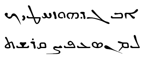
The Syriac language ( ; ), also known natively in its spoken form in early Syriac literature as Edessan (), the Mesopotamian language () and Aramaic (), is an Aramaic#Eastern Middle Aramaic, Eastern Middle Aramaic dialect. Classical Syriac is the academic term used to refer to the dialect's literary usage and standardization, distinguishing it from other Aramaic dialects also known as 'Syriac' or 'Syrian'. In its West-Syriac Rite, West-Syriac tradition, Classical Syriac is often known as () or simply , or , while in its East-Syriac Rite, East-Syriac tradition, it is known as () or (). It emerged during the first century AD from a local Eastern Aramaic languages, Eastern Aramaic dialect that was spoken in the ancient region of Osroene, centered in the city of Edessa. During the Early Christian period, it became the main literary language of various Aramaic-speaking Christian communities in the historical region of Syria (region), Ancient Syria and throughout the Near East. As ... [...More Info...] [...Related Items...] OR: [Wikipedia] [Google] [Baidu] |
Beyrouth
Beirut ( ; ) is the capital and largest city of Lebanon. , Greater Beirut has a population of 2.5 million, just under half of Lebanon's population, which makes it the fourth-largest city in the Levant region and the sixteenth-largest in the Arab world. The city is situated on a peninsula at the midpoint of Lebanon's Mediterranean coast. Beirut has been inhabited for more than 5,000 years, making it one of the oldest cities in the world. Beirut is Lebanon's seat of government and plays a central role in the Lebanese economy, with many banks and corporations based in the city. Beirut is an important seaport for the country and region, and rated a Beta- World City by the Globalization and World Cities Research Network. Beirut was severely damaged by the Lebanese Civil War, the 2006 Lebanon War, and the 2020 massive explosion in the Port of Beirut. Its architectural and demographic structure underwent major change in recent decades. Etymology The English name Beirut ... [...More Info...] [...Related Items...] OR: [Wikipedia] [Google] [Baidu] |
Beit Ed-Dine
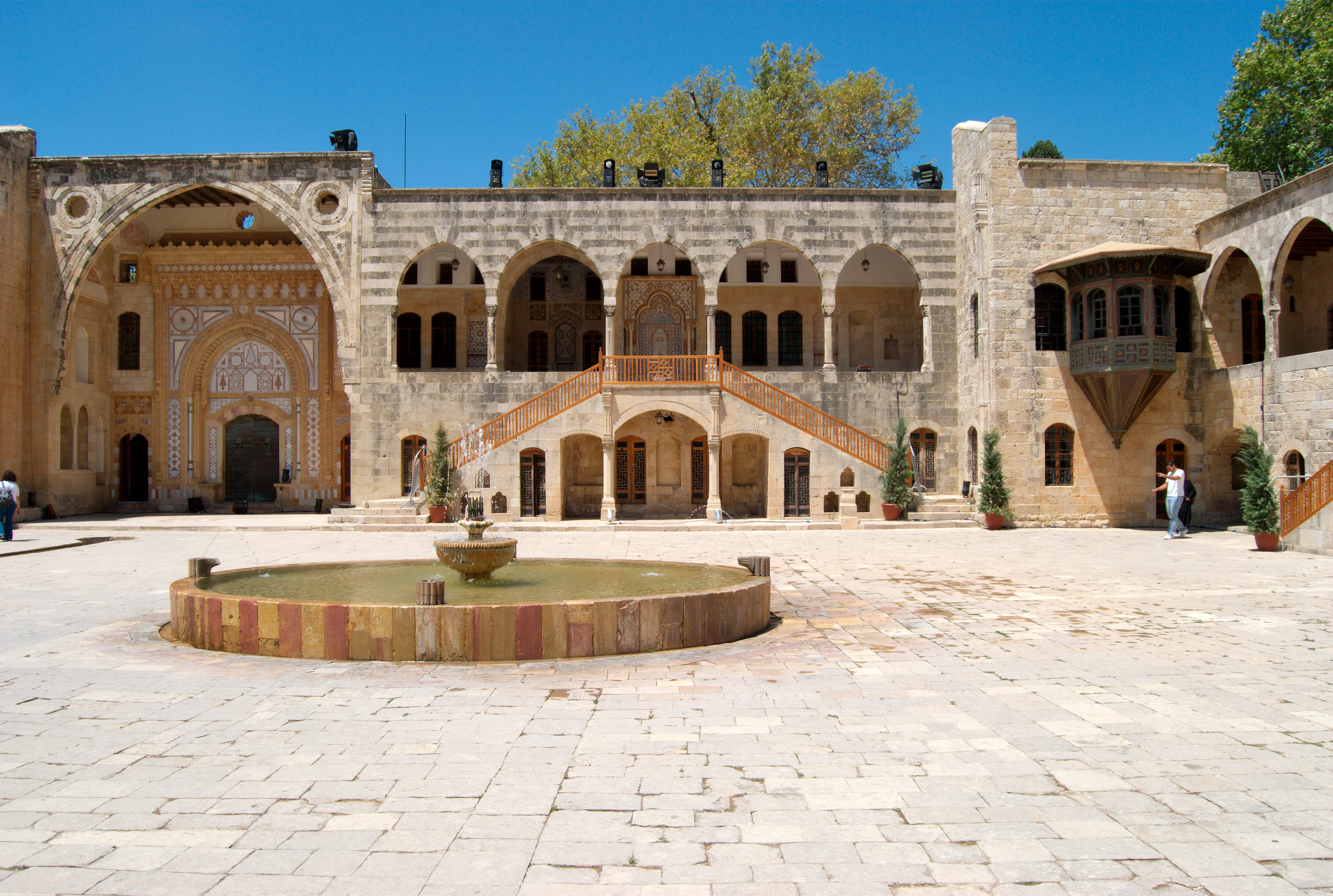
Beit ed-Dine (), also known as Btaddine () is a small town and the administrative capital of the Chouf District in the Mount Lebanon Governorate in Lebanon. The town is located 45 kilometers southeast of Beirut, and near the town of Deir el-Qamar from which it is separated by a steep valley. It had 1,613 registered voters in 2010 and its inhabitants are predominantly Christians from the Maronite, Melkite and Greek Orthodox denominations. Beit ed-Dine's total land area consists of 244 hectares and its average elevation is 860 meters above sea level. The town is well known for the Beiteddine Palace, which hosts the annual summer Beiteddine Festival. History Ottoman era Emir Bashir II of the Shihab dynasty, who later became the ruler of the Mount Lebanon Emirate, started building the palace in 1788 at the site of the Druze hermitage (hence the palace's name, translating as "''House of Faith''"), indicating that the town was initially populated by Druze before Bashir lived ... [...More Info...] [...Related Items...] OR: [Wikipedia] [Google] [Baidu] |


