|
Gavkhouni
Gavkhouni () also written as ''Batlaq-e-Gavkhuni'', located in the Iranian Plateau in central Iran, east of the city of Isfahan, is the terminal basin of the Zayandeh River. Gavkhouni is a salt marsh with a salinity of 31.5% and an average depth of about 1 m. The salt marsh can dry up in summer. The Zayandeh River originates in the Zagros mountains, and travels around 300 km, before terminating in Gavkhouni. Gavkhouni receives pollution from Isfahan and other urban sources. Isfahan is a major oasis city on the Zayandeh River with a population over 1.5 million. The marshes were designated a Ramsar site in 1975, the 19th wetland in Iran designated as a Wetland of International Importance on the Ramsar list. The wetland is home to a variety of migratory birds including flamingos, ducks, geese, gulls, pelicans, and grebes. The vegetation of the area is very specialised; there are no green plants and trees around the lake due to soil salinity, but in the wetland, different ... [...More Info...] [...Related Items...] OR: [Wikipedia] [Google] [Baidu] |
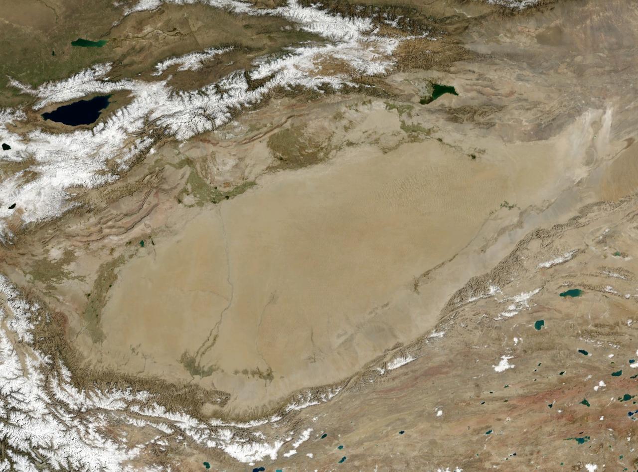
Gavkhouni 20190329 13
Gavkhouni () also written as ''Batlaq-e-Gavkhuni'', located in the Iranian Plateau in central Iran, east of the city of Isfahan, is the terminal basin of the Zayandeh River. Gavkhouni is a salt marsh with a salinity of 31.5% and an average depth of about 1 m. The salt marsh can dry up in summer. The Zayandeh River originates in the Zagros mountains, and travels around 300 km, before terminating in Gavkhouni. Gavkhouni receives pollution from Isfahan and other urban sources. Isfahan is a major oasis city on the Zayandeh River with a population over 1.5 million. The marshes were designated a Ramsar site in 1975, the 19th wetland in Iran designated as a Wetland of International Importance on the Ramsar list. The wetland is home to a variety of migratory birds including flamingos, ducks, geese, gulls, pelicans, and grebes. The vegetation of the area is very specialised; there are no green plants and trees around the lake due to soil salinity, but in the wetland, different speci ... [...More Info...] [...Related Items...] OR: [Wikipedia] [Google] [Baidu] |
Zayandeh River
The Zayanderud or Zayandehrud (; from "fertile" or "life-giver", and "river"), also spelled as ''Zayanderud'' or ''Zayanderood, ...'', is the largest river of the Iranian Plateau in central Iran. Geography The Zayandeh starts in the Zard-Kuh subrange of the Zagros Mountains in Chaharmahal and Bakhtiari Province. It flows eastward before ending in the Gavkhouni swamp, a seasonal salt lake, southeast of Isfahan (Esfahan) city. The Zayandeh used to have significant flow all year long, unlike many of Iran's rivers which are seasonal, but today it runs dry due to water extraction before reaching the city of Esfahan. In the early 2010s, the lower reaches of the river dried out completely after several years of seasonal dry-outs. The Zayandeh River basin has an area of , an altitude from to , an average rain fall of and a monthly average temperature of to . There are of irrigated land in the Zayandeh River basin, with water derived from the nine main hydraulic units of th ... [...More Info...] [...Related Items...] OR: [Wikipedia] [Google] [Baidu] |
Iranian Plateau
The Iranian plateau or Persian plateau is a geological feature spanning parts of the Caucasus, Central Asia, South Asia, and West Asia. It makes up part of the Eurasian plate, and is wedged between the Arabian plate and the Indian plate. The plateau is situated between the Zagros Mountains to the west, the Caspian Sea and the Köpet Dag to the north, the Armenian Highlands and the Caucasus Mountains to the northwest, the Strait of Hormuz and the Persian Gulf to the south, and the Indian subcontinent to the southeast. As a historical region, it includes Parthia, Media, Persis, and some of the previous territories of Greater Iran."Old Iranian Online" , University of Texas College of Liberal Arts (retrieved 10 February 2007) The Zagros form the plateau's western boundary, and its eastern slopes may also ... [...More Info...] [...Related Items...] OR: [Wikipedia] [Google] [Baidu] |
Endorheic Basins Of Asia
An endorheic basin ( ; also endoreic basin and endorreic basin) is a drainage basin that normally retains water and allows no outflow to other external bodies of water (e.g. rivers and oceans); instead, the water drainage flows into permanent and seasonal lakes and swamps that wiktionary:equilibrate, equilibrate through evaporation. Endorheic basins are also called closed basins, terminal basins, and internal drainage systems. Endorheic regions contrast with open and closed lakes, open lakes (exorheic regions), where surface waters eventually drain into the ocean. In general, water basins with subsurface outflows that lead to the ocean are not considered endorheic; but cryptorheic. Endorheic basins constitute local base levels, defining a limit of the erosion and Deposition (geology), deposition processes of nearby areas. Endorheic water bodies include the Caspian Sea, which is the world's largest inland body of water. Etymology The term ''endorheic'' derives from the French ... [...More Info...] [...Related Items...] OR: [Wikipedia] [Google] [Baidu] |
Isfahan
Isfahan or Esfahan ( ) is a city in the Central District (Isfahan County), Central District of Isfahan County, Isfahan province, Iran. It is the capital of the province, the county, and the district. It is located south of Tehran. The city has a population of approximately 2,220,000, making it the third-most populous city in Iran, after Tehran and Mashhad, and the second-largest metropolitan area. Isfahan is located at the intersection of the two principal routes that traverse Iran, north–south and east–west. Isfahan flourished between the 9th and 18th centuries. Under the Safavid Iran, Safavid Empire, Isfahan became the capital of Iran, for the second time in its history, under Abbas the Great. It is known for its Persian architecture, Persian–Islamic architecture, Muslim architecture, grand boulevards, covered bridges, palaces, tiled mosques, and minarets. Isfahan also has many historical buildings, monuments, paintings, and artifacts. The fame of Isfahan led to the ... [...More Info...] [...Related Items...] OR: [Wikipedia] [Google] [Baidu] |
Endorheic Basin
An endorheic basin ( ; also endoreic basin and endorreic basin) is a drainage basin that normally retains water and allows no outflow to other external bodies of water (e.g. rivers and oceans); instead, the water drainage flows into permanent and seasonal lakes and swamps that equilibrate through evaporation. Endorheic basins are also called closed basins, terminal basins, and internal drainage systems. Endorheic regions contrast with open lakes (exorheic regions), where surface waters eventually drain into the ocean. In general, water basins with subsurface outflows that lead to the ocean are not considered endorheic; but cryptorheic. Endorheic basins constitute local base levels, defining a limit of the erosion and deposition processes of nearby areas. Endorheic water bodies include the Caspian Sea, which is the world's largest inland body of water. Etymology The term ''endorheic'' derives from the French word , which combines ( 'within') and 'flow'. Endorheic lake ... [...More Info...] [...Related Items...] OR: [Wikipedia] [Google] [Baidu] |
Ramsar Convention
The Ramsar Convention on Wetlands of International Importance Especially as Waterfowl Habitat is an international treaty for the conservation and sustainable use of Ramsar site, Ramsar sites (wetlands). It is also known as the Convention on Wetlands. It is named after the city of Ramsar, Mazandaran, Ramsar in Iran, where the convention was signed in 1971. Every three years, representatives of the contracting parties meet as the Ramsar Convention#Conference of the Contracting Parties, Conference of the Contracting Parties (COP), the policy-making organ of the wetland conservation, convention which adopts decisions (site designations, resolutions and recommendations) to administer the work of the convention and improve the way in which the parties are able to implement its objectives. In 2022, COP15 was held in Montreal, Canada. List of wetlands of international importance The list of wetlands of international importance included 2,531 Ramsar site, Ramsar sites in Februa ... [...More Info...] [...Related Items...] OR: [Wikipedia] [Google] [Baidu] |
Cattail
''Typha'' is a genus of about 30 species of monocotyledonous flowering plants in the family Typhaceae. These plants have a variety of common names, in British English as bulrushStreeter D, Hart-Davies C, Hardcastle A, Cole F, Harper L. 2009. ''Collins Flower Guide''. Harper Collins or (mainly historically) reedmace, in American English as cattail, or punks, in Australia as cumbungi or bulrush, in Canada as bulrush or cattail, and in New Zealand as raupō, bullrush, cattail or reed. Other taxa of plants may be known as bulrush, including some sedges in '' Scirpus'' and related genera. The genus is largely distributed in the Northern Hemisphere, where it is found in a variety of wetland habitats. The rhizomes are edible, though at least some species are known to accumulate toxins and so must first undergo treatment before being eaten. Evidence of preserved starch grains on grinding stones suggests they were already eaten in Europe 30,000 years ago. Description ''Typha'' ... [...More Info...] [...Related Items...] OR: [Wikipedia] [Google] [Baidu] |
Landforms Of Isfahan Province
A landform is a land feature on the solid surface of the Earth or other planetary body. They may be natural or may be anthropogenic (caused or influenced by human activity). Landforms together make up a given terrain, and their arrangement in the landscape is known as topography. Landforms include hills, mountains, canyons, and valleys, as well as shoreline features such as bays, peninsulas, and seas, including submerged features such as mid-ocean ridges, volcanoes, and the great oceanic basins. Physical characteristics Landforms are categorized by characteristic physical attributes such as elevation, slope, orientation, structure stratification, rock exposure, and soil type. Gross physical features or landforms include intuitive elements such as berms, cliffs, hills, mounds, peninsulas, ridges, rivers, valleys, volcanoes, and numerous other structural and size-scaled (e.g. ponds vs. lakes, hills vs. mountains) elements including various kinds of inland and oceanic waterbodi ... [...More Info...] [...Related Items...] OR: [Wikipedia] [Google] [Baidu] |
Marshes Of Iran
In ecology, a marsh is a wetland that is dominated by herbaceous plants rather than by woody plants.Keddy, P.A. 2010. Wetland Ecology: Principles and Conservation (2nd edition). Cambridge University Press, Cambridge, UK. 497 p More in general, the word can be used for any low-lying and seasonally waterlogged terrain. In Europe and in agricultural literature low-lying meadows that require draining and embanked polderlands are also referred to as marshes or marshland. Marshes can often be found at the edges of lakes and streams, where they form a transition between the aquatic and terrestrial ecosystems. They are often dominated by grasses, rushes or reeds. If woody plants are present they tend to be low-growing shrubs, and the marsh is sometimes called a carr. This form of vegetation is what differentiates marshes from other types of wetland such as swamps, which are dominated by trees, and mires, which are wetlands that have accumulated deposits of acidic peat. Marshes prov ... [...More Info...] [...Related Items...] OR: [Wikipedia] [Google] [Baidu] |
Chaharmahal And Bakhtiari Province
Chaharmahal and Bakhtiari Province () is one of the 31 provinces of Iran. Its capital is the city of Shahr-e Kord. The province lies in the southwest of the country, with an area of 16,332 square kilometers. The province was classified as part of Regions of Iran, Region 2 upon the division of the provinces into Regions of Iran, 5 regions solely for coordination and development purposes on June 22, 2014. Demographics Languages Bakhtiari dialect, Bakhtiāri, which belongs to the Luri language of the Iranian languages, Iranian language family, is the province's main language. Bakhtiāri is primarily spoken in the valleys of the higher areas in the western half of the province. It is also spoken in the lower areas around Lordegan, Lordegān in the south, and by speakers who have moved into the cities in the north-east. In the north-east quarter of the province, people in most cities and villages speak either Charmahali Persian, Chārmahāli (also in the Southwestern branch o ... [...More Info...] [...Related Items...] OR: [Wikipedia] [Google] [Baidu] |


