|
Garífuna
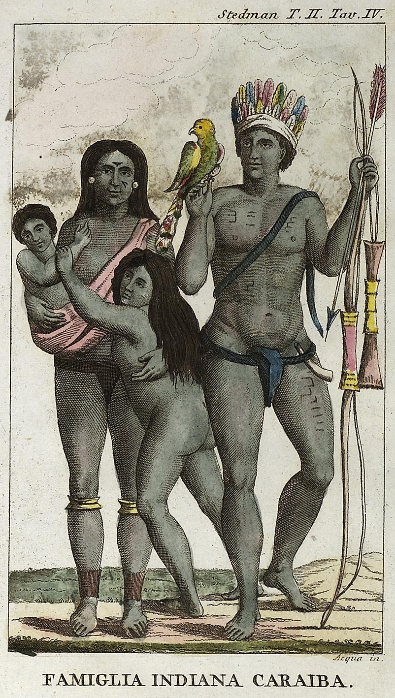
The Garifuna people ( or ; pl. Garínagu in Garifuna language, Garifuna) are a people of mixed free African people, African and Indigenous people of the Americas, Amerindian ancestry that originated in the Caribbean island of Saint Vincent (Antilles), Saint Vincent and traditionally speak Garifuna language, Garifuna, an Arawakan language. The Garifuna are the descendants of Indigenous Arawak, Kalinago (Island Carib), and Afro-Caribbean people. The founding population of the Central American diaspora, estimated at 2,500 to 5,000 persons, were transplanted to Roatán from Saint Vincent, which was known to the Garinagu as ''Yurumein'', in the Windward Islands of the Lesser Antilles. Small Garifuna communities still live in Saint Vincent and the Grenadines. The Garifuna diaspora abroad includes communities in Honduras, Garifuna Americans, the United States, and Belize. Name In the Garifuna language, the endonym ''Garínagu'' refers to the people as a whole and the term ''Garífun ... [...More Info...] [...Related Items...] OR: [Wikipedia] [Google] [Baidu] |
Arawakan Language
Arawakan (''Arahuacan, Maipuran Arawakan, "mainstream" Arawakan, Arawakan proper''), also known as Maipurean (also ''Maipuran, Maipureano, Maipúre''), is a language family that developed among ancient Indigenous peoples in South America. Branches migrated to Central America and the Greater Antilles and Lesser Antilles in the Caribbean and the Atlantic, including what is now the Bahamas. Almost all present-day South American countries are known to have been home to speakers of Arawakan languages, the exceptions being Ecuador, Uruguay, and Chile. Maipurean may be related to other language families in a hypothetical Macro-Arawakan stock. Name The name ''Maipure'' was given to the family by Filippo S. Gilii in 1782, after the Maipure language of Venezuela, which he used as a basis of his comparisons. It was renamed after the culturally more important Arawak language a century later. The term ''Arawak'' took over, until its use was extended by North American scholars to the broader ... [...More Info...] [...Related Items...] OR: [Wikipedia] [Google] [Baidu] |
Garifuna Language
Garifuna (Karif) is a minority language widely spoken in villages of Garifuna people in the western part of the northern coast of Central America. It is a member of the Arawakan language family but an atypical one since it is spoken outside the Arawakan language area, which is otherwise now confined to the northern parts of South America, and because it contains an unusually high number of loanwords, from both Carib languages and a number of European languages because of an extremely tumultuous past involving warfare, migration and colonization. The language was once confined to the Antillean islands of St. Vincent and Dominica, but its speakers, the Garifuna people, were deported by the British in 1797 to the north coast of Honduras from where the language and Garifuna people has since spread along the coast south to Nicaragua and north to Guatemala and Belize. Parts of Garifuna vocabulary are split between men's speech and women's speech, and some concepts have two ... [...More Info...] [...Related Items...] OR: [Wikipedia] [Google] [Baidu] |
Kalinago
The Kalinago, also called Island Caribs or simply Caribs, are an Indigenous people of the Lesser Antilles in the Caribbean. They may have been related to the Mainland Caribs (Kalina) of South America, but they spoke an unrelated language known as Kalinago or Island Carib. They also spoke a pidgin language associated with the Mainland Caribs. At the time of Spanish contact, the Kalinago were one of the dominant groups in the Caribbean (the name of which is derived from "Carib", as the Kalinago were once called). They lived throughout north-eastern South America, Trinidad and Tobago, Barbados, the Windward Islands, Dominica, and possibly the southern Leeward Islands. Historically, it was thought their ancestors were mainland peoples who had conquered the islands from their previous inhabitants, the Igneri. However, linguistic and archaeological evidence contradicts the notion of a mass emigration and conquest; the Kalinago language appears not to have been Cariban, but like ... [...More Info...] [...Related Items...] OR: [Wikipedia] [Google] [Baidu] |
Guatemala
Guatemala, officially the Republic of Guatemala, is a country in Central America. It is bordered to the north and west by Mexico, to the northeast by Belize, to the east by Honduras, and to the southeast by El Salvador. It is hydrologically bordered to the south by the Pacific Ocean and to the northeast by the Gulf of Honduras. The territory of modern Guatemala hosted the core of the Maya civilization, which extended across Mesoamerica; in the 16th century, most of this was Spanish conquest of Guatemala, conquered by the Spanish and claimed as part of the viceroyalty of New Spain. Guatemala attained independence from Spain and Mexico in 1821. From 1823 to 1841, it was part of the Federal Republic of Central America. For the latter half of the 19th century, Guatemala suffered instability and civil strife. From the early 20th century, it was ruled by a series of dictators backed by the United States. In 1944, authoritarian leader Jorge Ubico was overthrown by a pro-democratic m ... [...More Info...] [...Related Items...] OR: [Wikipedia] [Google] [Baidu] |
Roatán
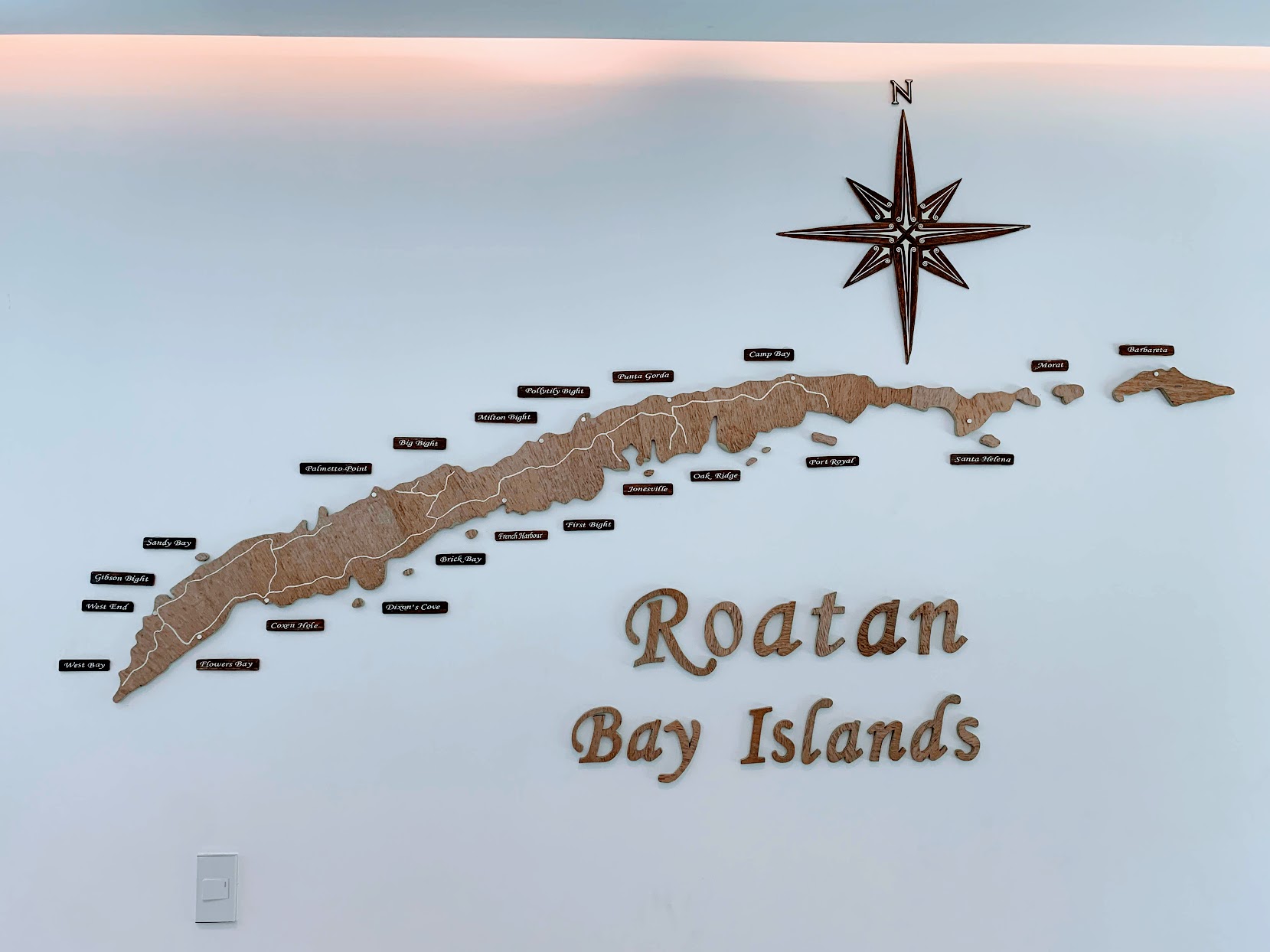
Roatán () is an island in the Caribbean, about off the northern coast of Honduras. The largest of the Bay Islands Department, Bay Islands of Honduras, it is located between the islands of Utila and Guanaja. It is approximately long, and less than across at its widest point. The island consists of two Municipalities of Honduras, municipalities: José Santos Guardiola, Bay Islands, José Santos Guardiola in the east and Roatán, including the Cayos Cochinos, in the west. The island was formerly known in English as Ruatan and Rattan. Geography Roatán is a coral island. Situated atop an exposed ancient coral reef, it rises to about above sea level. The easternmost quarter of the island is separated by a 15-meter-wide channel through the mangrove forest. This section is called Helene, or ''Santa Elena'' in Spanish. Satellite islands at the eastern end are Morat, Barbareta, and Pigeon Cay. Most of the infrastructure is on the western half of the island. The most populous to ... [...More Info...] [...Related Items...] OR: [Wikipedia] [Google] [Baidu] |
Arawak
The Arawak are a group of Indigenous peoples of northern South America and of the Caribbean. The term "Arawak" has been applied at various times to different Indigenous groups, from the Lokono of South America to the Taíno (Island Arawaks), who lived in the Greater Antilles and northern Lesser Antilles in the Caribbean. All these groups spoke related Arawakan languages. Name Early Spanish explorers and administrators used the terms ''Arawak'' and '' Caribs'' to distinguish the peoples of the Caribbean, with ''Carib'' reserved for Indigenous groups that they considered hostile and ''Arawak'' for groups that they considered friendly. In 1871, ethnologist Daniel Garrison Brinton proposed calling the Caribbean populace "Island Arawak" because of their cultural and linguistic similarities with the mainland Arawak. Subsequent scholars shortened this convention to "Arawak", creating confusion between the island and mainland groups. In the 20th century, scholars such as Irving Ro ... [...More Info...] [...Related Items...] OR: [Wikipedia] [Google] [Baidu] |
Lesser Antilles
The Lesser Antilles is a group of islands in the Caribbean Sea, forming part of the West Indies in Caribbean, Caribbean region of the Americas. They are distinguished from the larger islands of the Greater Antilles to the west. They form an arc which begins east of Geography of Puerto Rico, Puerto Rico at the Virgin Islands, archipelago of the Virgin Islands, swings southeast through the Leeward Islands, Leeward and Windward Islands towards South America, and turns westward through the Leeward Antilles along the Geography of Venezuela, Venezuelan coast. Most of them are part of a long, partially volcanic arc, volcanic island arc between the Greater Antilles to the north-west and the continent of South America."West Indies." ''Merriam-Webster's Geographical Dictionary'', 3rd ed. 2001. () Springfield, MA: Merriam-Webster Inc., p. 1298. The islands of the Lesser Antilles form the eastern boundary of the Caribbean Sea where it meets the Atlantic Ocean. Together, the Lesser Antilles a ... [...More Info...] [...Related Items...] OR: [Wikipedia] [Google] [Baidu] |
Windward Islands
The Windward Islands are the southern, generally larger islands of the Lesser Antilles of the Caribbean islands or the West Indies. Located approximately between latitudes 10° and 16° N and longitudes 60° and 62° W, they extend from Dominica in the north to Trinidad and Tobago in the south, and lie south of the Leeward Islands and east of Leeward Antilles. The name was also used to refer to a British colony which existed between 1833 and 1960 and originally consisted of the islands of Grenada, Saint Lucia, and Saint Vincent. Today, these islands constitute three sovereign states, the latter of which is now known as Saint Vincent and the Grenadines. The island of Dominica was traditionally considered a part of the Leeward Islands until 1940, when it was transferred from the British Leeward Islands colony to the British Windward Islands. It now composes the fourth sovereign state in the group. Barbados (until 1885) and Tobago (until 1889) were also part of the Brit ... [...More Info...] [...Related Items...] OR: [Wikipedia] [Google] [Baidu] |
Saint Vincent (Antilles)
Saint Vincent is a volcanic island in the Caribbean. It is the largest island of the country Saint Vincent and the Grenadines and is located in the Caribbean Sea, between Saint Lucia and Grenada. It is composed of partially submerged volcanic mountains. Its largest volcano and the country's highest peak, Soufrière (volcano), La Soufrière, is active, with the latest episode of volcanic activity having begun in December 2020 and intensifying in April 2021. There were major territory wars between the indigenous population of the Black Caribs, also called the Garifuna, and Great Britain in the 18th century, before the island was ceded to the British in 1763, and again in 1783. Saint Vincent and the Grenadines gained independence from the United Kingdom on 27 October 1979, and became part of the British Commonwealth of Nations thereafter. Approximately 130,000 people currently live on the island, and the population saw significant migration to the UK in the early 1900s, and betwee ... [...More Info...] [...Related Items...] OR: [Wikipedia] [Google] [Baidu] |
Indigenous People Of The Americas
In the Americas, Indigenous peoples comprise the two continents' pre-Columbian inhabitants, as well as the ethnic groups that identify with them in the 15th century, as well as the ethnic groups that identify with the pre-Columbian population of the Americas as such. These populations exhibit significant diversity; some Indigenous peoples were historically hunter-gatherers, while others practiced agriculture and aquaculture. Various Indigenous societies developed complex social structures, including pre-contact monumental architecture, organized cities, city-states, chiefdoms, states, kingdoms, republics, confederacies, and empires. These societies possessed varying levels of knowledge in fields such as engineering, architecture, mathematics, astronomy, writing, physics, medicine, agriculture, irrigation, geology, mining, metallurgy, art, sculpture, and goldsmithing. Indigenous peoples continue to inhabit many regions of the Americas, with significant populations in Bolivia, C ... [...More Info...] [...Related Items...] OR: [Wikipedia] [Google] [Baidu] |
African People
The population of Africa has grown rapidly over the past century and consequently shows a large youth bulge, further reinforced by increasing life expectancy in most African countries. Total population as of 2024 is about 1.5 billion, with a growth rate of about 100 million every three years. The total fertility rate (births per woman) for Africa is 4.1 as of 2024, the highest in the world. The most populous African country is Nigeria with over 206 million inhabitants as of 2020 and a growth rate of 2.6% p.a. The least populous African country is Seychelles with about 130,000 inhabitants. Population Genetics History Alternative Estimates of African Population, 0–2018 AD (in thousands) Source: Maddison and others. (University of Groningen). Shares of Africa and World Population, 0–2020 AD (% of world total) Source: Maddison and others (University of Groningen) and others. Vital Statistics 1950– Registration of vital events in most of Africa is incomplete. ... [...More Info...] [...Related Items...] OR: [Wikipedia] [Google] [Baidu] |


