|
Gary Junction Road
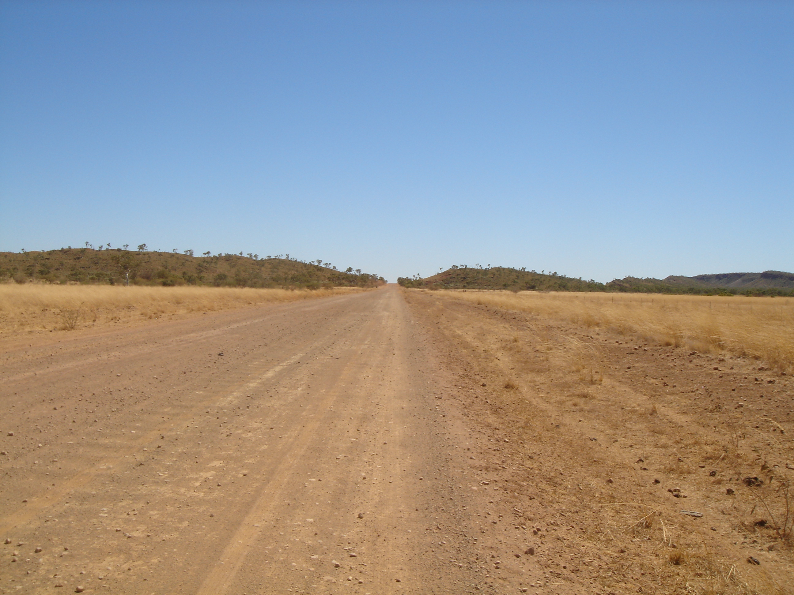
The Gary Junction Road is an outback unsealed road in Australia built by Len Beadell in the 1960s as part of a network of roads for the Weapons Research Establishment at Woomera, South Australia. In its original form, the Gary Junction Road ran from Liebig bore in the Northern Territory to Callawa Station in Western Australia. On present day maps, it is depicted as running from the Tanami Road ( Narwietooma turnoff) to Gary Junction, just east of the Canning Stock Route, a distance of 852 kilometres. The road was named after Beadell's only son Gary. File:Gary Junction Road 0216 map.svg, Map of the original Gary Junction Road 1350 km in length. History Beadell and his Gunbarrel Road Construction Party (GRCP) commenced work immediately after completing the Sandy Blight Junction Road in August 1960. Starting from Sandy Blight Junction, the first stage was built towards an existing bore track near Mount Liebig 180 km to the east (67 km west of Papunya). Liebig bo ... [...More Info...] [...Related Items...] OR: [Wikipedia] [Google] [Baidu] |
Tanami Road
__NOTOC__ The Tanami Road, also known as the Tanami Track, Tanami Highway, and the McGuire Track, is a road in Australia that runs between the Stuart Highway in the Northern Territory and the Great Northern Highway in Western Australia. It is also known as State Route 5 in the Northern Territory. Its southern junction is north of Alice Springs and the northern junction is south-west of Halls Creek. It follows a cattle droving route northwest from the MacDonnell Ranges area of central Australia to Halls Creek in the Kimberley. The Tanami Road is the most direct route from Alice Springs to the Kimberley, passing through the Tanami Desert. Along its route are Yuendumu, the tiny community of Yuelamu, and The Granites gold mine owned by Newmont Mining. In the Northern Territory it passes through land owned by the Aboriginal Warlpiri people, and in Western Australia it passes through pastoral land. About 20% of the road is bitumen, the remainder is dirt and gravel and, althou ... [...More Info...] [...Related Items...] OR: [Wikipedia] [Google] [Baidu] |
Tracks In Remote Areas Of Western Australia
Track or Tracks may refer to: Routes or imprints * Ancient trackway, any track or trail whose origin is lost in antiquity * Animal track, imprints left on surfaces that an animal walks across * Desire path, a line worn by people taking the shortest/most convenient route across fields, parks or woods * Forest track, a track (unpaved road) or trail through a forest * Fossil trackway, a type of trace fossil, usually preserving a line of animal footprints * Trackway, an ancient route of travel or track used by animals * Trail * Vineyard track, a land estate (defined by law) meant for the growing of vine grapes Arts, entertainment, and media Films * ''Tracks'' (1976 film), an American film starring Dennis Hopper * ''Tracks'' (2003 film), a 2003 animated short film * ''Tracks'' (2013 film), an Australian film starring Mia Wasikowska * ''The Track'' (film), a 1975 French thriller–drama film Literature * ''Tracks'' (novel), written by Native American author Louise Erdrich * '' ... [...More Info...] [...Related Items...] OR: [Wikipedia] [Google] [Baidu] |
William Tietkens
William Harry Tietkens (30 August 1844 – 19 April 1933), known as "Harry Tietkens", explorer and naturalist, was born in England and emigrated to Australia in 1859. Tietkens was second in command to Ernest Giles on expeditions to Central Australia in 1873 and on a journey from Beltana, South Australia to Perth, Western Australia in 1875. In 1889 Tietkens led his own expedition west of Alice Springs to the vicinity of the Western Australian border. This expedition discovered Lake Macdonald, the Kintore Range, Mount Leisler, Mount Rennie, the Cleland Hills, defined the western borders of Lake Amadeus, and photographed Uluru (Ayers Rock) and Kata Tjuta (Mount Olga) for the first time. The expedition collected new species of plants and rock samples allowing the South Australian government geologist to compile a 'geological sketch' of the country traversed. Tietkens was elected a fellow of the Royal Geographical Society on his return. Specimens of 250 plant species were collec ... [...More Info...] [...Related Items...] OR: [Wikipedia] [Google] [Baidu] |
Eighty Mile Beach
Eighty Mile Beach, also spelled Eighty-mile Beach or 80-mile Beach, lies along the north-west coast of Western Australia about half-way between the towns of Broome and Port Hedland. It is a beach some in length, forming the coastline where the Great Sandy Desert approaches the Indian Ocean. It is one of the most important sites for migratory shorebirds, or waders, in Australia, and is recognised as a wetland of international importance under the Ramsar Convention on Wetlands. History Traditional ownership and usage The southern section of Eighty Mile Beach is part of the traditional territory of the Nyangumarta people, who maintain a strong connection to the area with many songs, stories and ceremonies associated with sites along and in the vicinity of the beach. In June 2009 the Federal Court of Australia determined that the Nyangumarta People were the valid native title holders of that section of the beach. The judgement of the Court was delivered on country at Nyiy ... [...More Info...] [...Related Items...] OR: [Wikipedia] [Google] [Baidu] |
Great Northern Highway
Great Northern Highway is an Australian highway that links Western Australia's capital city Perth with its northernmost port, Wyndham. With a length of almost , it is the longest highway in Australia, with the majority included as part of the Perth Darwin National Highway. The highway is constructed as a sealed, predominantly two-lane single carriageway, but with some single-lane bridges in the Kimberley. The Great Northern Highway travels through remote areas of the state, and is the only sealed road link between the Northern Territory and northern Western Australia. Economically, it provides vital access through the Wheatbelt and Mid West to the resource-rich regions of the Pilbara and Kimberley. In these areas, the key industries of mining, agriculture and pastoral stations, and tourism are all dependent on the highway. In Perth, the highway begins in Midland near Great Eastern Highway, and further north intersects the Reid and Roe highways, which together form Perth's ... [...More Info...] [...Related Items...] OR: [Wikipedia] [Google] [Baidu] |
Wapet Road
The Wapet Road, also known as the Kidson Track, is an outback track in the Pilbara region of Western Australia. Since 2014, both the part of the road that is within the native title lands of the Nyangumarta people (Nyangumarta country) and the adjacent part between Nyangumarta country and Great Northern Highway are called Nyangumarta Highway. The name of the road was derived from early tracks cut by the oil exploration company WAPET. Despite it predominantly passing through desert, birdwatchers and others access the track notwithstanding its difficult traverse. It approximately follows the Canning Basin boundary in the Great Sandy Desert from a starting point south west of the Sandfire Roadhouse on the Great Northern Highway, and continues for south east to the Kunawaritji community on the Canning Stock Route. It passes through country known as the Western Desert cultural bloc The Western Desert cultural bloc or just Western Desert is a cultural region in central Aust ... [...More Info...] [...Related Items...] OR: [Wikipedia] [Google] [Baidu] |
Marble Bar, Western Australia
Marble Bar is a town and rock formation in the Pilbara region of north-western Western Australia. Its extremely hot climate, with a mean maximum temperature second only to Wyndham, Western Australia has resulted in the town being well known for its hot weather. History Fossilised stromatolites, found near Marble Bar, are one of the earliest forms of life on Earth, dating to 3.5 billion years ago during the Paleoarchean era, when at that time oxygen produced aerobic organisms. The town was officially gazetted in 1893 following the discovery of gold in the area in 1890 by a prospector named Francis Jenkins who is remembered by the name of the town's main street. The name Marble Bar was derived from a nearby jasper bar mistaken for marble and now known as Marble Bar, which runs across the bed of the Coongan River. In 1891 the town boasted a population in excess of 5,000 as it experienced a rush on the goldfields. Several large gold nuggets were discovered as a result of the goldr ... [...More Info...] [...Related Items...] OR: [Wikipedia] [Google] [Baidu] |
Port Hedland, Western Australia
Port Hedland (Kariyarra: ''Marapikurrinya'') is the second largest town in the Pilbara region of Western Australia, with an urban population of 14,320 Estimated resident population, 30 June 2018. at June 2018 including the satellite town of South Hedland, away. It is also the site of the highest tonnage port in Australia. Port Hedland has a natural deep anchorage harbour which, as well as being the main fuel and container receival point for the region, was seen as perfect for shipment of the iron ore being mined in the ranges located inland from the town. The ore is moved by railway from four major iron ore deposits to the east and south of the Port Hedland area. The port exported of iron ore (2017–2018). Other major resource activities supported by the town include the offshore natural gas fields, salt, manganese, and livestock. Major deposits of lithium are being developed and exploited south of the town as well. Grazing of cattle and sheep was formerly a major revenue ear ... [...More Info...] [...Related Items...] OR: [Wikipedia] [Google] [Baidu] |
Percival Lakes
The Percival Lakes form a string of "S" shaped ephemeral salt lakes in the north of Western Australia. They lie at the southern region of the Great Sandy Desert and east of Karlamilyi National Park. They stretch in an east-west direction for and north-south for . The surface elevation is . The Canning Stock Route runs in close proximity to some of the lakes, and crosses the salt pan of Tobin Lake near the eastern end. The lakes were named during the aerial expedition of Donald George Mackay in 1933, after the designer of the Percival Gull aircraft being used. See also * Edgar Percival Edgar Wikner Percival (23 February 1897 – 21 January 1984) was a noted Australian aircraft designer and pilot whose aircraft were distinguished by speed and grace. Percival went on to set up the Percival Aircraft Company, a British aircraft ... References Saline lakes of Western Australia Lakes of the Pilbara (Western Australia) {{WesternAustralia-geo-stub ... [...More Info...] [...Related Items...] OR: [Wikipedia] [Google] [Baidu] |
Great Sandy Desert
The Great Sandy Desert is an interim Australian bioregion,IBRA Version 6.1 data located in the northeast of straddling the Pilbara and southern regions and extending east into the . It is the second largest desert in Australia after the [...More Info...] [...Related Items...] OR: [Wikipedia] [Google] [Baidu] |
Gary Highway
The Gary Highway is a remote unsealed track in central Western Australia running through the Gibson Desert and the Great Sandy Desert. It was built by Len Beadell's Gunbarrel Road Construction Party in April and May 1963 and named after Beadell's son, who was born in February that year. It connects the Gunbarrel Highway from Everard Junction in the south, to the Gary Junction Road at Gary Junction in the north. It is one of only two north-south tracks in the central deserts of Western Australia, the other being the Sandy Blight Junction Road, also built by Len Beadell. Points of interest The Gary Highway passes several interesting points in its desert crossing: *Veevers crater, accessible by a track to the east. The visitors' book contains entries from the original team who identified the crater. This meteorite explosion crater is one of only 15 known worldwide, and only 3 in Western Australia. A good description can be found in the Australian Government Heritage site. *T ... [...More Info...] [...Related Items...] OR: [Wikipedia] [Google] [Baidu] |


