|
Gandarbha
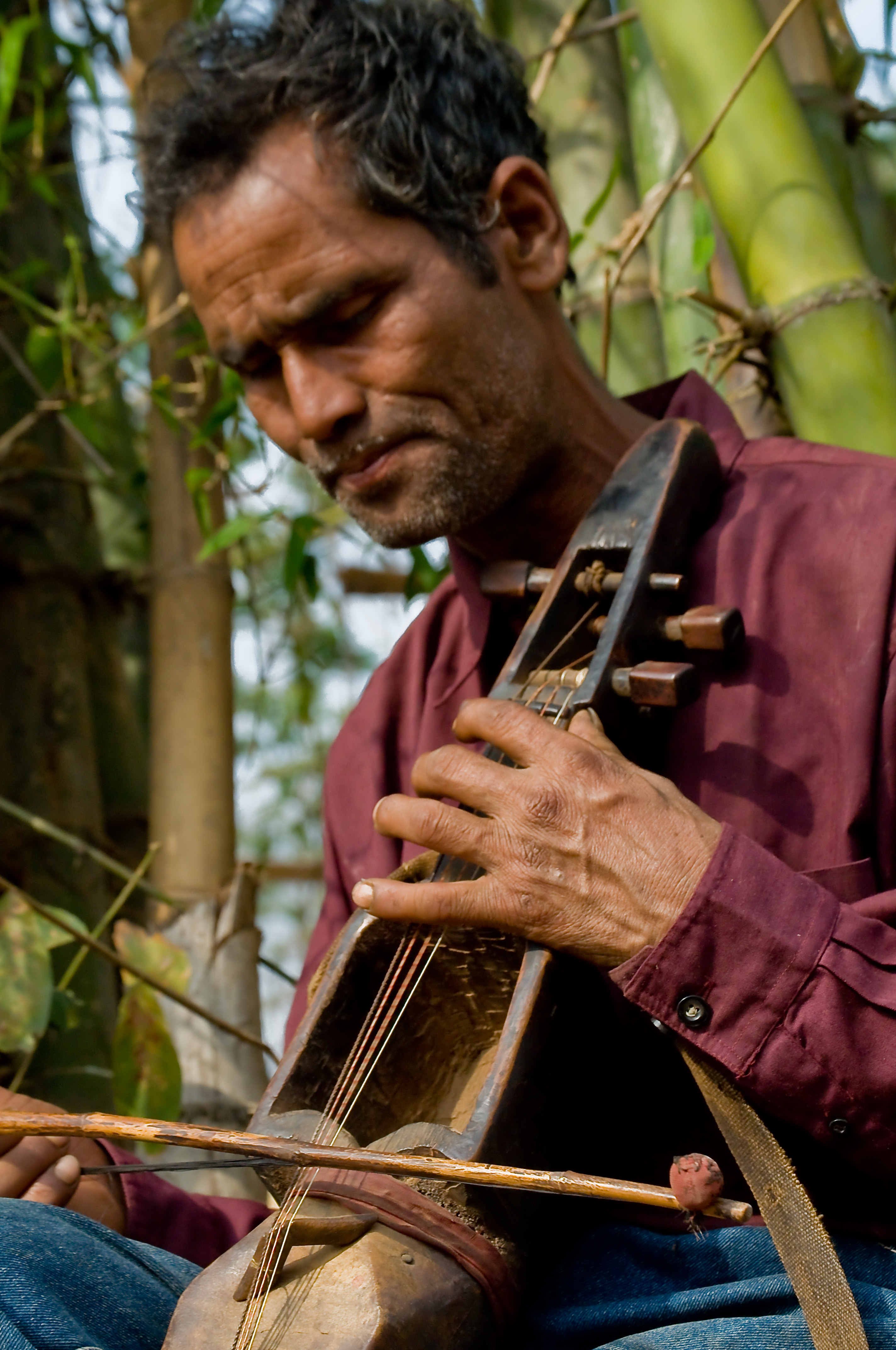
The Gandarbha caste () or Gaine () are a tribal community which belongs to the Indo-Aryans, Indo-Aryan ethnic group from the central, hilly region of Nepal. They have also been called a "caste of professional musicians" and "itinerant bards." By tradition they make their living by singing Gandarbha Geet or Gaine Geet, a type of folk song. The Gandarbhas traditionally work as travelling musicians and play traditional folk and historical songs. They improvise songs too, incorporating news into them as a service, in return for which they receive donations of food or other things. They use the ''sarangi (Nepal), Nepali sarangi'', a type of violin, as their main musical instrument. The ''sarangi'' has been an iconic musical instrument identified with the Gandarbha people. The instrument has replaced another instrument they played, the aarbajo, which was larger and "more cumbersome." They speak their own language which is called Parse kura. Due to many caste-based discriminations in Ne ... [...More Info...] [...Related Items...] OR: [Wikipedia] [Google] [Baidu] |
Sarangi (Nepal)
The Nepali Sarangi () is a Nepali folk instrument. It is a chordophone played by bowing. Traditionally in Nepal, the Sarangi was only played by people of Gandarbha or Gaine caste (both contested and interchangeable terms), who sing narrative tales and folk song, however, in present days, its popularity extends beyond the Gandharba community and is widely used and played by other caste members as well. It has also garnered much interest in other music genres, such as Nepali rock and film music. While the Sarangi has become the quintessential Gandharba instrument, its counterpart, the ''arbajo'',. ''... one of the most important of these rites is puja 'worship' performed to music of the sararigi and the arbajo, believed to be its predecessor.'' which is a plucked lute, has fallen into obscurity. Construction Traditional Nepali Sarangi is not standardized with regards to shape, construction materials, or scale or key. It is made up of a single piece of wood. Having a neck and ho ... [...More Info...] [...Related Items...] OR: [Wikipedia] [Google] [Baidu] |
Aarbajo
The arbajo () is a Nepali four-string lute used as a rhythm instrument (Tālabājā ()). It is the traditional instrument of the Gandarbha caste of musical performers, and is considered a companion to the Nepali sarangi. The Gandarbhas consider the aarbajo to be the "male instrument", the sarangi the "female." The aarbajo is used less than in the past, and been replaced by the sarangi, which was considered in 1999 to have superseded the aarbajo in common use.. ''... one of the most important of these rites is puja 'worship' performed to music of the sararigi and the arbajo, believed to be its predecessor.''. "...ancestry are not confined to the damai, but are prevalent in the folklore of other Indo-Nepalese occupational castes. ... always accompanied by the cow's hoof, which became the (now extinct) plucked lute arbajo" (Helffer 1977:51)... The instrument has historically been played by Gandarbha performers at festivals, such as the "Chaiteti" festival. Although considered the old ... [...More Info...] [...Related Items...] OR: [Wikipedia] [Google] [Baidu] |
Sarangi Music By Balaram Gandarbha
The sārangī is a bowed, short-necked three-stringed instrument played in traditional music from South Asia – Punjabi folk music, Rajasthani folk music, Sindhi folk music, Haryanvi folk music, Braj folk music, and Boro folk music (there known as the ''serja'') – in Pakistan, South India and Bangladesh. It is said to most resemble the sound of the human voice through its ability to imitate vocal ornaments such as ''Gamaks or Gamakam'' (shakes) and ''meends'' (sliding movements). The Nepali sarangi is similar but is a folk instrument, unornate and four-stringed. Playing The repertoire of ''sarangi'' players is traditionally very closely related to vocal music. Nevertheless, a concert with a solo sarangi as the main item will sometimes include a full-scale ''raag'' presentation with an extensive ''alap'' (the unmeasured improvisatory development of the raga) in increasing intensity (''alap'' to ''jor'' to ''jhala'') and several compositions in increasing tempo called ... [...More Info...] [...Related Items...] OR: [Wikipedia] [Google] [Baidu] |
Bardiya District
Bardiya District (), one of the seventy-seven Districts of Nepal, is part of Lumbini Province of Nepal. The district, with Gulariya as its headquarters, covers an area of and according to the 2001 census the population was 382,649 in 2011 it has 426,576. Geography and climate Bardiya lies in Lumbini Province in midwestern Nepal. It covers 2025 square kilometers and lies west of Banke District, south of Surkhet District of Karnali Province, east of Kailali District of Sudurpashchim Province. To the south lies Uttar Pradesh, India. Most of Bardiya is in the fertile '' Terai'' plains, covered with agricultural land and forest. The northernmost part of the district extends into the ''Churiya'' or '' Siwalik Hills''. Bardiya National Park covers occupies most of the northern half of the district. This park is the largest undisturbed wilderness in Nepal's Terai. It provides forest, grassland and riverine habitat for endangered mammal, bird and reptile species. More than ... [...More Info...] [...Related Items...] OR: [Wikipedia] [Google] [Baidu] |
Banke District
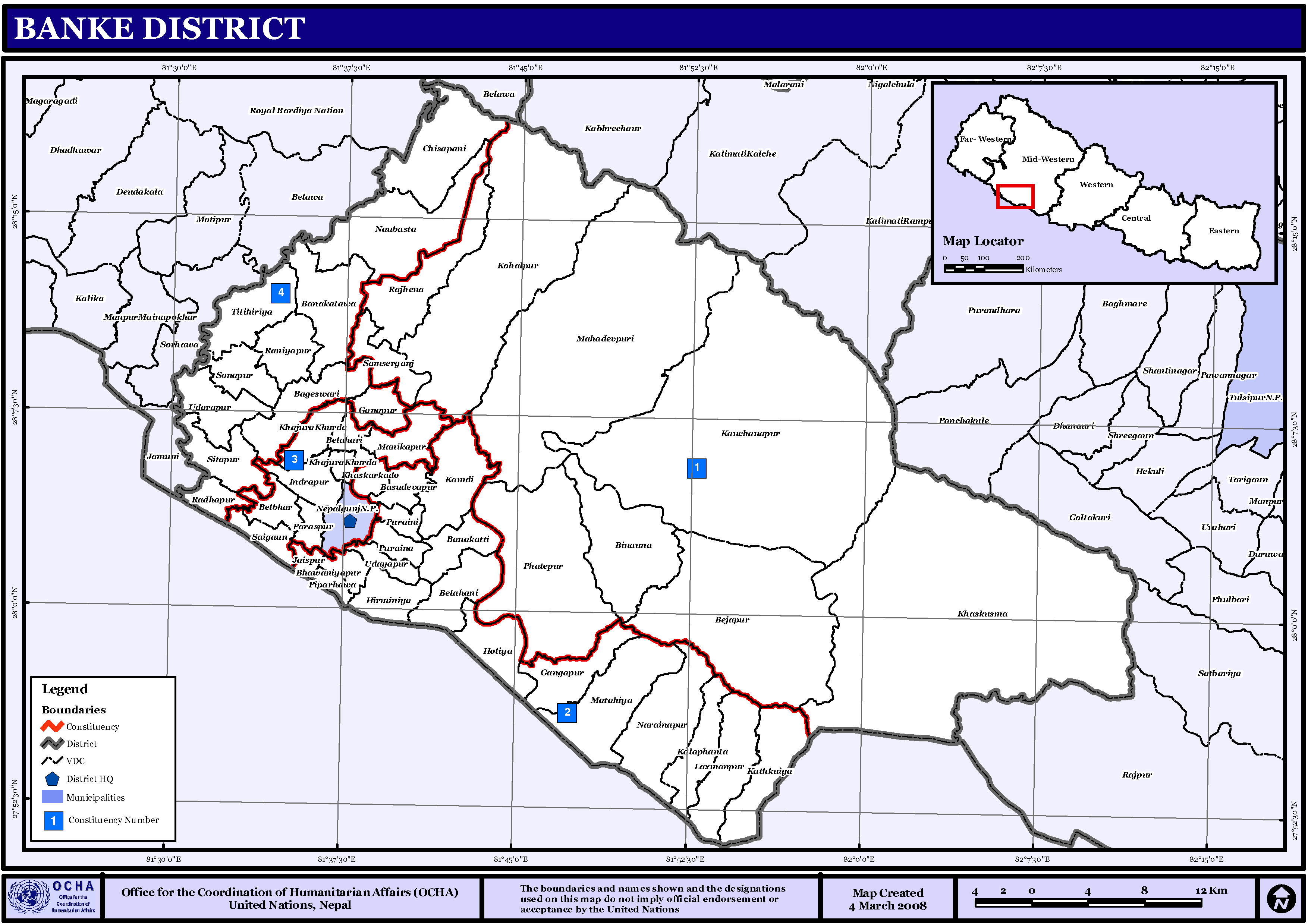
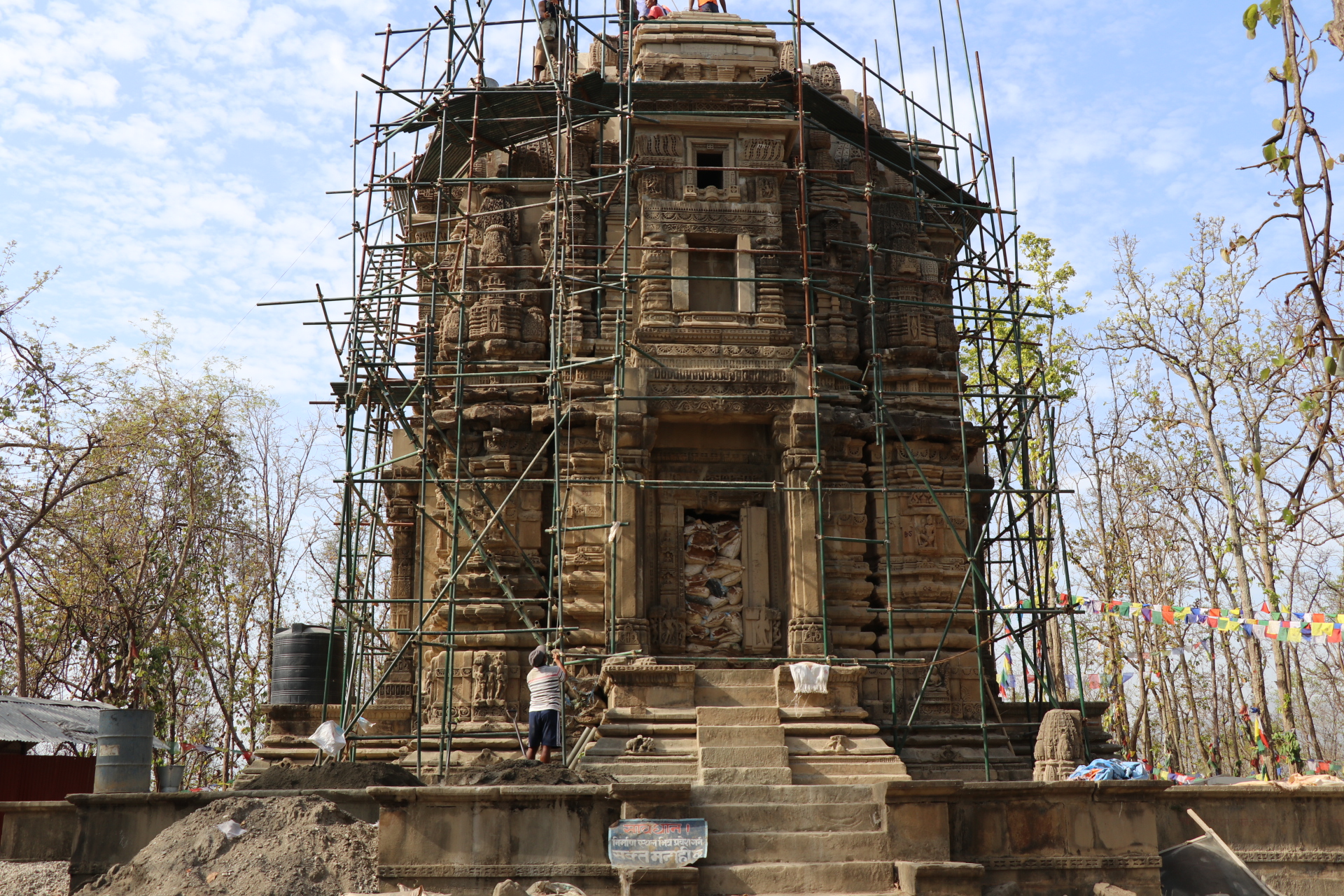
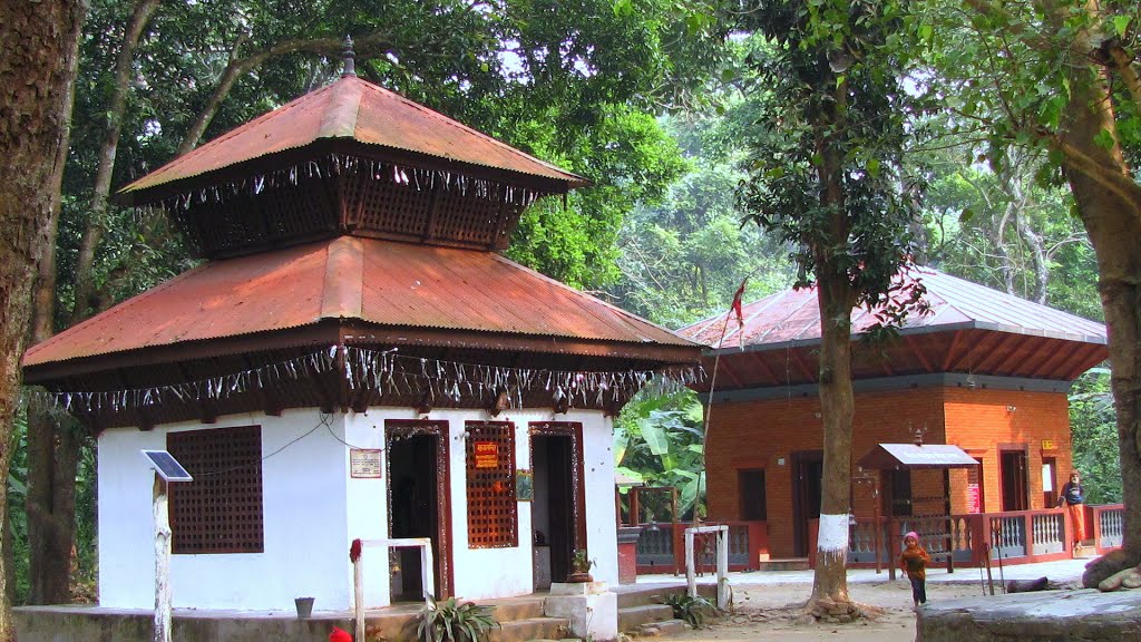
Banke District (; , a part of Lumbini Province, is one of the 77 districts of Nepal. The district, located in midwestern Nepal with Nepalganj as its district headquarters, covers an area of and had a population of 385,840 in 2001 and 491,313 in 2011. There are three main cities in the Banke District: Nepalganj, Kohalpur and Khajura Bajaar. Geography and Climate Banke is bordered on the west by '' Bardiya district''. '' Rapti zone's'' ''Salyan'' and '' Dang Deukhuri Districts'' border to the north and east. To the south lies ''Uttar Pradesh'', India, a country in Asia; specifically ''Shravasti'' and '' Bahraich districts'' of ''Awadh''. East of Nepalganj the international border follows the southern edge of the '' Dudhwa Range'' of the ''Siwaliks''. Most of the district is drained by the ''Rapti'', except the district's western edge is drained by the ''Babai''. Rapti and Babai cross into Uttar Pradesh, a state in India, Nepal's neighboring country and eventually join the ... [...More Info...] [...Related Items...] OR: [Wikipedia] [Google] [Baidu] |
Arghakhanchi District
Arghakhanchi ( ) is one of the districts of Lumbini Province in Nepal. The district headquarter is Sandhikharka. The district covers an area of and has a population (2011) of 197,632. Its neighboring districts are Palpa in the east, Gulmi in the north, Kapilvastu District in the south and Pyuthan in the west. The district also covers 4.18 km of road connecting Kapilvastu and Bhalubang, Lalmatiya, Dang with Rapti River as Mahendra Highway or Easy-West Highway. History The district consists of two pre-unification principalities Argha and Khanchi. Argha (Nepali:अर्घा) was the name given to ritual offerings made at the former principality's main Bhagwati Temple. Khanchi may come from the word Khajanchi (Nepali:खजाञ्चि) or tax collector since the center of the latter principality was known for its tax office. Both were two of the Chaubisi rajya (24 principalities) centred in the Gandaki Basin. In 1786 A.D. (1843 BS) during the unification of Nepal the ... [...More Info...] [...Related Items...] OR: [Wikipedia] [Google] [Baidu] |
Surkhet District
Surkhet District (, ) is a district in Karnali Province of mid-western Nepal. Surkhet is one of the ten districts of Karnali located about west of the national capital Kathmandu. The district's area is . It had 288,527 population in 2001 and 350,804 in 2011 which male comprised 169,461 and female 181,381. Its district headquarters, Birendranagar, is the capital of Karnali Province. It is serving as a business hub and document center for Karnali province. According to population, development, road links, landforms, climate, many peoples are migrating here. After becoming province capital developmental activities are boosted and are in peak level. All the governmental works are carried here. Birendranagar is beautiful valley surrounded by hills having moderate climate. Geography and Climate Surkhet Valley is one of the Inner Terai Valleys of Nepal. It borders Achham district of Sudurpashchim, Dailekh and Jajarkot districts to the north, Salyan district to the east, Banke and ... [...More Info...] [...Related Items...] OR: [Wikipedia] [Google] [Baidu] |
Gorkha District
Gorkha District (), a part of Gandaki Province, is one of seventy-seven districts of Nepal, and the fourth largest district of the country in terms of area. It is historically linked with the creation of modern Nepal and the name of the legendary Gorkha soldiers. The district, with Gorkha Municipality (previously known as Prithvi Narayan Municipality) as its district headquarters, covers an area of and has a population of 252,201, according to the 2021 Nepal census. Gorkha district is the site of the Manakamana Temple, as well as Gorakhnath and Gorakh Kali temples. Several major rivers—including the Chepe, Daraudi, Marsyangdi, Budi Gandaki, and Trishuli—run through the district. Origin of the name Myth holds that a saint named Gorakhnath appeared for the first time in Nepal in Gorkha. There remains a cave with his '' paduka'' ('footprint') and a likeness which supports the myth. As the city was established in the place where Sage Gorakhnath appeared, it was named ... [...More Info...] [...Related Items...] OR: [Wikipedia] [Google] [Baidu] |
Chitwan District
Chitwan District (, , ) is one of seventy-seven districts of Nepal, and takes up the southwestern corner of Bagmati Province. Bharatpur, largest city of Nepal after Kathmandu, is its administrative centre. It covers , and in 2011 had a population of 579,984 (279,087 male and 300,897 female) people. Bharatpur is the commercial and service centre of South Central Nepal and a major destination for higher education, health care and transportation in the region. Chitwan lies in the Terai region of Nepal. It is in the drainage basin of the Gandaki River and is roughly triangular, taking that river as its meandering northwestern border, and a modest watershed border, with India, as the basis of its southern limit. Local government: Bharatpur Metropolitan, Rapti Municipality, Ratnanagar Municipality, Kalika Municipality, Khairahani Municipality, Madi Municipality, Ikshyakamana Gaupalika History The district takes its name from the Chitwan Valley, one of Nepal's Inner Terai valleys ... [...More Info...] [...Related Items...] OR: [Wikipedia] [Google] [Baidu] |


