|
Gamma Island (Greenland)
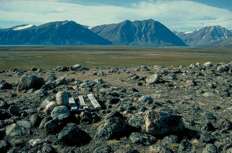
Gamma Island () also known as Bjornesk Island is a large uninhabited island of the Greenland Sea, Greenland. The island has an area of 236 km2 and an elevation of 293 meters. It lies south of Jokel Bay and southwest of the Danske Islands and is separated from the mainland by the Orleans Sound, on the other side of which lies Nordmarken. History Gamma Island was named by the Mørkefjord expedition 1938–39 after the name of ship "Gamma" used by the expedition. See also *List of islands of Greenland *Mylonite *Cataclasite References Uninhabited islands of Greenland {{Greenland-geo-stub ... [...More Info...] [...Related Items...] OR: [Wikipedia] [Google] [Baidu] |
Greenland Sea
The Greenland Sea ( Danish: ''Grønlandshavet'') is a body of water that borders Greenland to the west, the Svalbard archipelago to the east, Fram Strait and the Arctic Ocean to the north, and the Norwegian Sea and Iceland to the south. The Greenland Sea is often defined as part of the Arctic Ocean, sometimes as part of the Atlantic Ocean. However, definitions of the Arctic Ocean and its seas tend to be imprecise or arbitrary. In general usage the term "Arctic Ocean" would exclude the Greenland Sea. In oceanographic studies the Greenland Sea is considered part of the Nordic Seas, along with the Norwegian Sea. The Nordic Seas are the main connection between the Arctic and Atlantic oceans and, as such, could be of great significance in a possible shutdown of thermohaline circulation. In oceanography the Arctic Ocean and Nordic Seas are often referred to collectively as the "Arctic Mediterranean Sea", a marginal sea of the Atlantic. The sea has Arctic climate with regular northe ... [...More Info...] [...Related Items...] OR: [Wikipedia] [Google] [Baidu] |
Greenland
Greenland is an autonomous territory in the Danish Realm, Kingdom of Denmark. It is by far the largest geographically of three constituent parts of the kingdom; the other two are metropolitan Denmark and the Faroe Islands. Citizens of Greenland are full Danish nationality law, citizens of Denmark and European Union citizenship, of the European Union. Greenland is one of the Special territories of members of the European Economic Area#Overseas countries and territories, Overseas Countries and Territories of the European Union and is part of the Council of Europe. It is the List of islands by area, world's largest island, and lies between the Arctic Ocean, Arctic and Atlantic oceans, east of the Arctic Archipelago, Canadian Arctic Archipelago. It is the location of the northernmost point of land in the world; Kaffeklubben Island off the northern coast is the world's Northernmost point of land, northernmost undisputed point of land—Cape Morris Jesup on the mainland was thought to ... [...More Info...] [...Related Items...] OR: [Wikipedia] [Google] [Baidu] |
Northeast Greenland National Park
Northeast Greenland National Park (, ) is the world's largest national park and the 10th largest protected area (the only larger protected areas consist mostly of sea). Established in 1974, the Northeast Greenland national park expanded to its present size in 1988. It protects of the interior and northeastern coast of Greenland and is larger than the area of Tanzania, but smaller than that of Egypt. This means that the national park is bigger than 166 of the world's 195 countries. It was the first national park to be created in the Kingdom of Denmark and remains Greenland's only national park. It is the northernmost national park in the world and the second-largest by area of any second-level subdivision of any country in the world, trailing only the Qikiqtaaluk Region in Nunavut, Canada. Geography The park shares borders, largely laid out as straight lines, with the Sermersooq municipality in the south and with the Avannaata municipality in the west, partly along the 45° ... [...More Info...] [...Related Items...] OR: [Wikipedia] [Google] [Baidu] |
Jokel Bay
Jokel may refer to: * Jokel Bay, bay in NE Greenland * Borg Jokel, a glacier in NE Greenland *''J-ok'el ''J-ok'el'' is a 2007 Mexico, Mexican supernatural horror film directed by Benjamin Williams. This film was Williams' debut. Plot An American man travels to a small town in Chiapas, Mexico called San Cristobal de las Casas, to help his mother wh ...'', a 2007 Mexican horror movie * Jaroslav Jokeľ, Slovak weightlifter * Oliver Jokeľ, Slovak ice-hockey player See also * Joeckel * Jökull (other) {{disambiguation, surname ... [...More Info...] [...Related Items...] OR: [Wikipedia] [Google] [Baidu] |
Danske Islands
Danske Islands, ; meaning 'Danish Islands', is an island group of the Greenland Sea, NE Greenland. The islands are uninhabited. Administratively they belong to the Northeast Greenland National Park. Name conflict This island group was named by John Haller during the 1956–1958 Expedition to East Greenland led by Lauge Koch, to pay tribute to the work of the 1906–08 Denmark expedition. Previously the Duke of Orléans in 1905 had given the name "Îles Françaises" to an island group further north, approximating to the position of the present Franske Islands. A few years later the 1906–08 Denmark expedition had transferred the name "Franske Islands" to that position, corresponding to the northernmost islands the Duke of Orléans Arctic Expedition could have seen. A number of maps, such as the World Aeronautical Charts of 1952, among others, retain the outdated names for this island group located further south —"Franske Islands" or ''Îles Françaises''. Geography The ... [...More Info...] [...Related Items...] OR: [Wikipedia] [Google] [Baidu] |
Mørkefjord Expedition
The Mørkefjord expedition of 1938–1939 was sent out by Alf Trolle, Ebbe Munck, and Eigil Knuth in order to continue the work of the Denmark Expedition. It was an exploratory expedition to Northeast Greenland led by Eigil Knuth and had been planned to last from 1938 to 1939. It was affected by the outbreak of World War II. History There had been a previous expedition to Northeast Greenland led by Johan Peter Koch in 1913; the Mørkefjord Expedition. – which Alfred Wegener had been a part of.Mott, T. Greene. (2016). ''Alfred Wegener: Science, Exploration, and the Theory of Continental Drift''. JHU Press. p. 143. Eigil Knuth arrived in Greenland with his co-leader and friend, Ebbe Munck, on 19 June 1938. The other expedition members were botanist Paul Gelting, Alf Trolle, and five more men. The expedition made use of an aircraft – a Tiger Moth. The expedition members began by building a scientific station north of the mouth of the Mørkefjord, west of Hvalrosodden. It wa ... [...More Info...] [...Related Items...] OR: [Wikipedia] [Google] [Baidu] |
Operational Navigation Chart B-9, 1st Edition
An operational definition specifies concrete, replicable procedures designed to represent a construct. In the words of American psychologist S.S. Stevens (1935), "An operation is the performance which we execute in order to make known a concept." For example, an operational definition of "fear" (the construct) often includes measurable physiologic responses that occur in response to a perceived threat. Thus, "fear" might be operationally defined as specified changes in heart rate, electrodermal activity, pupil dilation, and blood pressure. Overview An operational definition is designed to model or represent a concept or theoretical definition, also known as a construct. Scientists should describe the operations (procedures, actions, or processes) that define the concept with enough specificity such that other investigators can replicate their research. Operational definitions are also used to define system states in terms of a specific, publicly accessible process of preparation ... [...More Info...] [...Related Items...] OR: [Wikipedia] [Google] [Baidu] |
List Of Islands Of Greenland
The following is an alphabetical list of the islands of Greenland. Many of these islands have both a Kalaallisut language name and a Indo-European languages, European language name. Islands and archipelagoes *Aaluik *Aasiaat *Achton Friis Islands *Aggas *Akilia *Alluttoq Island *Aluk Island *Ammassalik Island *Appat Island *Apusiaajik Island *ATOW1996 *Beaumont Island (Greenland), Beaumont Island *Bjorne Island *Bjorne Islands *Bonsall Islands *Bontekoe Island *Borup Island (West Jensen Island) *Brainard Island *Bushnan Island *Cape Farewell Archipelago **Annikitsoq **Anoraliuirsoq **Avallersuaq **Egger Island **Ikeq Island **Nunarsuaq (Nunarssuak) **Pamialluk **Qernertoq **Sammisoq **Saningassoq **Walkendorff Island *Carey Islands *Castle Island, Greenland *Clavering Island *Crown Prince Islands *Crozier Island *Danmark Island *Danske Islands *Deception Island (Greenland) *Diego's Island *Djævleøen *Dog's Island *Edward Island *Elison Island *Ella Island *Ensomheden *Finsch ... [...More Info...] [...Related Items...] OR: [Wikipedia] [Google] [Baidu] |
Mylonite
Mylonite is a fine-grained, compact metamorphic rock produced by dynamic recrystallization of the constituent minerals resulting in a reduction of the grain size of the rock. Mylonites can have many different mineralogical compositions; it is a classification based on the textural appearance of the rock. Formation Mylonites are ductilely deformed rocks formed by the accumulation of large shear strain, in ductile fault zones. There are many different views on the formation of mylonites, but it is generally agreed that crystal-plastic deformation must have occurred, and that fracturing and cataclastic flow are secondary processes in the formation of mylonites. Mechanical abrasion of grains by milling does not occur, although this was originally thought to be the process that formed mylonites, which were named from the Greek μύλος ''mylos'', meaning mill. Mylonites form at depths of no less than 4 km. There are many different mechanisms that accommodate crystal-plastic ... [...More Info...] [...Related Items...] OR: [Wikipedia] [Google] [Baidu] |
Cataclasite
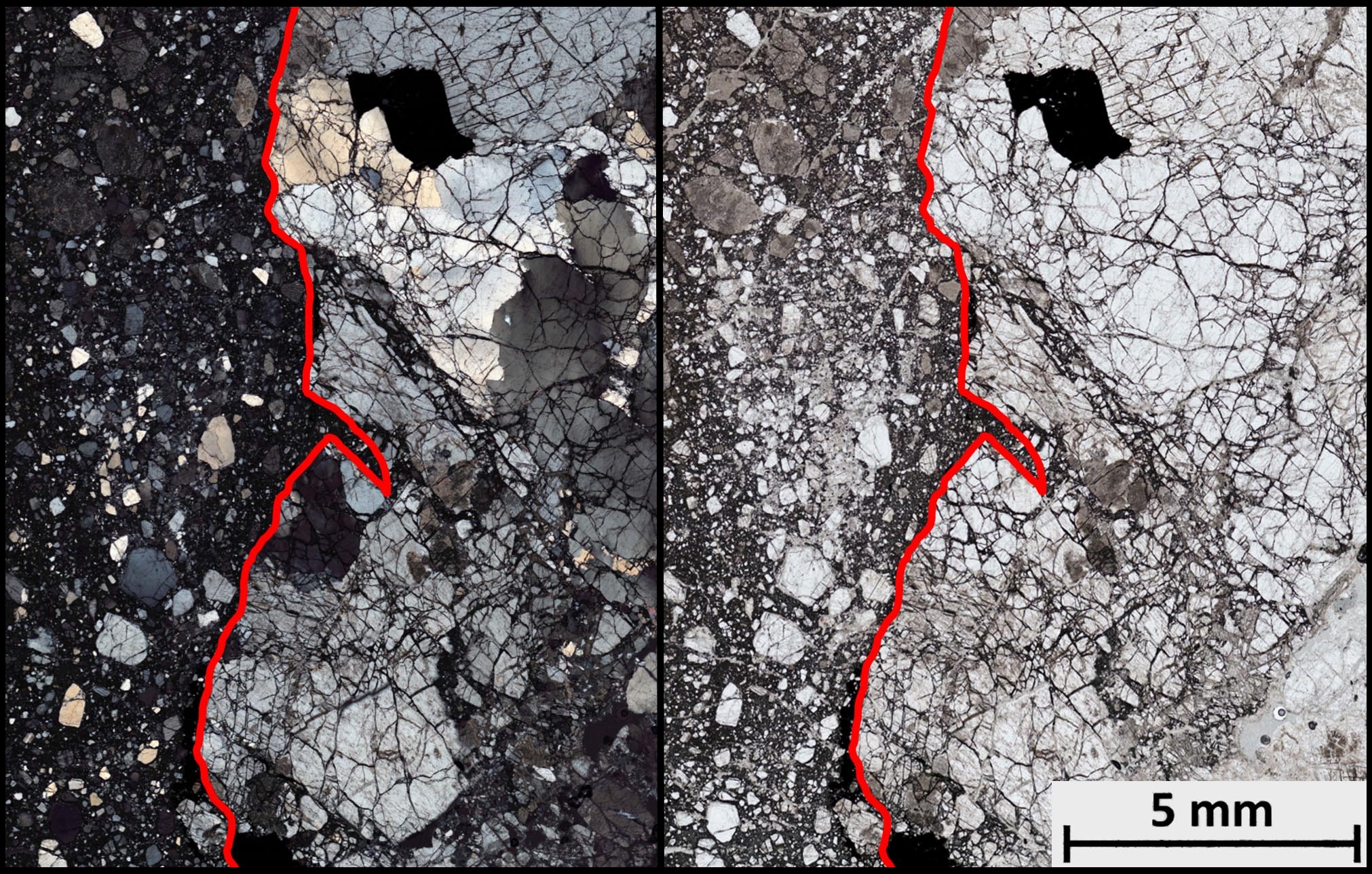
Cataclasite is a cohesive granular Fault (geology)#Fault rock, fault rock. Comminution, also known as cataclasis, is an important process in forming cataclasites. They fall into the category of cataclastic rocks which are formed through faulting or fracturing in the upper Crust (geology), crust. Cataclasites are distinguished from fault gouge, which is incohesive, and fault breccia, which contains coarser fragments. Types Cataclasites are composed of fragments of the pre-existing wall rock as well as a Matrix (geology), matrix consisting of crushed microfragments, which cohesively holds the rock together. There are different types of classification schemes for cataclasites in the fault rock literature. The original classification scheme by Sibson classifies them by their proportion of fine-grained matrix to angular fragments. The term fault breccia is used for describing a cataclasite with coarser grains. A fault breccia is a cataclastic rock with clasts that are larger t ... [...More Info...] [...Related Items...] OR: [Wikipedia] [Google] [Baidu] |


