|
Gainsthorpe
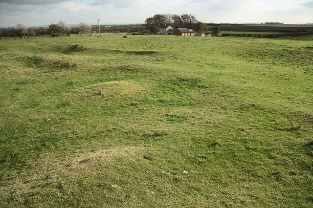
Gainsthorpe is a Deserted Medieval Village, deserted medieval village site in a field which is part of the present Gainsthorpe Farm in Lincolnshire, England. The site is in Hibaldstow civil parish located on a minor road west of the A15 road (Great Britain), A15 road, south of Hibaldstow and south-west of Brigg, North Lincolnshire, Brigg. Gainsthorpe DMV It is now in the care of English Heritage. There is a small car park from where a footpath of about leads to the site. The typical medieval layout of Sunken lane, sunken roads and raised rectangular Croft and toft, tofts and crofts is clearly seen in the earthworks (archaeology), humps and hollows of the field. References External links History, research and visiting information:English Heritage {{Authority control Deserted medieval villages in Lincolnshire Tourist attractions in Lincolnshire English Heritage sites in Lincolnshire Archaeological sites in Lincol ... [...More Info...] [...Related Items...] OR: [Wikipedia] [Google] [Baidu] |
Hibaldstow
Hibaldstow is a village and Civil parishes in England, civil parish in North Lincolnshire, England. The population of the civil parish at the 2011 census was 2,433. It is situated on the B1206 road, south from Brigg and the M180 motorway, M180. The site of the deserted medieval village of Gainsthorpe is nearby. History Hibaldstow was founded as a Roman legionary 'roadside fort' on Ermine Street, the road from Lincoln, Lincolnshire, Lincoln to the Humber; later it became a posting station. The earliest evidence for occupation suggests a date in the late first century. Occupation continued into the late fourth century. There is no Iron Age settlement evidence from the Roman site itself. The village name derives from Hybald, Saint Hybald – a Northumbrian missionary who came to the area in the latter part of the 7th century. Described as a 'shadowy figure' the missionary became Abbot of Bardney and later a saint. Three churches around the village – then known as Ceceseg – be ... [...More Info...] [...Related Items...] OR: [Wikipedia] [Google] [Baidu] |
Deserted Medieval Village
In the United Kingdom, a deserted medieval village (DMV) is a former settlement which was abandoned during the Middle Ages, typically leaving no trace apart from earthworks or cropmarks. If there are fewer than three inhabited houses the convention is to regard the site as deserted; if there are more than three houses, it is regarded as a shrunken medieval village. There are estimated to be more than 3,000 DMVs in England alone. Other deserted settlements Not all sites are medieval: villages reduced in size or disappeared over a long period, from as early as Anglo-Saxon times to as late as the 1960s, due to numerous different causes. Reasons for desertion Over the centuries, settlements have been deserted as a result of natural events, such as rivers changing course or silting up, flooding (especially during the wet 13th and 14th centuries) as well as coastal and estuarine erosion or being overwhelmed by windblown sand. Many were thought to have been abandoned due to the ... [...More Info...] [...Related Items...] OR: [Wikipedia] [Google] [Baidu] |
A15 Road (Great Britain)
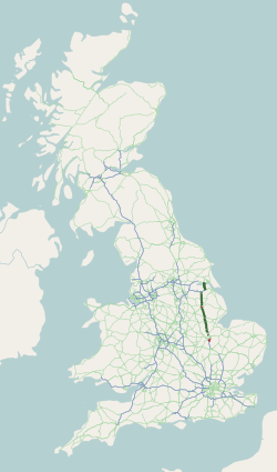
The A15 is a major road in England. It runs north from Peterborough via Market Deeping, Bourne, Sleaford and Lincoln along a variety of ancient, Roman, and Turnpike alignments before it is interrupted at its junction with the M180 near Scawby. The road restarts east, and then continues north past Barton-upon-Humber, crossing the Humber on the Humber Bridge before terminating at Hessle near Kingston upon Hull. Driving conditions According to the AA, the route is long and should take 2 hours. Norman Cross to Bourne takes 33 minutes, Bourne to Lincoln takes 46 minutes, and Lincoln to the Humber Bridge takes 54 minutes. A section of the A15 (between Scampton and the M180) provides the longest stretch of straight road in the UK. Route Peterborough The A15 is Peterborough's main connecting road from the south to the A1(M), joining near Stilton, at Norman Cross. It begins as ''London Road'' at junction 16 of the A1(M) with the B1043 (former A1) in Cambridgeshir ... [...More Info...] [...Related Items...] OR: [Wikipedia] [Google] [Baidu] |
Lincolnshire
Lincolnshire (), abbreviated ''Lincs'', is a Ceremonial counties of England, ceremonial county in the East Midlands and Yorkshire and the Humber regions of England. It is bordered by the East Riding of Yorkshire across the Humber estuary to the north, the North Sea to the east, Norfolk, Cambridgeshire, Northamptonshire and Rutland to the south, and Leicestershire, Nottinghamshire and South Yorkshire to the west. The county is predominantly rural, with an area of and a population of 1,095,010. After Lincoln (104,565), the largest towns are Grimsby (85,911) and Scunthorpe (81,286). For Local government in England, local government purposes Lincolnshire comprises a non-metropolitan county with seven districts, and the unitary authority areas of North Lincolnshire and North East Lincolnshire. The last two areas are part of the Yorkshire and the Humber region, and the rest of the county is in the East Midlands. The non-metropolitan county council and two unitary councils collabora ... [...More Info...] [...Related Items...] OR: [Wikipedia] [Google] [Baidu] |
Civil Parish
In England, a civil parish is a type of administrative parish used for local government. It is a territorial designation which is the lowest tier of local government. Civil parishes can trace their origin to the ancient system of parishes, which for centuries were the principal unit of secular and religious administration in most of England and Wales. Civil and religious parishes were formally split into two types in the 19th century and are now entirely separate. Civil parishes in their modern form came into being through the Local Government Act 1894 ( 56 & 57 Vict. c. 73), which established elected parish councils to take on the secular functions of the parish vestry. A civil parish can range in size from a sparsely populated rural area with fewer than a hundred inhabitants, to a large town with a population in excess of 100,000. This scope is similar to that of municipalities in continental Europe, such as the communes of France. However, unlike their continental Euro ... [...More Info...] [...Related Items...] OR: [Wikipedia] [Google] [Baidu] |
Brigg, North Lincolnshire
Brigg ( /'brɪg/) is a market town in North Lincolnshire, England, with a population of 5,076 in the 2001 UK census, the population increased to 5,626 at the 2011 census. The town lies at the junction of the River Ancholme and east–west transport routes across northern Lincolnshire. As a formerly important local centre, the town's full name of Glanford Brigg is reflected in the surrounding area and local government district of the same name. The town's urban area includes the neighbouring hamlet of Scawby Brook. History The area of present-day Brigg has been used for thousands of years as both a crossing point of the Ancholme and for access to the river itself. Prehistoric boats of sewn–built and dugout construction have been found in the town, both dating to around 900 BC. A causeway or jetty also stood on the riverside during the late Bronze Age, although its exact use is uncertain. During the Anglo-Saxon period the area became known as ''Glanford''. The second ... [...More Info...] [...Related Items...] OR: [Wikipedia] [Google] [Baidu] |
English Heritage
English Heritage (officially the English Heritage Trust) is a charity that manages over 400 historic monuments, buildings and places. These include prehistoric sites, a battlefield, medieval castles, Roman forts, historic industrial sites, Listed building, listed ruins, and architecturally notable English country houses. The charity states that it uses these properties to "bring the story of England to life for over 10 million people each year". Within its portfolio are Stonehenge, Dover Castle, Tintagel Castle, and the "best-preserved" parts of Hadrian's Wall. English Heritage also manages the London blue plaque scheme, which links influential historical figures to particular buildings. When originally formed in 1983, English Heritage was the operating name of an executive non-departmental public body of the Her Majesty's Government, British Government, officially titled the Historic Buildings and Monuments Commission for England, that ran the national system of heritage prot ... [...More Info...] [...Related Items...] OR: [Wikipedia] [Google] [Baidu] |
Sunken Lane
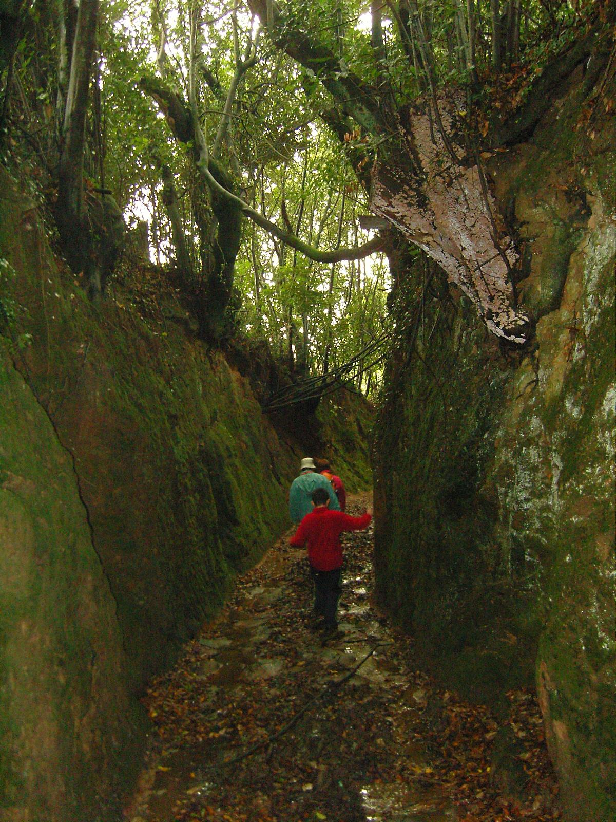
A sunken lane (also hollow way or holloway) is a road or track that is significantly lower than the land on either side, not formed by the (recent) engineering of a road cutting but possibly of much greater age. Holloways may have been formed in various ways, including erosion by water or traffic; the digging of embankments to assist with the herding of livestock; and the digging of double banks to mark the boundaries of estates. Means of formation A variety of theories have been proposed for the origins of holloways. Different mechanisms may well apply in different cases. Erosion Some sunken lanes are created incrementally by erosion, by water and traffic. Some are ancient, with evidence of Roman or Iron Age origins, but others such as the Deep Hill Ruts in the old Oregon Trail at Guernsey, Wyoming, developed in the space of a decade or two. Where ancient trackways have lapsed from use, the overgrown and shallow marks of hollow ways through forest may be the sole evidence ... [...More Info...] [...Related Items...] OR: [Wikipedia] [Google] [Baidu] |
Croft And Toft
Croft may refer to: Occupations * Croft (land), a small area of land, often with a crofter's dwelling * Crofting, small-scale food production * Bleachfield, an open space used for the bleaching of fabric, also called a croft Locations In the United Kingdom *Croft, Cheshire, in the Borough of Warrington *Croft, Leicestershire * Croft, Lincolnshire * Croft, Herefordshire **Croft Castle, Herefordshire *Croft-on-Tees, North Yorkshire * Croft (Aberdeenshire castle), a former keep in Scotland * The Croft, a listed house in Totteridge, Barnet *Croft Circuit, a motor racing circuit in northeast England In the United States * Croft, California, in El Dorado County * Croft, Kansas People * Croft (surname) * Crofts (surname) See also * Crofts End, Bristol *Crofton, Cumbria *Crofton, British Columbia * Ashcroft (other) *Undercroft An undercroft is traditionally a cellar or storage room, often brick-lined and Vault (architecture), vaulted, and used for storage in buildings s ... [...More Info...] [...Related Items...] OR: [Wikipedia] [Google] [Baidu] |
Earthworks (archaeology)
In archaeology, earthworks are artificial changes in land level, typically made from piles of artificially placed or sculpted rocks and soil. Earthworks can themselves be archaeological features, or they can show features beneath the surface. Types There are two broad categories of archaeological earthwork: positive features where earth is built up above the previous ground level, and negative features which are cut into the landscape. Beyond this, earthworks of interest to archaeologists include hill forts, henges, mounds, platform mounds, effigy mounds, enclosure (archaeology), enclosures, long barrows, tumulus, tumuli, ridge and furrow, motte-and-bailey castle, mottes, round barrows, and other tombs. * Hill forts, a type of fort made out of mostly earth and other natural materials including sand, straw, and water, were built as early as the late Stone Age and were built more frequently during the Bronze Age and Iron Age as a means of protection. See also Oppidum. * Henge eart ... [...More Info...] [...Related Items...] OR: [Wikipedia] [Google] [Baidu] |
Deserted Medieval Villages In Lincolnshire
{{disambig ...
Deserted may refer to: *Desertion, the act of abandoning or withdrawing support from an entity to which one has given. This most commonly refers to a military desertion. * ''Deserted'' (film), a 2016 film *"Deserted", a song by Blind Melon from their 1992 album ''Blind Melon'' *''Deserted'', a 2019 album by the Mekons The Mekons are a British Post-punk band formed in 1976 as an art collective. They are one of the longest-running and most prolific of the first-wave British punk rock bands. The band's style has evolved over time to incorporate aspects of co ... [...More Info...] [...Related Items...] OR: [Wikipedia] [Google] [Baidu] |


