|
Gachalá
Gachalá is a municipality and town of Colombia in the Guavio Province, part of the department of Cundinamarca. The urban centre of Gachalá is situated at a distance of from the capital Bogotá at an altitude of in the Eastern Ranges of the Colombian Andes. The municipality borders the western portion of the split municipality Ubalá and the department of Boyacá in the north, the eastern part of Ubalá and Medina in the east, Fómeque, Junín and Gama in the west and Fómeque, Medina and the department of Meta in the south. Etymology The name of Gachalá is derived from Chibcha and means "clay vessel of the night" or "defeat of the night". History Before the Spanish conquest of the Muisca, Gachalá was inhabited by the Chío tribe, belonging to the Muisca. As of 1548, the terrain of Gachalá belonged to the ''cacique'' of Guatavita. Modern Gachalá was founded on February 22, 1810, by Mariano de Mendoza y Bueno. Economy Main economical activity in Gachalá is the h ... [...More Info...] [...Related Items...] OR: [Wikipedia] [Google] [Baidu] |
Gachalá Emerald
The Gachalá Emerald, one of the most valuable and famous emeralds in the world, was found in 1967, in the mine called Vega de San Juan, located in Gachala, a town in Colombia, located from Bogota. Gachalá Chibcha means "place of Gacha." Presently the emerald is in the United States, where it was donated to the Smithsonian Institution by the New York City jeweler, Harry Winston. Symbolism The emerald was named in honor of Gachalá, the municipality of Cundinamarca where it was found. Ficha técnica de la Esmeralda Gachalá de la página web oficial del Smithsonian Institution of Washington, (Consulted on 06-19-2011) Characteristics * Shape: Emerald * Color: Intense green * Carats: 858 Carats * Weight: 172 grams * Size: 5 centimeters * Year of extraction: 1967 Conservation The emerald is part of the permanent collection of the Smithsonian Institution in Washington, D.C. It was donated in 1969 by the American jeweler Harry Winston, and is labeled under number 122078 ... [...More Info...] [...Related Items...] OR: [Wikipedia] [Google] [Baidu] |
Gonzalo Correal Urrego
Gonzalo Correal Urrego ( Gachalá, Colombia, 23 October 1939) is a Colombian anthropologist, palaeontologist and archaeologist.Curriculum Vitae Gonzalo Correal Urrego He has been contributing to the knowledge of prehistoric Colombia for over forty years and has published in Spanish and English.List of publications by Gonzalo Correal Urrego - WorldCat Correal Urrego is considered one of the most important anthropologists of Colombia. He has collaborated ... [...More Info...] [...Related Items...] OR: [Wikipedia] [Google] [Baidu] |
Guavio Province
The Guavio Province ( es, Provincia del Guavio) is one of the 15 provinces in the Cundinamarca department, Colombia. Guavio borders the Capital District of Bogotá and the Central Savanna Province to the west, to the north the Almeidas Province, to the east the Boyacá Department and Medina Province and to the south the Meta Department and the Eastern Province. The Alberto Lleras Dam is also located in this area. The eastern municipalities Gachalá and Ubalá are rich in emeralds. Subdivision Guavio Province is subdivided into 8 municipalities A municipality is usually a single administrative division having corporate status and powers of self-government or jurisdiction as granted by national and regional laws to which it is subordinate. The term ''municipality'' may also mean the ...: [...More Info...] [...Related Items...] OR: [Wikipedia] [Google] [Baidu] |
Colombian Emeralds
Emeralds are green precious gemstones that are mined in various geological settings. They are minerals in the beryl group of silicates. For more than 4,000 years, emeralds have been among the most valuable of all jewels. Colombia, located in northern South America, is the country that mines and produces the most emeralds for the global market, as well as the most desirable. It is estimated that Colombia accounts for 70–90% of the world's emerald market. While commercial grade emeralds are quite plentiful, fine and extra fine quality emeralds are extremely rare. Colombian emeralds over 50 carat can cost much more than diamonds of the same size. The Colombian departments of Boyacá and Cundinamarca, both in the Eastern Ranges of the Colombian Andes, are the locations where most of the emerald mining takes place. Although the Colombian emerald trade has a rich history that dates as far back as the pre-Columbian era, the increase in worldwide demand for the industry of the gem ... [...More Info...] [...Related Items...] OR: [Wikipedia] [Google] [Baidu] |
Guavio Reservoir
The Guavio Province ( es, Provincia del Guavio) is one of the 15 provinces in the Cundinamarca department, Colombia. Guavio borders the Capital District of Bogotá and the Central Savanna Province to the west, to the north the Almeidas Province, to the east the Boyacá Department and Medina Province and to the south the Meta Department and the Eastern Province. The Alberto Lleras Dam is also located in this area. The eastern municipalities Gachalá and Ubalá are rich in emeralds. Subdivision Guavio Province is subdivided into 8 municipalities A municipality is usually a single administrative division having corporate status and powers of self-government or jurisdiction as granted by national and regional laws to which it is subordinate. The term ''municipality'' may also mean the go ...: [...More Info...] [...Related Items...] OR: [Wikipedia] [Google] [Baidu] |
Municipalities Of Colombia
The Municipalities of Colombia are decentralized subdivisions of the Republic of Colombia. Municipalities make up most of the departments of Colombia with 1,122 municipalities ('' municipios''). Each one of them is led by a mayor (''alcalde'') elected by popular vote and represents the maximum executive government official at a municipality level under the mandate of the governor of their department which is a representative of all municipalities in the department; municipalities are grouped to form departments. The municipalities of Colombia are also grouped in an association called the ''Federación Colombiana de Municipios'' (Colombian Federation of Municipalities), which functions as a union under the private law and under the constitutional right to free association to defend their common interests. Categories Conforming to the law 1551/12 that modified the sixth article of the law 136/94 Article 7 http://www.alcaldiabogota.gov.co/sisjur/normas/Norma1.jsp?i=48267 the mu ... [...More Info...] [...Related Items...] OR: [Wikipedia] [Google] [Baidu] |
Gama, Cundinamarca
Gama is a municipality and town of Colombia in the Guavio Province, part of the department of Cundinamarca. The urban centre of Gama is situated at an altitude of in the Eastern Ranges of the Colombian Andes. Gama, at from the capital Bogotá, borders Gachetá in the north, Junín and Gachalá in the south, Ubalá in the east and Junín in the west. Etymology Gama is derived either from Muysccubun meaning "our back", or from the language of the local Chío tribe; "behind the licked hill", referring to the lake of Guatavita behind the mountains to the northwest. History Before the Spanish conquest of the Muisca, Gama was inhabited by a tribe called the Chío. The first registration of the village was made in 1846, when the church in Ubalá was constructed. Gama was properly founded not earlier than 1903, by Juan Martín Romero. Economy Main economical activity in Gama is agriculture, with predominantly potatoes, beans, peas and maize cultivated. Other products include ... [...More Info...] [...Related Items...] OR: [Wikipedia] [Google] [Baidu] |
Junín, Cundinamarca
Junín is a municipality and town of Colombia in the Guavio Province, part of the department of Cundinamarca. The urban centre is situated at an altitude of in the east of the Altiplano Cundiboyacense. Junín borders Gachetá and Guatavita in the north, Gama and Gachalá in the east, Fómeque in the south, and La Calera and Guasca in the west. Etymology The former name Chipazaque of Junín refers to the shared terrain by the ''zipa'' and '' zaque'', the most important ''caciques'' of the Muisca Confederation. In Muysccubun it means "our father the ''zaque''" or "union between ''zipa'' and ''zaque''". The name Junín was given by Tomas Cipriano de Mosquera in 1861, because the green valleys reminded him of the Pampa de Junín, location of the Battle of Junín in Peru. History Before the Spanish conquest of the Muisca, the green hills of Junín, then called Chipazaque, were a shared terrain between the ''zipa'' of Bacatá and the ''zaque'' of Hunza Hunza may refer to: ... [...More Info...] [...Related Items...] OR: [Wikipedia] [Google] [Baidu] |
Andes
The Andes, Andes Mountains or Andean Mountains (; ) are the longest continental mountain range in the world, forming a continuous highland along the western edge of South America. The range is long, wide (widest between 18°S – 20°S latitude), and has an average height of about . The Andes extend from north to south through seven South American countries: Venezuela, Colombia, Ecuador, Peru, Bolivia, Chile, and Argentina. Along their length, the Andes are split into several ranges, separated by intermediate depressions. The Andes are the location of several high plateaus—some of which host major cities such as Quito, Bogotá, Cali, Arequipa, Medellín, Bucaramanga, Sucre, Mérida, El Alto and La Paz. The Altiplano plateau is the world's second-highest after the Tibetan plateau. These ranges are in turn grouped into three major divisions based on climate: the Tropical Andes, the Dry Andes, and the Wet Andes. The Andes Mountains are the highest mountain ra ... [...More Info...] [...Related Items...] OR: [Wikipedia] [Google] [Baidu] |
Muisca People
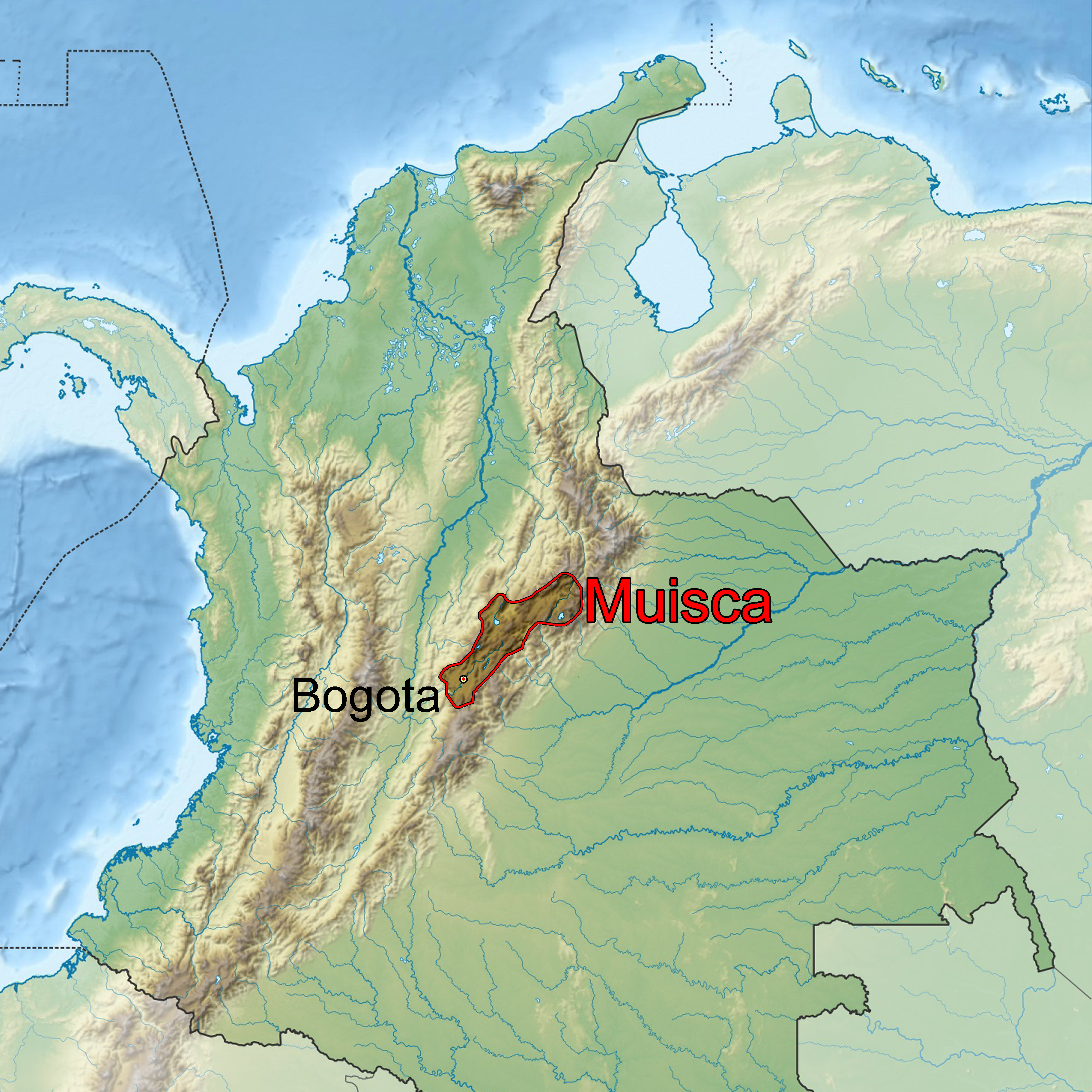
The Muisca (also called Chibcha) are an indigenous peoples of Colombia, indigenous people and Pre-Columbian cultures of Colombia, culture of the Altiplano Cundiboyacense, Colombia, that formed the Muisca Confederation before the Spanish conquest of the Muisca, Spanish conquest. The people spoke Muysccubun, a language of the Chibchan languages, Chibchan language family, also called ''Muysca'' and ''Mosca''. They were encountered by list of conquistadors in Colombia, conquistadors dispatched by the Spanish Empire in 1537 at the time of the Spanish conquest of the Muisca, conquest. Subgroupings of the Muisca were mostly identified by their allegiances to three great rulers: the ''zaque, hoa'', centered in Tunja, Hunza, ruling a territory roughly covering modern southern and northeastern Boyacá Department, Boyacá and southern Santander Department, Santander; the ''zipa, psihipqua'', centered in Bacatá, Muyquytá and encompassing most of modern Cundinamarca Department, Cundinama ... [...More Info...] [...Related Items...] OR: [Wikipedia] [Google] [Baidu] |
Municipalities Of Cundinamarca Department
A municipality is usually a single administrative division having corporate status and powers of self-government or jurisdiction as granted by national and regional laws to which it is subordinate. The term ''municipality'' may also mean the governing body of a given municipality. A municipality is a general-purpose administrative subdivision, as opposed to a special-purpose district. The term is derived from French and Latin . The English word ''municipality'' derives from the Latin social contract (derived from a word meaning "duty holders"), referring to the Latin communities that supplied Rome with troops in exchange for their own incorporation into the Roman state (granting Roman citizenship to the inhabitants) while permitting the communities to retain their own local governments (a limited autonomy). A municipality can be any political jurisdiction, from a sovereign state such as the Principality of Monaco, to a small village such as West Hampton Dunes, New York. ... [...More Info...] [...Related Items...] OR: [Wikipedia] [Google] [Baidu] |


.jpg)
