|
Funton
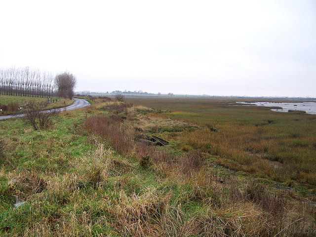
Funton is a location in Kent, United Kingdom. It is a creek situated on the edge of the North Kent Marshes on the right bank of the River Medway about halfway between the towns Chatham and Sheerness. There is evidence of Celtic/Romano-British salt extraction here deduced from the excavated remains of an evaporating vessel. Brick making continues here using the local Brickearth Brickearth is a term originally used to describe superficial windblown deposits found in southern England. The term has been employed in English-speaking regions to describe similar deposits. Brickearths are periglacial loess, a wind-bl ... clay. A small brick works produces the classic, yellow London stock bricks for which this area is well known. The brick works closed in 2010. References Medway Villages in Kent {{Kent-geo-stub ... [...More Info...] [...Related Items...] OR: [Wikipedia] [Google] [Baidu] |
Funton Brick Works - Geograph
Funton is a location in Kent, United Kingdom. It is a creek situated on the edge of the North Kent Marshes on the right bank of the River Medway about halfway between the towns Chatham and Sheerness. There is evidence of Celtic/Romano-British salt extraction here deduced from the excavated remains of an evaporating vessel. Brick making continues here using the local Brickearth Brickearth is a term originally used to describe superficial windblown deposits found in southern England. The term has been employed in English-speaking regions to describe similar deposits. Brickearths are periglacial loess, a wind-blow ... clay. A small brick works produces the classic, yellow London stock bricks for which this area is well known. The brick works closed in 2010. References Medway Villages in Kent {{Kent-geo-stub ... [...More Info...] [...Related Items...] OR: [Wikipedia] [Google] [Baidu] |
Brickearth
Brickearth is a term originally used to describe superficial windblown deposits found in southern England. The term has been employed in English-speaking regions to describe similar deposits. Brickearths are periglacial loess, a wind-blown dust deposited under extremely cold, dry, peri- or postglacial conditions. The name arises from its early use in making house bricks, its composition being suitable for brick-making without additional material being added and unlike clay its bricks can be hardened (fused) at lower temperatures, including in wood-fired kilns. The brickearth is normally represented on 1:50,000 solid and drift edition geological maps. In the Thames valley, in broad patches brickearth overlies fluvial terrace gravel; it has been reclassified on later maps as the " Langley Silt Complex". Description Brickearth is a superficial deposit of homogeneous loam or silt [...More Info...] [...Related Items...] OR: [Wikipedia] [Google] [Baidu] |
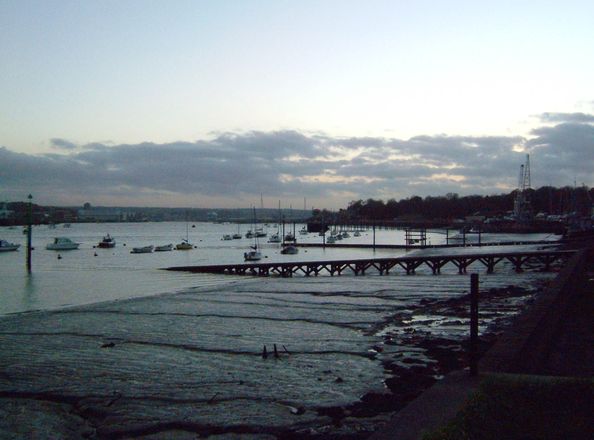
Shoreline Of Funton Creek - Geograph
A shore or a shoreline is the fringe of land at the edge of a large body of water, such as an ocean, sea, or lake. In physical oceanography, a shore is the wider fringe that is geologically modified by the action of the body of water past and present, while the beach is at the edge of the shore, representing the intertidal zone where there is one. In contrast to a coast, a shore can border any body of water, while the coast must border an ocean or a sea. Therefore, in that sense, a coast is a type of shore. However, the word "coast" often refers to an area far wider than the shore, often stretching miles into the interior. Shores are influenced by the topography of the surrounding landscape, as well as by water induced erosion, such as waves. The geological composition of rock and soil dictates the type of shore which is created. Rivieras ''Riviera'' is an Italian word for "shoreline", ultimately derived from Latin ''ripa'' ("riverbank"). It came to be applied as a proper n ... [...More Info...] [...Related Items...] OR: [Wikipedia] [Google] [Baidu] |
Kent
Kent is a county in South East England and one of the home counties. It borders Greater London to the north-west, Surrey to the west and East Sussex to the south-west, and Essex to the north across the estuary of the River Thames; it faces the French department of Pas-de-Calais across the Strait of Dover. The county town is Maidstone. It is the fifth most populous county in England, the most populous non-Metropolitan county and the most populous of the home counties. Kent was one of the first British territories to be settled by Germanic tribes, most notably the Jutes, following the withdrawal of the Romans. Canterbury Cathedral in Kent, the oldest cathedral in England, has been the seat of the Archbishops of Canterbury since the conversion of England to Christianity that began in the 6th century with Saint Augustine. Rochester Cathedral in Medway is England's second-oldest cathedral. Located between London and the Strait of Dover, which separates England from mainla ... [...More Info...] [...Related Items...] OR: [Wikipedia] [Google] [Baidu] |
North Kent Marshes
The North Kent Marshes are in the far north of the county of Kent spanning dry and wet south banks and inlets of the Thames Estuary in south-east England. The marshes are one of 22 Environmentally Sensitive Areas recognised by the UK's Department for Environment, Food and Rural Affairs (DEFRA). They are in the Thames Gateway regional planning area.TGKP Working Document 2. 26 Nov 2002 They include the South Thames Estuary and Marshes biological SSSI. Governance The marshes are nearly contiguous and span the districts of Dartford, Gravesham, Medway, Swale and Canterbury. They are protected in the Kent and Medway Structure Plan. In successive Local Plans, required by UK Planning Law they have been included, regard being had to their environmental benefit. The marshes serve as emergency natural flood protection for London. Ecology Most of the northern edge of Kent, west of the relatively modest Thanet peninsula, has been marshland for millennia. Steeper gravel beaches with hil ... [...More Info...] [...Related Items...] OR: [Wikipedia] [Google] [Baidu] |
River Medway
The River Medway is a river in South East England. It rises in the High Weald, East Sussex and flows through Tonbridge, Maidstone and the Medway conurbation in Kent, before emptying into the Thames Estuary near Sheerness, a total distance of . About of the river lies in East Sussex, with the remainder being in Kent. It has a catchment area of , the second largest in southern England after the Thames. The map opposite shows only the major tributaries: a more detailed map shows the extensive network of smaller streams feeding into the main river. Those tributaries rise from points along the North Downs, the Weald and Ashdown Forest. Tributaries The major tributaries are: * River Eden * River Bourne, known in the past as the Shode or Busty * River Teise, major sub-tributary River Bewl * River Beult * Loose Stream * River Len Minor tributaries include: * Wateringbury Stream * East Malling Stream * River Grom Former minor tributaries include the Old Bourne ... [...More Info...] [...Related Items...] OR: [Wikipedia] [Google] [Baidu] |
Chatham, Kent
Chatham ( ) is a town located within the Medway unitary authority in the ceremonial county of Kent, England. The town forms a conurbation with neighbouring towns Gillingham, Rochester, Strood and Rainham. The town developed around Chatham Dockyard and several Army barracks, together with 19th-century forts which provided a defensive shield for the dockyard. The Corps of Royal Engineers is still based in Chatham at Brompton Barracks. The Dockyard closed in 1984, but the remaining major naval buildings are an attraction for a flourishing tourist industry. Following closure, part of the site was developed as a commercial port, other parts were redeveloped for business and residential use, and part was used as the Chatham Historic Dockyard museum. Its attractions include the submarine . The town has important road links and the railway and bus stations are the main interchanges for the area. It is the administrative headquarters of Medway unitary authority, as well as its ... [...More Info...] [...Related Items...] OR: [Wikipedia] [Google] [Baidu] |
Sheerness
Sheerness () is a town and civil parish beside the mouth of the River Medway on the north-west corner of the Isle of Sheppey in north Kent, England. With a population of 11,938, it is the second largest town on the island after the nearby town of Minster which has a population of 21,319. Sheerness began as a fort built in the 16th century to protect the River Medway from naval invasion. In 1665 plans were first laid by the Navy Board for Sheerness Dockyard, a facility where warships might be provisioned and repaired. The site was favoured by Samuel Pepys, then Clerk of the Acts of the navy, for shipbuilding over Chatham inland. After the raid on the Medway in 1667, the older fortification was strengthened; in 1669 a Royal Navy dockyard was established in the town, where warships were stocked and repaired until its closure in 1960. Beginning with the construction of a pier and a promenade in the 19th century, Sheerness acquired the added attractions of a seaside resort. ... [...More Info...] [...Related Items...] OR: [Wikipedia] [Google] [Baidu] |
Medway
Medway is a unitary authority district and conurbation in Kent, South East England. It had a population of 278,016 in 2019. The unitary authority was formed in 1998 when Rochester-upon-Medway amalgamated with the Borough of Gillingham to form Medway Towns. It is now a unitary authority area run by Medway Council, independent of Kent County Council but still part of the ceremonial county of Kent. Medway is one of the boroughs included in the Thames Gateway development scheme. It is also the home of Universities at Medway, a tri-partite collaboration of the University of Greenwich, the University of Kent and Canterbury Christ Church University on a single campus in Chatham, together with the University for the Creative Arts, which has a campus in Rochester. Geography Because of its strategic location by the major crossing of the River Medway, it has made a wide and significant contribution to Kent, and to England, dating back thousands of years, as evident in the siting of Wa ... [...More Info...] [...Related Items...] OR: [Wikipedia] [Google] [Baidu] |


