|
Fundy Shore Ecotour
The Fundy Shore Ecotour is a former scenic drive and network of tourist destinations in the Canadian province of Nova Scotia and encircles several sub-basins of the Bay of Fundy, which contains the highest tidal range on the planet. The Fundy Shore Ecotour ran from Brooklyn, Hants County in the south, to Amherst, Cumberland County near the inter-provincial boundary with New Brunswick in the north. It followed the shores of Chignecto Bay, Minas Basin, and Cobequid Bay and overlaps with and extends the Glooscap Trail in many places. Some remnant signage of the Fundy Shore Ecotour still remain, but the route has been largely replaced by the Glooscap Trail and Fundy Shore Scenic Drive. Communities *Amherst * River Hebert * Joggins *Advocate Harbour *Parrsboro * Five Islands *Economy * Bass River *Glenholme * Onslow *Truro * Old Barns * Clifton * Beaver Brook * Green Oaks * Maitland * Selma * Noel Shore * Onslow * Minasville * Moose Brook * Tenecape * Walton * Pembroke *Cambridge * ... [...More Info...] [...Related Items...] OR: [Wikipedia] [Google] [Baidu] |
Amherst, Nova Scotia
Amherst ( ) is a town in northwestern Nova Scotia, Canada, located at the northeast end of the Cumberland Basin, an arm of the Bay of Fundy, and south of the Northumberland Strait. The town sits on a height of land at the eastern boundary of the Isthmus of Chignecto and Tantramar Marshes, east of the interprovincial border with New Brunswick and southeast of the city of Moncton. It is southwest of the New Brunswick abutment of the Confederation Bridge to Prince Edward Island at Cape Jourimain. History According to Dr. Graham P. Hennessey, "The Micmac name was ''Nemcheboogwek'' meaning 'going up rising ground', in reference to the higher land to the east of the Tantramar Marshes. The Acadians who settled here as early as 1672 called the village ''Les Planches''. The village was later renamed Amherst by Colonel Joseph Morse in honour of Lord Amherst, the commander-in-chief of the British Army in North America during the Seven Years' War." The town was first settled in ... [...More Info...] [...Related Items...] OR: [Wikipedia] [Google] [Baidu] |
Parrsboro, Nova Scotia
Parrsboro is a community located in Cumberland County, Nova Scotia, Cumberland County, Nova Scotia, Canada. A regional service centre for southern Cumberland County, the community is also known for its Parrsboro Harbour, port on the Minas Basin, the Ship's Company Theatre productions, and the Fundy Geological Museum. History Before the arrival of European ethnic groups, European settlers, Parrsboro was a portage point for Mikmaq travellers along the Minas Basin and Cumberland County river systems. The native inhabitants called the region "Awokum," meaning a 'short-cut' or 'passing-over point.' The first European settlers were the Acadians in 1670 at the western mouth of the Parrsboro Harbour, near Partridge Island (Nova Scotia), Partridge Island. After they were Expulsion of the Acadians, expelled in 1755, they were replaced by New England Planters. The centre of settlement gradually shifted from Partridge Island to the sheltered estuary of the Parrsboro River where a harbo ... [...More Info...] [...Related Items...] OR: [Wikipedia] [Google] [Baidu] |
Noel Shore, Nova Scotia
Noel Shore is a community in the Canadian province of Nova Scotia, located in the Municipal District of East Hants. The community is named after Noel Doiron and may have originally been named Vil Robere. Acadians left the area during the Acadian Exodus (1710). Birthplace of one of the famous "Miller Brothers", Harry Herbert Miller winner of the American Medal of Honor for actions during the Spanish–American War. His brother, Willard Miller was born in the neighbouring community of Maitland, Nova Scotia Maitland, East Hants, Nova Scotia (originally known as Jean Peter's Village) is a village in East Hants, Nova Scotia. It is home to the historic Lawrence House Museum, which is part of the Nova Scotia Museum. The community was part of the Douglas .... References Noel Shore on Destination Nova Scotia Communities in Hants County, Nova Scotia General Service Areas in Nova Scotia {{HantsNS-geo-stub ... [...More Info...] [...Related Items...] OR: [Wikipedia] [Google] [Baidu] |
Selma, Nova Scotia
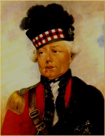
Selma is a small community in the Canadian province of Nova Scotia, located in The Municipality of the District of East Hants in Hants County. Acadians The LeJeune Family lived in Selma prior to the Acadian Exodus from the area in 1750 during Father Le Loutre's War. According to Captain Matthew Floyer, Selma had four dwellings and a mill. The field beside the Selma Brook was named "La Pree a Breard". Selma may have been named Village Robere as referenced by Charles Morris, which would mean that the Robert Henry Family also lived in the village. The Ile St. Jean census date of 1752 suggest that the Henry family married many of those in the Pitre family. The Pitre Family were in the neighbouring community of Maitland, Nova Scotia. Alternatively, however, there is evidence to suggest that Vil Robere may have been East Noel (present day Densmore Mills, Nova Scotia). Major Small and the 84th Highland Regiment After the American Revolution Selma was settled by loyalists so ... [...More Info...] [...Related Items...] OR: [Wikipedia] [Google] [Baidu] |
Maitland, Nova Scotia
Maitland, East Hants, Nova Scotia (originally known as Jean Peter's Village) is a village in East Hants, Nova Scotia. It is home to the historic Lawrence House Museum, which is part of the Nova Scotia Museum. The community was part of the Douglas Township until it was named Maitland after Governor General of Nova Scotia Peregrine Maitland (1828–34) when building the Shubenacadie Canal was first attempted (1826–1831). The Canal was supposed to start at Maitland, Nova Scotia and run through the province to Maitland Street, Dartmouth, the canal being "bookended" by two "Maitland" landmarks. History Maitland was first settled by the Acadians. After the Acadian expulsion from the region (1750), the village was eventually settled by Ulster Scots whose descendants became shipbuilders. Acadians Maitland was settled by Jean Pitre (i.e., Peters), son of Jean Denis Pitre, prior to the Acadian Expulsion. Oral tradition states that the Oak Island Graveyard was an Acadian burial ground, ... [...More Info...] [...Related Items...] OR: [Wikipedia] [Google] [Baidu] |
Green Oaks, Nova Scotia
Green Oaks is a small rural community in the Canadian province of Nova Scotia, located in Colchester County Colchester County is a county in the Canadian province of Nova Scotia. With a population of 51,476 the county is the fourth largest in Nova Scotia. Colchester County is located in north central Nova Scotia. The majority of the county is govern .... ReferencesGreen Oaks on Destination Nova Scotia Communities in Colchester County General Service Areas in Nova Scotia {{ColchesterNS-geo-stub ... [...More Info...] [...Related Items...] OR: [Wikipedia] [Google] [Baidu] |
Beaver Brook, Nova Scotia
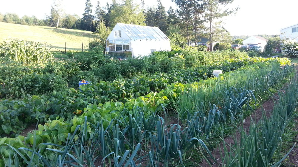
Beaver Brook is a small community in the Canadian province of Nova Scotia, located in Colchester County. It is a mainly rural community with one small saw mill. Beaver Brook is located on the 236 Highway just west of the community of Old Barns. The "Beaver Brook" runs through the community's farm fields and finally into the Cobequid Bay at the headwaters of the Bay of Fundy. The land is gently rolling, glaciated hills with fertile soils. Dairy farming is the main agriculture industry in Beaver Brook. Corn and soy beans are the main crops. Eagles from Cobequid Bay and the close by Shubenacadie River The Shubenacadie River is a river in Nova Scotia, Canada. It has a meander length of approximately 72 km from its source at Shubenacadie Grand Lake to its mouth at the historic seaport village of Maitland on Cobequid Bay, site of the build ... often fly over Beaver Brook. Hawks are common as well as foxes. Nova Scotia Route 236 is a busy road that is a shorter route to Wi ... [...More Info...] [...Related Items...] OR: [Wikipedia] [Google] [Baidu] |
Clifton, Nova Scotia
Clifton is a rural community in the Canadian province of Nova Scotia, located in Colchester County Colchester County is a county in the Canadian province of Nova Scotia. With a population of 51,476 the county is the fourth largest in Nova Scotia. Colchester County is located in north central Nova Scotia. The majority of the county is govern ... . References Clifton on Destination Nova Scotia Communities in Colchester County {{ColchesterNS-geo-stub ... [...More Info...] [...Related Items...] OR: [Wikipedia] [Google] [Baidu] |
Old Barns, Nova Scotia
Old Barns is a community in the Canadian province of Nova Scotia, located in Colchester County Colchester County is a county in the Canadian province of Nova Scotia. With a population of 51,476 the county is the fourth largest in Nova Scotia. Colchester County is located in north central Nova Scotia. The majority of the county is govern .... References Old Barns on Destination Nova Scotia Communities in Colchester County General Service Areas in Nova Scotia {{ColchesterNS-geo-stub ... [...More Info...] [...Related Items...] OR: [Wikipedia] [Google] [Baidu] |
Truro, Nova Scotia
Truro ( Mi'kmaq: ''Wagobagitik''; Scottish Gaelic: ''Truru'') is a town in central Nova Scotia, Canada. Truro is the shire town of Colchester County and is located on the south side of the Salmon River floodplain, close to the river's mouth at the eastern end of Cobequid Bay. History The area has been home to the Mi'kmaq people for several centuries. The Mi'kmaq name for the Truro area, "Wagobagitik" means "end of the water's flow". Mi'kmaq people continue to live in the area at the Millbrook and Truro reserves of the Millbrook – We’kopekwitk band. Acadian settlers came to this area in the early 1700s. The Mi'kmaq name for the Truro area was shortened by the settlers to "Cobequid", and the bay to the west of the town is still named Cobequid Bay. By 1727, the settlers had established a small village near the present downtown site of Truro known as "Vil Bois Brule" (Village in the burnt wood). Many Acadians in this region left in the Acadian Exodus which preceded the Exp ... [...More Info...] [...Related Items...] OR: [Wikipedia] [Google] [Baidu] |
Onslow, Nova Scotia
Onslow is a rural, unincorporated Canadian community in central Colchester County, Nova Scotia. The community is located along the north bank of the Salmon River, opposite the town of Truro and is largely a farming area. The area was first settled by Acadians and resettled after their expulsion as Onslow Township in 1761 by Irish emigrants under Colonel McNutt. The township is believed to have been named after Arthur Onslow. An important highway interchange is located in the community, where Highway 102 terminates at Highway 104. Onslow is home to Central Colchester Junior High School, operated by the Chignecto-Central Regional School Board. Onslow also contains a John Deere dealership and a volunteer fire department; the corner store has closed. In the fall and spring, migrating Canada geese are attracted to the farmlands. Onslow is geographically situated in an area with high winds, making it an excellent location for wind turbines. Some farmers in the area have chosen t ... [...More Info...] [...Related Items...] OR: [Wikipedia] [Google] [Baidu] |
Glenholme, Nova Scotia
Glenholme is a community in the Canadian province of Nova Scotia, located in Colchester County Colchester County is a county in the Canadian province of Nova Scotia. With a population of 51,476 the county is the fourth largest in Nova Scotia. Colchester County is located in north central Nova Scotia. The majority of the county is govern .... ReferencesGlenholme on Destination Nova Scotia Communities in Colchester County General Service Areas in Nova Scotia {{ColchesterNS-geo-stub ... [...More Info...] [...Related Items...] OR: [Wikipedia] [Google] [Baidu] |


