|
Frying Pan Shoals
The Frying Pan Shoals are a shifting area of shoals off Cape Fear in North Carolina, United States. Formed by silt from the Cape Fear River, the shoals are over 28 miles long and resemble a frying pan in shape. They provide excellent fishing. The shoals are known for the high number of shipwrecks found in the region and are deemed part of the Graveyard of the Atlantic. From May 1994 to August 2008, over 130 new shipwreck locations have been discovered in the area. Known since the beginning of European exploration, the shoals were marked on a map in 1738. The southern edge of the shoals has been marked by nine lightships including the ''Frying Pan'', a light tower, and a weather buoy. The Bald Head Light and the Oak Island lighthouse The Oak Island Lighthouse is located in the Town of Caswell Beach near the mouth of the Cape Fear River in Southeastern North Carolina. It sits next to the Oak Island Coast Guard Station on the east end of Oak Island in Brunswick County looking ... [...More Info...] [...Related Items...] OR: [Wikipedia] [Google] [Baidu] |
Graveyard Of The Atlantic
Graveyard of the Atlantic is a nickname for the treacherous waters and area of numerous shipwrecks off the Outer Banks of North Carolina, United States, which are due to the coast's shifting sands and inlets. To a lesser degree, this nickname has also been applied to Sable Island off of Nova Scotia, Canada, as well as the waters off Cape Cod, Massachusetts, United States. Outer Banks Along the Outer Banks, navigational challenges posed by the Diamond Shoals area off Cape Hatteras, caused the loss of thousands of ships and an unknown number of human lives. More than 5,000 ships have sunk in these waters since record-keeping began in 1526. The Graveyard of the Atlantic Museum, located in Hatteras Village, focuses on the history of this area and features many artifacts recovered from area shipwrecks. Among the better known shipwrecks were the , a participant in the famous Battle of Hampton Roads during the American Civil War, and the ''Patriot'' which carried Theodosia Burr Als ... [...More Info...] [...Related Items...] OR: [Wikipedia] [Google] [Baidu] |
Oak Island Lighthouse
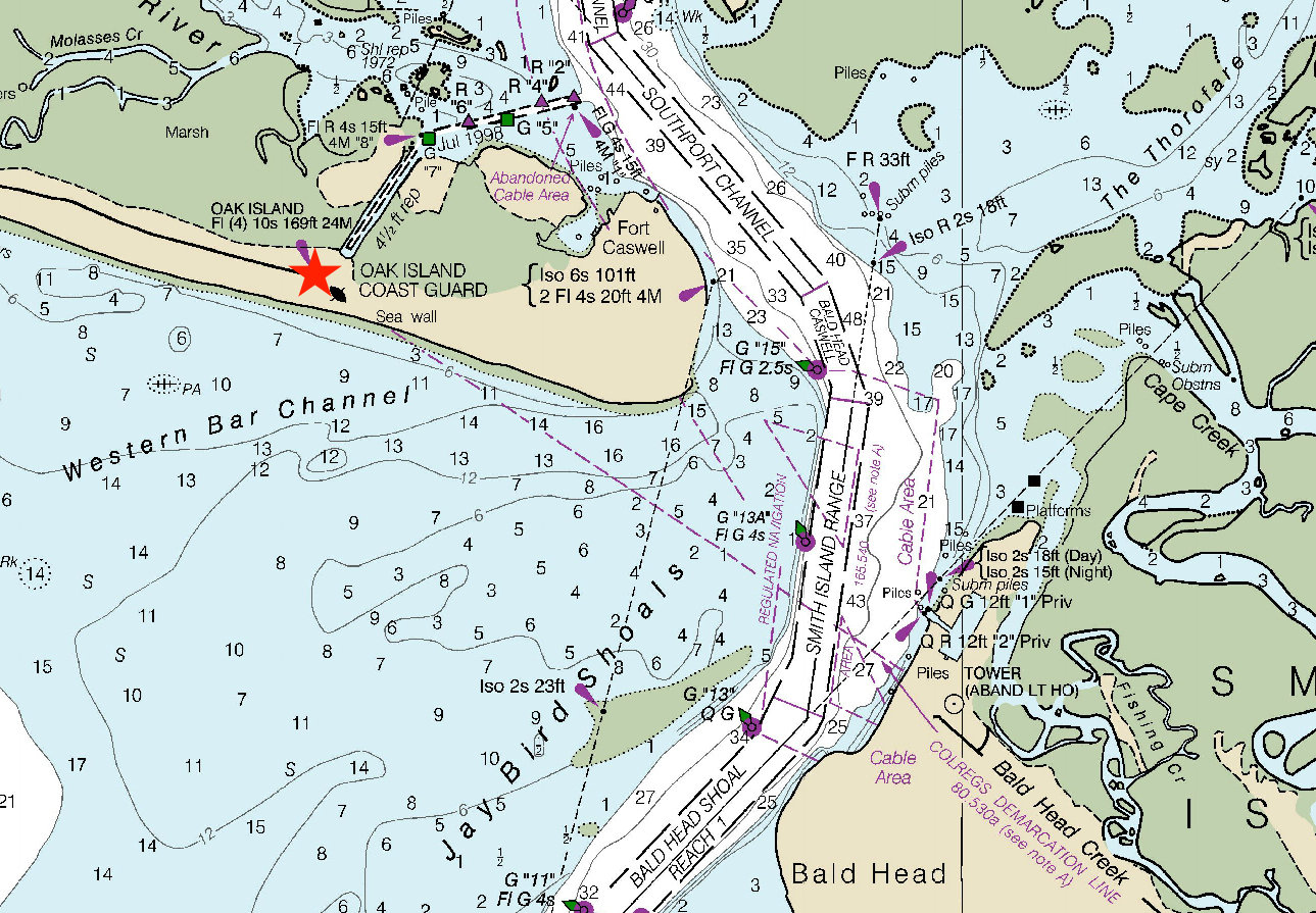
The Oak Island Lighthouse is located in the Town of Caswell Beach near the mouth of the Cape Fear River in Southeastern North Carolina. It sits next to the Oak Island Coast Guard Station on the east end of Oak Island in Brunswick County looking south out at the Atlantic Ocean. Featuring 16 LED lights which produce four, one-second bursts of light every 10 seconds, it has a luminous range of 20.5 nautical miles. Owned by the town since 2004, it is managed by a citizens group (Friends of Oak Island Lighthouse). History In May 1958, the Oak Island Lighthouse replaced the Cape Fear Light, a steel skeleton structure on Bald Head Island which was demolished that same year. The Cape Fear Light began operation in 1903 and was then a functional replacement for the still standing and now popular tourist attraction, the 1817 Bald Head Light (Old Baldy). During the period 1958–1962, the Oak Island Light was the brightest in the US (the Charleston Light Charleston Light, also known ... [...More Info...] [...Related Items...] OR: [Wikipedia] [Google] [Baidu] |
Bald Head Light
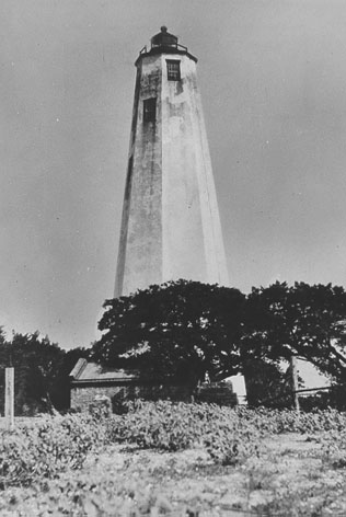
Bald Head Lighthouse, known as Old Baldy, is the oldest lighthouse still standing in North Carolina. It is the second of three lighthouses that have been built on Bald Head Island since the 18th century to help guide ships past the dangerous shoals at the mouth of the Cape Fear river. History A site on the west side of Bald Head Island, along the banks of the Cape Fear River, was selected for North Carolina's first lighthouse. The property was purchased from Benjamin Smith, who would later become the governor of North Carolina. In 1792, Congress appropriated $4,000 to complete the lighthouse that had been started by the North Carolina Colony before becoming part of the United States. Work on the lighthouse was overseen by Abisha Woodward, who would later build five lighthouses along the Connecticut coast and one in New York on the east end of Long Island, two of which still stand at New London, and Falkner's Island. The lighthouse, which was first activated on December 23, 17 ... [...More Info...] [...Related Items...] OR: [Wikipedia] [Google] [Baidu] |
Weather Buoy
Weather buoys are instruments which collect weather and ocean data within the world's oceans, as well as aid during emergency response to chemical spills, legal proceedings, and engineering design. Moored buoys have been in use since 1951, while drifting buoys have been used since 1979. Moored buoys are connected with the ocean bottom using either chains, nylon, or buoyant polypropylene. With the decline of the weather ship, they have taken a more primary role in measuring conditions over the open seas since the 1970s. During the 1980s and 1990s, a network of buoys in the central and eastern tropical Pacific Ocean helped study the El Niño-Southern Oscillation. Moored weather buoys range from in diameter, while drifting buoys are smaller, with diameters of . Drifting buoys are the dominant form of weather buoy in sheer number, with 1250 located worldwide. Wind data from buoys has smaller error than that from ships. There are differences in the values of sea surface temper ... [...More Info...] [...Related Items...] OR: [Wikipedia] [Google] [Baidu] |
Frying Pan Shoals Light
Frying Pan Shoals Light Tower is a decommissioned lighthouse located on the Frying Pan Shoals approximately southeast of Southport, North Carolina, and from Bald Head Island, North Carolina. The tower is currently privately owned and was formerly a bed and breakfast retreat, and is noted for its survival through several significant tropical storms. The light tower is modeled after a steel oil drilling platform, known as a " Texas Tower", on top of four steel legs that was engineered to be used as a lighthouse housing several Coast Guard members. The light tower marks the shoals at the confluence of the Cape Fear River and the Atlantic Ocean. History The shoals have been patrolled by a lightboat since 1854 by the United States Coast Guard. In 1966, the light tower was built, and was staffed year-round by a four-person crew until the operation of the light was automated in 1979. The station was ultimately decommissioned in 2004, owing to the advent of GPS systems on ships ma ... [...More Info...] [...Related Items...] OR: [Wikipedia] [Google] [Baidu] |
Frying Pan (lightship)
''Frying Pan'' (LV-115) is a lightvessel moored at Pier 66a in the Chelsea neighborhood of Manhattan in New York City. It served at Frying Pan Shoals, off Cape Fear in North Carolina, for over 30 years. Frying Pan Shoals station In 1854, because of complaints from mariners that the height of the existing Bald Head Lighthouse was inadequate, and the light of its third-order Fresnel lens was not bright enough to warn mariners of the shallow waters of the treacherous Frying Pan Shoals off the coast of Cape Fear in North Carolina, United States, the first lightship was stationed on the shoals, in lieu of a proposal to improve Bald Point Lighthouse. The Bald Point lighthouse, and others, were turned off during the Civil War to avoid aiding the Northern ships. Lightships remained on station for 110 years. On July 29, 1944, Lieutenant (jg) Clarence Samuels, USCG, became the first Hispanic-American of African descent to command a lightship when he assumed command of ''Frying Pan''. ... [...More Info...] [...Related Items...] OR: [Wikipedia] [Google] [Baidu] |
Age Of Discovery
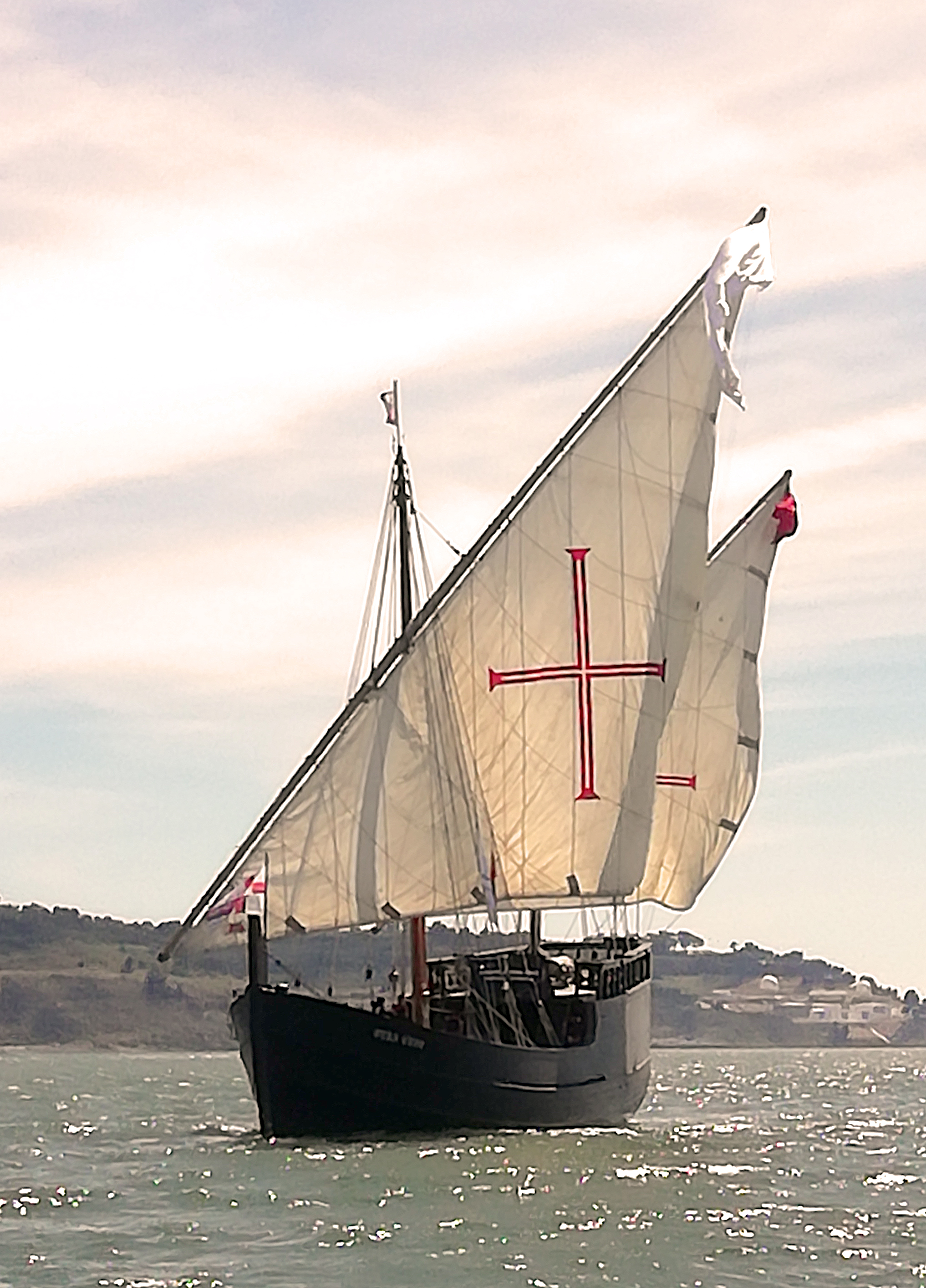
The Age of Discovery (or the Age of Exploration), also known as the early modern period, was a period largely overlapping with the Age of Sail, approximately from the 15th century to the 17th century in European history, during which seafaring Europeans explored and colonized regions across the globe. The extensive overseas exploration, with the Portuguese and Spanish at the forefront, later joined by the Dutch, English, and French, emerged as a powerful factor in European culture, most notably the European encounter and colonization of the Americas. It also marks an increased adoption of colonialism as a government policy in several European states. As such, it is sometimes synonymous with the first wave of European colonization. European exploration outside the Mediterranean started with the maritime expeditions of Portugal to the Canary Islands in 1336, and later with the Portuguese discoveries of the Atlantic archipelagos of Madeira and Azores, the coast of West ... [...More Info...] [...Related Items...] OR: [Wikipedia] [Google] [Baidu] |
The Weather Channel
The Weather Channel (TWC) is an American pay television channel owned by Weather Group, LLC, a subsidiary of Allen Media Group. The channel's headquarters are in Atlanta, Georgia. Launched on May 2, 1982, the channel broadcasts weather forecasts and weather-related news and analysis, along with documentaries and entertainment programming related to weather. A sister network, Weatherscan, was a digital cable and satellite service that offered 24-hour automated local forecasts and radar imagery. Weatherscan was officially shut down on December 9, 2022. The Weather Channel also produces outsourced weathercasts, notably for CBS News and RFD-TV. The Weather Channel was a subsidiary of the Weather Company until the latter was bought by IBM in 2016. The Weather Channel licenses its weather data from IBM. History The Weather Channel was founded on July 18, 1980,USPTO filings: First Use (not First Use in Commerce date on various filings, including filing w/ serial number 7336982 ... [...More Info...] [...Related Items...] OR: [Wikipedia] [Google] [Baidu] |
Shipwreck
A shipwreck is the wreckage of a ship that is located either beached on land or sunken to the bottom of a body of water. Shipwrecking may be intentional or unintentional. Angela Croome reported in January 1999 that there were approximately three million shipwrecks worldwide (an estimate rapidly endorsed by UNESCO and other organizations). When a ship's crew has died or abandoned the ship, and the ship has remained adrift but unsunk, they are instead referred to as ghost ships. Types Historic wrecks are attractive to maritime archaeologists because they preserve historical information: for example, studying the wreck of revealed information about seafaring, warfare, and life in the 16th century. Military wrecks, caused by a skirmish at sea, are studied to find details about the historic event; they reveal much about the battle that occurred. Discoveries of treasure ships, often from the period of European colonisation, which sank in remote locations leaving few livi ... [...More Info...] [...Related Items...] OR: [Wikipedia] [Google] [Baidu] |
Shoal
In oceanography, geomorphology, and geoscience, a shoal is a natural submerged ridge, bank, or bar that consists of, or is covered by, sand or other unconsolidated material and rises from the bed of a body of water to near the surface. It often refers to those submerged ridges, banks, or bars that rise near enough to the surface of a body of water as to constitute a danger to navigation. Shoals are also known as sandbanks, sandbars, or gravelbars. Two or more shoals that are either separated by shared troughs or interconnected by past or present sedimentary and hydrographic processes are referred to as a shoal complex.Neuendorf, K.K.E., J.P. Mehl Jr., and J.A. Jackson, eds. (2005) ''Glossary of Geology'' (5th ed.). Alexandria, Virginia, American Geological Institute. 779 pp. The term ''shoal'' is also used in a number of ways that can be either similar or quite different from how it is used in geologic, geomorphic, and oceanographic literature. Sometimes, this term refer ... [...More Info...] [...Related Items...] OR: [Wikipedia] [Google] [Baidu] |
Fishing
Fishing is the activity of trying to catch fish. Fish are often caught as wildlife from the natural environment, but may also be caught from stocked bodies of water such as ponds, canals, park wetlands and reservoirs. Fishing techniques include hand-gathering, spearing, netting, angling, shooting and trapping, as well as more destructive and often illegal techniques such as electrocution, blasting and poisoning. The term fishing broadly includes catching aquatic animals other than fish, such as crustaceans (shrimp/lobsters/ crabs), shellfish, cephalopods (octopus/squid) and echinoderms (starfish/sea urchins). The term is not normally applied to harvesting fish raised in controlled cultivations ( fish farming). Nor is it normally applied to hunting aquatic mammals, where terms like whaling and sealing are used instead. Fishing has been an important part of human culture since hunter-gatherer times, and is one of the few food production activities that ha ... [...More Info...] [...Related Items...] OR: [Wikipedia] [Google] [Baidu] |


