|
Frostline
The frost line—also known as frost depth or freezing depth—is most commonly the depth to which the groundwater in soil is expected to freeze. The frost depth depends on the climatic conditions of an area, the heat transfer properties of the soil and adjacent materials, and on nearby heat sources. For example, snow cover and asphalt insulate the ground and homes can heat the ground (see also ''heat island''). The line varies by latitude, it is deeper closer to the poles. The maximum frost depth observed in the contiguous United States ranges from 0 to . Below that depth, the temperature varies, but is always above . Alternatively, in Arctic and Antarctic locations the freezing depth is so deep that it becomes year-round permafrost, and the term " thaw depth" is used instead. Finally, in tropical regions, frost line may refer to the vertical geographic elevation below which frost does not occur. ''Frost front'' refers to the varying position of the frost line during seasonal ... [...More Info...] [...Related Items...] OR: [Wikipedia] [Google] [Baidu] |
Snow Line
The climatic snow line is the boundary between a snow-covered and snow-free surface. The actual snow line may adjust seasonally, and be either significantly higher in elevation, or lower. The permanent snow line is the level above which snow will lie all year. Background Snow line is an umbrella term for different interpretations of the boundary between snow-covered surface and snow-free surface. The definitions of the snow line may have different temporal and spatial focus. In many regions the changing snow line reflect seasonal dynamics. The final height of the snow line in a mountain environment at the end of the melting season is subject to climatic variability, and therefore may be different from year to year. The snow line is measured using automatic cameras, aerial photographs, or satellite images. Because the snow line can be established without on-the-ground measurements, it can be measured in remote and difficult to access areas. Therefore, the snow line has become an ... [...More Info...] [...Related Items...] OR: [Wikipedia] [Google] [Baidu] |
Frost
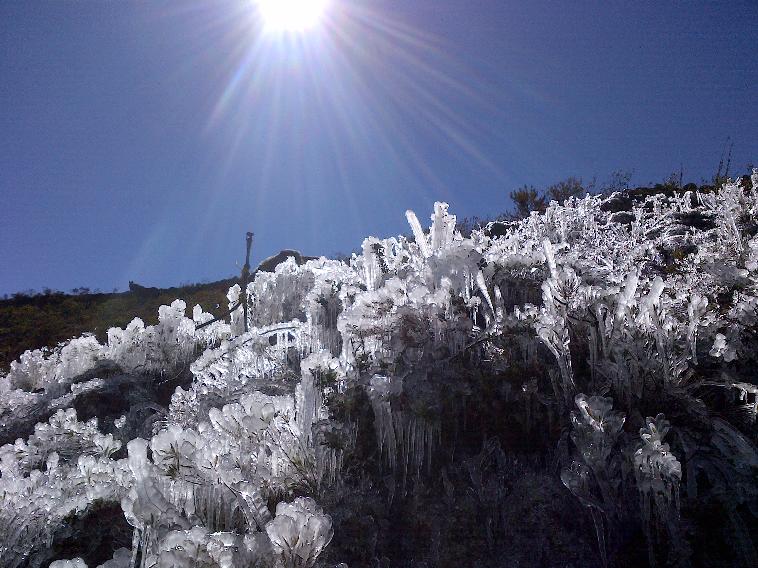
Frost is a thin layer of ice on a solid surface, which forms from water vapor that deposits onto a freezing surface. Frost forms when the air contains more water vapor than it can normally hold at a specific temperature. The process is similar to the formation of dew, except it occurs below the freezing point of water typically without crossing through a liquid state. Air always contains a certain amount of water vapor, depending on temperature. Warmer air can hold more than colder air. When the atmosphere contains more water than it can hold at a specific temperature, its relative humidity rises above 100% becoming supersaturated, and the excess water vapor is forced to deposit onto any nearby surface, forming seed crystals. The temperature at which frost will form is called the dew point, and depends on the humidity of the air. When the temperature of the air drops below its dew point, excess water vapor is forced out of solution, resulting in a phase change directly fro ... [...More Info...] [...Related Items...] OR: [Wikipedia] [Google] [Baidu] |
Glaciology
Glaciology (; ) is the scientific study of glaciers, or, more generally, ice and natural phenomena that involve ice. Glaciology is an interdisciplinary Earth science that integrates geophysics, geology, physical geography, geomorphology, climatology, meteorology, hydrology, biology, and ecology. The impact of glaciers on people includes the fields of human geography and anthropology. The discoveries of water ice on the Moon, Mars, Europa (moon), Europa and Pluto add an extraterrestrial component to the field, which is referred to as "astroglaciology". Overview A glacier is a persistent body of dense ice, a form of rock) formed from snow falling and accumulating over a long period of time; glaciers move very slowly, either descending from high mountains, as in valley glaciers, or moving outward from centers of accumulation, as in continental glaciers. Areas of study within glaciology include glacial history and the reconstruction of past glaciation. A glaciologist is a person ... [...More Info...] [...Related Items...] OR: [Wikipedia] [Google] [Baidu] |
Windsor, Ontario
Windsor ( ) is a city in southwestern Ontario, Canada. It is situated on the south bank of the Detroit River directly across from the U.S city of Detroit, Detroit, Michigan. Geographically located within but administratively independent of Essex County, Ontario, Essex County, it is the southernmost city in Canada and marks the southwestern end of the Quebec City–Windsor Corridor. The city's population was 229,660 at the 2021 Canadian Census, 2021 census, making it the third-most populated city in Southwestern Ontario, after London, Ontario, London and Kitchener, Ontario, Kitchener. This represents a 5.7 percent increase from Windsor's 2016 population census of 217,188. The Detroit–Windsor urban area is North America's most populous trans-border conurbation. Linking the Great Lakes Megalopolis, the Ambassador Bridge border crossing is the busiest commercial crossing on the Canada–United States border, carrying about one-quarter of the two countries' trade volume. Windsor ... [...More Info...] [...Related Items...] OR: [Wikipedia] [Google] [Baidu] |
Ottawa
Ottawa is the capital city of Canada. It is located in the southern Ontario, southern portion of the province of Ontario, at the confluence of the Ottawa River and the Rideau River. Ottawa borders Gatineau, Gatineau, Quebec, and forms the core of the Ottawa–Gatineau census metropolitan area (CMA) and the National Capital Region (Canada), National Capital Region (NCR). Ottawa had a city population of 1,017,449 and a metropolitan population of 1,488,307, making it the list of the largest municipalities in Canada by population, fourth-largest city and list of census metropolitan areas and agglomerations in Canada, fourth-largest metropolitan area in Canada. Ottawa is the political centre of Canada and the headquarters of the federal government. The city houses numerous List of diplomatic missions in Ottawa, foreign embassies, key buildings, organizations, and institutions of Government of Canada, Canada's government; these include the Parliament of Canada, the Supreme Court of ... [...More Info...] [...Related Items...] OR: [Wikipedia] [Google] [Baidu] |
Ontario
Ontario is the southernmost Provinces and territories of Canada, province of Canada. Located in Central Canada, Ontario is the Population of Canada by province and territory, country's most populous province. As of the 2021 Canadian census, it is home to 38.5% of the country's population, and is the second-largest province by total area (after Quebec). Ontario is Canada's fourth-largest jurisdiction in total area of all the Canadian provinces and territories. It is home to the nation's capital, Ottawa, and its list of the largest municipalities in Canada by population, most populous city, Toronto, which is Ontario's provincial capital. Ontario is bordered by the province of Manitoba to the west, Hudson Bay and James Bay to the north, and Quebec to the east and northeast. To the south, it is bordered by the U.S. states of (from west to east) Minnesota, Michigan, Ohio, Pennsylvania, and New York (state), New York. Almost all of Ontario's border with the United States follows riv ... [...More Info...] [...Related Items...] OR: [Wikipedia] [Google] [Baidu] |
Spokane, WA
Spokane ( ) is the most populous city in eastern Washington and the county seat of Spokane County, Washington, United States. It lies along the Spokane River, adjacent to the Selkirk Mountains, and west of the Rocky Mountain foothills, south of the Canadian border, west of the Washington–Idaho border, and east of Seattle, along Interstate 90. Spokane is the economic and cultural center of the Spokane metropolitan area, the Spokane–Coeur d'Alene combined statistical area, and the Inland Northwest. It is known as the birthplace of Father's Day, and locally by the nickname of "Lilac City". Officially, Spokane goes by the nickname of ''Hooptown USA'', due to Spokane's annual hosting of the Spokane Hoopfest, the world's largest basketball tournament. The city and the wider Inland Northwest area are served by Spokane International Airport, west of Downtown Spokane, which is located near another airfield at Fairchild Air Force Base. According to the 2020 census, Spokane ha ... [...More Info...] [...Related Items...] OR: [Wikipedia] [Google] [Baidu] |
Edmonds, WA
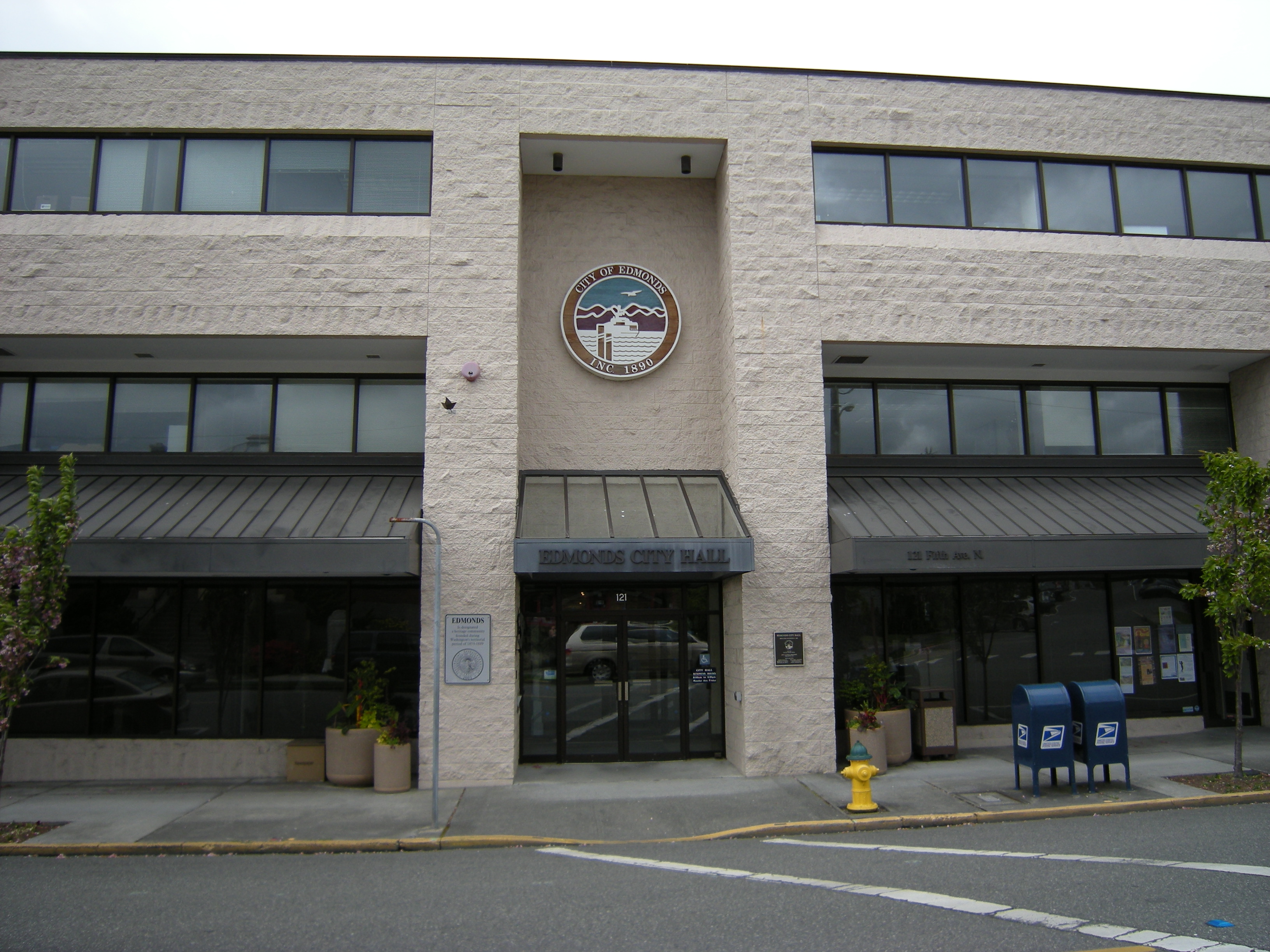
Edmonds is a city in Snohomish County, Washington, United States. It is located in the southwest corner of the county, facing Puget Sound and the Olympic Mountains to the west. The city is part of the Seattle metropolitan area and is located north of Seattle and southwest of Everett, Washington, Everett. With a population of 42,853 residents in the 2020 United States Census, 2020 U.S. census, Edmonds is the third most populous city in the county. Edmonds was established in 1876 by logger George Brackett, who bought the land claim of an earlier settler. It was incorporated as a city in 1890, shortly before the arrival of the Great Northern Railway (US), Great Northern Railway. Early residents of the city were employed by the Wood shingle, shingle mills and logging companies that operated in the area until the 1950s. The hills surrounding Edmonds were developed into suburban bedroom community, bedroom communities in the mid-to-late 20th century and subsequently annexed into the c ... [...More Info...] [...Related Items...] OR: [Wikipedia] [Google] [Baidu] |
Washington (state)
Washington, officially the State of Washington, is a state in the Pacific Northwest region of the United States. It is often referred to as Washington State to distinguish it from the national capital, both named after George Washington (the first U.S. president). Washington borders the Pacific Ocean to the west, Oregon to the south, Idaho to the east, and shares an international border with the Canadian province of British Columbia to the north. Olympia is the state capital, and the most populous city is Seattle. Washington is the 18th-largest state, with an area of , and the 13th-most populous state, with a population of just less than 8 million. The majority of Washington's residents live in the Seattle metropolitan area, the center of transportation, business, and industry on Puget Sound, an inlet of the Pacific Ocean consisting of numerous islands, deep fjords and bays carved out by glaciers. The remainder of the state consists of deep temperate rainforests in ... [...More Info...] [...Related Items...] OR: [Wikipedia] [Google] [Baidu] |


