|
Fostoria, Pennsylvania
Fostoria is an unincorporated community and census-designated place (CDP) in Blair County, Pennsylvania, United States. It was first listed as a CDP prior to the 2020 census. The CDP is in northern Blair County, in the eastern part of Antis Township. It is bordered to the east by the Little Juniata River and to the west by the Pittsburgh Line of the Norfolk Southern Railway. Fostoria is north of Bellwood and southwest of Tyrone. Demographics Education The school district is Bellwood-Antis School District The Bellwood-Antis School District is a small, rural public school district located in Blair County, Pennsylvania. It serves the Borough of Bellwood and Antis Township. Bellwood-Antis School District encompasses approximately . According to 2 .... Text list/ref> References Census-designated places in Blair County, Pennsylvania Census-designated places in Pennsylvania {{BlairCountyPA-geo-stub ... [...More Info...] [...Related Items...] OR: [Wikipedia] [Google] [Baidu] |
Census-designated Place
A census-designated place (CDP) is a Place (United States Census Bureau), concentration of population defined by the United States Census Bureau for statistical purposes only. CDPs have been used in each decennial census since 1980 as the counterparts of incorporated places, such as self-governing city (United States), cities, town (United States), towns, and village (United States), villages, for the purposes of gathering and correlating statistical data. CDPs are populated areas that generally include one officially designated but currently unincorporated area, unincorporated community, for which the CDP is named, plus surrounding inhabited countryside of varying dimensions and, occasionally, other, smaller unincorporated communities as well. CDPs include small rural communities, Edge city, edge cities, colonia (United States), colonias located along the Mexico–United States border, and unincorporated resort and retirement community, retirement communities and their environs. ... [...More Info...] [...Related Items...] OR: [Wikipedia] [Google] [Baidu] |
Federal Information Processing Standards
The Federal Information Processing Standards (FIPS) of the United States are a set of publicly announced standards that the National Institute of Standards and Technology (NIST) has developed for use in computer systems of non-military United States government agencies and contractors. FIPS standards establish requirements for ensuring computer security and interoperability, and are intended for cases in which suitable industry standards do not already exist. Many FIPS specifications are modified versions of standards the technical communities use, such as the American National Standards Institute (ANSI), the Institute of Electrical and Electronics Engineers (IEEE), and the International Organization for Standardization (ISO). Specific areas of FIPS standardization The U.S. government has developed various FIPS specifications to standardize a number of topics including: * Codes, e.g., FIPS county codes or codes to indicate weather conditions or emergency indications. In 1994, ... [...More Info...] [...Related Items...] OR: [Wikipedia] [Google] [Baidu] |
Bellwood-Antis School District
The Bellwood-Antis School District is a small, rural public school district located in Blair County, Pennsylvania. It serves the Borough of Bellwood and Antis Township. Bellwood-Antis School District encompasses approximately . According to 2020 federal census data, it serves a resident population of 6,478. The district was established in 1938 when multiple schoolhouses from Antis Township merged with the Bellwood schools. It was the first of its kind in Blair County to offer education to all twelve grades. The current Superintendent of Schools in the district is Edward DiSabato. Schools * Myers Elementary School (Grades K-4)220 Martin StreetBellwood, Pennsylvania 16617 * Bellwood-Antis Middle School (Grades 5-8)400 Martin StreetBellwood, Pennsylvania 16617 * Bellwood-Antis High School (Grades 9-12)300 Martin StreetBellwood, Pennsylvania 16617 Extracurriculars The district offers a variety of clubs, activities and sports. Athletics The district funds the following sport ... [...More Info...] [...Related Items...] OR: [Wikipedia] [Google] [Baidu] |
Bellwood, Pennsylvania
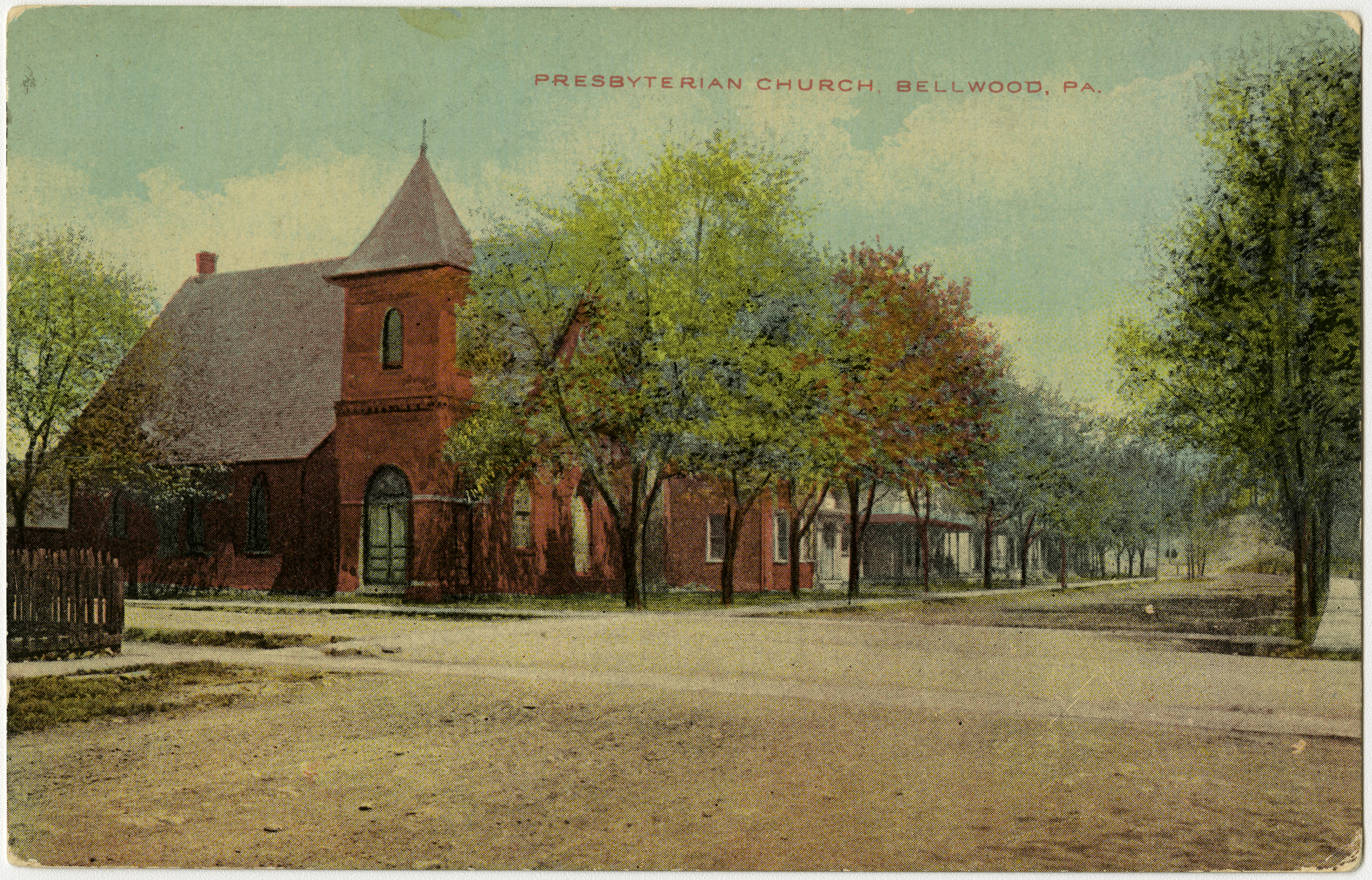
Bellwood is a borough (Pennsylvania), borough in Blair County, Pennsylvania, Blair County, Pennsylvania, United States. It is part of the Altoona, PA Metropolitan Statistical Area. The population was at 1,829 as of the 2020 census. Geography According to the United States Census Bureau, the borough has a total area of , all land. Bellwood is a rural area situated in the Tuckahoe Valley, part of the Antis Township, Blair County, Pennsylvania, Logan Valley area. Bellwood was originally called Bell's Mills. The Borough of Bellwood is surrounded by the Antis Township, Blair County, Pennsylvania, Township of Antis. History Bellwood's first resident was Edward Bell who moved here with his wife, mother, and father John Bell in 1806. Edward Bell's son, Martin Bell, founded the Sabbath Rest Foundry located in Antis Township (Pinecroft, Pennsylvania, Pinecroft) so-called because he invented a new way to stoke the fires and leave them burn Sunday without having any person attend to th ... [...More Info...] [...Related Items...] OR: [Wikipedia] [Google] [Baidu] |
Norfolk Southern Railway
The Norfolk Southern Railway is a Class I freight railroad operating in the Eastern United States. Headquartered in Atlanta, the company was formed in 1982 with the merger of the Norfolk and Western Railway and Southern Railway. The company operates in 22 eastern states, the District of Columbia, and has rights in Canada over the Albany to Montreal route of the Canadian Pacific Kansas City. Norfolk Southern Railway is the leading subsidiary of the Norfolk Southern Corporation. Norfolk Southern maintains 28,400 miles of track, with the rest managed by other parties through trackage rights. Intermodal containers and trailers are the most common commodity type carried by NS, which have grown as the coal business has declined throughout the 21st century; coal was formerly the largest traffic source. The railway offers the largest intermodal rail network in eastern North America. NS was also the pioneer of Roadrailer service. Norfolk Southern and its chief competitor, CSX ... [...More Info...] [...Related Items...] OR: [Wikipedia] [Google] [Baidu] |
Pittsburgh Line
The Pittsburgh Line is the Norfolk Southern Railway's primary east–west artery in its Pittsburgh Division and Harrisburg Division across the U.S. state of Pennsylvania and is part of the Keystone Corridor, Amtrak-Norfolk Southern's combined rail corridor. The Pittsburgh Line spans between its namesake city of Pittsburgh (PT 353.3) and the state capital in Harrisburg (PT 105.1), crossing the Allegheny Mountains through the Gallitzin Tunnels west of Altoona and the famous Horseshoe Curve in the process. Its east end connects with the railroad's Harrisburg Line HP 112.9) to Reading and Philadelphia, and the west end connects to the Fort Wayne Line to Conway, Pennsylvania, and points west in Ohio and Indiana. The Pittsburgh Line is arguably Norfolk Southern's busiest freight corridor, where 50 to 70 trains traverse the line daily and is the leading connector of intermodal traffic between New York City and Chicago. History The Pittsburgh Line was originally owned by the ... [...More Info...] [...Related Items...] OR: [Wikipedia] [Google] [Baidu] |
Little Juniata River
The Little Juniata River, sometimes called the "Little J", is a U.S. Geological Survey. National Hydrography Dataset high-resolution flowline dataThe National Map, accessed August 8, 2011 tributary of the Juniata River in the Susquehanna River Drainage basin, watershed of Pennsylvania. It is formed at Altoona, Pennsylvania, Altoona by the confluence of several short streams. It flows northeast in the Logan Valley at the foot of Brush Mountain (Blair County, Pennsylvania), Brush Mountain. At Tyrone, Pennsylvania, Tyrone, the river receives the southern Bald Eagle Creek (Little Juniata River), Bald Eagle Creek, then turns abruptly southeast, passing through a water gap between the Brush and Bald Eagle Mountain ridges and enters Sinking Valley where it receives Sinking Run. Approximately northwest of Huntingdon, Pennsylvania, Huntingdon, near Petersburg, Pennsylvania, Petersburg, it joins the Frankstown Branch Juniata River, forming the Juniata River. In colonial America, the rive ... [...More Info...] [...Related Items...] OR: [Wikipedia] [Google] [Baidu] |
Census-designated Place
A census-designated place (CDP) is a Place (United States Census Bureau), concentration of population defined by the United States Census Bureau for statistical purposes only. CDPs have been used in each decennial census since 1980 as the counterparts of incorporated places, such as self-governing city (United States), cities, town (United States), towns, and village (United States), villages, for the purposes of gathering and correlating statistical data. CDPs are populated areas that generally include one officially designated but currently unincorporated area, unincorporated community, for which the CDP is named, plus surrounding inhabited countryside of varying dimensions and, occasionally, other, smaller unincorporated communities as well. CDPs include small rural communities, Edge city, edge cities, colonia (United States), colonias located along the Mexico–United States border, and unincorporated resort and retirement community, retirement communities and their environs. ... [...More Info...] [...Related Items...] OR: [Wikipedia] [Google] [Baidu] |
Unincorporated Area
An unincorporated area is a parcel of land that is not governed by a local general-purpose municipal corporation. (At p. 178.) They may be governed or serviced by an encompassing unit (such as a county) or another branch of the state (such as the military). There are many unincorporated communities and areas in the United States and Canada, but many countries do not use the concept of an unincorporated area. By country Argentina In Argentina, the provinces of Chubut Province, Chubut, Córdoba Province (Argentina), Córdoba, Entre Ríos Province, Entre Ríos, Formosa Province, Formosa, Neuquén Province, Neuquén, Río Negro Province, Río Negro, San Luis Province, San Luis, Santa Cruz Province, Argentina, Santa Cruz, Santiago del Estero Province, Santiago del Estero, Tierra del Fuego Province, Argentina, Tierra del Fuego, and Tucumán Province, Tucumán have areas that are outside any municipality or commune. Australia Unlike many other countries, Australia has only local go ... [...More Info...] [...Related Items...] OR: [Wikipedia] [Google] [Baidu] |
Geographic Names Information System
The Geographic Names Information System (GNIS) is a database of name and location information about more than two million physical and cultural features, encompassing the United States and its territories; the Compact of Free Association, associated states of the Marshall Islands, Federated States of Micronesia, and Palau; and Antarctica. It is a type of gazetteer. It was developed by the United States Geological Survey (USGS) in cooperation with the United States Board on Geographic Names (BGN) to promote the standardization of feature names. Data were collected in two phases. Although a third phase was considered, which would have handled name changes where local usages differed from maps, it was never begun. The database is part of a system that includes topographic map names and bibliographic references. The names of books and historic maps that confirm the feature or place name are cited. Variant names, alternatives to official federal names for a feature, are also recor ... [...More Info...] [...Related Items...] OR: [Wikipedia] [Google] [Baidu] |
Area Codes 814 And 582
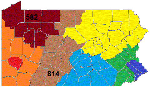
Area codes 814 and 582 are telephone area codes in the North American Numbering Plan (NANP) for the northwestern and central portions of the Commonwealth of Pennsylvania. Cities served by the area code include Altoona, Bradford, DuBois, Erie, Meadville, Oil City, Titusville, Johnstown, St. Marys, and Warren as well as the boroughs of State College, Brockway, Clearfield, Huntingdon, Mount Union, Bedford, Clarion, Punxsutawney, Tyrone, Ebensburg, Coudersport, Ridgway and Brookville. Area code 814 is the original area code assigned to the numbering plan area in 1947. Area code 582 was activated in the service area as an additional code to form an overlay numbering plan with a starting date of October 3, 2020. History Area code 814 is one of the original North American area codes established in 1947. Its numbering plan area (NPA) is the largest in the state. It is the only one of Pennsylvania's original four NPAs that still has its original boundaries. The large ... [...More Info...] [...Related Items...] OR: [Wikipedia] [Google] [Baidu] |


