|
Forestville Line
The Forestville Line, designated as Route K12, was a daily bus route operated by the Washington Metropolitan Area Transit Authority between Suitland station and Branch Avenue station of the Green Line of the Washington Metro. The line operated every 15 – 45 minutes during weekdays and 60 minutes during weekends. Trips were roughly 30 – 40 minutes long. There were a few early morning/late night and rush hour trips that only operate between the Suitland Metro Station & Penn Mar Shopping Center. Background Route K12 operated between Branch Avenue and Suitland Stations via Penn Mar Shopping Center. Some trips were shortened to operate between Penn Mar and Suitland. Route K12 operateed out of Andrews Federal Center garage since 2019. Prior to moving to Andrews, K12 operated from Southern Avenue until 1989 when it was moved to Landover division. K12 Stops History K12 & K19 were initially created as new bus routes in 1963, to operate between Federal Triangle in Downtown Washing ... [...More Info...] [...Related Items...] OR: [Wikipedia] [Google] [Baidu] |
Metrobus (Washington, D
Metrobus may refer to: Transport services Bus Rapid Transit *MetroBus (Bristol), a bus rapid transit system in Bristol, England, United Kingdom *Metrobus (Buenos Aires), a bus rapid transit system in Buenos Aires, Argentina *Metrobus (Istanbul), a bus rapid transit system in Istanbul, Turkey *Metrobus (Lahore), a public rapid transit system in Lahore, Pakistan *Metrobus (Tegucigalpa), a bus system under construction in Tegucigalpa, Honduras *Mexico City Metrobús, a bus rapid transit system in Mexico City, Mexico *Multan Metrobus, a public rapid transit system in Multan, Pakistan *Rawalpindi-Islamabad Metrobus, a public rapid transit system in Rawalpindi-Islamabad, Pakistan *Los Angeles Metro Busway, a bus rapid transit system in Los Angeles, United States *Metronit, a bus rapid transit system in Haifa, Israel *Transmilenio, a bus rapid transit system in Bogotá, Colombia Conventional *Los Angeles Metro Bus, the transit bus service of the Los Angeles County Metropolitan Transportat ... [...More Info...] [...Related Items...] OR: [Wikipedia] [Google] [Baidu] |
TheBus (Prince George's County)
TheBus (stylized as ''THEBUS''), also branded as Prince George's County Transit on newer buses, is a bus transportation system serving Prince George's County, Maryland providing Monday-Saturday service. There are 29 bus routes, with most operating between Washington Metro stations in the county, with two routes running to Upper Marlboro. The fare is $1.25, but seniors (age 60+), the disabled, one child under five years old, and students (between 2:00PM and 7:00PM) ride free. On October 13, 2008, TheBus began accepting payment using SmarTrip regional farecards. The county has contracted operations and maintenance of ''THE BUS'' system to RATP Dev. In , the system had a ridership of or about per weekday as of . History The idea for Prince George's County establishing its own transit system was initially brought up by Prince George's County in 1986, as a way of providing better transportation access to the Upper Marlboro Courthouse and other important government offices, that w ... [...More Info...] [...Related Items...] OR: [Wikipedia] [Google] [Baidu] |
Eastern Market Station
Eastern Market station is a Washington Metro station in the Capitol Hill neighborhood of Washington, D.C., United States. The island platformed station was opened on July 1, 1977, and is operated by the Washington Metropolitan Area Transit Authority (WMATA). The station currently provides service for the Blue, Orange, and Silver Lines. The station is located in Southeast D.C. at Pennsylvania Avenue and 7th Street. It is named after the nearby Eastern Market, a historic public marketplace. History Originally, the station was to be named Marine Barracks, after the Washington Marine Barracks located a few blocks south of the station on 8th Street. However, after lobbying from the Capitol Hill Restoration Society, the name was changed to Eastern Market. The station opened on July 1, 1977. Its opening coincided with the completion of of rail between National Airport and RFK Stadium and the opening of an entire section of line, which included 16 stations in total, between the Ro ... [...More Info...] [...Related Items...] OR: [Wikipedia] [Google] [Baidu] |
Potomac Avenue Station
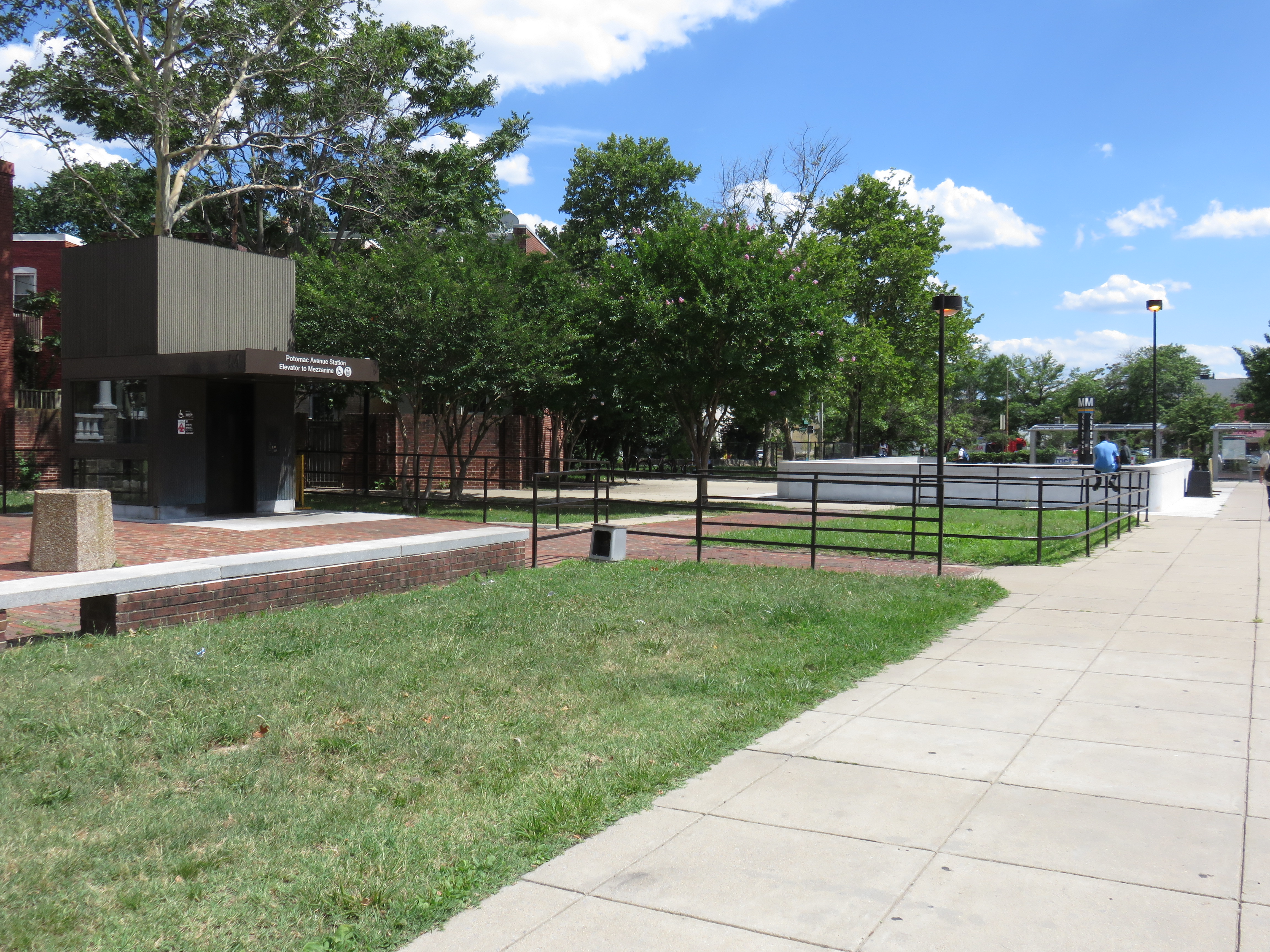
Potomac Avenue station is an island-platformed Washington Metro station in the Hill East neighborhood of Washington, D.C., U.S.. The station was opened on July 1, 1977, and is operated by the Washington Metropolitan Area Transit Authority (WMATA). The station currently provides service for the Blue, Orange, and Silver Lines. The station serves a dense residential area of Southeast Washington around Potomac Avenue and is located at 14th and G Streets. History The station's opening coincided with the completion of of rail between National Airport and RFK Stadium and the opening of the Arlington Cemetery, Capitol South, Crystal City, Eastern Market, Farragut West, Federal Center SW, Federal Triangle, Foggy Bottom–GWU, L'Enfant Plaza, McPherson Square, National Airport, Pentagon In geometry, a pentagon () is any five-sided polygon or 5-gon. The sum of the internal angles in a simple polygon, simple pentagon is 540°. A pentagon may be simple or list of self-i ... [...More Info...] [...Related Items...] OR: [Wikipedia] [Google] [Baidu] |
Andrews Air Force Base
Andrews Air Force Base (Andrews AFB, AAFB) is the airfield portion of Joint Base Andrews, which is under the jurisdiction of the United States Air Force (USAF). In 2009, Andrews Air Force Base merged with Naval Air Facility Washington to form Joint Base Andrews. Andrews, located near Morningside, Maryland in suburban Washington, D.C., is the home base of two Boeing VC-25A aircraft with the call sign Air Force One when the president is on board, that serve the President of the United States, and the President is typically flown in and out of Andrews when travelling from Washington, D.C. by plane. The host unit at Andrews is the 316th Wing, assigned to the Air Force District of Washington. It is responsible for maintaining emergency reaction rotary-wing airlift and other National Capital Region contingency response capabilities critical to national security and for organizing, training, equipping and deploying combat-ready forces for Air and Space Expeditionary Forces (AEF ... [...More Info...] [...Related Items...] OR: [Wikipedia] [Google] [Baidu] |
Downtown (Washington, D
''Downtown'' is a term primarily used in American and Canadian English to refer to a city's sometimes commercial, cultural and often the historical, political, and geographic heart. It is often synonymous with its central business district (CBD). It may also be a center for shopping and entertainment. Downtowns typically contain a small percentage of a city's employment but are concentrated in services, including high-end services (office or white-collar jobs). Sometimes, smaller downtowns include lower population densities and nearby lower incomes than suburbs. It is often distinguished as a hub of public transit and culture. History Origins The ''Oxford English Dictionarys first citation for "down town" or "downtown" dates to 1770, in reference to the center of Boston. Some have posited that the term "downtown" was coined in New York City, where it was in use by the 1830s to refer to the original settlement, or town, at the southern tip of the island of Manhattan.Fogels ... [...More Info...] [...Related Items...] OR: [Wikipedia] [Google] [Baidu] |
Federal Triangle
Federal Triangle is a Triangle, triangular area in Washington, D.C., formed by 15th Street NW, Constitution Avenue, Constitution Avenue NW, Pennsylvania Avenue, Pennsylvania Avenue NW, and E Street NW. Federal Triangle is occupied by 10 large city and federal office buildings, all of which are part of the Pennsylvania Avenue National Historic Site. Seven of the buildings in Federal Triangle were built by the Federal government of the United States, U.S. federal government in the early and mid-1930s as part of a coordinated construction plan that has been called "one of the greatest building projects ever undertaken". Two buildings predating this coordinated effort were incorporated into Federal Triangle, and one was constructed in the 1990s. Federal Triangle station is the Washington Metro station serving Federal Triangle and its immediately surrounding areas. Name The name "Federal Triangle" appears to have been a journalistic invention. The press wrote of a "Pennsylvania A ... [...More Info...] [...Related Items...] OR: [Wikipedia] [Google] [Baidu] |
District Heights-Suitland Line
A district is a type of administrative division that in some countries is managed by the local government. Across the world, areas known as "districts" vary greatly in size, spanning regions or county, counties, several municipality, municipalities, subdivisions of municipalities, school district, or political district. Etymology The word "district" in English is a Loanword, loan word from French language, French. It comes from Medieval Latin districtus–"exercising of justice, restraining of offenders". The earliest known English-language usage dates to 1611, in the work of lexicographer Randle Cotgrave. By country or territory Afghanistan In Afghanistan, a district (Persian language, Persian ) is a subdivision of a province. There are almost 400 districts in the country. Australia Electoral districts are used in state elections. Districts were also used in several states as cadastral units for land titles. Some were used as squatting districts. Cadastral divi ... [...More Info...] [...Related Items...] OR: [Wikipedia] [Google] [Baidu] |
Oxon Hill-Suitland Line
{{disambig ...
Oxon may refer to: * An abbreviation for the English city of Oxford, or the English county of Oxfordshire, or the University of Oxford (from ''Oxonia'', Latin for Oxford) * The post-nominal suffix indicating a degree from the University of Oxford (Latin name ''Universitas Oxoniensis'') * An area of the English town of Shrewsbury * Oxon (chemical), an organic compound See also * Oxen, plural of ox * Oxon Creek * Oxon Hill High School * Oxon Hill, Maryland * Oxon Hoath * Oxus * Auxonne Auxonne ( or ) is a commune in the Côte-d'Or department in the Bourgogne-Franche-Comté region of eastern France. Auxonne is one of the sites of the defensive structures of Vauban, clearly seen from the train bridge as it enters the train s ... [...More Info...] [...Related Items...] OR: [Wikipedia] [Google] [Baidu] |
Maryland Route 458
Maryland Route 458 (MD 458) is a state highway in the U.S. state of Maryland. Known as Silver Hill Road, the highway runs from MD 5 in Silver Hill north to Walker Mill Road in District Heights. MD 458 is a four- to six-lane divided highway that connects the inner suburbs of Hillcrest Heights, Silver Hill, Suitland, and District Heights in western Prince George's County. The highway also connects those communities with the Suitland station of the Washington Metro. MD 458 was originally constructed in the early 1930s between the original alignments of MD 5 and MD 4. The route was relocated in District Heights in 1960 and widened to a divided highway in the mid-1960s. MD 458 was extended to its present southern and northern termini in the late 1960s and mid-1980s, respectively. Route description MD 458 begins at an intersection with MD 5 (Branch Avenue) in Silver Hill. The west leg of the intersection is Iverson Street, which passes under The Shops at Iverson and through H ... [...More Info...] [...Related Items...] OR: [Wikipedia] [Google] [Baidu] |
Maryland Route 4
Maryland Route 4 (MD 4) is a state highway in the U.S. state of Maryland. The highway runs from Maryland Route 5, MD 5 in Leonardtown, Maryland, Leonardtown north to Southern Avenue (Washington, D.C.), Southern Avenue in Suitland, Maryland, Suitland at the District of Columbia boundary, beyond which the highway continues into Washington, D.C., Washington as Pennsylvania Avenue. MD 4 is a four- to six-lane highway that connects Washington and communities around Interstate 95 in Maryland, Interstate 95 (I-95)/Interstate 495 (Maryland), I-495 (Capital Beltway) with southern Prince George's County, Maryland, Prince George's County with southwestern Anne Arundel County, Maryland, Anne Arundel County. The highway is the primary highway for the length of Calvert County, Maryland, Calvert County, during most of which the route concurrency (road), runs concurrently with Maryland Route 2, MD 2. MD 4 also connects Calvert and St. Mary's County, Maryland, St. Mary's counties via the Govern ... [...More Info...] [...Related Items...] OR: [Wikipedia] [Google] [Baidu] |


