|
Foldfjord
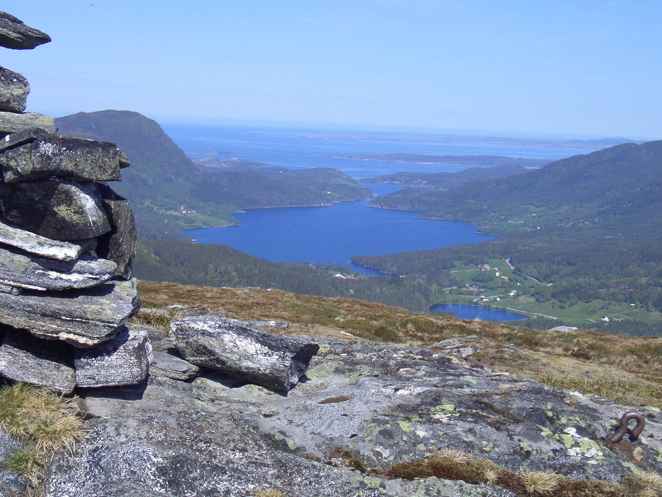
Foldfjord ( no, Foldfjorden or ''Follfjorden'') is a fjord on the island of Ertvågsøy in the municipality of Aure in Møre og Romsdal county, Norway. The fjord's natural surroundings support a large wildlife population, including many red deer. County Road 682 runs along the east shore of the fjord. At the north end, County Road 680 crosses the fjord at a narrow point near Espset. The fjord flows north where it joins Gjerdavika, an arm off Edøyfjorden Edøyfjorden is a fjord (more technically, a strait) in the Nordmøre region of Møre og Romsdal county, Norway. The long fjord runs between Smøla Municipality and Aure Municipality with many large and small islands on both sides. Some of th .... References External linksFoldfjord at Norgeskart Aure, Norway Fjords of Møre og Romsdal {{MøreRomsdal-geo-stub ... [...More Info...] [...Related Items...] OR: [Wikipedia] [Google] [Baidu] |
Aure, Norway
Aure is a municipality in Møre og Romsdal county, Norway. It is part of the region of Nordmøre. The administrative centre is the village of Aure. Other villages in Aure include Gullstein, Stemshaug, Todalen, Tjeldbergodden, Arasvika, and Tømmervåg. Aure has one of the largest wooden churches in Norway, Aure Church. The municipality is the 179th largest by area out of the 356 municipalities in Norway. Aure is the 218th most populous municipality in Norway with a population of 3,384. The municipality's population density is and its population has decreased by 3.6% over the previous 10-year period. General information The municipality was established on 1 January 1838 (see formannskapsdistrikt law). On 1 January 1894, the southern district of Aure (population: 942) was separated to form the new municipality of Valsøyfjord. Then on 1 July 1914, the northeastern district of Aure (population: 851) was separated to form the new municipality of Stemshaug. During the 1960 ... [...More Info...] [...Related Items...] OR: [Wikipedia] [Google] [Baidu] |
Norwegian County Road 682
County Road 682 ( no, Fylkesvei 682) is a road in the municipalities of Aure (in Møre og Romsdal county) and Heim (in Trøndelag county) in Norway. In addition to its land length, the route also includes a ferry connection. The road branches off from County Road 680 at Espset and runs south across the island of Ertvågsøy, first along the east shore of Foldfjord and then along the east shore of the lake ''Skausetvatnet''. County Road 362 branches off to the east at Vågosen just before the road reaches the ferry dock at Arasvika. There the route continues via ferry across Arasvik Fjord to Hennset, where it joins European route E39. The road is also named ''Arasvikvegen'' (Arasvika Road) for its entire length. Prior to January 1, 2010, the route was a national road, but control and maintenance of the road was transferred to the counties from the national government on that date, and so now it is a county road A county highway (also county road or county route; usua ... [...More Info...] [...Related Items...] OR: [Wikipedia] [Google] [Baidu] |
Møre Og Romsdal
Møre og Romsdal (; en, Møre and Romsdal) is a county in the northernmost part of Western Norway. It borders the counties of Trøndelag, Innlandet, and Vestland. The county administration is located in the town of Molde, while Ålesund is the largest town. The county is governed by the Møre og Romsdal County Municipality which includes an elected county council and a county mayor. The national government is represented by the county governor. Name The name ''Møre og Romsdal'' was created in 1936. The first element refers to the districts of Nordmøre and Sunnmøre, and the last element refers to Romsdal. Until 1919, the county was called "Romsdalens amt", and from 1919 to 1935 "Møre fylke". For hundreds of years (1660-1919), the region was called ''Romsdalen amt'', after the Romsdalen valley in the present-day Rauma Municipality. The Old Norse form of the name was ''Raumsdalr''. The first element is the genitive case of the name ''Raumr'' derived from the nam ... [...More Info...] [...Related Items...] OR: [Wikipedia] [Google] [Baidu] |
Norway
Norway, officially the Kingdom of Norway, is a Nordic country in Northern Europe, the mainland territory of which comprises the western and northernmost portion of the Scandinavian Peninsula. The remote Arctic island of Jan Mayen and the archipelago of Svalbard also form part of Norway. Bouvet Island, located in the Subantarctic, is a dependency of Norway; it also lays claims to the Antarctic territories of Peter I Island and Queen Maud Land. The capital and largest city in Norway is Oslo. Norway has a total area of and had a population of 5,425,270 in January 2022. The country shares a long eastern border with Sweden at a length of . It is bordered by Finland and Russia to the northeast and the Skagerrak strait to the south, on the other side of which are Denmark and the United Kingdom. Norway has an extensive coastline, facing the North Atlantic Ocean and the Barents Sea. The maritime influence dominates Norway's climate, with mild lowland temperatures on the ... [...More Info...] [...Related Items...] OR: [Wikipedia] [Google] [Baidu] |
Fjord
In physical geography, a fjord or fiord () is a long, narrow inlet with steep sides or cliffs, created by a glacier. Fjords exist on the coasts of Alaska, Antarctica, British Columbia, Chile, Denmark, Germany, Greenland, the Faroe Islands, Iceland, Ireland, Kamchatka, the Kerguelen Islands, Labrador, Newfoundland, New Zealand, Norway, Novaya Zemlya, Nunavut, Quebec, the Patagonia region of Argentina and Chile, Russia, South Georgia Island, Tasmania, United Kingdom, and Washington state. Norway's coastline is estimated to be long with its nearly 1,200 fjords, but only long excluding the fjords. Formation A true fjord is formed when a glacier cuts a U-shaped valley by ice segregation and abrasion of the surrounding bedrock. According to the standard model, glaciers formed in pre-glacial valleys with a gently sloping valley floor. The work of the glacier then left an overdeepened U-shaped valley that ends abruptly at a valley or trough end. Such valleys are fjords when ... [...More Info...] [...Related Items...] OR: [Wikipedia] [Google] [Baidu] |
Red Deer
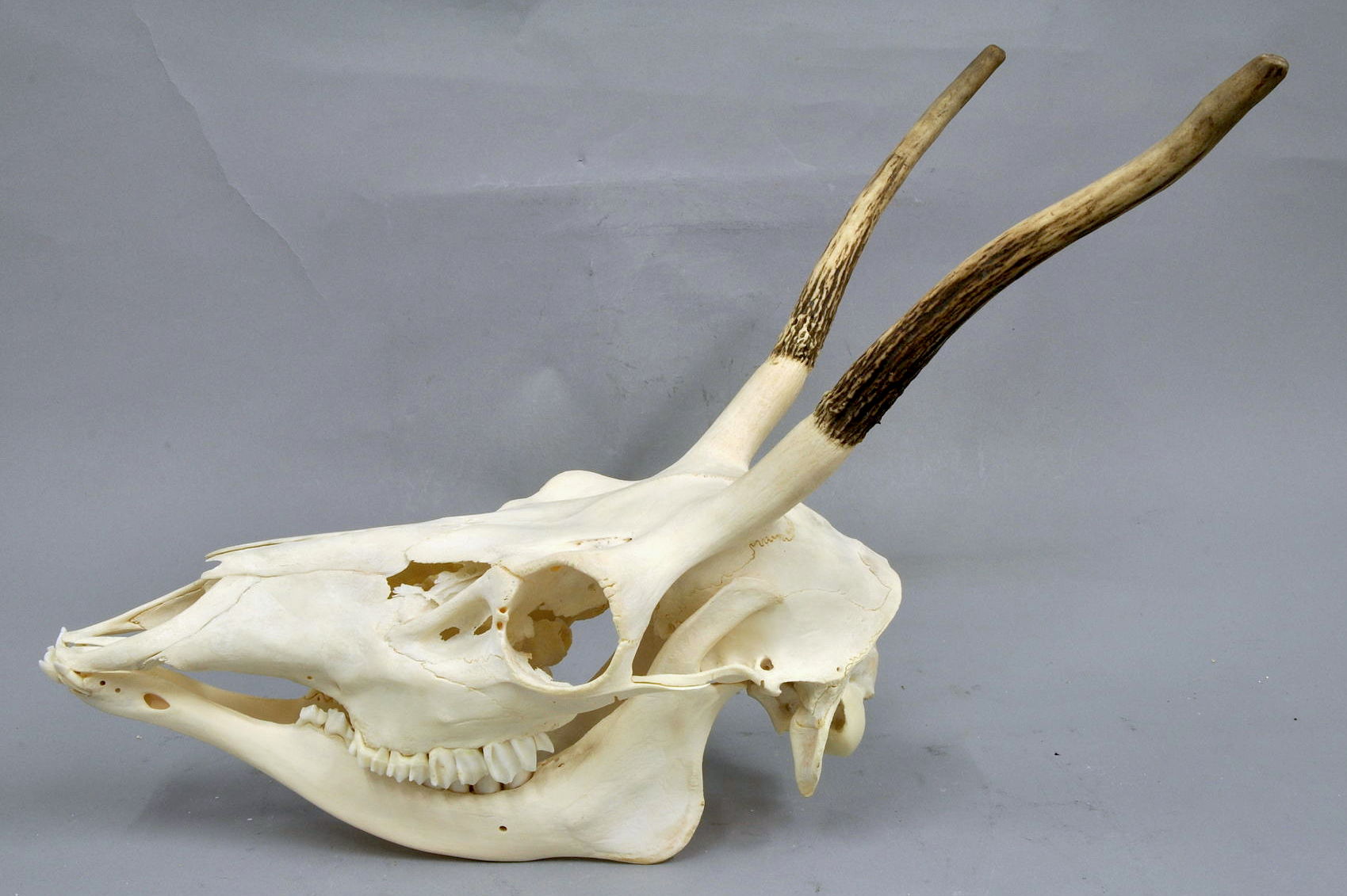
The red deer (''Cervus elaphus'') is one of the largest deer species. A male red deer is called a stag or hart, and a female is called a hind. The red deer inhabits most of Europe, the Caucasus Mountains region, Anatolia, Iran, and parts of western Asia. It also inhabits the Atlas Mountains of Northern Africa; its early ancestors are thought to have crossed over to Morocco, then to Algeria, Libya and Tunisia via the Strait of Gibraltar, becoming the only species of true deer ( Cervidae) to inhabit Africa. Red deer have been introduced to other areas, including Australia, New Zealand, the United States, Canada, Peru, Uruguay, Chile and Argentina. In many parts of the world, the meat (venison) from red deer is used as a food source. Red deer are ruminants, characterized by a four-chambered stomach. Genetic evidence indicates that the red deer, as traditionally defined, is a species group, rather than a single species, though exactly how many species the group includes remains ... [...More Info...] [...Related Items...] OR: [Wikipedia] [Google] [Baidu] |
Norwegian County Road 680
Norwegian County Road 680 ( no, Fylkesvei 680) is a road in the municipalities of Kristiansund and Aure in Møre og Romsdal county and Heim in Trøndelag county, Norway. In addition to its land length ( in Møre og Romsdal and in Trøndelag), the route also includes the Seivika–Tømmervåg Ferry across the Talgsjø channel. The route starts in Øygarden in Kristiansund, where it branches off from European route E70, and runs west to Seivika, from which there is a ferry to Tømmervåg on the island of Tustna. It then takes a meandering coastal route eastward through the municipality of Aure to Svanem in Trøndelag, where it turns south and runs through Kyrksæterøra before meeting European route E39 in Stormyra, just outside Vinjeøra. Prior to January 1, 2010, the route was a Norwegian national road, but control and maintenance of the road was transferred to the counties from the national government on that date, and so now it is a Norwegian county road. References Ext ... [...More Info...] [...Related Items...] OR: [Wikipedia] [Google] [Baidu] |
Edøyfjorden
Edøyfjorden is a fjord (more technically, a strait) in the Nordmøre region of Møre og Romsdal county, Norway. The long fjord runs between Smøla Municipality and Aure Municipality with many large and small islands on both sides. Some of the major islands include Smøla, Edøya, and Kuli on the north side and Tustna, Stabblandet, Solskjeløya, Ertvågsøya, and Grisvågøya on the south side. The fjord flows into the Norwegian Sea on its southwestern end and into the Trondheimsleia and Ramsøyfjorden on the northeastern end. See also * List of Norwegian fjords This list of Norwegian fjords shows many of the fjords in Norway. In total, there are about 1,190 fjords in Norway and the Svalbard islands. The sortable list includes the lengths and locations of those fjords. Fjords See also * List of gl ... References {{DEFAULTSORT:Edoyfjorden Fjords of Møre og Romsdal Smøla Aure, Norway ... [...More Info...] [...Related Items...] OR: [Wikipedia] [Google] [Baidu] |

.jpg)
