|
Fisheries Monitoring Control And Surveillance
Monitoring, control and surveillance (MCS), in the context of fisheries, is defined by the Food and Agriculture Organization (FAO) of the United Nations as a broadening of traditional enforcing national rules over fishing, to the support of the broader problem of fisheries management. Internationally, the basis of law for fisheries management comes from the 1982 United Nations Convention on the Law of the Sea (UNCLOS). Further definition was in the Declaration of Cancun This is complemented by the work of a variety of regional organizations that cover high seas fishing areas. A key concept in international fishing laws is that of the Exclusive Economic Zone, which extends 200 miles (370 km) from the coast of nations bordering on the oceans. EEZ is not a meaningful concept in relatively small seas such as the Mediterranean and Baltic, so those areas tend to have regional agreements for MCS of international waters within those seas. Components and related activities MCS has aspe ... [...More Info...] [...Related Items...] OR: [Wikipedia] [Google] [Baidu] |
Food And Agriculture Organization
The Food and Agriculture Organization of the United Nations; . (FAO) is a specialized agency of the United Nations that leads international efforts to defeat hunger and improve nutrition and food security. Its Latin motto, , translates to "let there be bread". It was founded on 16 October 1945. The FAO comprises 195 members, including 194 countries and the European Union. Its headquarters is in Rome, Italy, and it maintains regional and field offices worldwide, operating in over 130 countries. It helps governments and development agencies coordinate their activities to improve and develop agriculture, forestry, fisheries, and land and water resources. It also conducts research, provides technical assistance to projects, operates educational and training programs, and collects agricultural output, production, and development data. The FAO is governed by a biennial conference representing each member country and the European Union, which elects a 49-member executive cou ... [...More Info...] [...Related Items...] OR: [Wikipedia] [Google] [Baidu] |
Embedded System
An embedded system is a specialized computer system—a combination of a computer processor, computer memory, and input/output peripheral devices—that has a dedicated function within a larger mechanical or electronic system. It is embedded as part of a complete device often including electrical or electronic hardware and mechanical parts. Because an embedded system typically controls physical operations of the machine that it is embedded within, it often has real-time computing constraints. Embedded systems control many devices in common use. , it was estimated that ninety-eight percent of all microprocessors manufactured were used in embedded systems. Modern embedded systems are often based on microcontrollers (i.e. microprocessors with integrated memory and peripheral interfaces), but ordinary microprocessors (using external chips for memory and peripheral interface circuits) are also common, especially in more complex systems. In either case, the processor(s) us ... [...More Info...] [...Related Items...] OR: [Wikipedia] [Google] [Baidu] |
Fisheries Science
Fisheries science is the academic discipline of managing and understanding fisheries. It is a multidisciplinary science, which draws on the disciplines of limnology, oceanography, freshwater biology, marine biology, meteorology, conservation, ecology, population dynamics, economics, statistics, decision analysis, management, and many others in an attempt to provide an integrated picture of fisheries. In some cases new disciplines have emerged, as in the case of bioeconomics and fisheries law. Because fisheries science is such an all-encompassing field, fisheries scientists often use methods from a broad array of academic disciplines. Over the most recent several decades, there have been declines in fish stocks (populations) in many regions along with increasing concern about the impact of intensive fishing on marine and freshwater biodiversity. Fisheries science is typically taught in a university setting, and can be the focus of an undergraduate, master's or Ph.D. progra ... [...More Info...] [...Related Items...] OR: [Wikipedia] [Google] [Baidu] |
Fishing Industry
The fishing industry includes any industry or activity that takes, cultures, processes, preserves, stores, transports, markets or sells fish or fish products. It is defined by the Food and Agriculture Organization as including recreational, subsistence and commercial fishing, as well as the related harvesting, processing, and marketing sectors.FAO Fisheries Section: Glossary''Fishing industry.''Retrieved 28 May 2008. The commercial activity is aimed at the delivery of fish and other seafood products for human consumption or as input factors in other industrial processes. The livelihood of over 500 million people in developing countries depends directly or indirectly on fisheries and aquaculture. The fishing industry is struggling with environmental and welfare issues, including overfishing and occupational safety. Additionally, the combined pressures of climate change, biodiversity loss and overfishing endanger the livelihoods and food security of a substantial portio ... [...More Info...] [...Related Items...] OR: [Wikipedia] [Google] [Baidu] |
Frontiers In Marine Science
Frontiers Media SA is a publisher of peer-reviewed, open access, scientific journals currently active in science, technology, and medicine. It was founded in 2007 by Kamila and Henry Markram. Frontiers is based in Lausanne, Switzerland, with offices in the United Kingdom, Spain, and China. In 2022, Frontiers employed more than 1,400 people, across 14 countries. All Frontiers journals are published under a Creative Commons Attribution License. In 2015, Frontiers Media was classified as a possible predatory publisher by Jeffrey Beall, though Beall's list was taken offline two years later in a decision that remains controversial. History The first journal published was ''Frontiers in Neuroscience'', which opened for submission as a beta version in 2007. In 2010, Frontiers launched a series of another 11 journals in medicine and science. In February 2012, the Frontiers Research Network was launched, a social networking platform for researchers, intended to disseminate the open a ... [...More Info...] [...Related Items...] OR: [Wikipedia] [Google] [Baidu] |
Marine Policy
''Marine Policy'' is a monthly interdisciplinary peer-reviewed academic journal published by Elsevier concerning ocean policy studies, analyzing social science disciplines relevant to the formulation of marine policy. It was established in 1977 by founding editor Tony Loftas. The current editor-in-chief is Sebastián Villasante ( University of Santiago de Compostela). Abstracting and indexing According to the ''Journal Citation Reports'', the journal has a 2023 impact factor of 3.5. See also * List of international relations journals The following list of scholarly journals in international relations contains notable English-language academic journals on international relations. It is not comprehensive, as there are hundreds currently published. Popular magazines or other publi ... References External links * {{DEFAULTSORT:Marine Policy Elsevier academic journals English-language journals International relations journals Monthly journals Academic journals esta ... [...More Info...] [...Related Items...] OR: [Wikipedia] [Google] [Baidu] |
Geosynchronous Orbit
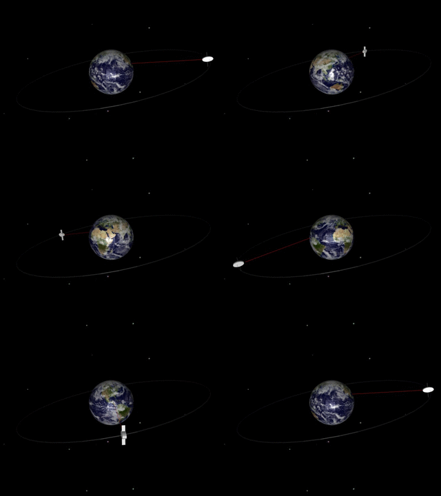
A geosynchronous orbit (sometimes abbreviated GSO) is an Earth-centered orbit with an orbital period that matches Earth's rotation on its axis, 23 hours, 56 minutes, and 4 seconds (one sidereal day). The synchronization of rotation and orbital period means that, for an observer on Earth's surface, an object in geosynchronous orbit returns to exactly the same position in the sky after a period of one sidereal day. Over the course of a day, the object's position in the sky may remain still or trace out a path, typically in a figure-8 form, whose precise characteristics depend on the orbit's inclination and eccentricity. A circular geosynchronous orbit has a constant altitude of . A special case of geosynchronous orbit is the geostationary orbit (often abbreviated ''GEO''), which is a circular geosynchronous orbit in Earth's equatorial plane with both inclination and eccentricity equal to 0. A satellite in a geostationary orbit remains in the same position in the sky to observers ... [...More Info...] [...Related Items...] OR: [Wikipedia] [Google] [Baidu] |
Low Earth Orbit
A low Earth orbit (LEO) is an geocentric orbit, orbit around Earth with a orbital period, period of 128 minutes or less (making at least 11.25 orbits per day) and an orbital eccentricity, eccentricity less than 0.25. Most of the artificial objects in outer space are in LEO, peaking in number at an altitude around , while the farthest in LEO, before medium Earth orbit (MEO), have an altitude of 2,000 km, about one-third of the Earth radius, radius of Earth and near the beginning of the Van Allen radiation belt#Inner belt, inner Van Allen radiation belt. The term ''LEO region'' is used for the area of space below an altitude of (about one-third of Earth's radius). Objects in orbits that pass through this zone, even if they have an apogee further out or are sub-orbital spaceflight, sub-orbital, are carefully tracked since they present a collision risk to the many LEO satellites. No human spaceflights other than the lunar missions of the Apollo program (1968-1972) have gone beyond L ... [...More Info...] [...Related Items...] OR: [Wikipedia] [Google] [Baidu] |
Nautical Charts
A nautical chart or hydrographic chart is a graphic representation of a sea region or water body and adjacent coasts or banks. Depending on the scale of the chart, it may show depths of water (bathymetry) and heights of land (topography), natural features of the seabed, details of the coastline, navigational hazards, locations of natural and human-made aids to navigation, information on tides and currents, local details of the Earth's magnetic field, and human-made structures such as harbours, buildings, and bridges. Nautical charts are essential tools for marine navigation; many countries require vessels, especially commercial ships, to carry them. Nautical charting may take the form of charts printed on paper (raster navigational charts) or computerized electronic navigational charts. Recent technologies have made available paper charts which are printed "on demand" with cartographic data that has been downloaded to the commercial printing company as recently as the night b ... [...More Info...] [...Related Items...] OR: [Wikipedia] [Google] [Baidu] |
Echo Sounding
Echo sounding or depth sounding is the use of sonar for ranging, normally to determine the depth (coordinate), depth of water (bathymetry). It involves transmitting acoustic waves into water and recording the time interval between emission and return of a pulse; the resulting time of flight, along with knowledge of the speed of sound in water, allows determining the distance between sonar and target. This information is then typically used for navigation purposes or in order to obtain depths for Nautical chart, charting purposes. Echo sounding can also be used for ranging to other targets, such as fish schools. Hydroacoustic assessments have traditionally employed mobile surveys from boats to evaluate fish biomass and spatial distributions. Conversely, fixed-location techniques use stationary transducers to monitor passing fish. The word ''Depth sounding, sounding'' is used for all types of depth measurements, including those that don't use sound, and is unrelated in origin to ... [...More Info...] [...Related Items...] OR: [Wikipedia] [Google] [Baidu] |
Radar
Radar is a system that uses radio waves to determine the distance ('' ranging''), direction ( azimuth and elevation angles), and radial velocity of objects relative to the site. It is a radiodetermination method used to detect and track aircraft, ships, spacecraft, guided missiles, motor vehicles, map weather formations, and terrain. The term ''RADAR'' was coined in 1940 by the United States Navy as an acronym for "radio detection and ranging". The term ''radar'' has since entered English and other languages as an anacronym, a common noun, losing all capitalization. A radar system consists of a transmitter producing electromagnetic waves in the radio or microwave domain, a transmitting antenna, a receiving antenna (often the same antenna is used for transmitting and receiving) and a receiver and processor to determine properties of the objects. Radio waves (pulsed or continuous) from the transmitter reflect off the objects and return to the receiver, giving ... [...More Info...] [...Related Items...] OR: [Wikipedia] [Google] [Baidu] |


