|
Finegand
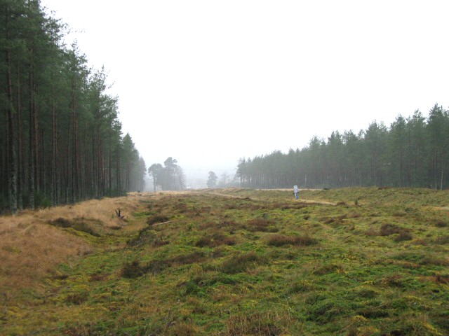
Finegand is a farming hamlet located in eastern Perth and Kinross, Scotland and also refers historically to the portion of lands surrounding the hamlet. Finegand is located in Glen Shee and encompasses the lands east of the Shee Water adjacent to a burn which joins it about below the Spittal and about north of Blairgowrie. The name is a corruption of the Gaelic Gaelic (pronounced for Irish Gaelic and for Scots Gaelic) is an adjective that means "pertaining to the Gaels". It may refer to: Languages * Gaelic languages or Goidelic languages, a linguistic group that is one of the two branches of the Insul ... ''Fèith nan Ceann'', meaning "the burn of the heads" and takes its name from an event, which according to legend, took place sometime in the 15th century. Local history tells of 15th century tax collectors sent repeatedly to Glenshee, probably by the oppressive Earl of Atholl, to collect ever-increasing tax from the highlanders "in whatever manner they deemed most ... [...More Info...] [...Related Items...] OR: [Wikipedia] [Google] [Baidu] |
Clan MacThomas
Clan MacThomas is a Scottish Highlands, Highland Scottish clan and is a member of the Clan Chattan Confederation.Way, George and Squire, Romily. ''Collins Scottish Clan & Family Encyclopedia''. (Foreword by The Rt Hon. The Earl of Elgin KT, Convenor, The Standing Council of Scottish Chiefs). Published in 1994. Pages 258–259. History Origins of the clan The progenitor of the Clan MacThomas was Thomas, who was a Scottish Gaelic speaking Highlander. He was known as ''Tomaidh Mòr'' and it is from him that the clan takes its name. He was a grandson of William Mackintosh, 7th chief of Clan Mackintosh and 8th chief of the Chattan Confederation.Andrew MacThomas of Finegand, The History of the Clan MacThomas, 2009, various pages. Thomas lived in the fifteenth century when the Clan Chattan had become so large that it was unmanageable, so Thomas took his clan from Badenoch, across the Grampian Mountains to Glen Shee where they re-settled. Here they flourished and became known as McCom ... [...More Info...] [...Related Items...] OR: [Wikipedia] [Google] [Baidu] |
Glenshee
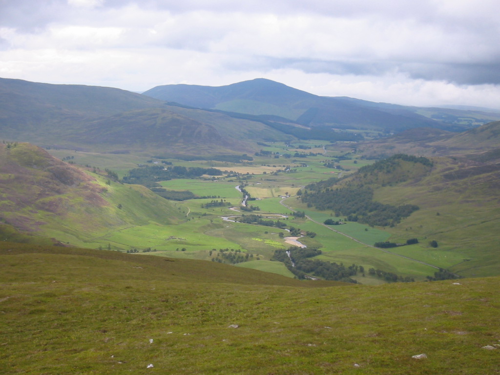
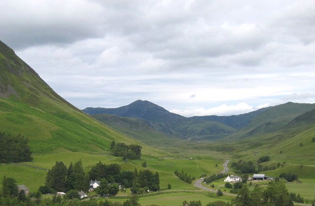
Glen Shee () is a glen in eastern Perthshire, Scotland. Shee Water flows through the glen. The head of the glen, where Gleann Taitneach and Glen Lochsie meet, is approximately 2 km north-west of the Spittal of Glenshee; it then runs south-east to Bridge of Cally where it merges with Strathardle to form Glen Ericht. Once known as the glen of the fairies it takes its name from the Gaelic "sith" meaning fairy and the old meeting place at the standing stone behind the present day church is called ''Dun Shith'' or Hill of the Fairies. The main settlement is the Spittal of Glenshee, now by-passed, which has a historic hotel, first run by monks from Coupar Angus Abbey to provide shelter and hospitality for travellers, hence the name "Spittal", an outdoor activity centre, self-catering lodges, the church and an original General Wade humpback bridge. The first record of a refuge for travellers there dates back to 961 AD. Over the centuries it has had an unenviable record of ... [...More Info...] [...Related Items...] OR: [Wikipedia] [Google] [Baidu] |
Perth And Kinross
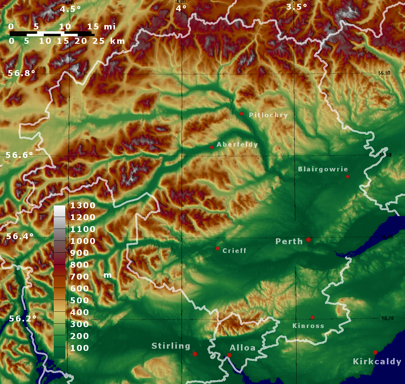
Perth and Kinross (; ) is one of the 32 council areas of Scotland, and a Lieutenancy areas of Scotland, lieutenancy area. It is bordered by Highland (council area), Highland and Aberdeenshire to the north, Angus, Scotland, Angus, Dundee, and Fife to the east, Clackmannanshire to the south, and Stirling (council area), Stirling and Argyll and Bute to the west. Geographically the area is split by the Highland Boundary Fault into a more mountainous northern part and a flatter southern part. The northern area is a popular tourist spot, while agriculture makes an important contribution to the southern part of the area. The area is run by Perth and Kinross Council, which is based in Perth, Scotland, Perth. History The area takes its name from the two historical Shires of Scotland, shires of Perthshire and Kinross-shire. Each was administered by a Sheriff principal, sheriff from medieval times, supplemented by Commissioners of Supply, commissioners of supply from 1667 and then by a ... [...More Info...] [...Related Items...] OR: [Wikipedia] [Google] [Baidu] |
Perth And North Perthshire (UK Parliament Constituency)
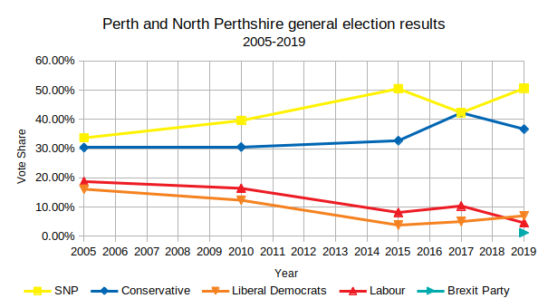
Perth and North Perthshire was a county constituency of the House of Commons of the Parliament of the United Kingdom. It elected one Member of Parliament (MP) by the first past the post system of election. The constituency was created in 2005. Campaigns in the seat had resulted in a minimum of 30% of votes at each election consistently for the same two parties' choice for candidate, and the next lower-placed party's having fluctuated between 8.1% and 18.7% of the vote since its relatively recent creation. The seat attracted a record seven candidates in 2015 and had seen as few as four, in 2017. Further to the completion of the 2023 Periodic Review of Westminster constituencies, the seat was abolished. Subject to boundary changesentailing the transfer of "North Perthshire" to the new constituency of Angus and Perthshire Glens, offset by the addition of Strathearn, Almond and Earn and Kinross-shire from the abolished constituency of Ochil and South Perthshireit was be refo ... [...More Info...] [...Related Items...] OR: [Wikipedia] [Google] [Baidu] |
Perthshire North (Scottish Parliament Constituency)
Perthshire North is a constituency of the Scottish Parliament ( Holyrood) covering part of the council area of Perth and Kinross. It elects one Member of the Scottish Parliament (MSP) by the plurality (first past the post) method of election. It is one of nine constituencies in the Mid Scotland and Fife electoral region, which elects seven additional members, in addition to the nine constituency MSPs, to produce a form of proportional representation for the region as a whole. The constituency was created for the 2011 Scottish Parliament election, and comprises areas that were formerly part of the constituencies of Angus, Perth and North Tayside, which were abolished. Since first created it has been held by John Swinney of the Scottish National Party, who was previously the member for North Tayside. Electoral region The other eight constituencies of the Mid Scotland and Fife region are: Clackmannanshire and Dunblane, Cowdenbeath, Dunfermline, Kirkcaldy, Mid Fife and ... [...More Info...] [...Related Items...] OR: [Wikipedia] [Google] [Baidu] |
Hamlet (place)
A hamlet is a human settlement that is smaller than a town or village. This is often simply an informal description of a smaller settlement or possibly a subdivision or satellite entity to a larger settlement. Sometimes a hamlet is defined for official or Administrative division, administrative purposes. The word and concept of a hamlet can be traced back to Anglo-Normans, Norman England, where the Old French came to apply to small human settlements. Etymology The word comes from Anglo-Norman language, Anglo-Norman ', corresponding to Old French ', the diminutive of Old French ' meaning a little village. This, in turn, is a diminutive of Old French ', possibly borrowed from (West Germanic languages, West Germanic) Franconian languages. It is related to the modern French ', Dutch language, Dutch ', Frisian languages, Frisian ', German ', Old English ', and Modern English ''home''. By country Afghanistan In Afghanistan, the counterpart of the hamlet is the Qila, qala ... [...More Info...] [...Related Items...] OR: [Wikipedia] [Google] [Baidu] |
Shee Water
The Shee Water () is a river in the highland portion of eastern Perth and Kinross, Scotland. The Allt a' Ghlinne Bhig, Allt Ghlinn Thaitneach and Glen Lochsie Burn (plus numerous smaller streams) drain south out of the Grampian mountains. They converge at the Spittal of Glenshee to form the Shee Water. This runs through Glenshee to the Strathmore valley where it becomes the Black Water for a short distance and, close to Bridge of Cally, joins the River Ardle to form the River Ericht. The Water eventually reaches the North Sea via the River Isla and the River Tay The River Tay (, ; probably from the conjectured Brythonic ''Tausa'', possibly meaning 'silent one' or 'strong one' or, simply, 'flowing' David Ross, ''Scottish Place-names'', p. 209. Birlinn Ltd., Edinburgh, 2001.) is the longest river in Sc .... External links * Rivers of Perth and Kinross {{Scotland-river-stub ... [...More Info...] [...Related Items...] OR: [Wikipedia] [Google] [Baidu] |
Spittal Of Glenshee
The Spittal of Glenshee (, ) lies at the head of Glenshee in the highlands of eastern Perth and Kinross, Scotland, where the confluence of many small streams flowing south out of the Grampians form the Shee Water. For centuries, there has been a hostel or inn at the site and, in modern times, the small village has become a centre for travel, tourism and winter sports in the region, sited at a bend on the A93 road, A93 trunk road which leads from Blairgowrie and Rattray, Blairgowrie north past the Spittal to the Glenshee Ski Centre and on to Braemar. Inhabitation in the Neolithic period is indicated by a Megalithic standing stone behind the old kirk, and the ''Four Poster stone circle'' on a nearby mound. When interest in ski mountaineering revived after the First World War and the Scottish Ski Club was resuscitated in 1929, they restarted weekly snow reports with reporters appointed at Lix Toll near Killin, Dalwhinnie, Braemar and the Spittal of Glenshee. The Dundee Ski Club ... [...More Info...] [...Related Items...] OR: [Wikipedia] [Google] [Baidu] |
Blairgowrie And Rattray
Blairgowrie and Rattray () is a Twin cities (geographical proximity), twin burgh in Perth and Kinross, Scotland. Locals refer to the town as "Blair". Blairgowrie is the larger of the two former burghs which were united by an Act of Parliament in 1928 and lies on the southwest side of the River Ericht while Rattray is on the northeast side. Rattray claims to be the older and certainly Old Rattray, the area round Rattray Kirk, dates back to the 12th century. New Rattray, the area along the Boat Brae and Balmoral Road dates from 1777 when the River was spanned by the Brig o' Blair. The town lies on the north side of Strathmore, Angus, Strathmore at the foot of the Grampian Mountains. The west boundary is formed by the Knockie, a round grassy hill, and Craighall Gorge on the Ericht. Blairgowrie and Rattray developed over the centuries at the crossroads of several historic routes with links from the town to Perth, Scotland, Perth, Coupar Angus, Alyth and Braemar. The roads to Coup ... [...More Info...] [...Related Items...] OR: [Wikipedia] [Google] [Baidu] |
Scottish Gaelic Language
Scottish Gaelic (, ; Endonym and exonym, endonym: ), also known as Scots Gaelic or simply Gaelic, is a Celtic language native to the Gaels of Scotland. As a member of the Goidelic language, Goidelic branch of Celtic, Scottish Gaelic, alongside both Irish language, Irish and Manx language, Manx, developed out of Old Irish. It became a distinct spoken language sometime in the 13th century in the Middle Irish period, although a Classical Gaelic, common literary language was shared by the Gaels of both Ireland and Scotland until well into the 17th century. Most of modern Scotland was once Gaelic-speaking, as evidenced especially by Gaelic-language place names. In the 2011 United Kingdom census#2011 Census for Scotland, 2011 census of Scotland, 57,375 people (1.1% of the Scottish population, three years and older) reported being able to speak Gaelic, 1,275 fewer than in 2001. The highest percentages of Gaelic speakers were in the Outer Hebrides. Nevertheless, there is a language ... [...More Info...] [...Related Items...] OR: [Wikipedia] [Google] [Baidu] |


