|
Fife Cup
The Fife Cup is a Scottish regional football competition for clubs in the historic county of Fife. The competition was founded by the Fifeshire Football Association in 1882. The competition was originally known as the "Fifeshire Cup" from 1882–1896 and the "Fife and District Cup" between 1896 and 1900. It also run on league lines between 1903 and 1905 called the "Fifeshire League" before its current name. The current holders are Dunfermline Athletic who won the 2018 –19 competition. Participants For the 2022–23 season, nine clubs are taking part in the competition. * Burntisland Shipyard * Cowdenbeath Cowdenbeath () is a town and burgh in west Fife, Scotland. It is north-east of Dunfermline and north of the capital, Edinburgh. The town grew up around the extensive coalfields of the area and became a police burgh in 1890. According to a 20 ... * Dundonald Bluebell * Dunfermline Athletic (holders) * East Fife * Hill of Beath Hawthorn * Kelty Hearts * Raith ... [...More Info...] [...Related Items...] OR: [Wikipedia] [Google] [Baidu] |
Fife
Fife ( , ; ; ) is a council areas of Scotland, council area and lieutenancy areas of Scotland, lieutenancy area in Scotland. A peninsula, it is bordered by the Firth of Tay to the north, the North Sea to the east, the Firth of Forth to the south, Perth and Kinross to the west and Clackmannanshire to the south-west. The largest settlement is the city of Dunfermline, and the administrative centre is Glenrothes. The area has an area of and had a resident population of in , making it Scotland's largest local authority area by population. The population is concentrated in the south, which contains Dunfermline, Kirkcaldy and Glenrothes. The north is less densely populated, and the largest town is St Andrews on the north-east coast. The area is governed by the unitary Fife Council. It covers the same area as the Counties of Scotland, historic county of the same name. Fife was one of the major Picts, Pictish monarchy, kingdoms, known as ''Fib'', and is still commonly known as the ... [...More Info...] [...Related Items...] OR: [Wikipedia] [Google] [Baidu] |
Cowdenbeath
Cowdenbeath () is a town and burgh in west Fife, Scotland. It is north-east of Dunfermline and north of the capital, Edinburgh. The town grew up around the extensive coalfields of the area and became a police burgh in 1890. According to a 2008 estimate, the town has a population of 14,081. The wider civil parish of Beath has a population of 17,351 (in 2011).Census of Scotland 2011, Table KS101SC – Usually Resident Population, publ. by National Records of Scotland. Web site http://www.scotlandscensus.gov.uk/ retrieved March 2016. See “Standard Outputs”, Table KS101SC, Area type: Civil Parish 1930 Toponymy The first element of the town's name comes from the surname ''Colden'' or ''Cowden'', often indicated in early forms as a possessor by the addition of , for example ''Cowdennyes Baith''. ''Beath'', the name of the wider parish, is from the Gaelic , meaning birch. History The earliest indication of human activity in the immediate vicinity of the current site of Cowden ... [...More Info...] [...Related Items...] OR: [Wikipedia] [Google] [Baidu] |
Bayview Park, Methil
Bayview Park was a football stadium in the town of Methil, Fife, Scotland. It was the home ground of East Fife F.C. from their formation in 1903 until they moved to the new Bayview Stadium in 1998. History The ground was previously known as Town Hall Park when it became the home of a local junior club, Leven Thistle, in 1902. When East Fife were formed in 1903 as a new senior club to represent the Levenmouth area, they took over the venue, which subsequently led to the demise of Leven Thistle. Town Hall Park was renamed as Bayview Park (due to its location near Largo Bay) and reopened with a match against Heart of Midlothian on 15 August 1903. Bayview became fully enclosed with a 400-seat grandstand in 1906, but soon afterwards doubts about the ground's future viability were raised because of plans to build a new school nearby. This ultimately led to the pitch being moved several yards to the west in 1910, with the outcome that the stand – previously situated halfway alo ... [...More Info...] [...Related Items...] OR: [Wikipedia] [Google] [Baidu] |
Methil
Methil () is a coastal town in Fife, Scotland. Methil has ancient origins: two Bronze Age cemeteries have been discovered which date the settlement as over 8,000 years old. The town was first recorded as "Methkil" in 1207, and belonged to the Bishop of St Andrews (Roman Catholic), Bishop of St Andrews. Methil was part of its own Barony (county division), barony from 1614 and also part of the former burgh of Buckhaven and Methil, which existed between 1891 and 1975. Previously an industrial maritime powerhouse of the region and once Scotland's greatest coal port, it is now redirecting itself towards a green energy future. Methil lies on the north shore of the Firth of Forth, between Largo Bay to the east and Wemyss Bay to the west. It is situated within a continuous urban area described as Levenmouth; the River Leven, Fife, River Leven delineates Methil from adjacent towns. The Fife Coastal Path, one of Scotland's Great Trails, runs through Methil. The town has a population ... [...More Info...] [...Related Items...] OR: [Wikipedia] [Google] [Baidu] |
Stark's Park
Stark's Park is a football stadium in Kirkcaldy, Scotland. It is the home ground of Raith Rovers, who have played there since 1891. The ground has an all-seated capacity of . History Raith started using the ground in 1891 and it seats . It is located in Kirkcaldy, Fife. The park can clearly be seen from the railway line on the route between Edinburgh and Aberdeen. The unusual L-shaped main stand that houses the players dressing facilities and the supporters lounge was designed by the renowned ''Grandstand'' architect Archibald Leitch and was built with part funding from the sale of Alex James to Preston North End in 1925. Other funding came from a loan scheme that was not finally paid off until 1946. The terracing was open to the elements except for a covered enclosure affectionately known as the "coo shed" which stood opposite the main stand and ran approximately two-thirds of the length of the pitch. The ash and railway sleeper terracing which surrounded all sides of the ... [...More Info...] [...Related Items...] OR: [Wikipedia] [Google] [Baidu] |
Kirkcaldy United F
Kirkcaldy ( ; ; ) is a town and former royal burgh in Fife, on the east coast of Scotland. It is about north of Edinburgh and south-southwest of Dundee. The town had a recorded population of 49,460 in 2011, making it Fife's second-largest settlement and the 11th most populous settlement in Scotland. Kirkcaldy has long been nicknamed the Lang Toun (; Scots for "long town") in reference to the early town's main street, as indicated on maps from the 16th and 17th centuries. The street would finally reach a length of nearly , connecting the burgh to the neighbouring settlements of Linktown, Pathhead, Sinclairtown and Gallatown, which became part of the town in 1876. The formerly separate burgh of Dysart was also later absorbed into Kirkcaldy in 1930 under an act of Parliament. The area around Kirkcaldy has been inhabited since the Bronze Age. The first document to refer to the town is from 1075, when Malcolm III granted the settlement to the church of Dunfermline. David I l ... [...More Info...] [...Related Items...] OR: [Wikipedia] [Google] [Baidu] |
North End Park
North End Park, also known as Colliers Den, is a disused playing field in Cowdenbeath. Between 1888 and 1917 the site was a football ground and the home venue of Cowdenbeath F.C. It was later the home ground of Fife amateur club Hearts of Beath and was also used as a greyhound racing stadium from the 1930s until the 1970s, before the site was sold for development. History Cowdenbeath moved to North End Park from their previous ground, Jubilee Park, in 1888.Paul Smith & Shirley Smith (2005) ''The Ultimate Directory of English & Scottish Football League Grounds Second Edition 1888–2005'', Yore Publications, p205 A stand was built on the northern side of the pitch, but the pitch was later rotated 45º to allow for the creation of a whippet racing track. The original stand remained in place and an open seated stand was later built on the south-eastern side of the pitch. Cowdenbeath joined the Division Two of the Scottish Football League (SFL) in 1905, and the first SFL match ... [...More Info...] [...Related Items...] OR: [Wikipedia] [Google] [Baidu] |
Hearts Of Beath F
Hearts most commonly refers to: * Hearts (card game), a trick-taking game ** Black Lady, a common variant of Hearts * Hearts (suit), one of the standard four suits of cards * Heart, an organ Hearts may also refer to: Music * The Hearts, an American girl group closely related to the Jaynetts Albums * ''Hearts'' (America album) * ''Hearts'' (I Break Horses album) * ''Hearts'', an album by Lenny Songs * "Hearts" (song), a 1981 song by Marty Balin * "Hearts", a 1983 song by Yes from ''90125'' Sports * Auckland Hearts, a New Zealand women's cricket team * Buchanhaven Hearts F.C., a Scottish football club based in Aberdeenshire * Buncrana Hearts F.C., an association football club based in the Inishowen peninsula, County Donegal, Northern Ireland * Heart of Midlothian F.C., a Scottish football club based in Edinburgh * Kelty Hearts F.C., a Scottish football club based in Fife * Kennoway Star Hearts J.F.C., a Scottish football club based in Fife Other uses * Microsoft Hearts, a co ... [...More Info...] [...Related Items...] OR: [Wikipedia] [Google] [Baidu] |
Kirkcaldy
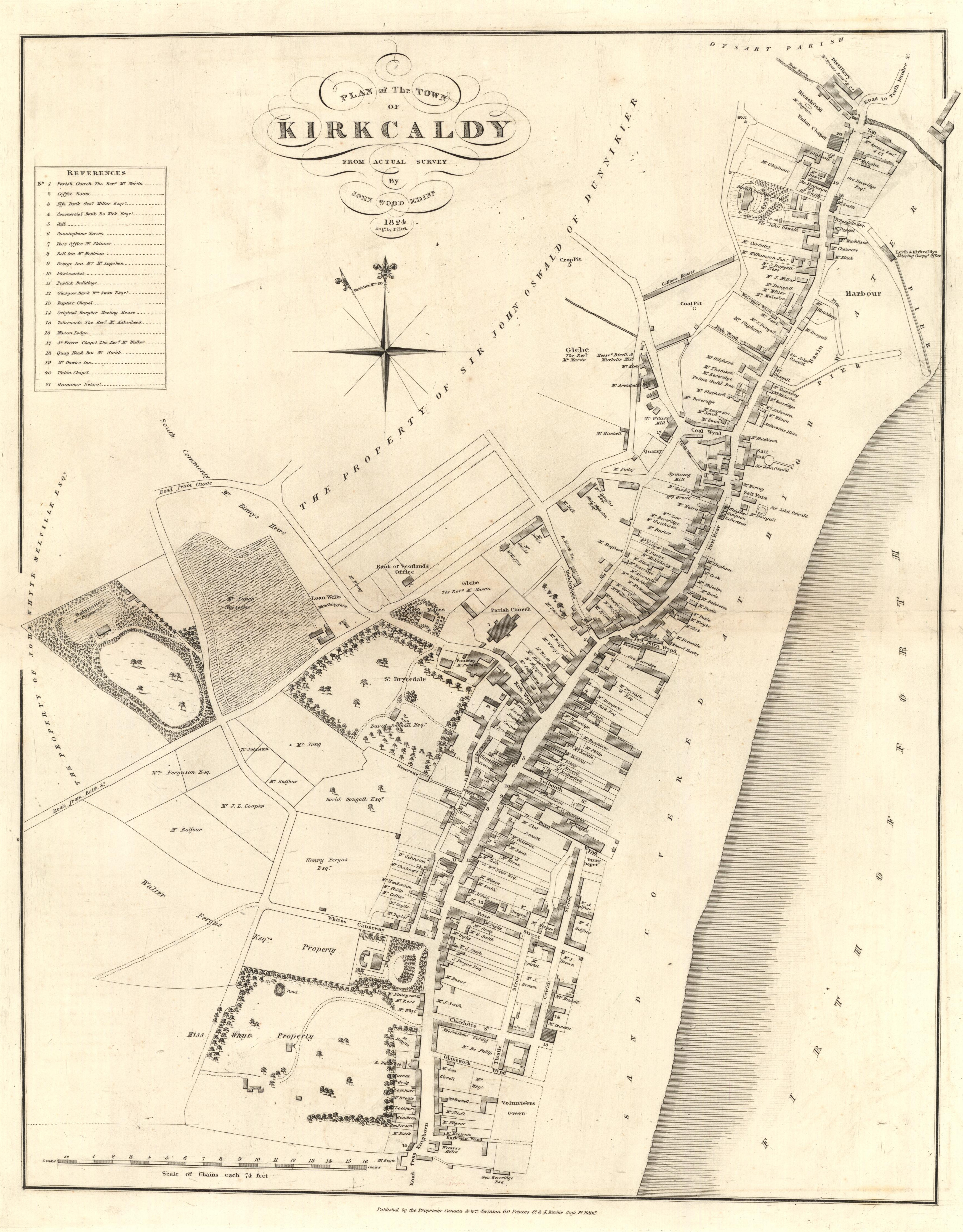
Kirkcaldy ( ; ; ) is a town and former royal burgh in Fife, on the east coast of Scotland. It is about north of Edinburgh and south-southwest of Dundee. The town had a recorded population of 49,460 in 2011, making it Fife's second-largest settlement and the List of towns and cities in Scotland by population, 11th most populous settlement in Scotland. Kirkcaldy has long been nicknamed the Lang Toun (; Scots language, Scots for "long town") in reference to the early town's main street, as indicated on maps from the 16th and 17th centuries. The street would finally reach a length of nearly , connecting the burgh to the neighbouring settlements of Linktown, Pathhead, Sinclairtown and Gallatown, which became part of the town in 1876. The formerly separate burgh of Dysart, Fife, Dysart was also later absorbed into Kirkcaldy in 1930 under an act of Parliament of the United Kingdom, Parliament. The area around Kirkcaldy has been inhabited since the Bronze Age. The first document t ... [...More Info...] [...Related Items...] OR: [Wikipedia] [Google] [Baidu] |
Sauchie
Sauchie is a town in the Central Lowlands of Scotland. It lies north of the River Forth and south of the Ochil Hills, within the council area of Clackmannanshire. Sauchie has a population of around 6000 and is located northeast of Alloa and east-southeast of Tullibody. History The name means the place or field of the willows. The land originally belonged to Clan Campbell, being mentioned in connection with Cailean Mór and Gilleasbaig of Menstrie. In 1321 Robert the Bruce granted the lands of Sauchie to Henry de Annand, former Sheriff of Clackmannan. A tower was built in 1335, and the present Sauchie Tower is on the same site. The extant tower was built before 1431 when Mary de Annand, the co-heiress to the estate, married Sir James Schaw of Greenock. The tower is all that remains of the village which developed within its protective radius. In the early 18th century the Clan Schaw, Schaw family moved from the tower to the more comfortable Newtonschaw. The village developed ... [...More Info...] [...Related Items...] OR: [Wikipedia] [Google] [Baidu] |
Clackmannan F
Clackmannan ( ; , perhaps meaning "Stone of Manau"), is a small town and civil parish set in the Central Lowlands of Scotland. Situated within the Forth Valley, Clackmannan is south-east of Alloa and south of Tillicoultry. The town is within the county of Clackmannanshire, of which it was formerly the county town, until Alloa overtook it in size and importance. Name and toponymy The name ''Clackmannan'' may be of Brittonic origin. The first element is probably ''*clog'', meaning "rock, crag, cliff" (cf. Welsh ''clog''), and the second is the personal name ''Manau'', from the root ''man-'' meaning "projecting''.'' The name of the town has been said to allude to the Stone of Manau or Stone of Mannan, a pagan monument that can be seen in the town square beside Clackmannan Tolbooth, which dates from 1592. A crater on asteroid 253 Mathilde is named after Clackmannan. Because Mathilde is a dark, carbonaceous body, its craters have been named after famous coalfields from acro ... [...More Info...] [...Related Items...] OR: [Wikipedia] [Google] [Baidu] |
Lochgelly United F
Lochgelly ( ; , IPA: �ɫ̪ɔxˈʝaɫ̪ai is a town in Fife, Scotland. It is located between Lochs Ore and Gelly to the north-west and south-east respectively. It is separated from Cowdenbeath by the village of Lumphinnans. According to the 2007 population estimate, the town has a population of 6,834. History Lochgelly, as part of the old parliamentary constituency of West Fife, was known as " Little Moscow" up to the 1950s owing to its Communist political leanings. An area of Lochgelly was known as the Happy Lands (or Happy Valley) and is referenced in the Scottish folk song 'The Kelty Clippie'. The town is served by Lochgelly railway station on the line between Edinburgh and Markinch. Economy In the 1970s new investment was brought in the form of a factory and development office built by the Andrew Corporation. This created microwave antennae under the banner of Andrew Antennas, symbolised by a red lightning flash on the dishes they made. These dishes were primarily f ... [...More Info...] [...Related Items...] OR: [Wikipedia] [Google] [Baidu] |


