|
Fam Islands
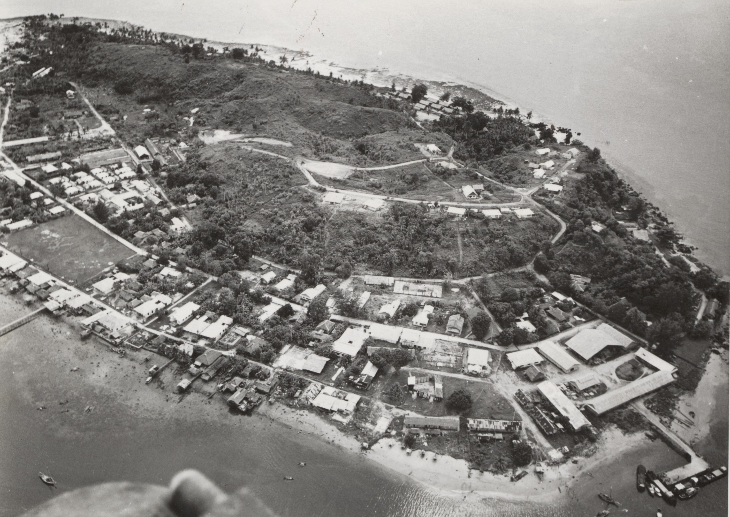
Fam Islands ( id, Kepulauan Fam) are a group of islands in the Raja Ampat Archipelago, which are administered as part of the Indonesian province of Southwest Papua. The main islands are Fam, Penemu (''Fam Besar''), Inus and Yar. They lie northwest of Batanta island, in the straits between Waigeo and Batanta and New Guinea New Guinea (; Hiri Motu: ''Niu Gini''; id, Papua, or , historically ) is the world's second-largest island with an area of . Located in Oceania in the southwestern Pacific Ocean, the island is separated from Australia by the wide Torr .... References Archipelagoes of Indonesia Raja Ampat Islands {{SwPapua-geo-stub ... [...More Info...] [...Related Items...] OR: [Wikipedia] [Google] [Baidu] |
Raja Ampat Archipelago
Raja Ampat, or the ''Four Kings'', is an archipelago located off the northwest tip of Bird's Head Peninsula on the island of New Guinea, in Indonesia's Southwest Papua province. It comprises over 1,500 small islands, cays, and shoals surrounding the four main islands of Misool, Salawati, Batanta, and Waigeo, and the smaller island of Kofiau. The Raja Ampat archipelago straddles the Equator and forms part of Coral Triangle which contains the richest marine biodiversity on earth. Administratively, the archipelago is part of the province of Southwest Papua. Most of the islands constitute the Raja Ampat Regency, which was separated out from Sorong Regency in 2004. The regency encompasses around of land and sea, of which 8,034.44 km2 constitutes the land area and has a population of 64,141 at the 2020 Census. This excludes the southern half of Salawati Island, which is not part of this regency but instead constitutes the Salawati Selatan and Salawati Tengah Districts of Sorong R ... [...More Info...] [...Related Items...] OR: [Wikipedia] [Google] [Baidu] |
Southwest Papua
Southwest Papua ( id, Papua Barat Daya) is a provinces of Indonesia, province of Indonesia, and is a fraction of Western New Guinea. Despite being named southwest, it is a misnomer and this province is actually located in the northwest edge of Papua (Indonesia), Papua. The area that belongs to this province includes the Greater Sorong area which consists of Sorong, Sorong City, Sorong Regency, South Sorong Regency, Maybrat Regency, Tambrauw Regency, and Raja Ampat Regency. The Draft Law (RUU) on the Establishment of the Southwest Papua Province has been passed into law and becomes the 38th province in Indonesia. Southwest Papua is located at the northwestern tip of an area called the Doberai Peninsula or the Bird's Head Peninsula. The westernmost tip of this province is the Raja Ampat Regency Regional Marine Protected Area whose beauty is worldwide and has a high diversity of marine life such as coral reefs, giant turtles, manta rays to whale sharks so that it is called a diver's ... [...More Info...] [...Related Items...] OR: [Wikipedia] [Google] [Baidu] |
Batanta
Batanta is one of the four major islands in the Raja Ampat Islands in Southwest Papua province, Indonesia. Its area is 453 km² and its highest point is 1184 m. The Pitt Strait separates it from Salawati, while the Dampier Strait separates it from Waigeo. Dampier Strait is named for the English explorer William Dampier. In 1759 Captain William Wilson sailing in the East Indiaman ''Pitt'' navigated these waters and named the channel between Batanta and Salawati Pitt Strait, after his vessel. History Islam first arrived in the Raja Ampat archipelago in the 15th century due to political and economic contacts with the Bacan Sultanate.Wanggai, Toni V. M. (2008)Rekonstruki sejarah umat Islam di tanna Papua econstruction of the History of lslam in Papua Syariff Hidayatullah State Islamic University Jakarta (in Indonesian). Retrieved 2022-03-13. During the 16th and 17th centuries, the Sultante of Tidore had close economic ties with the island. During this period, Islam becam ... [...More Info...] [...Related Items...] OR: [Wikipedia] [Google] [Baidu] |
Waigeo
Waigeo is an island in Southwest Papua province of eastern Indonesia. The island is also known as Amberi, or Waigiu. It is the largest of the four main islands in the Raja Ampat Islands archipelago, between Halmahera and about to the north-west coast of New Guinea. The Dampier Strait (a.k.a. Augusta's Strait) separates it from Batanta, and the Bougainville Strait from the Kawe Islands to its north-west. The "inner sea" that nearly cleaves the island in two is Mayalibit Bay, also known as the Majoli Gulf. The area of the island is ; the highest elevations are Buffalo Horn (Gunung Nok) and Serodjil. From west to east the island measures approximately , north–south about . The town of Waisai in the south of the island is the capital of the Raja Ampat Regency. History Jorge de Menezes, a Portuguese explorer, landed on Waigeo Island in 1526–27. Islam first arrived in the Raja Ampat archipelago in the 15th century due to political and economic contacts with the Bacan Sult ... [...More Info...] [...Related Items...] OR: [Wikipedia] [Google] [Baidu] |
New Guinea
New Guinea (; Hiri Motu: ''Niu Gini''; id, Papua, or , historically ) is the world's second-largest island with an area of . Located in Oceania in the southwestern Pacific Ocean, the island is separated from Australia by the wide Torres Strait, though both landmasses lie on the same continental shelf. Numerous smaller islands are located to the west and east. The eastern half of the island is the major land mass of the independent state of Papua New Guinea. The western half, known as Western New Guinea, forms a part of Indonesia and is organized as the provinces of Papua, Central Papua, Highland Papua, South Papua, Southwest Papua, and West Papua. The largest cities on the island are Jayapura (capital of Papua, Indonesia) and Port Moresby (capital of Papua New Guinea). Names The island has been known by various names: The name ''Papua'' was used to refer to parts of the island before contact with the West. Its etymology is unclear; one theory states that ... [...More Info...] [...Related Items...] OR: [Wikipedia] [Google] [Baidu] |


