|
Falkland Current
The Falkland Current is a cold water current that flows northward along the Atlantic coast of Patagonia as far north as the mouth of the Río de la Plata. This current results from the movement of water from the West Wind Drift as it rounds Cape Horn. It takes its name from the Falkland Islands (). This cold current mixes with the tropical Brazil Current in the Argentine Sea (see Brazil–Falkland Confluence), giving it its temperate climate.Ecorregión Mar Argentino The current is an equatorward flowing current that carries cold and relatively fresh water. The Falkland Current is a branch of the [...More Info...] [...Related Items...] OR: [Wikipedia] [Google] [Baidu] |
Patagonia
Patagonia () is a geographical region that includes parts of Argentina and Chile at the southern end of South America. The region includes the southern section of the Andes mountain chain with lakes, fjords, temperate rainforests, and glaciers in the west and Patagonian Desert, deserts, Plateaus, tablelands, and steppes to the east. Patagonia is bounded by the Pacific Ocean on the west, the Atlantic Ocean to the east, and many bodies of water that connect them, such as the Strait of Magellan, the Beagle Channel, and the Drake Passage to the south. The northern limit of the region is not precisely defined; the Colorado River, Argentina, Colorado and Barrancas River, Barrancas rivers, which run from the Andes to the Atlantic, are commonly considered the northern limit of Argentine Patagonia. The archipelago of Tierra del Fuego is sometimes considered part of Patagonia. Most geographers and historians locate the northern limit of Chilean Patagonia at Huincul Fault, in Araucanía R ... [...More Info...] [...Related Items...] OR: [Wikipedia] [Google] [Baidu] |
Río De La Plata
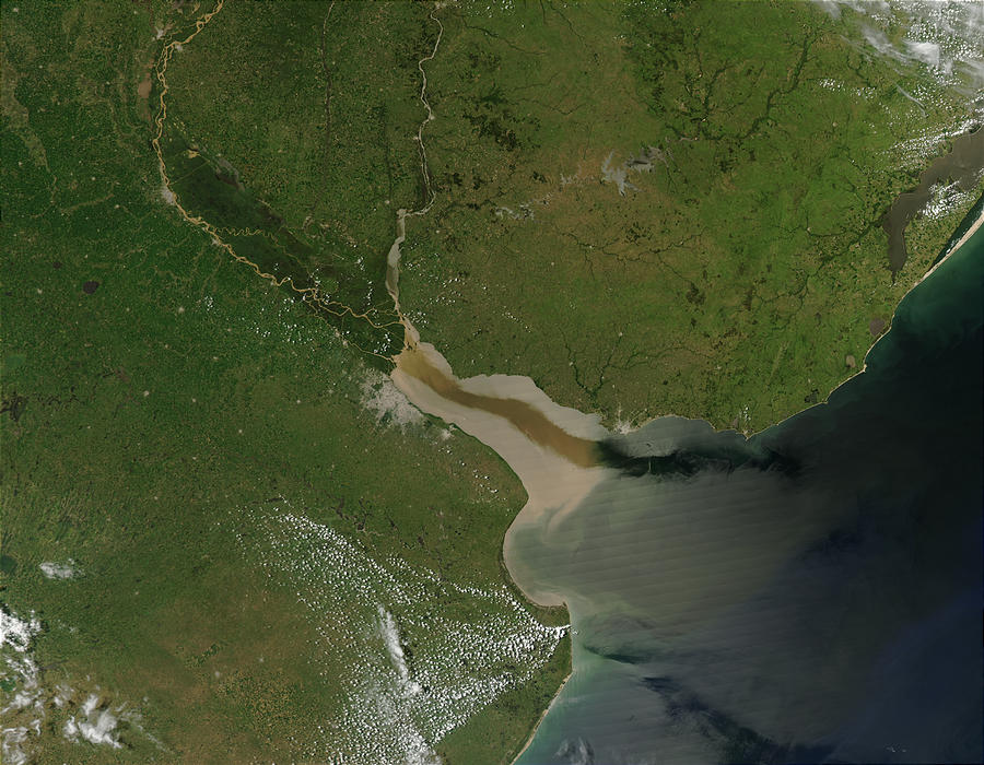
The Río de la Plata (; ), also called the River Plate or La Plata River in English, is the estuary formed by the confluence of the Uruguay River and the Paraná River at Punta Gorda, Colonia, Punta Gorda. It empties into the Atlantic Ocean and forms a funnel-shaped indentation on the southeastern coastline of South America. Depending on the geographer, the Río de la Plata may be considered a river, an estuary, a gulf, or a marginal sea. If considered a river, it is the widest in the world, with a maximum width of . The river is about long and widens from about at its source to about at its mouth. It forms part of Argentina–Uruguay border, the border between Argentina and Uruguay. The name Río de la Plata is also used to refer to the populations along the estuary, especially the main Port city, port cities of Buenos Aires and Montevideo, where Rioplatense Spanish is spoken and tango culture developed. The coasts of the river are the most densely populated areas of Urugua ... [...More Info...] [...Related Items...] OR: [Wikipedia] [Google] [Baidu] |
Cape Horn
Cape Horn (, ) is the southernmost headland of the Tierra del Fuego archipelago of southern Chile, and is located on the small Hornos Island. Although not the most southerly point of South America (which is Águila Islet), Cape Horn marks the northern boundary of the Drake Passage and marks where the Atlantic and Pacific Oceans meet. Cape Horn was identified by mariners and first rounded in 1616 by the Dutchmen Willem Schouten and Jacob Le Maire, who named it after the city of Hoorn in the Netherlands. For decades, Cape Horn was a major milestone on the clipper route, by which sailing ships carried trade around the world. The waters around Cape Horn are particularly hazardous, owing to strong winds, large waves, strong currents and icebergs. The need for boats and ships to round Cape Horn was greatly reduced by the opening of the Panama Canal in August 1914. Sailing around Cape Horn is still widely regarded as one of the major challenges in yachting. Thus, a few recreational ... [...More Info...] [...Related Items...] OR: [Wikipedia] [Google] [Baidu] |
Falkland Islands
The Falkland Islands (; ), commonly referred to as The Falklands, is an archipelago in the South Atlantic Ocean on the Patagonian Shelf. The principal islands are about east of South America's southern Patagonian coast and from Cape Dubouzet at the northern tip of the Antarctic Peninsula, at a latitude of about 52°S. The archipelago, with an area of , comprises East Falkland, West Falkland, and 776 smaller islands. As a British Overseas Territory, the Falklands have internal self-governance, while the United Kingdom takes responsibility for their defence and foreign affairs. The capital and largest settlement is Stanley, Falkland Islands, Stanley on East Falkland. The islands are believed to have been uninhabited prior to European discovery in the 17th century. Controversy exists over the Falklands' discovery and subsequent colonisation by Europeans. At various times, the islands have had French, British, Spanish, and Argentine settlements. Britain Reassertion of Britis ... [...More Info...] [...Related Items...] OR: [Wikipedia] [Google] [Baidu] |
Brazil Current
The Brazil Current is a warm water current that flows south along the Brazilian south coast to the mouth of the Río de la Plata. Description This current is caused by diversion of a portion of the Atlantic South Equatorial Current from where that current meets the South American continent. The Brazil Current begins at about 10–15˚S where the South Equatorial Current (SEC) splits near Cabo de São Roque, Brazil. The current reaches a depth of 700 m and the estimated transport at 12˚S is 2.5 Sv. The transport increases as the current goes further south with 4 Sv at 15˚S. On the offshore side of the current an anticyclonic recirculation gyre at about 30˚S causes an increase of the Brazil Current’s transport. The estimated southward transport at 27˚S, 31˚S, 34˚S, and 36˚S are 11 Sv, 17 Sv, 22 Sv, and 41 Sv. The total transport can be from 70 to 80 Sv by 36˚S with half of it being in the recirculation gyre.Zemba, J.C., 1991. "The structure and transport of the B ... [...More Info...] [...Related Items...] OR: [Wikipedia] [Google] [Baidu] |
Argentine Sea
The Argentine Sea () is a marginal sea of the Atlantic Ocean adjacent to the southern tip of South America. It ranges from the mouth of the estuary of the Río de la Plata in the north (35th parallel south) to the Isla de los Estados in the south, and from the Argentine coast to the 200 meters isobath. Its width varies between 210 km in front of Mar del Plata and 850 km at the latitude of the Falkland Islands. The coastline extends for 4,725 km. To the east of the Argentine Sea extends much deeper and more extensive Argentine Basin. History The name ''Argentine Sea'' appears to have been coined by Romanian-born explorer Julius Popper, who surveyed and charted parts of Tierra del Fuego in the mid 1880s. The name appears in charts of the region he published in 1891. Geography The Argentine Sea is in the South Atlantic Ocean off the southeastern coast of Argentina, extending from the approximate latitude of Montevideo, Uruguay, southward to Tierra del Fuego, and is s ... [...More Info...] [...Related Items...] OR: [Wikipedia] [Google] [Baidu] |
Brazil–Falkland Confluence
The Brazil–Falkland Confluence Zone (also called the Brazil–Falklands Confluence Zone or the Brazil–Malvinas Confluence Zone) is a very energetic region of water just off the coast of Argentina and Uruguay where the warm poleward flowing Brazil Current and the cold equatorward flowing Falkland Current converge. The region oscillates latitudinally, but in general the region of confluence occurs between 35th parallel south, 35 and 45th parallel south, 45 degrees south latitude and 50th meridian west, 50 to 70th meridian west, 70 degrees west longitude. The confluence of these two currents causes a strong Thermocline, thermocline to exist and causes numerous high energy Eddy (fluid dynamics), eddies to form.Maamaatuaiahutapu, K. et al.(1998)., Transports of the Brazil and Malvinas Currents at their Confluence. Journal of Marine Research Vol. 56 Issue 2, p417 Brazil Current The Brazil Current is a poleward flowing current that carries warm Subtropics, subtropical water. The B ... [...More Info...] [...Related Items...] OR: [Wikipedia] [Google] [Baidu] |
Subantarctic
The sub-Antarctic zone is a physiographic region in the Southern Hemisphere, located immediately north of the Antarctic region. This translates roughly to a latitude of between 46th parallel south, 46° and 60th parallel south, 60° south of the Equator. The subantarctic region includes many List of Antarctic and subantarctic islands, islands in the southern parts of the Atlantic Ocean, Atlantic, Indian Ocean, Indian, and Pacific Ocean, Pacific oceans, especially those situated north of the Antarctic Convergence. Subantarctic glaciers are, by definition, located on islands within the subantarctic region. All glaciers located on the continent of Antarctica are by definition considered to be list of glaciers in the Antarctic, Antarctic glaciers. Geography The subantarctic region comprises two geographic zones and three distinct weather front, fronts. The northernmost boundary of the subantarctic region is the rather ill-defined subtropical front, Subtropical Front (STF), also r ... [...More Info...] [...Related Items...] OR: [Wikipedia] [Google] [Baidu] |
Sverdrup
In oceanography, the sverdrup (symbol: Sv) is a non- SI metric unit of volumetric flow rate, with equal to . It is equivalent to the SI derived unit cubic hectometer per second (symbol: hm3/s or hm3⋅s−1): is equal to . It is used almost exclusively in oceanography to measure the volumetric rate of transport of ocean currents. It is named after Harald Sverdrup. One sverdrup is about five times what is carried at the estuary by the world's largest river, the Amazon. In the context of ocean currents, a volume of one million cubic meters may be imagined as a "slice" of ocean with dimensions × × (width × length × thickness) or a cube with dimensions × × . At this scale, these units can be more easily compared in terms of width of the current (several km), depth (hundreds of meters), and current speed (as meters per second). Thus, a hypothetical current wide, (m) deep, and moving at would be transporting of water. The sverdrup is distinct from the SI siever ... [...More Info...] [...Related Items...] OR: [Wikipedia] [Google] [Baidu] |
Surface Current
An ocean current is a continuous, directed movement of seawater generated by a number of forces acting upon the water, including wind, the Coriolis effect, breaking waves, cabbeling, and temperature and salinity differences. Depth contours, shoreline configurations, and interactions with other currents influence a current's direction and strength. Ocean currents move both horizontally, on scales that can span entire oceans, as well as vertically, with vertical currents (upwelling and downwelling) playing an important role in the movement of nutrients and gases, such as carbon dioxide, between the surface and the deep ocean. Ocean currents flow for great distances and together they create the global conveyor belt, which plays a dominant role in determining the climate of many of Earth's regions. More specifically, ocean currents influence the temperature of the regions through which they travel. For example, warm currents traveling along more temperate coasts increase the te ... [...More Info...] [...Related Items...] OR: [Wikipedia] [Google] [Baidu] |


