|
Eucumbene
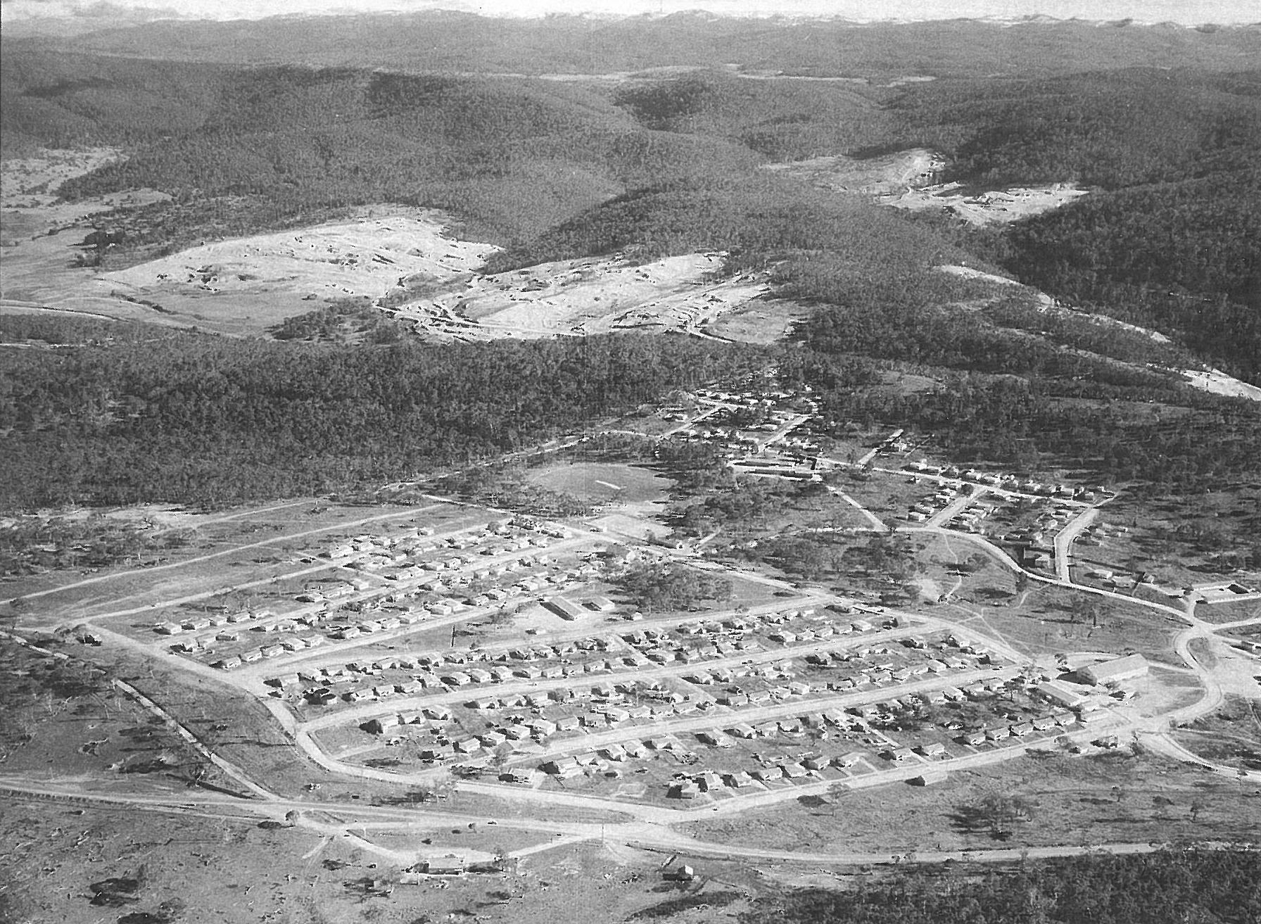
Eucumbene is a locality in the Snowy Monaro Regional Council in New South Wales, Australia. In the , Eucumbene had a population of 12 people. Geography The locality over looks Eucumbene Cove of Lake Eucumbene which is the impoundment of the Eucumbene Dam. The dam is part of the Snowy Mountains Scheme, a major Australian hydro-electricity and irrigation project. History The locality was formerly known as Eucumbene Cove. The former town of Eucumbene (1953 to 1966) was located approximately 2.5 kilometres to the south-east. Heritage listings Eucumbene has a number of heritage sites, including: * Old Adaminaby and Lake Eucumbene Old Adaminaby and Lake Eucumbene are the heritage-listed former town of Adaminaby and the reservoir that flooded the town, now at Eucumbene, Snowy Valleys Council, New South Wales, Australia. The town was established in 1830. The reservoir was ... References {{reflist Snowy Monaro Regional Council ... [...More Info...] [...Related Items...] OR: [Wikipedia] [Google] [Baidu] |
Old Adaminaby And Lake Eucumbene
Old Adaminaby and Lake Eucumbene are the heritage-listed former town of Adaminaby and the reservoir that flooded the town, now at Eucumbene, Snowy Valleys Council, New South Wales, Australia. The town was established in 1830. The reservoir was designed by the Snowy Hydro Electric Authority and built from 1956 to 1958 by the Authority. It is also known as Old Adaminaby and Lake Eucumbene, including relics and movable objects, Eucumbene River, Eucumbene Valley, Old Adaminaby Remains, Old Adaminaby Ruins and Old Adaminaby Drowned Landscape. The property is owned by Snowy Hydro Limited, a statutory corporation owned by the governments of Australia, New South Wales and Victoria. The site was added to the New South Wales State Heritage Register on 3 June 2008. History Indigenous history The Ngarigo people occupied the country from Canberra south to just below the NSW/Victorian border, west to Tumbarumba and east to the coast. This group name is that of the plains turkey or Austral ... [...More Info...] [...Related Items...] OR: [Wikipedia] [Google] [Baidu] |
Lake Eucumbene
Eucumbene Dam is a major gated earthfill embankment dam with an overflow ski-jump and bucket spillway with two vertical lift gates across the Eucumbene River in the Snowy Mountains of New South Wales, Australia. The dam's main purpose is for the generation of hydro-power and is one of the sixteen major dams that comprise the Snowy Mountains Scheme, a vast hydroelectricity and irrigation complex constructed in south-east Australia between 1949 and 1974 and now run by Snowy Hydro. The impounded reservoir is called Lake Eucumbene, the largest storage lake in the Snowy Mountains Scheme. Location and features Commenced in May 1956 and completed in May 1958, Eucumbene Dam is a major dam, located approximately northeast of the locality of Eucumbene Cove. The dam was constructed by a consortium comprising the Department of Public Works and Kaiser-Walsh-Perini-Raymond based on engineering plans developed by the United States Bureau of Reclamation and the Department of Public Works, und ... [...More Info...] [...Related Items...] OR: [Wikipedia] [Google] [Baidu] |
Eucumbene Dam
Eucumbene Dam is a major gated earthfill embankment dam with an overflow ski-jump and bucket spillway with two vertical lift gates across the Eucumbene River in the Snowy Mountains of New South Wales, Australia. The dam's main purpose is for the generation of hydro-power and is one of the sixteen major dams that comprise the Snowy Mountains Scheme, a vast hydroelectricity and irrigation complex constructed in south-east Australia between 1949 and 1974 and now run by Snowy Hydro. The impounded reservoir is called Lake Eucumbene, the largest storage lake in the Snowy Mountains Scheme. Location and features Commenced in May 1956 and completed in May 1958, Eucumbene Dam is a major dam, located approximately northeast of the locality of Eucumbene Cove. The dam was constructed by a consortium comprising the Department of Public Works and Kaiser-Walsh-Perini-Raymond based on engineering plans developed by the United States Bureau of Reclamation and the Department of Public Works, ... [...More Info...] [...Related Items...] OR: [Wikipedia] [Google] [Baidu] |
Eucumbene, New South Wales
Eucumbene is a locality in the Snowy Monaro Regional Council in New South Wales, Australia. In the , Eucumbene had a population of 12 people. Geography The locality over looks Eucumbene Cove of Lake Eucumbene which is the impoundment of the Eucumbene Dam. The dam is part of the Snowy Mountains Scheme, a major Australian hydro-electricity and irrigation project. History The locality was formerly known as Eucumbene Cove. The former town of Eucumbene (1953 to 1966) was located approximately 2.5 kilometres to the south-east. Heritage listings Eucumbene has a number of heritage sites, including: * Old Adaminaby and Lake Eucumbene Old Adaminaby and Lake Eucumbene are the heritage-listed former town of Adaminaby and the reservoir that flooded the town, now at Eucumbene, Snowy Valleys Council, New South Wales, Australia. The town was established in 1830. The reservoir was ... References {{reflist Snowy Monaro Regional Council ... [...More Info...] [...Related Items...] OR: [Wikipedia] [Google] [Baidu] |
Snowy Mountains Scheme
The Snowy Mountains Scheme or Snowy scheme is a hydroelectricity and irrigation complex in south-east Australia. The Scheme consists of sixteen major dams; nine power stations; two pumping stations; and of tunnels, pipelines and aqueducts that were constructed between 1949 and 1974. The Scheme was completed under the supervision of Chief Engineer, Sir William Hudson. It is the largest engineering project undertaken in Australia. The water of the Snowy River and some of its tributaries, much of which formerly flowed southeast onto the river flats of East Gippsland, and into Bass Strait of the Tasman sea, is captured at high elevations and diverted inland to the Murray and Murrumbidgee Rivers irrigation areas. The Scheme includes two major tunnel systems constructed through the continental divide of the Snowy Mountains, known in Australia as the Great Dividing Range. The water falls and travels through large hydro-electric power stations which generate peak-load power fo ... [...More Info...] [...Related Items...] OR: [Wikipedia] [Google] [Baidu] |
Snowy Monaro Regional Council
The Snowy Monaro Regional Council is a local government area located in the Snowy Mountains and Monaro regions of New South Wales, Australia. The council was formed on 12 May 2016 through a merger of the Bombala, Cooma-Monaro and Snowy River shires. The council comprises an area of and occupies the higher slopes of the eastern side of the Great Dividing Range between the Australian Capital Territory to the north and the state boundary with Victoria to the south. At the time of its establishment the council had an estimated population of . Its population at the was 20,218. The Mayor of the Snowy Monaro Regional Council is Narelle Davis. Towns and localities The following towns are located within Snowy Monaro Regional Council: The following localities are located within Snowy Monaro Regional Council: Heritage listings The Snowy Monaro Region has a number of heritage-listed sites, including: * Bombala, Goulburn-Bombala railway: Bombala railway station * Bombala, 91 ... [...More Info...] [...Related Items...] OR: [Wikipedia] [Google] [Baidu] |
Braemar Bay, New South Wales
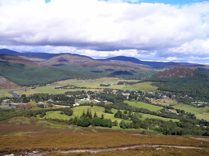
Braemar is a village in Aberdeenshire, Scotland, around west of Aberdeen in the Highlands. It is the closest significantly-sized settlement to the upper course of the River Dee sitting at an elevation of . The Gaelic ''Bràigh Mhàrr'' properly refers to the area of upper Marr (as it literally means), i.e. the area of Marr to the west of Aboyne, the village itself being Castleton of Braemar (''Baile a' Chaisteil''). The village used to be known as ''Cinn Drochaid'' (bridge end); ''Baile a' Chaisteil'' referred to only the part of the village on the east bank of the river, the part on the west bank being known as ''Ach an Droighinn'' (thorn field). Geography Braemar is approached from the South on the A93 from Glen Clunie and the Cairnwell Pass and from the East also on the A93 from Deeside. Braemar can be approached on foot from the West through Glen Tilt, Glen Feshie, Glen Dee (by the Lairig Ghru), and Glen Derry (by the Lairig an Laoigh). Braemar is within a one-and-a ... [...More Info...] [...Related Items...] OR: [Wikipedia] [Google] [Baidu] |
Suburbs And Localities (Australia)
Suburbs and localities are the names of geographic subdivisions in Australia, used mainly for address purposes. The term locality is used in rural areas, while the term suburb A suburb (more broadly suburban area) is an area within a metropolitan area, which may include commercial and mixed-use, that is primarily a residential area. A suburb can exist either as part of a larger city/urban area or as a separate ... is used in urban areas. Australian postcodes closely align with the boundaries of localities and suburbs. This Australian usage of the term "suburb" differs from common American and British usage, where it typically means a smaller, frequently separate residential community outside, but close to, a larger city. The Australian usage is closer to the American or British use of "district" or "neighbourhood", and can be used to refer to any portion of a city. Unlike the use in British or American English, this term can include inner-city, outer-metropolitan ... [...More Info...] [...Related Items...] OR: [Wikipedia] [Google] [Baidu] |
New South Wales
) , nickname = , image_map = New South Wales in Australia.svg , map_caption = Location of New South Wales in AustraliaCoordinates: , subdivision_type = Country , subdivision_name = Australia , established_title = Before federation , established_date = Colony of New South Wales , established_title2 = Establishment , established_date2 = 26 January 1788 , established_title3 = Responsible government , established_date3 = 6 June 1856 , established_title4 = Federation , established_date4 = 1 January 1901 , named_for = Wales , demonym = , capital = Sydney , largest_city = capital , coordinates = , admin_center = 128 local government areas , admin_center_type = Administration , leader_title1 = Monarch , leader_name1 = Charles III , leader_title2 = Governor , leader_name2 = Margaret Beazley , leader_title3 = Premier , leader_name3 = Dominic Perrottet ( Liberal) , national_representation = Parliament of Australia , national_representation_type1 = Sen ... [...More Info...] [...Related Items...] OR: [Wikipedia] [Google] [Baidu] |


