|
Erlianhot
Erenhot ( ; zh, s=二连浩特, p=Èrliánhàotè, commonly shortened to Ereen or Erlian) is a county-level city under jurisdiction of the Xilingol League, Inner Mongolia, China, located in the Gobi Desert along the Sino-Mongolian border, across from the Mongolian town of Zamyn-Üüd. There are 74,197 inhabitants ( 2010 census) and the elevation is . Demographics Climate Erenhot experiences a cold desert climate (Köppen ''BWk'') with long, very dry, and bitter winters and short, hot summers. Monthly daily average temperatures range from in January to in July, with an annual mean of . The city receives 3,232 hours (about 73% of the possible total) of bright sunshine per year, and clear, sunny, dry weather dominates year-round; due to the aridity, the diurnal temperature variation frequently approaches and exceeds . Over two-thirds of the sparse of annual rainfall occurs from June to August alone. With monthly percent possible sunshine ranging from 67% in July to 78% in F ... [...More Info...] [...Related Items...] OR: [Wikipedia] [Google] [Baidu] |
Mongolia
Mongolia is a landlocked country in East Asia, bordered by Russia to the north and China to the south and southeast. It covers an area of , with a population of 3.5 million, making it the world's List of countries and dependencies by population density, most sparsely populated sovereign state. Mongolia is the world's largest landlocked country that does not border an Endorheic basin, inland sea, and much of its area is covered by grassy steppe, with mountains to the north and west and the Gobi Desert to the south. Ulaanbaatar, the capital and List of cities in Mongolia, largest city, is home to roughly half of the country's population. The territory of modern-day Mongolia has been ruled by various nomadic empires, including the Xiongnu, the Xianbei, the Rouran, the First Turkic Khaganate, the Second Turkic Khaganate, the Uyghur Khaganate and others. In 1206, Genghis Khan founded the Mongol Empire, which became the largest List of largest empires, contiguous land empire i ... [...More Info...] [...Related Items...] OR: [Wikipedia] [Google] [Baidu] |
Manchu People
The Manchus (; ) are a Tungusic peoples, Tungusic East Asian people, East Asian ethnic group native to Manchuria in Northeast Asia. They are an officially recognized Ethnic minorities in China, ethnic minority in China and the people from whom Manchuria derives its name. The Later Jin (1616–1636), Later Jin (1616–1636) and Qing dynasty, Qing (1636–1912) dynasties of China were established and ruled by the Manchus, who are descended from the Jurchen people who earlier established the Jin dynasty (1115–1234), Jin dynasty (1115–1234) in northern China. Manchus form the largest branch of the Tungusic peoples and are distributed throughout China, forming the fourth largest ethnic group in the country. They are found in 31 Chinese provincial regions. Among them, Liaoning has the largest population and Hebei, Heilongjiang, Jilin, Inner Mongolia and Beijing have over 100,000 Manchu residents. About half of the population live in Liaoning and one-fifth in Hebei. There are a ... [...More Info...] [...Related Items...] OR: [Wikipedia] [Google] [Baidu] |
Trans-Mongolian Railway
The Trans-Mongolian Railway (, ) connects Ulan-Ude on the Trans-Siberian Railway in Buryatia, Russia, with Ulanqab in Inner Mongolia, China, via Ulaanbaatar, the capital of Mongolia. It was completed in 1956, and runs from northwest to southeast with major stations at Naushki/ Sükhbaatar on the Russian border, Darkhan, Züünkharaa, Choir, Sainshand, and Zamyn-Üüd/ Erenhot on the Chinese border, where the railway changes from single-track to double-track and its gauge changes from 1,520 mm Russian gauge to 1,435 mm standard gauge. The railway also has important branch lines to Erdenet and Baganuur. History Railway development came late to Mongolia. In 1937, a line was built from Ulan-Ude in the Soviet Union to Naushki on the border with Mongolia. In 1939, a paved road was extended to Ulaanbaatar, the country's capital. Construction of a rail line from Naushki to Ulaanbaatar was delayed by World War II, and completed in November 1949. The Soviet ... [...More Info...] [...Related Items...] OR: [Wikipedia] [Google] [Baidu] |
Erenhot Station
Erenhot ( ; zh, s=二连浩特, p=Èrliánhàotè, commonly shortened to Ereen or Erlian) is a county-level city under jurisdiction of the Xilingol League, Inner Mongolia, China, located in the Gobi Desert along the Sino-Mongolian border, across from the Mongolian town of Zamyn-Üüd. There are 74,197 inhabitants (2010 Chinese census, 2010 census) and the elevation is . Demographics Climate Erenhot experiences a cold desert climate (Köppen climate classification, Köppen ''BWk'') with long, very dry, and bitter winters and short, hot summers. Monthly daily average temperatures range from in January to in July, with an annual mean of . The city receives 3,232 hours (about 73% of the possible total) of bright sunshine per year, and clear, sunny, dry weather dominates year-round; due to the aridity, the diurnal temperature variation frequently approaches and exceeds . Over two-thirds of the sparse of annual rainfall occurs from June to August alone. With monthly percent po ... [...More Info...] [...Related Items...] OR: [Wikipedia] [Google] [Baidu] |
Administrative Division Codes Of The People's Republic Of China
The administrative division codes of the People's Republic of China identify the administrative divisions of China at county level and above. They are published by the National Bureau of Statistics of China with the latest version issued on September 30, 2015. Coding scheme Reading from left to right, administrative division codes contain the following information: * The first and second digits identify the highest level administrative division, which may be a province, autonomous region, municipality or Special Administrative Region (SAR). * Digits three and four show summary data for the associated prefecture-level city, prefecture (地区 ''dìqū''), autonomous prefecture, Mongolian league, municipal city district or county. Codes 01 – 20 and 51 – 70 identify provincial level cities, codes 21 – 50 represent prefectures, autonomous prefectures and Mongolian leagues. *The fifth and sixth digits represent the county-level division – city district, county-level ci ... [...More Info...] [...Related Items...] OR: [Wikipedia] [Google] [Baidu] |
Mongolian Cyrillic Alphabet
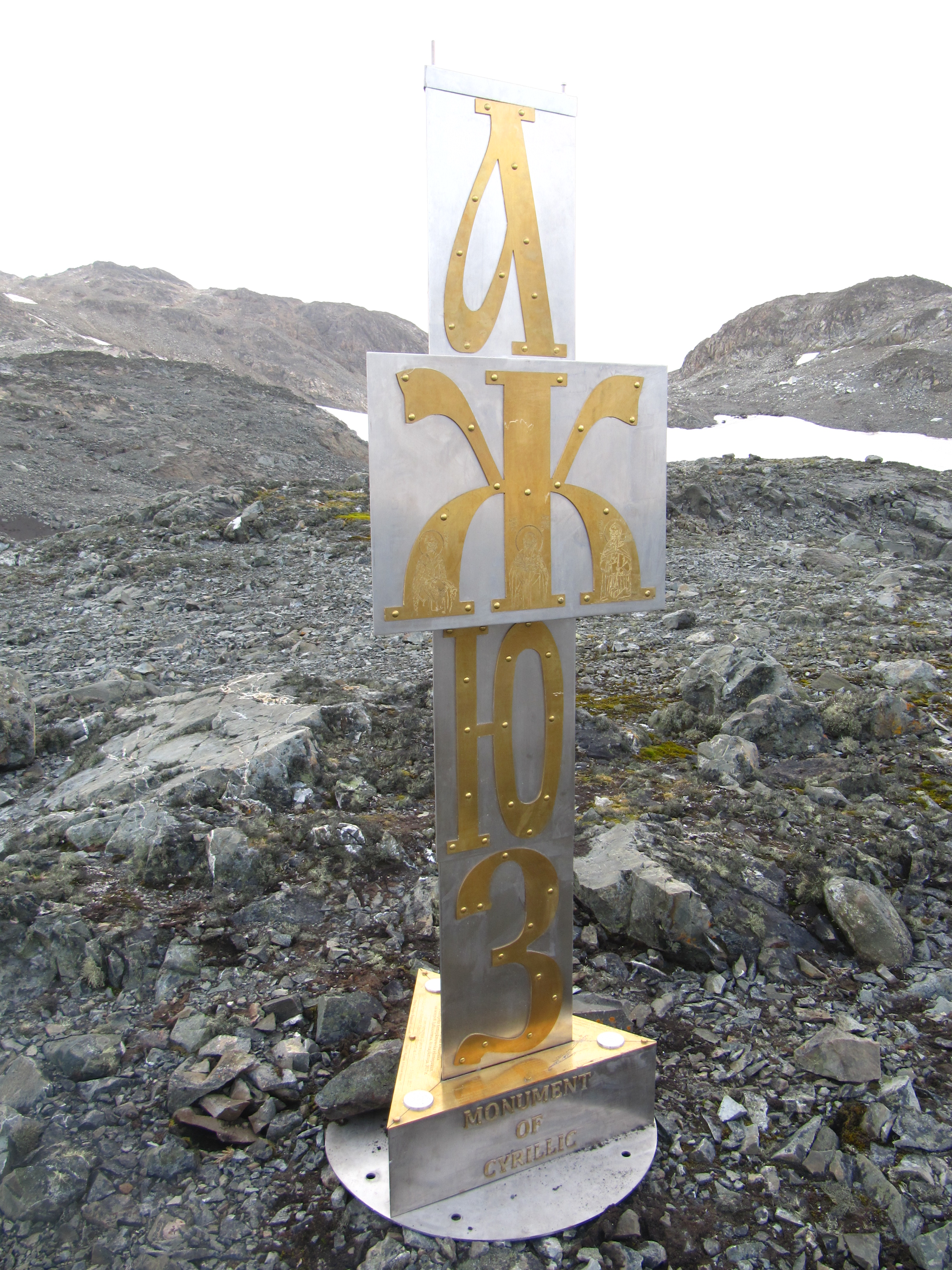
The Mongolian Cyrillic alphabet ( Mongolian: , or , ) is the writing system used for the standard dialect of the Mongolian language in the modern state of Mongolia. It has a largely phonemic orthography, meaning that there is a fair degree of consistency in the representation of individual sounds. Cyrillic has not been adopted as the writing system in the Inner Mongolia region of China, which continues to use the traditional Mongolian script. History Mongolian Cyrillic is the most recent of the many writing systems that have been used for Mongolian. It uses the same characters as the Russian alphabet except for the two additional characters Өө and Үү . It was introduced in the 1940s in the Mongolian People's Republic under Soviet influence, after two months in 1941 where Latin was used as the official script, while Latinisation in the Soviet Union was in vogue. On 1 January 1946, the Mongolian language officially adopted the Cyrillic alphabet. The Cyrillic script ... [...More Info...] [...Related Items...] OR: [Wikipedia] [Google] [Baidu] |
Mongolian Script
The traditional Mongolian script, also known as the Hudum Mongol bichig, was the first Mongolian alphabet, writing system created specifically for the Mongolian language, and was the most widespread until the introduction of Cyrillic script, Cyrillic in 1946. It is traditionally written in vertical lines from top to bottom, flowing in lines from left to right . Derived from the Old Uyghur alphabet, it is a true alphabet, with separate letters for consonants and vowels. It has been adapted for such languages as Oirat language, Oirat and Manchu language, Manchu. Alphabets based on this classical vertical script continue to be used in Mongolia and Inner Mongolia to write Mongolian, Xibe language, Xibe and, experimentally, Evenki language, Evenki. Computer operating systems have been slow to adopt support for the Mongolian script; almost all have incomplete support or other text rendering difficulties. History The Mongolian vertical script developed as an adaptation of the Old U ... [...More Info...] [...Related Items...] OR: [Wikipedia] [Google] [Baidu] |
Mongolian Language
Mongolian is the Prestige (sociolinguistics), principal language of the Mongolic languages, Mongolic language family that originated in the Mongolian Plateau. It is spoken by ethnic Mongols and other closely related Mongolic peoples who are native to modern Mongolia and surrounding parts of East Asia, East, Central Asia, Central and North Asia. Mongolian is the official language of Mongolia and Inner Mongolia and a recognized language of Xinjiang and Qinghai. The number of speakers across all its dialects may be 5–6 million, including the vast majority of the residents of Mongolia and many of the Mongols in China, ethnic Mongol residents of the Inner Mongolia of China. In Mongolia, Khalkha Mongolian is predominant, and is currently written in both Cyrillic script, Cyrillic and the traditional Mongolian script. In Inner Mongolia, it is dialectally more diverse and written in the traditional Mongolian script. However, Mongols in both countries often use the Latin script for conve ... [...More Info...] [...Related Items...] OR: [Wikipedia] [Google] [Baidu] |
Sum (administrative Division)
A sum is an administrative division used in China, Mongolia, and Russia. Countries such as China and Mongolia have employed the sum as administrative division, which was used during the Qing dynasty. This system was acted in the 1980s after the Chinese Communist Party gained power in conjunction with their growing internal and external problems. The decentralisation of government included restructuring of organisational methods, reduction of roles in rural government and creation of sums. Mongolia A sum (, , ) is the second level administrative division below the ''aimags'' (provinces), roughly comparable to a county in the United States. There are 330 sums in Mongolia. Each sum is again divided into ''bags'', ''bag'' being commonly translated as "brigade."Ole Bruun Precious Steppe: Mongolian Nomadic Pastoralists in Pursuit of the Market (2006). p. 68. "The historical administrative units of aimag, sum, and bag (Khotont constitutes one of nineteen sums in Arkangai aimag) still for ... [...More Info...] [...Related Items...] OR: [Wikipedia] [Google] [Baidu] |
Diurnal Temperature Variation
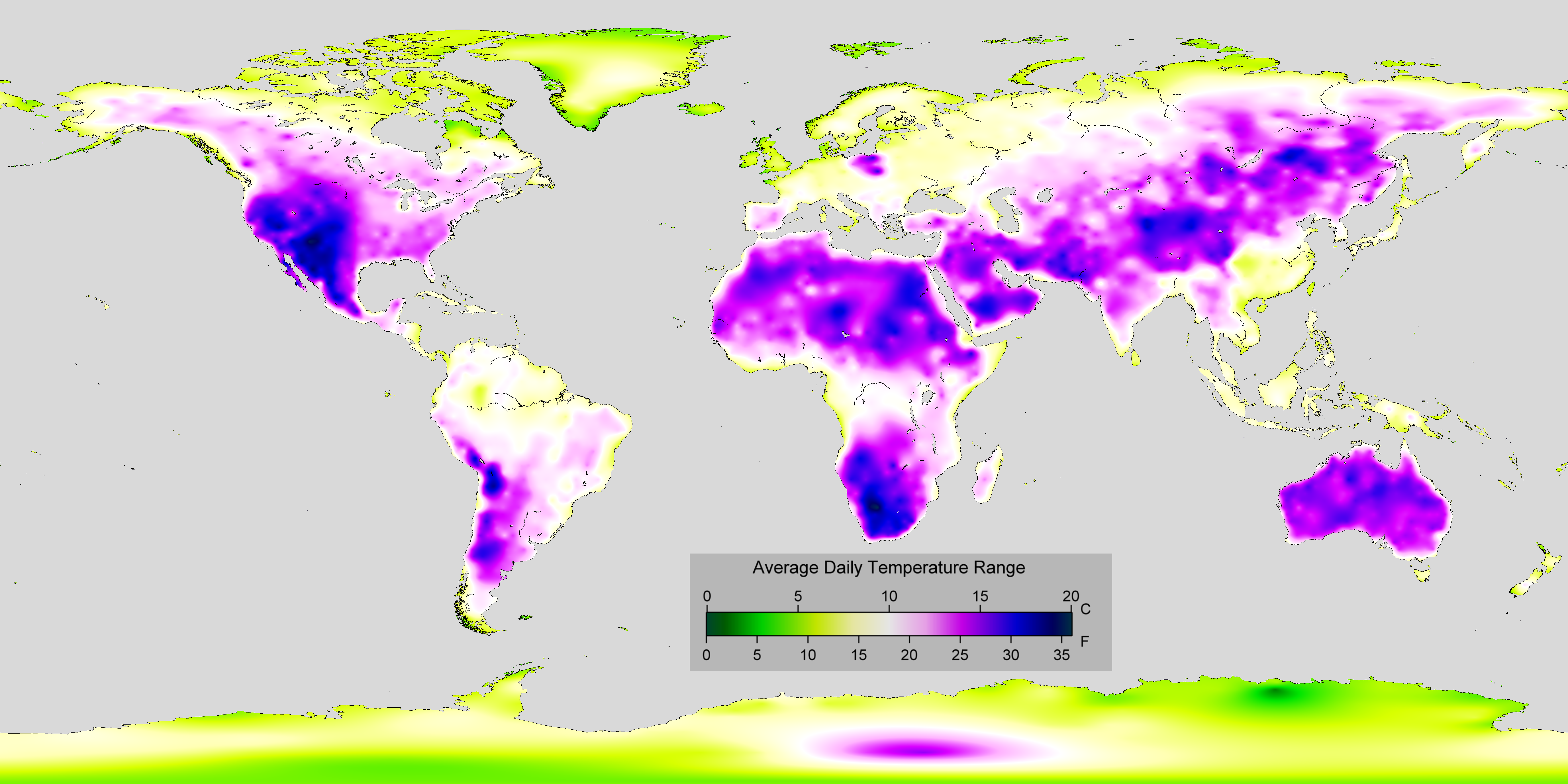
In meteorology, diurnal temperature variation is the variation between a high air temperature and a low temperature that occurs during the same day. Temperature lag Temperature lag, also known as thermal inertia, is an important factor in diurnal temperature variation. Peak daily temperature generally occurs ''after'' noon, as air keeps absorbing net heat for a period of time from morning through noon and some time thereafter. Similarly, minimum daily temperature generally occurs substantially after midnight, indeed occurring during early morning in the hour around dawn, since heat is lost all night long. The analogous annual phenomenon is seasonal lag. As solar energy strikes the Earth's surface each morning, a shallow layer of air directly above the ground is heated by conduction. Heat exchange between this shallow layer of warm air and the cooler air above is very inefficient. On a warm summer's day, for example, air temperatures may vary by from just above the ground t ... [...More Info...] [...Related Items...] OR: [Wikipedia] [Google] [Baidu] |
Köppen Climate Classification
The Köppen climate classification divides Earth climates into five main climate groups, with each group being divided based on patterns of seasonal precipitation and temperature. The five main groups are ''A'' (tropical), ''B'' (arid), ''C'' (temperate), ''D'' (continental), and ''E'' (polar). Each group and subgroup is represented by a letter. All climates are assigned a main group (the first letter). All climates except for those in the ''E'' group are assigned a seasonal precipitation subgroup (the second letter). For example, ''Af'' indicates a tropical rainforest climate. The system assigns a temperature subgroup for all groups other than those in the ''A'' group, indicated by the third letter for climates in ''B'', ''C'', ''D'', and the second letter for climates in ''E''. Other examples include: ''Cfb'' indicating an oceanic climate with warm summers as indicated by the ending ''b.'', while ''Dwb'' indicates a semi-Monsoon continental climate, monsoonal continental climate ... [...More Info...] [...Related Items...] OR: [Wikipedia] [Google] [Baidu] |


