|
England–Wales Border
The England–Wales border, sometimes referred to as the Wales–England border or the Anglo-Welsh border, runs for from the Dee estuary, in the north, to the Severn estuary in the south, separating England and Wales. It has followed broadly the same line since the 8th century, and in part that of Offa's Dyke; the modern boundary was fixed in 1536, when the former marcher lordships which occupied the border area were abolished and new Counties of the United Kingdom, county boundaries were created. The administrative boundary of Wales was confirmed in the Local Government Act 1972. Whether Monmouthshire (historic), Monmouthshire was part of Wales, or an English county treated for most purposes as though it were Welsh, was also settled by the 1972 Act, which included it in Wales. Geography The modern boundary between Wales and England runs from the salt marshes of the Dee estuary adjoining the Wirral Peninsula, across reclaimed land to the River Dee, Wales, River Dee at Sa ... [...More Info...] [...Related Items...] OR: [Wikipedia] [Google] [Baidu] |
Anglo-Saxon Settlement Of Britain
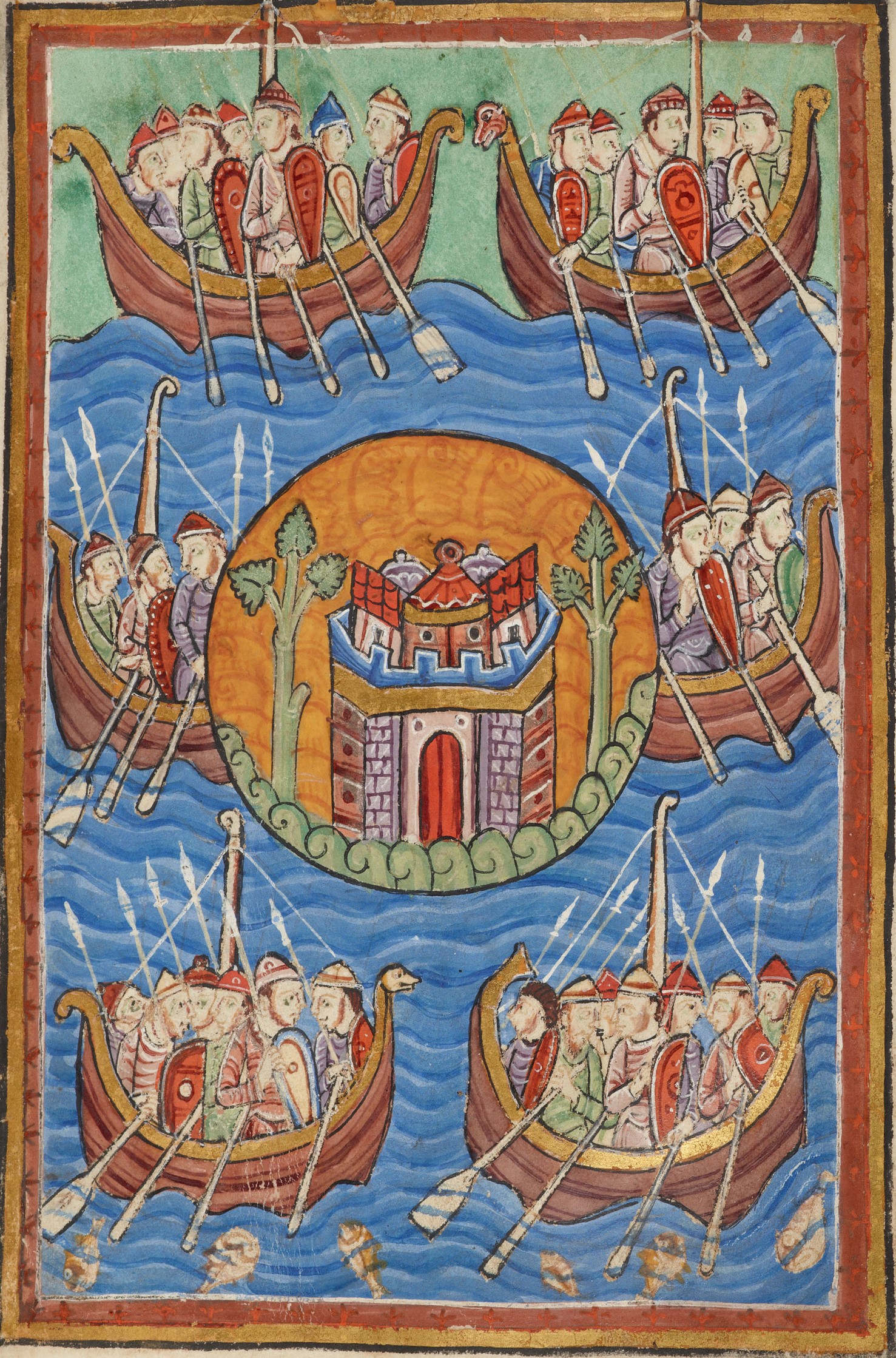
The settlement of Great Britain by Germanic peoples from continental Europe led to the development of an Anglo-Saxons, Anglo-Saxon cultural identity and a shared Germanic language—Old English—whose closest known relative is Old Frisian, spoken on the other side of the North Sea. The first Germanic speakers to settle Britain permanently are likely to have been soldiers recruited by the Roman administration in the 4th century AD, or even earlier. In the early 5th century, during the end of Roman rule in Britain and the breakdown of the Roman economy, larger numbers arrived, and their impact upon local culture and politics increased. There is Historiography of the Anglo-Saxon settlement of Britain, ongoing debate about the scale, timing and nature of the Anglo-Saxon settlements and also about what happened to the existing populations of the regions where the migrants settled. The available evidence includes a small number of medieval texts which emphasize Saxons, Saxon settle ... [...More Info...] [...Related Items...] OR: [Wikipedia] [Google] [Baidu] |
Wirral Peninsula
The Wirral Peninsula (), known locally as the Wirral, is a peninsula in North West England. The roughly rectangular peninsula is about long and wide, and is bounded by the Dee Estuary to the west, the Mersey Estuary to the east, and Liverpool Bay to the north. Historically, the Wirral was wholly in Cheshire; in the Domesday Book, its border with the rest of the county was placed at "two arrow falls from Chester city walls". However, since the Local Government Act 1972, only the southern third has been in Cheshire, with almost all the rest lying in the Metropolitan Borough of Wirral, Merseyside. An area of saltmarsh and reclaimed land adjoining the south-west of the peninsula lies in the Welsh county of Flintshire. Toponymy The name Wirral literally means " myrtle corner", from the Old English , a myrtle tree, and , an angle, corner or slope. It is supposed that the land was once overgrown with bog myrtle, a plant no longer found in the area, but plentiful around Form ... [...More Info...] [...Related Items...] OR: [Wikipedia] [Google] [Baidu] |
Llanymynech
Llanymynech is a village and former civil parish straddling the Wales-England border, border between Powys, Wales, and Shropshire, England, about north of the Welsh town of Welshpool. The name is Welsh language, Welsh for "Llan (placename), Llan of the Monks". The village is on the banks of the River Vyrnwy, and the Montgomery Canal passes through it. The border runs for the most part along the frontages of the buildings on the east (English) side of the village's main street, with the eastern half of the village in England and the western half in Wales. The Church of England parish church of St Agatha lies just in England, although the entire village lies in the same ecclesiastical parish. The border also passed right through the now closed Lion public house, pub, which had two bars in Shropshire and one in Montgomeryshire. At one time Sunday Closing (Wales) Act 1881, Welsh counties were referred to as "wet" or "dry" depending on whether people could drink in pubs on Sundays. ... [...More Info...] [...Related Items...] OR: [Wikipedia] [Google] [Baidu] |
River Vyrnwy
The River Vyrnwy (, ) flows through northern Powys, Wales, and Shropshire, England. The name derives from Severn, the river of which it is a tributary. Course The river used to be sourced from the many rivers and streams running off the mountains surrounding the Vyrnwy valley. However, since the Lake Vyrnwy dam was built in the 1880s, the river has flowed directly from the base of the dam. The river runs for , and the last form part of the Welsh/English border between Powys and Shropshire. It eventually joins the River Severn near the village of Melverley. Recreational The river is paddled frequently by kayakers and canoeists, with the upper reaches of the river being predominantly '' Grade II'' white water with a few '' Grade III'' sections, most notably the Vyrnwy Gorge near the village of Dolanog. The other most prominent feature of the upper river is Dolanog Falls, a man-made weir that requires a portage Portage or portaging ( CA: ; ) is the practice of carrying ... [...More Info...] [...Related Items...] OR: [Wikipedia] [Google] [Baidu] |
Oswestry
Oswestry ( ; ) is a market town, civil parish and historic railway town in Shropshire, England, close to the England–Wales border, Welsh border. It is at the junction of the A5 road (Great Britain), A5, A483 road, A483 and A495 road, A495 roads. The town was the administrative headquarters of the Borough of Oswestry until that was abolished in 2009. Oswestry is the third-largest town in Shropshire, following Telford and Shrewsbury. At the 2021 Census, the population was 17,509. The town is from the Welsh border and has a mixed English and Welsh heritage. Oswestry is the largest settlement within the Oswestry Uplands, a designated Natural areas of England, natural area and national character area. Toponym The name ''Oswestry'' is first attested in 1191, as . This Middle English name transparently derives from the Old English personal name and the word ('tree'). Thus the name seems once to have meant 'tree of a man called Ōswald'.A. D. Mills, ''A Dictionary of English Pl ... [...More Info...] [...Related Items...] OR: [Wikipedia] [Google] [Baidu] |
Chirk
Chirk () is a town and Community (Wales), community in Wrexham County Borough, Wales, south of Wrexham, between it and Oswestry. At the 2011 census, it had a population of 4,468. Historically in the historic counties of Wales, traditional county of Denbighshire (historic), Denbighshire, and later Clwyd, it has been part of Wrexham County Borough since a local government reorganisation in 1996. The Wales-England border, border with the England, English county of Shropshire is immediately south of the town, on the other side of the River Ceiriog. The town is served by Chirk railway station and the A5 road (Great Britain), A5/A483 road, A483 roads. Etymology The name of the town in English, Chirk, derives from the name of the River Ceiriog, which itself may mean "the favoured one". The Welsh place name, ', is literally "The Moor". History and heritage Chirk Castle, a National Trust for Places of Historic Interest or Natural Beauty, National Trust property, is a medieval castle. ... [...More Info...] [...Related Items...] OR: [Wikipedia] [Google] [Baidu] |
Whitchurch, Shropshire
Whitchurch is a market town in the north of Shropshire, England. It lies east of the Wales, Welsh border, 2 miles south of the Cheshire border, north of the county town of Shrewsbury, south of Chester, and east of Wrexham. At the 2021 United Kingdom census, 2021 census, the population of the Whitchurch Urban parish was 10,141, and the population of the Whitchurch built up area was 9,855. Whitchurch is the oldest continuously inhabited town in Shropshire. Notable people who have lived in Whitchurch include the composer Sir Edward German, and illustrator Randolph Caldecott. History Early times There is evidence from various discovered artefacts that people lived in this area about 3,000 BC. Flakes of flint from the Neolithic era were found in nearby Dearnford Farm. Roman times Originally a settlement founded by the Roman Britain, Romans about AD 52–70 called Mediolanum (Whitchurch), Mediolanum ( "Midfield" or "Middle of the Plain"), it stood on a major Roman road b ... [...More Info...] [...Related Items...] OR: [Wikipedia] [Google] [Baidu] |
Bangor-on-Dee
Bangor-on-Dee ( or Welsh Language Commissioner, standardised ) is a village and Community (Wales), community in Wrexham County Borough, Wales, on the banks of the River Dee, Wales, River Dee. Until 1974 it was in the exclave of Flintshire (historic), Flintshire known as the Maelor Saesneg, and from 1974 to 1996 in the county of Clwyd. The community (Wales), community had a population of 1,110 at the 2011 Census. Etymology The anglicised name refers to the village's proximity to the River Dee, Wales, River Dee. However, the older Welsh language, Welsh name, ''Bangor-is-y-Coed'' (or ''Bangor Is-Coed'') literally means "Bangor" (a settlement with a Wattle and daub, wattle enclosure) "below the wood/trees". This form was first recorded in 1699, while an alternative name of the parish, "Bangor Monachorum" ("Bangor of the monks"), was first recorded in 1677. [...More Info...] [...Related Items...] OR: [Wikipedia] [Google] [Baidu] |
Flintshire
Flintshire () is a county in the north-east of Wales. It borders the Irish Sea to the north, the Dee Estuary to the north-east, the English county of Cheshire to the east, Wrexham County Borough to the south, and Denbighshire to the west. Connah's Quay is the largest town, and Flintshire County Council is based in Ewloe. The county covers , with a population of 155,000 in 2021. After Connah's Quay (16,771), the largest settlements are Flint (13,736), Buckley (16,127) and Mold (10,123). The east of the county is industrialised and contains the Deeside conurbation, which extends into Cheshire and has a population of 53,568. The adjacent coast is also home to industry, but further west has been developed for tourism, particularly at Talacre. Inland, the west of the county is sparsely populated and characterised by gentle hills, including part of the Clwydian Range and Dee Valley AONB. The county is part of the preserved county of Clwyd. The county is named after th ... [...More Info...] [...Related Items...] OR: [Wikipedia] [Google] [Baidu] |
Exclave
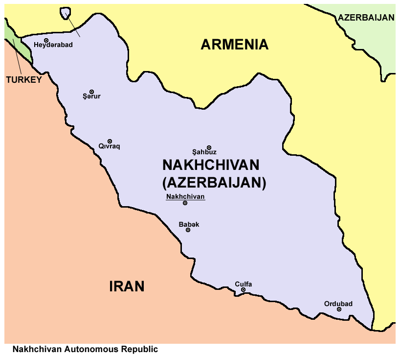
An enclave is a territory that is entirely surrounded by the territory of only one other state or entity. An enclave can be an independent territory or part of a larger one. Enclaves may also exist within territorial waters. ''Enclave'' is sometimes used improperly to denote a territory that is only partly surrounded by another state. Enclaves that are not part of a larger territory are not exclaves, for example Lesotho (enclaved by South Africa), and San Marino and Vatican City (both enclaved by Italy) are enclaved sovereign states. An exclave is a portion of a state or district geographically separated from the main part, by some surrounding alien territory. Many exclaves are also enclaves, but an exclave surrounded by the territory of more than one state is not an enclave. The Azerbaijani exclave of Nakhchivan is an example of an exclave that is not an enclave, as it borders Armenia, Iran, and Turkey. Semi-enclaves and semi-exclaves are areas that, except for possessing ... [...More Info...] [...Related Items...] OR: [Wikipedia] [Google] [Baidu] |
Maelor
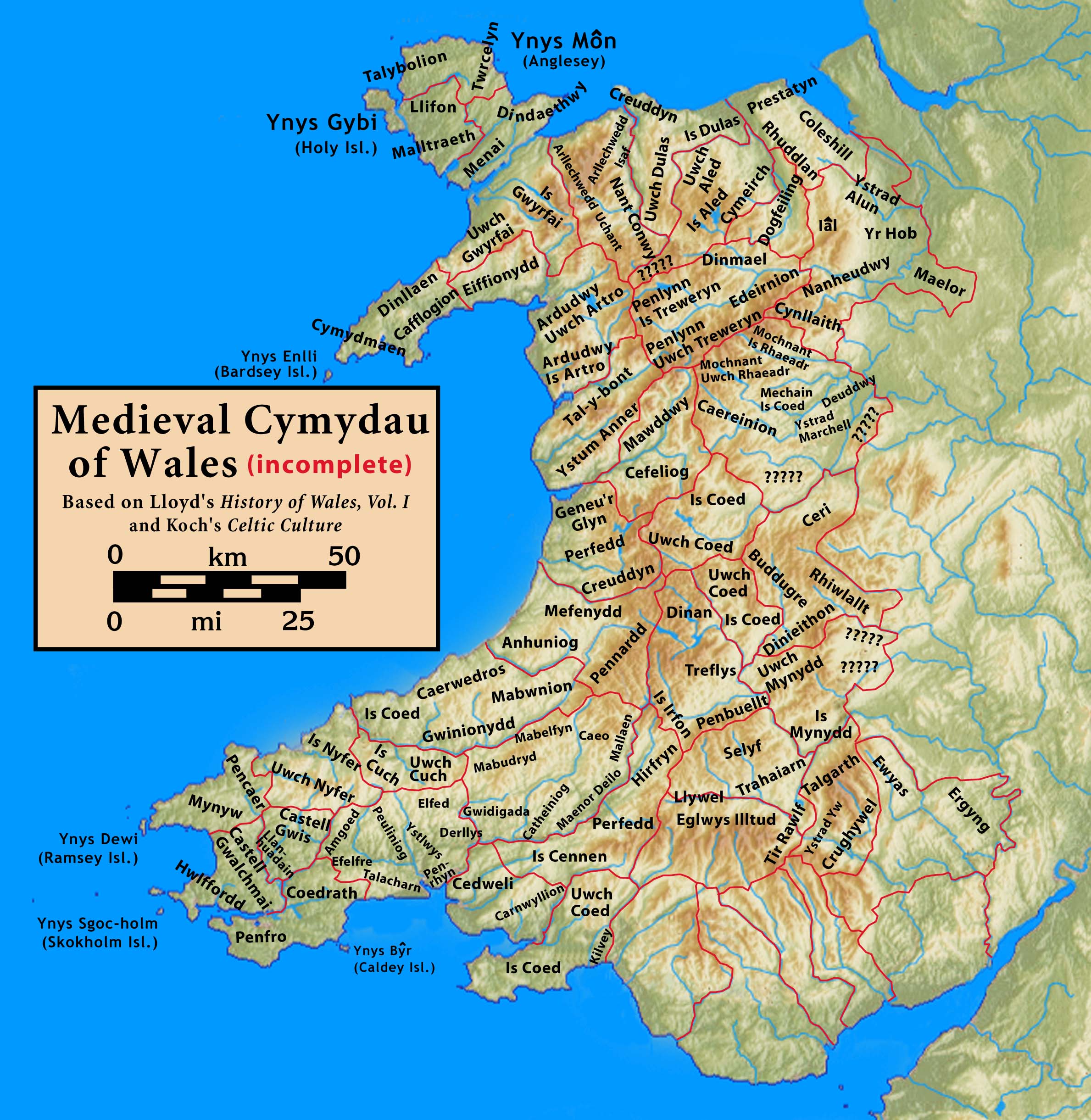
The Maelor is an area of north-east Wales along the border with England. It is now entirely part of Wrexham County Borough. The name ''Maelor'' is an old Welsh word: it can be translated as "land of the prince", from ''mael'' ("prince") and ''llawr'' ("low ground", "region").Owen, Hywel Wynn (2017) ''Place-names of Flintshire'', Univ. of Wales Press, p.115 History The Maelor originated as a cantref of the Kingdom of Powys, focused on the monastic settlement of Bangor-on-Dee and containing the commotes of Maelor, Yale (Iâl), the Alyn Valley (Ystrad Alun) and Hope (Yr Hob). Most of the area fell under control of the Kingdom of Mercia during the eighth century, with Offa's Dyke delineating the new border. By the time of the 1066 Norman conquest of England, its eastern areas were recorded as held by Edwin, Earl of Mercia: they were later granted to the Norman magnate Hugh d'Avranches, Earl of Chester. The lands of the Maelor were only reincorporated in Powys during the reign ... [...More Info...] [...Related Items...] OR: [Wikipedia] [Google] [Baidu] |
Maelor Saesneg
, also known as English Maelor, comprises one half of the Maelor region on the Welsh side of the Wales-England border, being the area of the Maelor east of the River Dee. The region has changed counties several times, previously being part of Cheshire and later a detached portion of Flintshire. The area is currently in Wales, despite its name, and administered as part of Wrexham County Borough. The name ''Maelor'' is an old Welsh word: it can be translated as "land of the prince", from ''mael'' "prince" and ''llawr'' "low ground", "region".Owen, Hywel Wynn (2017) ''Place-names of Flintshire'', Univ. of Wales Press, p.115 ''Malaur Saisnec'' appears in a document as early as 1202: ''Saesneg'' ("English") is believed to relate specifically to the area's religious administration, as it was historically part of the ancient Diocese of Lichfield and Chester. History At the time of the Roman invasion, the area was part of the region occupied by the Cornovii, one of the Celtic tribes ... [...More Info...] [...Related Items...] OR: [Wikipedia] [Google] [Baidu] |
