|
Elgin Street (other)
Elgin Street is the name of the following roads: * Elgin Street (Ottawa), Ontario, Canada * Elgin Street, Hong Kong * Elgin Street, former name of Haiphong Road in Tsim Sha Tsui, Kowloon, Hong Kong * Elgin Street, Bacup, Lancashire, UK, one of the world's shortest streets See also * Elgin Avenue Elgin Avenue is a street in Maida Vale in London. Located in the City of Westminster, it runs east to west from the A5 road close to Maida Vale tube station west to the Maida Hill area where it meets the Harrow Road. Sutherland Avenue runs ro ..., a street in Maida Vale, London * Elgin Crescent, a street in Notting Hill, London {{disambiguation ... [...More Info...] [...Related Items...] OR: [Wikipedia] [Google] [Baidu] |
Elgin Street (Ottawa)
Elgin Street ( ; Ottawa Road #91) is a street in the Downtown Ottawa, Downtown core of Ottawa, Ontario, Canada. Originally named Biddy's Lane, it was later named after James Bruce, 8th Earl of Elgin, Lord Elgin. The north/south running street begins at Wellington Street (Ottawa), Wellington Street in Confederation Square, just east of the Canadian parliament, Parliament buildings and just west of the bridge over the Rideau Canal. In the centre of Elgin Street for the first two blocks is Confederation Square, home of Canada's National War Memorial (Canada), National War Memorial. To the south of this on the east of Elgin is the National Arts Centre; to the west is the High Commission of the United Kingdom in Ottawa, British High Commission. Continuing south, Elgin is fronted by Confederation Park to the east and the Lord Elgin Hotel to the west. South of the park, just past Laurier Avenue (Ottawa), Laurier Avenue, is the Ottawa Court House, across from the First Baptist Church ( ... [...More Info...] [...Related Items...] OR: [Wikipedia] [Google] [Baidu] |
Elgin Street, Hong Kong
Elgin Street is located in Central, Hong Kong. It was named after James Bruce, 8th Earl of Elgin. It was also one of the earliest streets in Hong Kong. Location The street begins at a low elevation at Hollywood Road and ends high at Caine Road. The street is divided into two sections by the junction with Peel Street and Staunton Street. The upper section is less steep than the lower as it approaches the hilltop after the junction. Features One can find several stalls selling miscellaneous things, which are heaped on the ground, on the sloping street. Originally there were two ''dai pai dongs'' operating on the street near Hollywood Road, but one of them was forced to closed in 2005. Many international restaurants and a comedy club can be found on the upper section of the street. Gallery Image:Elgin_Street_Hong_Kong.jpg, The faded roadsign of the street image:Elgin_Street_Hong_Kong1.jpg, An antique shop on the street image:Elgin_Street_Hong_Kong2.jpg, The closed and the stil ... [...More Info...] [...Related Items...] OR: [Wikipedia] [Google] [Baidu] |
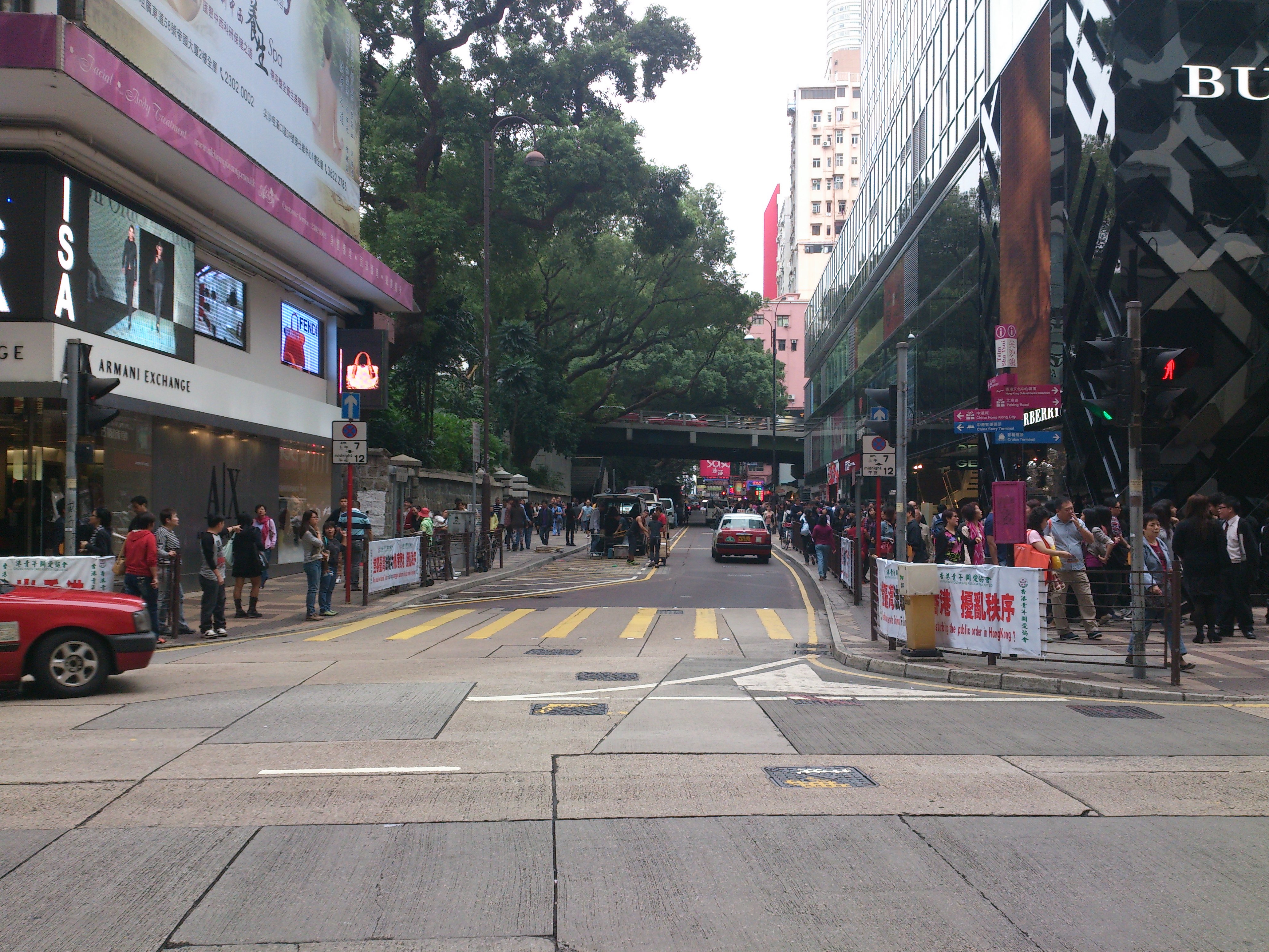
Haiphong Road
Haiphong Road (Traditional Chinese characters, Chinese: 海防道) is a road south of Kowloon Park, Tsim Sha Tsui, Hong Kong. The road links Canton Road and Nathan Road. History It was initially named as Elgin Street but its name changed in 1909 to Haiphong, a city in Vietnam to avoid confusion with another Elgin Street, Hong Kong, Elgin Street on the Hong Kong Island. As such, it is one of the few streets in Hong Kong not named for a Chinese or English subject. Along with Nathan Road it was one of the first two streets laid out in Tsim Sha Tsui."Haiphong Road" ''South China Morning Post'', 2 January 2000. Indian merchants, mostly Hindus from the province of Sindh, began establishing shops on the street in the 1920s, supplying Indian goods to soldiers stationed in the adjacent Whitfield Barracks.Jason Wordie, ... [...More Info...] [...Related Items...] OR: [Wikipedia] [Google] [Baidu] |
Elgin Street, Bacup
Elgin Street, located in Bacup, Lancashire, is one of the shortest streets in the world at . It held the British record until November 2006, when it was discovered that Ebenezer Place, Wick in Caithness, Scotland, which was constructed in 1883 and named in 1887, was shorter at only in length. The street is reached from a walkway In American English, walkway is a composite or umbrella term for all engineered surfaces or structures which support the use of trails. '' The New Oxford American Dictionary'' also defines a walkway as "a passage or path for walking along, esp. ... between Bank Street and Lord Street, but vehicular access has been cut off by the later construction of this walkway and steps. The street can be viewed from the railings above. References {{portal bar, Roads, Lancashire Borough of Rossendale Streets in England Bacup ... [...More Info...] [...Related Items...] OR: [Wikipedia] [Google] [Baidu] |
Elgin Avenue
Elgin Avenue is a street in Maida Vale in London. Located in the City of Westminster, it runs east to west from the A5 road close to Maida Vale tube station west to the Maida Hill area where it meets the Harrow Road. Sutherland Avenue runs roughly parallel to the south and is connected to Elgin Avenue by Lauderdale Road. The road continues east of the A5 as Abercorn Place which runs through St. John's Wood. The area was built as part of the rapid expansion of London in the first half of the nineteenth century. It was laid out as part of a plan for the area by the architect George Gutch in 1827, who envisaged a series of long avenues. While isolated villas were built from the 1820s, it was not for several decades that the street was completed. It was known as Elgin Road until 1886, and takes its name from the Lord Elgin Arms public house. Later in the century many of the original villas were replaced by mansion blocks. In 1915 the new Maida Vale tube station was opened ... [...More Info...] [...Related Items...] OR: [Wikipedia] [Google] [Baidu] |


