|
El Pilar
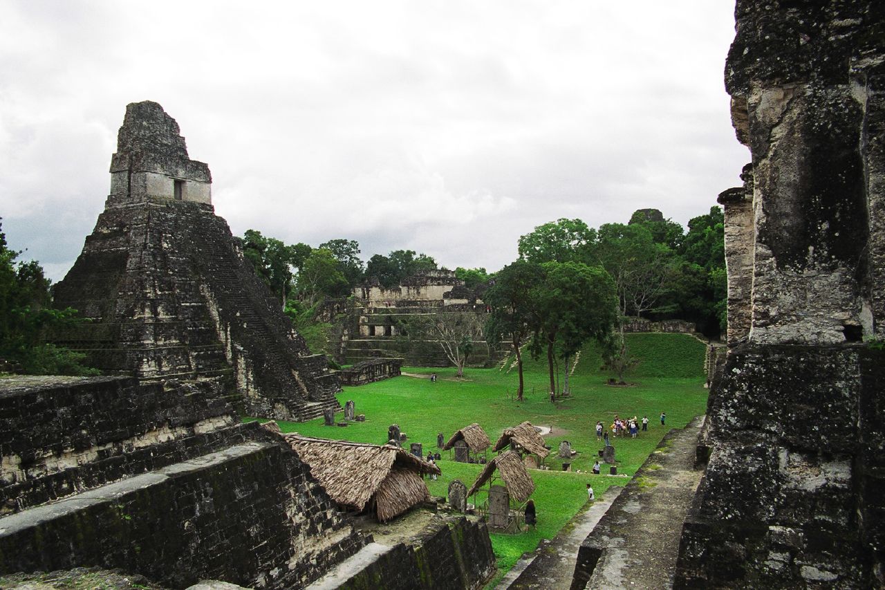
El Pilar is an ancient Maya city center located on the Belize-Guatemala border. The site is located north of San Ignacio, Belize and can be accessed through the San Ignacio and Bullet Tree Falls on the Belize River. The name "El Pilar" is Spanish for "watering basin", reflecting the abundance of streams around the site and below its escarpment, which is rare in the Maya area. The monuments of El Pilar are at the center of a protected area known as El Pilar Archeological Reserve for Maya Flora and Fauna, declared a cultural monument in both Belize and Guatemala in 1998. El Pilar is the largest Maya site in the Belize River area with over 25 plazas and hundreds of other major buildings, covering about . Archeological discovery Archaeologist Anabel Ford first mapped El Pilar in 1983 in the course of her Belize River Archaeological Settlement Survey or BRASS project. Settlement patterns in the region suggest a hierarchy of community size and composition that was directly rela ... [...More Info...] [...Related Items...] OR: [Wikipedia] [Google] [Baidu] |
Anabel Ford
Anabel Ford (born 22 December 1951) is an American archaeologist specializing in the study of Mesoamerica, with a focus on the lowland Maya of Belize and Guatemala. She is recognized for her discovery of the ancient Maya city El Pilar. Ford is currently affiliated with the Institute of Social Behavioral and Economic Research (ISBER) and is the director of the MesoAmerican Research Center (MARC) at the University of California, Santa Barbara. Early life Ford was born the oldest of three children, all of whom were born in Los Angeles. Her father, Joseph B. Ford, was a professor of Sociology at California State University, Northridge and spoke German, Italian, French, Spanish, and Japanese and could read and write in Latin. Anabel Ford's mother, actress Marjorie Henshaw, was also known by her stage name Anabel Shaw. Ford's interest in Mesoamerican prehistory—Teotihuacan, Monte Albán, Chichen Itza—led her to choose a research career around the jungles that enveloped Maya sites. ... [...More Info...] [...Related Items...] OR: [Wikipedia] [Google] [Baidu] |
Maya City
Maya cities were the centres of population of the pre-Columbian Maya civilization of Mesoamerica. They served the specialised roles of administration, commerce, manufacturing and religion that characterised ancient cities worldwide.Sharer & Traxler 2006, p.71. Maya cities tended to be more dispersed than cities in other societies, even within Mesoamerica, as a result of adaptation to a lowland tropical environment that allowed food production amidst areas dedicated to other activities. They lacked the grid plans of the highland cities of central Mexico, such as Teotihuacán and Tenochtitlan. Maya monarchs ruled their kingdoms from palaces that were situated within the centre of their cities.Martin & Grube 2000, p.15. Cities tended to be located in places that controlled trade routes or that could supply essential products.Sharer & Traxler 2006, p.85. This allowed the elites that controlled trade to increase their wealth and status. Such cities were able to construct temples for ... [...More Info...] [...Related Items...] OR: [Wikipedia] [Google] [Baidu] |
Forest Gardening
Agroforestry (also known as agro-sylviculture or forest farming) is a land use management system that integrates trees with crops or pasture. It combines agricultural and forestry technologies. As a polyculture system, an agroforestry system can produce timber and wood products, fruits, nuts, other edible plant products, edible mushrooms, medicinal plants, ornamental plants, animals and animal products, and other products from both domesticated and wild species. Agroforestry can be practiced for economic, environmental, and social benefits, and can be part of sustainable agriculture. Apart from production, benefits from agroforestry include improved farm productivity, healthier environments, reduction of risk for farmers, beauty and aesthetics, increased farm profits, reduced soil erosion, creating wildlife habitat, less pollution, managing animal waste, increased biodiversity, improved soil structure, and carbon sequestration. Agroforestry practices are especially pre ... [...More Info...] [...Related Items...] OR: [Wikipedia] [Google] [Baidu] |
Protected Areas Of Belize
Since declaring independence in 1981, Belize has enacted many environmental protection laws aimed at the preservation of the country's natural and cultural heritage, as well as its wealth of natural resources. These acts have established a number of different types of protected areas, with each category having its own set of regulations dictating public access, resource extraction, land use and ownership. Roughly 26% (2.6 million acres, or 1.22 million hectares) of Belizean land and sea is preserved within a total of 95 reserves, which vary in their purpose and level of protection. This network of protected areas exists under a variety of management structures: * of terrestrial reserves; * of marine reserves; * protected through officially recognised private conservation initiatives. However, most of these protected areas are actually for the management of resource use and extraction, rather than for the preservation of the environment. Background Biodiversity Situated ... [...More Info...] [...Related Items...] OR: [Wikipedia] [Google] [Baidu] |
Former Populated Places In Guatemala
A former is an object, such as a template, gauge or cutting die, which is used to form something such as a boat's hull. Typically, a former gives shape to a structure that may have complex curvature. A former may become an integral part of the finished structure, as in an aircraft fuselage, or it may be removable, being used in the construction process and then discarded or re-used. Aircraft formers Formers are used in the construction of aircraft fuselage, of which a typical fuselage has a series from the nose cone to the empennage, typically perpendicular to the longitudinal axis of the aircraft. The primary purpose of formers is to establish the shape of the fuselage and reduce the column length of stringers to prevent instability. Formers are typically attached to longerons, which support the skin of the aircraft. The "former-and-longeron" technique (also called stations and stringers) was adopted from boat construction, and was typical of light aircraft built until ... [...More Info...] [...Related Items...] OR: [Wikipedia] [Google] [Baidu] |
Maya Sites In Petén Department
Maya may refer to: Ethnic groups * Maya peoples, of southern Mexico and northern Central America ** Maya civilization, the historical civilization of the Maya peoples ** Mayan languages, the languages of the Maya peoples * Maya (East Africa), a population native to the old Wej province in Ethiopia * Sibuyanon, a Visayan population sometimes "May-" native to Sibuyan Island in the Philippines Religion and mythology * Maya (religion), in Indian religions, relates to the illusion of reality *Maya (mother of the Buddha) (died 563 BC), mother of the historical Buddha *Mayasura or Maya, a Hindu demon * Maya religion, the religious practices of the Maya peoples of parts of Mexico and Central America ** Maya mythology, the myths and legends of the Maya civilization People * Maya (given name), a feminine name (including a list of people and fictional characters with the name) Places * Maya (Aldan), a river in Yakutia and the north of Khabarovsk Krai, Russia * Maya (Uda), a river in Am ... [...More Info...] [...Related Items...] OR: [Wikipedia] [Google] [Baidu] |
Archaeology Under The Canopy
Archaeology Under the Canopy is a conservation strategy developed by Dr. Anabel Ford for the preservation of pre-Columbian Maya monuments at the archeological site El Pilar, an ancient Maya center on the border of Belize and Guatemala. This style of conservation encourages the conservation of Maya forest foliage for the protection of monuments and the strategic exposure of ancient structures. Objective The objective of Archaeology Under the Canopy is to preserve Maya cultural heritage by protecting the forest canopy guarding ancient Maya artifacts and monuments from damaging elements. The El Pilar Archaeological Reserve for Flora and Fauna practices this conservation strategy and treats the forest as if it was another piece of ancient Maya civilization. This conservation strategy aims to become an example for other future projects by showing the benefits of cooperating with nature rather than destroying it. With the increasing support of Archaeology Under the Canopy, the knowledge ... [...More Info...] [...Related Items...] OR: [Wikipedia] [Google] [Baidu] |
World Monuments Fund
World Monuments Fund (WMF) is a private, international, non-profit organization dedicated to the preservation of historic architecture and cultural heritage sites around the world through fieldwork, advocacy, grantmaking, education, and training. Founded in 1965, WMF is headquartered in New York, and has offices and affiliates around the world, including Cambodia, France, Peru, Portugal, Spain, and the United Kingdom. In addition to hands-on management, the affiliates identify, develop, and manage projects, negotiate local partnerships, and attract local support to complement funds provided by donors. History International Fund for Monuments (1965–1984) The International Fund for Monuments (IFM) was an organization created by Colonel James A. Gray (1909–1994) after his retirement from the U.S. Army in 1960. Gray had conceived of a visionary project to arrest the settlement of the Leaning Tower of Pisa by freezing the soil underneath, and he formed the organization in 196 ... [...More Info...] [...Related Items...] OR: [Wikipedia] [Google] [Baidu] |
Peace Park
A transboundary protected area (TBPA) is an ecological protected area that spans boundaries of more than one country or sub-national entity. Such areas are also known as transfrontier conservation areas (TFCAs) or peace parks. TBPAs exist in many forms around the world, and are established for various reasons. The preservation of traditional animal migration patterns, ensuring sufficient food and water sources for population growth, is a critical reason for the creation of TBPAs. However, TBPAs also encourage tourism, economic development and goodwill between neighbouring countries, as well as making it easier for indigenous inhabitants of the area to travel. Types of transboundary protected areas TBPAs exist in various types of geographic configuration, with various levels of ecological protection, and with various levels of international cooperation. Additionally, different organizations employ different definitions for TBPAs. Julia Marton-Lefevre broadly defines TBPAs as " ... [...More Info...] [...Related Items...] OR: [Wikipedia] [Google] [Baidu] |
Lidar
Lidar (, also LIDAR, an acronym of "light detection and ranging" or "laser imaging, detection, and ranging") is a method for determining ranging, ranges by targeting an object or a surface with a laser and measuring the time for the reflected light to return to the receiver. Lidar may operate in a fixed direction (e.g., vertical) or it may scan multiple directions, in a special combination of 3-D scanning and laser scanning. Lidar has terrestrial, airborne, and mobile applications. It is commonly used to make high-resolution maps, with applications in surveying, geodesy, geomatics, archaeology, geography, geology, geomorphology, seismology, forestry, atmospheric physics, laser guidance, airborne laser swathe mapping (ALSM), and Mars Orbiter Laser Altimeter, laser altimetry. It is used to make digital 3D modeling, 3-D representations of areas on the Earth's surface and ocean bottom of the intertidal and near coastal zone by varying the wavelength of light. It has also been in ... [...More Info...] [...Related Items...] OR: [Wikipedia] [Google] [Baidu] |


