|
Eichholzmaar 018x
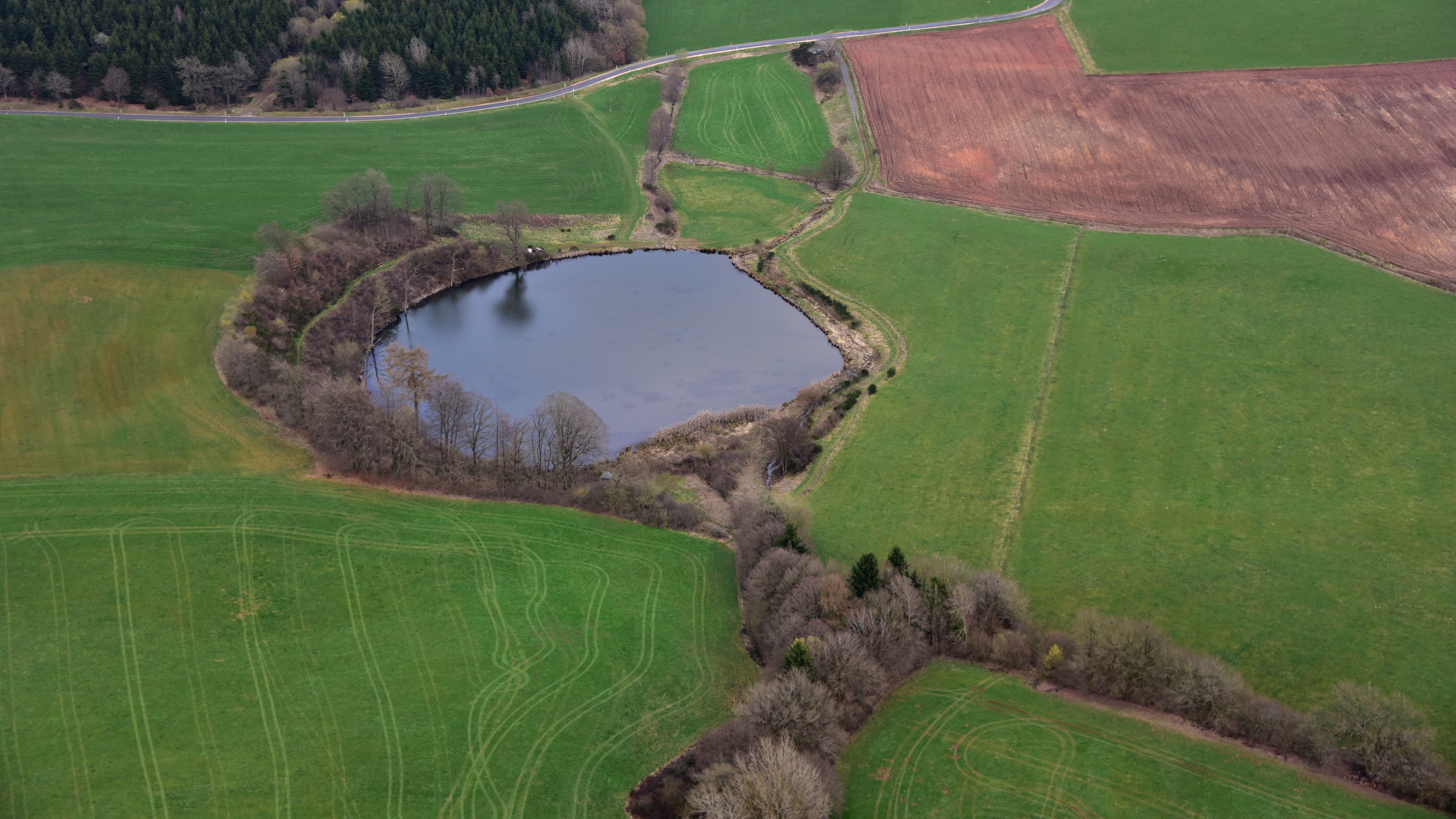
The Eichholzmaar is one of the smaller maars in the Volcanic Eifel and lies on the ''Landstraße'' between Steffeln and Duppach. It has a diameter of c. 120 metres. Its greatest depth is 3 metres. The circular shape of the bowl of the maar can still be easily seen. It lies exactly on a geological fault line, which runs from northwest to southeast. At the beginning of the 20th century the maar was drained in order to create meadows. From late summer 2007 to spring 2008 a renaturalisation was carried out and the lake restored with an area of c. 1,1 hectares. In only a few years the maar has become a refuge for rare water birds and reptiles. Two natural mineral springs in the immediate vicinity of the maar are accessible on foot. About 300 metres upstream in a westerly direction from the Eichholzmaar is the mineral spring known as the ''Steffelner Dress'' (). Around 270 metres downstream in an easterly direction from the Eichholzmaar is the mineral spring of ''Aueler Dress'' (). ... [...More Info...] [...Related Items...] OR: [Wikipedia] [Google] [Baidu] |
Steffeln (Eifel); Eichholzmaar E
Steffeln is an ''Ortsgemeinde'' – a municipality belonging to a ''Verbandsgemeinde'', a kind of collective municipality – in the Vulkaneifel district in Rhineland-Palatinate, Germany. It belongs to the ''Verbandsgemeinde'' of Gerolstein, whose seat is in the municipality of Gerolstein. Geography Location The municipality lies in the Vulkaneifel, a part of the Eifel known for its volcanic history, geographical and geological features, and even ongoing activity today, including gases that sometimes well up from the earth. Constituent communities Steffeln's ''Ortsteile'' are, besides the main centre, also called Steffeln, Auel and Lehnerath. Climate Yearly precipitation in Steffeln amounts to 946 mm, which is very high, falling into the highest fourth of the precipitation chart for all Germany. At 81% of the German Weather Service's weather stations, lower figures are recorded. The driest month is April. The most rainfall comes in December. In that month, precipit ... [...More Info...] [...Related Items...] OR: [Wikipedia] [Google] [Baidu] |
Maar
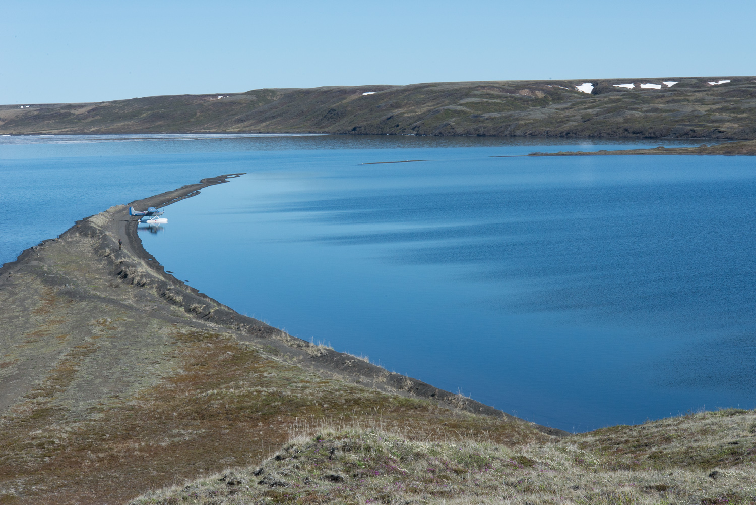
A maar is a broad, low-relief volcanic crater caused by a phreatomagmatic eruption (an explosion which occurs when groundwater comes into contact with hot lava or magma). A maar characteristically fills with water to form a relatively shallow crater lake which may also be called a maar. The name comes from a Moselle Franconian dialect word used for the circular lakes of the Daun area of Germany. Notes: * According to German Wikipedia's ''"Maar"'' article, in 1544 in his book ''Cosmographia'', Sebastian Münster (1488–1552) first applied the word "maar" (as ''Marh'') to the Ulmener Maar and the Laacher See. See: Sebastian Münster, ''Cosmographia'' (Basel, Switzerland: Heinrich Petri, 1544)p. 341. From p. 341: ''"Item zwen namhafftiger seen seind in der Eyfel / einer bey de schloß Ulmen / und ein ander bey dem Closter züm Laich / die seind sere tieff / habe kein ynflüß aber vil außflüß / die nennet man Marh unnd seind fischreich."'' (Also two noteworthy lakes ... [...More Info...] [...Related Items...] OR: [Wikipedia] [Google] [Baidu] |
Volcanic Eifel
The Volcanic Eifel or Vulkan Eifel (german: Vulkaneifel) is a region in the Eifel Mountains in Germany that is defined to a large extent by its volcanic geological history. Characteristic of this volcanic field are its typical explosion crater lakes or maars, and numerous other signs of volcanic activity such as volcanic tuffs, lava streams and volcanic craters like the Laacher See. The Volcanic Eifel is still volcanically active today. One sign of this activity is the escaping gases in the Laacher See. Geographical location The Volcanic Eifel stretches from the Rhine to the Wittlich Depression. It is bordered in the south and southwest by the South Eifel, in the west by Luxembourg and Belgian Ardennes and in the north by the North Eifel including the Hohes Venn. To the east the Rhine forms its geographical boundary, with no volcanicity immediately beyond it. The Volcanic Eifel is divided into three natural regions: * Volcanic West Eifel ( Manderscheid, Daun, Gerolstein, Ober ... [...More Info...] [...Related Items...] OR: [Wikipedia] [Google] [Baidu] |
Landstraße
Landstraße (; Central Bavarian: ''Laundstrossn'') is the 3rd municipal district of Vienna, Austria (german: 3. Bezirk). It is near the center of Vienna and was established in the 19th century. Landstraße is a heavily populated urban area with many workers and residential homes. Wien.gv.at webpage (see below: References). It has 89,834 inhabitants in an area of 7.42 km2 (2.9 sq miles). It has existed since about 1200 AD. In 1192, the English king Richard the Lionheart was captured in the Erdberg neighbourhood, after the unsuccessful Third Crusade. The name ''Landstraße'' means "country road". To tourists, it is mostly known for the 18th-century castle and gardens of Belvedere, the residence of Eugene of Savoy, which today houses the Austrian Gallery. Another residence was built by the Russian envoy to Vienna, Count Razumovsky. A more recent point of interest is the Hundertwasserhaus block of flats (apartment block) designed in a dream-like style by the architect and pain ... [...More Info...] [...Related Items...] OR: [Wikipedia] [Google] [Baidu] |
Steffeln
Steffeln is an ''Ortsgemeinde'' – a municipality belonging to a ''Verbandsgemeinde'', a kind of collective municipality – in the Vulkaneifel district in Rhineland-Palatinate, Germany. It belongs to the ''Verbandsgemeinde'' of Gerolstein, whose seat is in the municipality of Gerolstein. Geography Location The municipality lies in the Vulkaneifel, a part of the Eifel known for its volcanic history, geographical and geological features, and even ongoing activity today, including gases that sometimes well up from the earth. Constituent communities Steffeln's ''Ortsteile'' are, besides the main centre, also called Steffeln, Auel and Lehnerath. Climate Yearly precipitation in Steffeln amounts to 946 mm, which is very high, falling into the highest fourth of the precipitation chart for all Germany. At 81% of the German Weather Service's weather stations, lower figures are recorded. The driest month is April. The most rainfall comes in December. In that month, prec ... [...More Info...] [...Related Items...] OR: [Wikipedia] [Google] [Baidu] |
Duppach
Duppach is an ''Ortsgemeinde'' (a municipality), part of a group of municipalities called the ''Verbandsgemeinde'' of Gerolstein, which is located in the town of Gerolstein'' in the Vulkaneifel district of the state of Rhineland-Palatinate, Germany. Geography Location Duppach is located in the Vulkaneifel, a part of the Eifel region known for its volcanic origins, geographical and geological features. There is still ongoing volcanic activity and gases sometimes well up from the earth. The elevation of the region of Duppach ranges from 400 to 600 m above sea level. The village itself is located on slightly lower ground at 460 m above sea level. The towns of Hillesheim and Gerolstein are both 10 km away. The town of Prüm is 13 km away. Duppacher Maar (Duppacher Weiher) Volcano The former 16-hectare Duppacher Maar (Duppacher Weiher) is a volcano and was dried around 1930. * To the north, between Duppach and Steffeln, is the Eichholzmaar, a volcanic maar wit ... [...More Info...] [...Related Items...] OR: [Wikipedia] [Google] [Baidu] |
Eifel Club
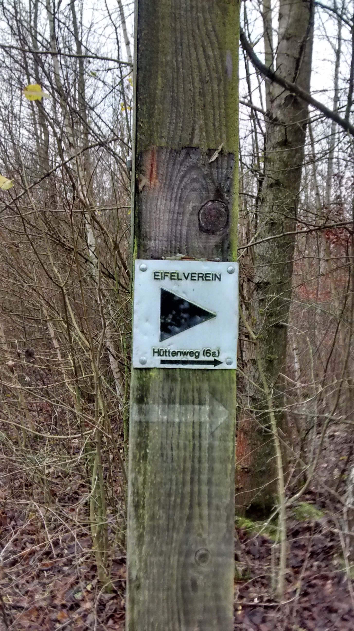
The Eifel Club (german: Eifelverein) is one of the largest rambling clubs in Germany with a membership of 28.000. Its purpose is the "maintenance of local customs, the protection and care of monuments to which it is particularly committed". The Eifel Club was founded on 22 May 1888 in the event hall at Bad Bertrich by Adolf Dronke and, in 2013, it celebrated its 125th anniversary. volksfreund.de, Internet release by the Trierischer Volksfreund, 25 May 2013 Karl Kaufmann, after whom one of the main footpaths through the Eifel (the ''Karl Kaufmann Way'' between Brühl ... [...More Info...] [...Related Items...] OR: [Wikipedia] [Google] [Baidu] |
Vulkaneifel
Vulkaneifel () is a district (''Kreis'') in the northwest of the state Rhineland-Palatinate, Germany. It is the least densely populated district in the state and the fourth most sparsely populated district in Germany. The administrative centre of the district is in Daun. Neighboring districts are Euskirchen (North Rhine-Westphalia), Ahrweiler, Mayen-Koblenz, Cochem-Zell, Bernkastel-Wittlich, and Bitburg-Prüm. Location The county of Vulkaneifel lies in the western part of the eponymous region which lies at heights between 150 and 700 metres above sea level. As a result of former volcanism numerous mineral springs (''Sauerbrunnen'') have formed. The Kyll flows through the county from north to south. The German Wildlife Route and the German Volcano Route also cross the county as does the Eifelsteig hiking trail. History The district was created in 1815 when the Eifel became part of Prussia. As most of the local industries had their traditional markets in France, the dist ... [...More Info...] [...Related Items...] OR: [Wikipedia] [Google] [Baidu] |
Maars Of The Eifel
A maar is a broad, low- relief volcanic crater caused by a phreatomagmatic eruption (an explosion which occurs when groundwater comes into contact with hot lava or magma). A maar characteristically fills with water to form a relatively shallow crater lake which may also be called a maar. The name comes from a Moselle Franconian dialect word used for the circular lakes of the Daun area of Germany. Notes: * According to German Wikipedia's ''"Maar"'' article, in 1544 in his book ''Cosmographia'', Sebastian Münster (1488–1552) first applied the word "maar" (as ''Marh'') to the Ulmener Maar and the Laacher See. See: Sebastian Münster, ''Cosmographia'' (Basel, Switzerland: Heinrich Petri, 1544)p. 341. From p. 341: ''"Item zwen namhafftiger seen seind in der Eyfel / einer bey de schloß Ulmen / und ein ander bey dem Closter züm Laich / die seind sere tieff / habe kein ynflüß aber vil außflüß / die nennet man Marh unnd seind fischreich."'' (Also two noteworthy ... [...More Info...] [...Related Items...] OR: [Wikipedia] [Google] [Baidu] |


